Safety Score: 2,7 of 5.0 based on data from 9 authorites. Meaning we advice caution when travelling to United States.
Travel warnings are updated daily. Source: Travel Warning United States. Last Update: 2024-08-13 08:21:03
Discover Parkway Place
Parkway Place in Lexington County (South Carolina) is a town in United States about 409 mi (or 658 km) south-west of Washington DC, the country's capital city.
Current time in Parkway Place is now 09:36 AM (Thursday). The local timezone is named America / New York with an UTC offset of -5 hours. We know of 8 airports near Parkway Place, of which 4 are larger airports. The closest airport in United States is Columbia Metropolitan Airport in a distance of 2 mi (or 3 km), South-West. Besides the airports, there are other travel options available (check left side).
There is one Unesco world heritage site nearby. It's Great Smoky Mountains National Park in a distance of 140 mi (or 225 km), North-West. Also, if you like playing golf, there are a few options in driving distance. Looking for a place to stay? we compiled a list of available hotels close to the map centre further down the page.
When in this area, you might want to pay a visit to some of the following locations: Columbia, Lexington, Winnsboro, Saint Matthews and Orangeburg. To further explore this place, just scroll down and browse the available info.
Local weather forecast
Todays Local Weather Conditions & Forecast: 13°C / 55 °F
| Morning Temperature | 7°C / 44 °F |
| Evening Temperature | 10°C / 50 °F |
| Night Temperature | 7°C / 44 °F |
| Chance of rainfall | 0% |
| Air Humidity | 36% |
| Air Pressure | 1009 hPa |
| Wind Speed | Fresh Breeze with 14 km/h (9 mph) from East |
| Cloud Conditions | Clear sky, covering 0% of sky |
| General Conditions | Sky is clear |
Thursday, 21st of November 2024
11°C (52 °F)
6°C (42 °F)
Few clouds, moderate breeze.
Friday, 22nd of November 2024
15°C (59 °F)
10°C (50 °F)
Sky is clear, gentle breeze, clear sky.
Saturday, 23rd of November 2024
18°C (64 °F)
12°C (53 °F)
Few clouds, gentle breeze.
Hotels and Places to Stay
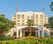
Embassy Suites by Hilton Columbia Greystone
Holiday Inn & Suites COLUMBIA-AIRPORT
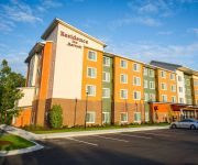
Residence Inn Columbia West/Lexington
DAYS SUITES COLUMBIA AIRPORT
Homewood Suites by Hilton Columbia
Suburban Extended Stay Hotel Columbia
Hampton Inn Columbia-I-26 Airport
Econo Lodge Inn & Suites Cayce
Executive Inn
Scottish Inn
Videos from this area
These are videos related to the place based on their proximity to this place.
Curves of West Columbia Zumba Flash Mob Dances (NOT FOR SISSIES)
Zumba Flash Mob Dances by the women of Curves of West Columbia for the Curves Not For Sissies campaign, Sep 2012.
Auto Glass Columbia - Auto Glass Now
http://autoglassnow.com/wcolumbia 2400 Augusta Road, West Columbia, SC 29169 Phone: (803) 936-1300.
Takeoff from Columbia, SC on Continental Express to Houston 2-17-2011
Takeoff from CAE on 2-17-10 to Houston 2hrs 7 min to Houston EMB 145LR N16976.
beer review: Sierra Nevada Harvest Series Southern Hemisphere
http://beersucker.com reviews the Sierra Nevada Harvest Series Southern Hemisphere. Commercial Description: Our newest addition to our Harvest family is Southern Hemisphere Harvest. This...
Takeoff from Columbia Metropolitan Airport
Columbia, SC (KCAE) to Atlanta, GA (KATL) at 6:45am on September 11, 2012 aboard Delta 971. MD-88. Notice the FedEx A320 at the beginning of the runway (11).
DC Universe Online Raid: Fortress of Solitude - The Power Core, Guide and Commentary
Note: Yeah, this is an old raid but still wanted it on my channel. Enjoy Black Ember ventures into the Fortress of Solitude, the Sunstone Matrix. Superman needed Tech support and Heat Visioned...
Videos provided by Youtube are under the copyright of their owners.
Attractions and noteworthy things
Distances are based on the centre of the city/town and sightseeing location. This list contains brief abstracts about monuments, holiday activities, national parcs, museums, organisations and more from the area as well as interesting facts about the region itself. Where available, you'll find the corresponding homepage. Otherwise the related wikipedia article.
Oak Grove, South Carolina
Oak Grove is a census-designated place (CDP) in Lexington County, South Carolina, United States. The population was 10,291 at the 2010 census. It is part of the Columbia, South Carolina Metropolitan Statistical Area.
Springdale, Lexington County, South Carolina
Springdale is a town in Lexington County, South Carolina, in the United States. The population was 2,877 at the 2000 census. It is part of the Columbia, South Carolina Metropolitan Statistical Area.1226835
Columbia Metropolitan Airport
See Columbia Army Air Base for the World War II use of the airport Columbia Metropolitan Airport is the main airport for Columbia, South Carolina. The airport lies five miles (8 km) southwest of Columbia's central business district, in Lexington County.
Saluda River
The Saluda River is a principal tributary of the Congaree River, about 200 mi (320 km) long, in northern and western South Carolina in the United States. Via the Congaree River, it is part of the watershed of the Santee River, which flows to the Atlantic Ocean.
Airport High School
Airport High School in West Columbia, South Carolina, USA, is a public high school offering education for grades 9 – 12, serving the communities of West Columbia, Cayce, South Congaree, Pine Ridge, and parts of Gaston. It derives its name from its location next to Columbia Metropolitan Airport. Sports teams are known as the Eagles. The main athletic rival is the Brookland-Cayce High School Bearcats. Airport HS has a student body of around 1400 and is part of the Lexington District #2.
WISW
WISW is a news/talk radio station licensed to Columbia, South Carolina. It serves the Columbia, South Carolina market. The Cumulus Media outlet is licensed by the Federal Communications Commission (FCC) to broadcast at 1320 kHz with 5,000 watts daytime and 2,500 watts nighttime, directional. The station goes by the name Newstalk 1320 WIS. WISW is frequently known as "News Talk 1320 WIS" or "WIS Radio", taking the base of its call sign from the former WIS.
Columbia Speedway
Columbia Speedway was an oval racetrack located in Cayce, a suburb of Columbia, South Carolina. It was the site of auto races for NASCAR's top series from 1951 through 1971. For most of its history, the racing surface was dirt. The races in April and August 1970 were two of the final three Grand National races ever held on a dirt track. The track was paved before hosting its last two Grand National races in 1971.
Columbia Army Air Base
See: Columbia Metropolitan Airport for civil airport information Columbia Army Air Base was a World War II United States Army Air Forces base. It was primarily used for advanced combat training of B-25 Mitchell medium bomber units and replacement pilots. It was used as a training base in early 1942 for Doolittle's Raiders. It was closed during the summer of 1945, and turned over for civil use as the Columbia Metropolitan Airport.


