Safety Score: 2,7 of 5.0 based on data from 9 authorites. Meaning we advice caution when travelling to United States.
Travel warnings are updated daily. Source: Travel Warning United States. Last Update: 2024-08-13 08:21:03
Discover Sullivans Island
Sullivans Island in Charleston County (South Carolina) with it's 1,791 citizens is a city in United States about 452 mi (or 727 km) south of Washington DC, the country's capital city.
Local time in Sullivans Island is now 07:21 AM (Thursday). The local timezone is named America / New York with an UTC offset of -5 hours. We know of 9 airports in the vicinity of Sullivans Island, of which 5 are larger airports. The closest airport in United States is Robert F Swinnie Airport in a distance of 51 mi (or 82 km), North. Besides the airports, there are other travel options available (check left side).
Also, if you like golfing, there are a few options in driving distance. We discovered 10 points of interest in the vicinity of this place. Looking for a place to stay? we compiled a list of available hotels close to the map centre further down the page.
When in this area, you might want to pay a visit to some of the following locations: Charleston, Moncks Corner, Georgetown, Walterboro and Saint George. To further explore this place, just scroll down and browse the available info.
Local weather forecast
Todays Local Weather Conditions & Forecast: 15°C / 58 °F
| Morning Temperature | 10°C / 49 °F |
| Evening Temperature | 13°C / 56 °F |
| Night Temperature | 11°C / 51 °F |
| Chance of rainfall | 0% |
| Air Humidity | 33% |
| Air Pressure | 1010 hPa |
| Wind Speed | Fresh Breeze with 14 km/h (9 mph) from South-East |
| Cloud Conditions | Clear sky, covering 0% of sky |
| General Conditions | Sky is clear |
Thursday, 21st of November 2024
11°C (53 °F)
9°C (49 °F)
Sky is clear, moderate breeze, clear sky.
Friday, 22nd of November 2024
15°C (59 °F)
12°C (54 °F)
Sky is clear, moderate breeze, clear sky.
Saturday, 23rd of November 2024
19°C (65 °F)
14°C (57 °F)
Sky is clear, gentle breeze, clear sky.
Hotels and Places to Stay
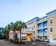
Hotel Indigo MOUNT PLEASANT
Comfort Suites at Isle of Palms Connector
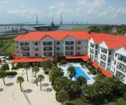
Harborside at Charleston Harbor Resort and Marina
Quality Inn & Suites Patriots Point
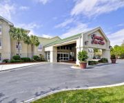
Hampton Inn Charleston-Mt Pleasant-Patriots
Holiday Inn Express & Suites CHARLESTON - MOUNT PLEASANT
Hampton Inn - Suites Charleston-MtPleasant-Isle Of Palms
SpringHill Suites Charleston Mount Pleasant
TownePlace Suites Charleston Mt. Pleasant
Residence Inn Charleston Mt. Pleasant
Videos from this area
These are videos related to the place based on their proximity to this place.
1670 Marsh Harbor Lane, Mount Pleasant SC 29492 Listed by Tim and Cathy Rogers
www.timrogersrealty.com Charleston Real Estate Video: 1670 Marsh Harbor Lane, Mount Pleasant SC 29492. Beautiful four bedroom, four bathroom home in Marsh Harbor Approximately 3382 sqaure.
Charleston Real Estate Video: 1670 Marsh Harbor Lane, Mount Pleasant SC 29492
http://www.keeneyemarketing.com - Charleston Real Estate Video: 1670 Marsh Harbor Lane, Mount Pleasant SC 29492. Beautiful four bedroom, four bathroom home in Marsh Harbor Approximately ...
A Testing of an Amphibious Personnel Vehicle on Sullivan's Island, SC
A Canadian company used Sullivan's Island beach to test an amphibious personnel carrier. I was told this vehicle can do up to 55mph on the road, and up to 7 knots in the water, and eventually...
2420 Atlantic Ave - Sullivans Island Beach Home
http://SullivansIslandProperty.net -- Circa 1930's beach home located on Sullivans, Island minutes from Charleston, SC. Tastefully decorated, lots of renovations complete and ready to build...
Sullivan's Island Overview - Bob Brennaman
Bobs shares some of what he likes about Sullivans Island from the 20 plus years he has spent working on Sulllivans Island. To get information about homes on Sullivans Island, please call Bob...
Kitesurfing On Sullivan's Island-July 1, 2012
The sun was hot and the breeze kickin'. Kitesurfing on Sullivan's Island, SC. Everybody gets to show their stuff. This hot spot for kitesurfing is near Breach Inlet. Great place to boat, fish,...
Sullivan's Island bike tour: Intro
Dan Conover introduces the Friday 5 bike tour of Sullivan's Island. For the Google Map version of the route at postscripts.typepad.com/friday_5.
Charleston Neighborhood Tours: Sullivan's Island brought to you by The Cassina Group
Charleston Neighborhood Tours: Sullivan's Island brought to you by The Cassina Group The Cassina Group 843-628-0008 www.thecassinagroup.com.
Videos provided by Youtube are under the copyright of their owners.
Attractions and noteworthy things
Distances are based on the centre of the city/town and sightseeing location. This list contains brief abstracts about monuments, holiday activities, national parcs, museums, organisations and more from the area as well as interesting facts about the region itself. Where available, you'll find the corresponding homepage. Otherwise the related wikipedia article.
Fort Moultrie
Moultrie]] Fort Moultrie is the name of a series of citadels on Sullivan's Island, South Carolina, built to protect the city of Charleston, South Carolina. The first fort, built of palmetto logs, inspired the flag and nickname of South Carolina, "The Palmetto State". It is named for the commander in the Battle of Sullivan's Island, General William Moultrie.
Second Battle of Fort Sumter
The Second Battle of Fort Sumter was fought on September 8, 1863, in Charleston Harbor. Confederate General P. G. T. Beauregard, who had commanded the defenses of Charleston and captured Fort Sumter in the first battle of the war, was in overall command of the defenders.
WSSX-FM
WSSX-FM is a Top 40 contemporary hit radio (CHR) music formatted radio station located in Charleston, South Carolina. The station is licensed by the Federal Communications Commission (FCC) to broadcast with an effective radiated power (ERP) of 100 kW. The station is owned by Cumulus Media.
First Battle of Charleston Harbor
The First Battle of Charleston Harbor was an engagement near Charleston, South Carolina that took place April 7, 1863, during the American Civil War. The striking force was a fleet of nine ironclad warships of the Union Navy, including seven monitors that were improved versions of the original USS Monitor. A Union Army contingent associated with the attack took no active part in the battle.
Battle of Sullivan's Island
The Battle of Sullivan's Island or the Battle of Fort Sullivan was fought on June 28, 1776, during the American Revolutionary War, also known as the American War of Independence. It took place near Charleston, South Carolina, during the first British attempt to capture the city from American rebels. It is also sometimes referred to as the First Siege of Charleston, owing to a more successful British siege in 1780.
Fort Sumter Range Lights
The Fort Sumter Range Lights are range lights to guide ships through the main channel of the Charleston Harbor, South Carolina. The original front light was built at Fort Sumter and the original rear light was in the steeple of St. Philip's Church in Charleston, South Carolina. Both lights were lit from 1893 to 1915 to make range lights. Today the Fort Sumter Range is the main approach channel to Charleston Harbor.
Ben Sawyer Bridge
The Ben Sawyer Bridge is a swing bridge that connects the town of Mount Pleasant with Sullivan's Island in South Carolina. The bridge swings on its central axis to open for boat traffic which is too tall to clear the bridge, and has an operator's station in the center of the span from which an attendant can operate the bridge. The bridge was constructed in 1945, but its swing-span section was replaced in 2010, albeit retaining the same general appearance.
WHDC-LD
WHDC-LDCharleston, South CarolinaBranding WHDC 12Slogan All 100% Local!Channels Digital: 40Virtual: 12Subchannels 12.1 Independent12.2 Mega TVOwner Local HDTV, Inc.


