Safety Score: 2,7 of 5.0 based on data from 9 authorites. Meaning we advice caution when travelling to United States.
Travel warnings are updated daily. Source: Travel Warning United States. Last Update: 2024-08-13 08:21:03
Delve into Remleys Point
Remleys Point in Charleston County (South Carolina) is located in United States about 450 mi (or 724 km) south of Washington DC, the country's capital town.
Current time in Remleys Point is now 10:49 PM (Monday). The local timezone is named America / New York with an UTC offset of -5 hours. We know of 9 airports close to Remleys Point, of which 5 are larger airports. The closest airport in United States is Robert F Swinnie Airport in a distance of 49 mi (or 79 km), North-East. Besides the airports, there are other travel options available (check left side).
Also, if you like playing golf, there are some options within driving distance. We encountered 10 points of interest near this location. If you need a hotel, we compiled a list of available hotels close to the map centre further down the page.
While being here, you might want to pay a visit to some of the following locations: Charleston, Moncks Corner, Saint George, Walterboro and Georgetown. To further explore this place, just scroll down and browse the available info.
Local weather forecast
Todays Local Weather Conditions & Forecast: 24°C / 76 °F
| Morning Temperature | 22°C / 72 °F |
| Evening Temperature | 22°C / 72 °F |
| Night Temperature | 22°C / 72 °F |
| Chance of rainfall | 7% |
| Air Humidity | 74% |
| Air Pressure | 1022 hPa |
| Wind Speed | Moderate breeze with 12 km/h (8 mph) from North-West |
| Cloud Conditions | Clear sky, covering 4% of sky |
| General Conditions | Light rain |
Tuesday, 5th of November 2024
25°C (77 °F)
23°C (73 °F)
Overcast clouds, gentle breeze.
Wednesday, 6th of November 2024
24°C (75 °F)
23°C (73 °F)
Light rain, gentle breeze, overcast clouds.
Thursday, 7th of November 2024
24°C (76 °F)
22°C (71 °F)
Broken clouds, gentle breeze.
Hotels and Places to Stay
Market Pavilion Hotel
THE LODGE ALLEY INN
ZERO GEORGE STREET
SpringHill Suites Charleston Mount Pleasant
TownePlace Suites Charleston Mt. Pleasant
Ansonborough Inn
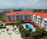
Harborside at Charleston Harbor Resort and Marina
SHEM CREEK INN
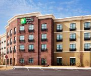
Holiday Inn Express & Suites CHARLESTON - MOUNT PLEASANT
Quality Inn & Suites Patriots Point
Videos from this area
These are videos related to the place based on their proximity to this place.
Charleston Real Estate - River Reach At Remley's Point
Visit http://www.OurCharlestonHome.com for additional videos, photos, information and homes for sale in Charleston area communities.
Stay Mobile - Mt. Pleasant Cellphone Repair Shop
StayMobile - Mount Pleasant, SC Soon To Open cellphone repair shop. Watch out for soft opening on November 18, 2013 at #889 Houston Northcutt Blvd. Suite B-9, Mount Pleasant, South Carolina.
349 Cooper River Dr Mount Pleasant SC
http://www.exite-listings.com/35863 Beautiful luxury condo over-looking the Cooper River and Ravenel Bridge This amazing 3 bedroom, 3 bath end unit is located on the 4th floor of building...
The Making Of Superman Crashes ( Jrock Comedy)
Yup now You Can See That Yes it Was Me Jamel Anderson Dressed As Superman I am An Actor and This Is one of many Videos To Come !
2018 Sober or Slammer
Law enforcement agencies all across the Lowcountry are out looking for impaired drivers! Please designate before you celebrate! Use a ride-hailing service like ...
Pat and Aniko Lallys travels(57)
Travellling Homeless Through America Thanks to Our Evil sisters and also Evil brother in law Atilla Vari and his nasty cunt wife Szusza Danni from Nyiregyhaza!!
Videos provided by Youtube are under the copyright of their owners.
Attractions and noteworthy things
Distances are based on the centre of the city/town and sightseeing location. This list contains brief abstracts about monuments, holiday activities, national parcs, museums, organisations and more from the area as well as interesting facts about the region itself. Where available, you'll find the corresponding homepage. Otherwise the related wikipedia article.
Charleston County, South Carolina
Charleston County is a county located in the U.S. state of South Carolina. As of the 2010 census, its population was 350,209. Its county seat is Charleston. It is the third-most populous county in the state. Charleston County was created in 1901 by an act of the South Carolina State Legislature. As defined by the U.S. Office of Management and Budget, and used by the U.S.
Arthur Ravenel Jr. Bridge
The Arthur Ravenel Jr. Bridge, also known as the New Cooper River Bridge, is a cable-stayed bridge over the Cooper River in South Carolina, connecting downtown Charleston to Mount Pleasant. The eight lane bridge satisfied the capacity of U.S. Route 17 when it opened in 2005 to replace two obsolete cantilever truss bridges. The bridge has a main span of 1,546 feet (471 m), the third longest among cable-stayed bridges in the Western Hemisphere.
Patriots Point
Patriots Point Naval & Maritime Museum is located in Mount Pleasant, South Carolina, at the mouth of the Cooper River on the Charleston Harbor, across from Charleston.
Wando River
The Wando River is a tidewater river in the coastal area of South Carolina. It begins in the town of Awendaw and empties into the Cooper River at Charleston Harbor. Its drainage area is 73,061 acres . in PHF
I'On, Mount Pleasant, South Carolina
I'Onhttp://www. ionvillage. com is a mixed-use New Urbanist "Traditional Neighborhood Development (TND)" style community located in Mt. Pleasant, South Carolina, USA just north of Charleston. I'On was one of the earliest full-time residential new urbanist communities developed in the US.
Patriots Point War Dog Memorial
The Patriots Point War Dog Memorial is located on the aircraft carrier USS Yorktown at the Patriots Point Naval & Maritime Museum in Charleston, South Carolina. It commemorates the contributions of trained military dogs in wartime.
Mount Pleasant Police Department (South Carolina)
The Mount Pleasant Police Department is the municipal level police agency of the Town of Mount Pleasant, South Carolina. The department has approximately 150 sworn officers and 45 civilian employees.
CofC Baseball Stadium at Patriot's Point
CofC Baseball Stadium at Patriot's Point is a baseball venue located in Mount Pleasant, South Carolina, USA. It is home to the College of Charleston Cougars baseball team, a member of the Division I Southern Conference. The venue is located across Charleston Harbor from the campus of the college. The field was constructed for the 2001 season and has a capacity of 2,000 people.


