Safety Score: 2,7 of 5.0 based on data from 9 authorites. Meaning we advice caution when travelling to United States.
Travel warnings are updated daily. Source: Travel Warning United States. Last Update: 2024-08-13 08:21:03
Discover Rosemont
The district Rosemont of North Charleston in Charleston County (South Carolina) is a district in United States about 450 mi south of Washington DC, the country's capital city.
Looking for a place to stay? we compiled a list of available hotels close to the map centre further down the page.
When in this area, you might want to pay a visit to some of the following locations: Charleston, Moncks Corner, Walterboro, Saint George and Beaufort. To further explore this place, just scroll down and browse the available info.
Local weather forecast
Todays Local Weather Conditions & Forecast: 8°C / 46 °F
| Morning Temperature | 3°C / 37 °F |
| Evening Temperature | 6°C / 42 °F |
| Night Temperature | 3°C / 38 °F |
| Chance of rainfall | 0% |
| Air Humidity | 44% |
| Air Pressure | 1030 hPa |
| Wind Speed | Moderate breeze with 10 km/h (6 mph) from South |
| Cloud Conditions | Clear sky, covering 1% of sky |
| General Conditions | Sky is clear |
Wednesday, 4th of December 2024
9°C (49 °F)
9°C (48 °F)
Sky is clear, gentle breeze, clear sky.
Thursday, 5th of December 2024
14°C (57 °F)
9°C (49 °F)
Overcast clouds, moderate breeze.
Friday, 6th of December 2024
9°C (48 °F)
6°C (42 °F)
Scattered clouds, moderate breeze.
Hotels and Places to Stay
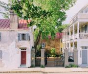
ZERO GEORGE STREET
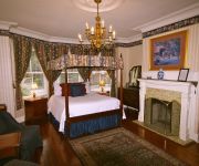
The Cannonboro Inn
HYATT HOUSE CHARLESTON HISTORIC DISTRICT
Zero George Street
86 Cannon
Embassy Suites by Hilton Charleston Historic District
Charleston Marriott
Hilton Garden Inn Charleston Waterfront-Downtown
Charleston Historic District/Hotel Bella Grace
Courtyard Charleston Waterfront
Videos from this area
These are videos related to the place based on their proximity to this place.
FSBO - 9 Boardman Rd, Charleston, SC
After enjoying a stroll around Charlestowne Landing, crabbing from the shared dock on the Ashley River just a short walk down the street, or cheering for the neighborhood pool's swim team,...
Personal Trainer Charleston | Family Fitness Gym Charleston | ESAC North Charleston
http://www.eastshoreac.com/Services/Personal-Training.aspx Personal Trainer Charleston Family Fitness Center Gym Health Club North Charleston Health Gym Personal Training Are you looking...
Police Release Video of vehicle pursuit with crash injuring pregnant women
Subscribe to RollCall2go - Daily Law Enforcement Media Authorities have released dash camera video of a car chase that ended with the suspect's vehicle crashing into a car that flipped over...
North Charleston Officer Michael L. Plog
North Charleston Police Officer Michael L. Plog was killed on duty E.O.W. 05.24.1989 Gunfire His legacy continues in the lives of his son and his grandchildren.
Public Comments on the Charleston County Incinerator
County Council held a meeting to accept public comments on the proposed contract renewal for the solid waste incinerator on June 24, 2008.
OutBack Backup Camera Safety Feature
Josh Stringer from Crews Subaru is back with some quick information on one of the Subaru Outback's great safety features - the backup camera!
Magnolia CemeteryOctober 20, 2012
A walk in historic Magnolia Cemetery and small part of Downtown Charleston, South Carolina.
Termite Bond North Charleston SC | Termite Bond Inspection | 843-376-1242
Termite Bond SC | Termite Bond inspection | North Charleston Pest Control. Call 843-376-1242 Termite Bond North Charleston SC Termite Control North Charleston Pest Control rids homes of...
166 Grove St, Wagener Terrace, Charleston, MLS# 1415015
Wagener Terrace brick 4 Bedroom 2 Full bath home on a wonderful street. This home features a nice flowing floor plan with 2 bed 1 bath down and an additional 2 bed 1 bath up. This home is ready...
2013-09-15 #CitadelFB Travel Squad Lifts
Light Squats (Eccentric Tempo), Heavy 3 Board Press & Assistance Movements. Maintaining our strength in season.
Videos provided by Youtube are under the copyright of their owners.
Attractions and noteworthy things
Distances are based on the centre of the city/town and sightseeing location. This list contains brief abstracts about monuments, holiday activities, national parcs, museums, organisations and more from the area as well as interesting facts about the region itself. Where available, you'll find the corresponding homepage. Otherwise the related wikipedia article.
H. L. Hunley (submarine)
H. L. Hunley was a submarine of the Confederate States of America that played a small part in the American Civil War, but a large role in the history of naval warfare. The Hunley demonstrated both the advantages and the dangers of undersea warfare. It was the first combat submarine to sink an enemy warship, although the Hunley was not completely submerged and was lost at some point following her successful attack.
Siege of Charleston
The Battle of Charleston was one of the major battles which took place towards the end of the American Revolutionary War, after the British began to shift their strategic focus towards the American Southern Colonies. After about six weeks of siege, Continental Army Major General Benjamin Lincoln surrendered forces numbering about 5,000 to the British.
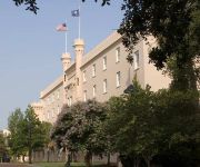
The Citadel, The Military College of South Carolina
The Citadel, The Military College of South Carolina, commonly referred to simply as The Citadel, is a state-supported, comprehensive college located in Charleston, South Carolina, United States, founded in 1842. It is one of the six Senior Military Colleges in the United States. It has 16 academic departments divided into five schools offering 18 majors and 35 minors.
Joseph P. Riley, Jr. Park
Joseph P. Riley, Jr. Park is a stadium located in Charleston, South Carolina. The stadium is named after Charleston's longest serving (and current) mayor, Joseph P. Riley, Jr.. The stadium replaced College Park. It was built in 1997 and seats 6,000 people. Nicknamed "The Joe" by locals, Joseph P. Riley, Jr.
Charleston Naval Shipyard
Charleston Naval Shipyard (formerly known as the Charleston Navy Yard) was a U.S. Navy ship building and repair facility located along the west bank of the Cooper River, in North Charleston, South Carolina and part of Naval Base Charleston. It began operations in 1901 as a drydock, and continued as a navy facility until 1996 when it was leased to Detyens Shipyards, Inc. during down-sizing.
John P. Grace Memorial Bridge
The John P. Grace Memorial Bridge, or the Cooper River Bridge as it was familiarly known, was a cantilever bridge that crossed the Cooper River in Charleston, South Carolina. It opened on August 8, 1929 and was built by the Cooper River Bridge Company. Shortridge Hardesty of Waddell & Hardesty, New York designed the bridge. The Silas N. Pearman Bridge was opened beside it in 1966 to relieve traffic. They were both replaced by the Arthur Ravenel, Jr. Bridge in 2005.
Silas N. Pearman Bridge
The Silas N. Pearman Bridge, known locally as the New Cooper River Bridge from the opening date to the groundbreaking of its replacement, was a cantilever bridge that crossed the Cooper River in Charleston, South Carolina, USA. It opened in 1966 to relieve traffic congestion on the companion John P. Grace Memorial Bridge. It was built by the South Carolina Department of Transportation and was designed by HNTB Corporation.
Johnson Hagood Stadium
Johnson Hagood Stadium, is a 21,000-seat football stadium, the home field of The Citadel Bulldogs, in Charleston, South Carolina, USA. The stadium is named in honor of Brigadier General Johnson Hagood, CSA, class of 1847, who commanded Confederate forces in Charleston during the Civil War and later served as Comptroller and Governor of South Carolina.
McAlister Field House
McAlister Field House is a 6,000-seat multi-purpose arena on the campus of The Citadel, The Military College of South Carolina in Charleston, South Carolina, United States. It was built in 1939 and is home to The Citadel Bulldogs basketball, wrestling and volleyball teams. Office space in the facility houses athletic department staff as well as several coaches. Previously known as The Citadel Armory, the facility was named in honor of Col. David S.
Warren Lasch Conservation Center
The Warren Lasch Conservation Center is a building located at 1250 Supply Street at the former Charleston Navy Yard, in North Charleston, South Carolina. It is being used to excavate, examine, and preserve the submarine H. L. Hunley. The name sake of this building is Warren F. Lasch, who was chairmen of Friends of the Hunley during the Hunley's recovery. The Hunley is housed in a specially designed tank of freshwater to await conservation.
College Park (Charleston)
College Park is a stadium in Charleston, South Carolina. It was primarily used for baseball and was the home of Charleston RiverDogs. The ballpark has a capacity of 4,000 people and opened in 1939. The grandstand is constructed of metal bleachers and is largely covered by a roof. The first few rows of seats between the dugouts are situated below ground level, giving fans the rare perspective seen from dugout level.
Charleston Harbor
The Charleston Harbor is an inlet (8 sq mi/20.7 km²) of the Atlantic Ocean at Charleston, South Carolina. The inlet is formed by the junction of Ashley and Cooper rivers at {{#invoke:Coordinates|coord}}{{#coordinates:32|49|7.10|N|79|55|40.41|W| | |name= }}. Morris and Sullivan's Island, shelter the entrance. Charleston Harbor is part of the Intracoastal Waterway.
WTMA
WTMA is an AM radio station serving the Charleston market area with a News/Talk format. This station operates on AM frequency 1250 kHz and is under ownership of Cumulus Media.
WQSC
WQSC (1340 AM, "The Boardwalk") is a news/talk radio station licensed to serve the community of Charleston, South Carolina.
Greek Orthodox Church of the Holy Trinity
The Holy Trinity Greek Orthodox Church is located at 28 Race St. , Charleston, South Carolina. The church was listed on the National Register of Historic Places in 2004. The first Greek Orthodox church in South Carolina was built in 1911 at Fishburne and St. Phillip Sts. Construction of the present church was begun in 1950 and completed in 1953. The church was designed by Demetrios Liollio, a Charleston architect, and is in the traditional style of a Byzantine church.
City of Charleston Police Department
The City of Charleston Police Department (CPD) is the official police force of Charleston, South Carolina. It is South Carolina's largest police department, besides the state police, in terms of manpower, with 422 sworn officers, 137 civilians and numerous reserve officers and non-sworn volunteers. In July, 2011, the department was re-accredited through 2014 with the Accreditation with Excellence Award by the Commission on Accreditation for Law Enforcement Agencies.
WQNT
WQNT is an American AM radio station licensed by the Federal Communications Commission (FCC) to Kirkman Broadcasting, Inc. to broadcast on 1450 kHz serving the community of Charleston, South Carolina. The station's programming format is Sports Talk.
Hampton Park (Charleston)
Hampton Park is a public park located in peninsular Charleston, South Carolina, USA. At 60 acres, it is the largest park on the peninsula. It is bordered by The Citadel to the west, Hampton Park Terrace to the south, North Central to the east, and Wagener Terrace to the north.
Allan Park (Charleston)
Allan Park is a park in Charleston, South Carolina, USA. It is bounded by Ashley Ave. (to the east), South Allan Park (to the south), Glenwood Ave. (to the west), and North Allan Park (to the north). In contrast to nearby Hampton Park, the city’s largest park on the peninsula, Allan Park is one of the smallest. The parcel of land was donated to the City of Charleston by Mrs. Amey Allan, the widow of James Allan and the developer of most of the eastern half of Hampton Park Terrace.
Mcmahon playground
McMahon Playground is a playground located between Hampton Park and Rutledge Ave. in Charleston, South Carolina. The playground is named for Genevieve Kanapaux McMahon. She was, for nearly twenty years, the supervisor of the Hampton Park playground. The playground was named in her honor on October 2, 1999.
Etiwan Park
Etiwan Park is a public park on Daniel Island in Charleston, South Carolina. The city spent $100,000 on the first phase of the park's development starting in late 1995. Work continued, and the city spent $325,000 in the fall of 1998.
Mitchell Playground
Mitchell Playground is a public park in Charleston, South Carolina bounded by Fishburne St. (north), Perry St. (east), Sheppard St. (south), and Rutledge Ave. (west). It is named for the Julian Mitchell Elementary School to the immediate east of the playground.
Corrine Jones Playground
Corrine Jones Playground was formerly known as Hester Park because of its location along Hester Street in Charleston, South Carolina. The property was used for temporary housing during World War II. Opened in May 1943, the Ashley Homes provided ninety-six three-room apartments that rented for $31.25, thirty four-room apartments for $36.25, and twenty-four five-room apartments at $41.25. The complex had been designed by North Carolina architect Douglas Ellington.
Vivian Anderson Moultrie Playground
Vivan Anderson Moultrie Playground was created in the early 1970s to mitigate the effects of I-26's routing across the peninsula of Charleston, South Carolina, United States. After the elevated interstate was completed, a sandbox and play equipment were installed under the roadway. The new recreation area was known as Linear Park. In 2000, the City of Charleston improved the playground and renamed it in honor of a longtime resident.
Naval Support Activity Charleston
Naval Support Activity Charleston is a base of the United States Navy formerly known as Naval Weapons Station Charleston located on the west bank of the Cooper River, in the cities of Goose Creek and Hanahan South Carolina. The base encompasses more than 17,000 acres (69 km²) of land with 10,000 acres (40 km²) of forest and wetlands, 16-plus miles of waterfront, four deep-water piers, 38.2 miles of railroad and 292 miles of road.


