Safety Score: 2,7 of 5.0 based on data from 9 authorites. Meaning we advice caution when travelling to United States.
Travel warnings are updated daily. Source: Travel Warning United States. Last Update: 2024-08-13 08:21:03
Discover Essex Village
The district Essex Village of Melrose in Charleston County (South Carolina) is a district in United States about 454 mi south of Washington DC, the country's capital city.
Looking for a place to stay? we compiled a list of available hotels close to the map centre further down the page.
When in this area, you might want to pay a visit to some of the following locations: Charleston, Moncks Corner, Walterboro, Saint George and Beaufort. To further explore this place, just scroll down and browse the available info.
Local weather forecast
Todays Local Weather Conditions & Forecast: 22°C / 72 °F
| Morning Temperature | 15°C / 59 °F |
| Evening Temperature | 17°C / 63 °F |
| Night Temperature | 17°C / 62 °F |
| Chance of rainfall | 0% |
| Air Humidity | 59% |
| Air Pressure | 1016 hPa |
| Wind Speed | Light breeze with 4 km/h (3 mph) from East |
| Cloud Conditions | Scattered clouds, covering 40% of sky |
| General Conditions | Scattered clouds |
Thursday, 28th of November 2024
24°C (76 °F)
19°C (67 °F)
Overcast clouds, gentle breeze.
Friday, 29th of November 2024
15°C (59 °F)
10°C (50 °F)
Light rain, gentle breeze, overcast clouds.
Saturday, 30th of November 2024
14°C (58 °F)
10°C (49 °F)
Broken clouds, light breeze.
Hotels and Places to Stay
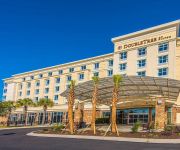
DoubleTree by Hilton North Charleston - Convention Center
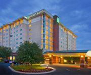
Embassy Suites North Charleston - Airport-Hotel - Convention
TownePlace Suites Charleston Airport/Convention Center
Hilton Garden Inn Charleston Airport
Residence Inn Charleston Downtown/Riverview
Holiday Inn CHARLESTON-RIVERVIEW
Hampton Inn - Suites Charleston Airport SC
Holiday Inn Express & Suites CHARLESTON ARPT-CONV CTR AREA
Homewood Suites by Hilton - North Charleston-Airport SC
Residence Inn Charleston Airport
Videos from this area
These are videos related to the place based on their proximity to this place.
Why 911 Driving School buys their New Kia Forte's at Kia Country of Charleston?
Checkout this Video Testimonial from one of our Happy Customers and Local Small Business Owner of 911 Driving School who just bought a NEW Kia Forte to add to their fleet! We are the #1 Rated...
New 2013 Kia SOUL Owner Testimonial at Kia Country of Charleston
Checkout this Video Testimonial from one of our Happy Customers at Kia Country of Charleston who just bought her NEW 2013 Kia SOUL! We are the #1 Rated Kia Dealer in the Carolinas on ...
Kia Country's Factory Connection Deals attracts NEW 2013 Kia SOUL Owner
Checkout this Video Testimonial from one of our Happy Customers at Kia Country of Charleston who just bought her NEW 2013 Kia SOUL! We are the #1 Rated Kia Dealer in the Carolinas on ...
From Audi to 2013 Kia SOUL! Kia Country of Charleston: #1 Rated Kia Dealer in SC!
Checkout this Video Testimonial from one of our Happy Customers at Kia Country of Charleston! We are the #1 Rated Kia Dealer in SC on Dealerrater.com. See for yourself how our customer's express.
2014 Kia Optima Comparison and Review vs. 2013 Kia Optima
Kia Country of Charleston's GM, Steve Appelbaum details the differences between the New Redesigned 2014 Kia Optima and last year's 2013 model. Some of these include a reshaped front fascia...
New Kia SOUL has ebough room for my kids and my dogs at Kia Country of Charleston
Checkout this Video Testimonial from one of our Happy Customers at Kia Country of Charleston who just bought her NEW 2013 Kia SOUL! We are the #1 Rated Kia Dealer in the Carolinas on ...
2013 Kia Rio 5-Door SX Tour and Review!
Checkout this Video Tour and Review of the 2013 Kia Rio 5-Door SX from one of our Sales Consultants at Kia Country of Charleston: Elijah Tucker! The 2013 Optima Rio 5-Door SX has amazing ...
Mario Ferrer
Mario and Barbara Ferrer are oh so delighted that they made the trip from Myrtle Beach.
Happy Customer Drives Away in New 2013 Kia Sorento from #1 Rated Kia Country of Charleston!
Checkout this Video Testimonial from one of our Happy Customers at Kia Country of Charleston! We are the #1 Rated Kia Dealer in SC on Dealerrater.com. See for yourself how our customer's express.
I Traded a 2013 Kia Soul for a 2014 Kia Sorento So I Could Tow Trailers
Check out this Video Testimonial from one of our Happy Customers at Kia Country of Charleston! We are the #1 Rated Kia Dealer in the Carolinas on Dealerrater.com. See for yourself how our...
Videos provided by Youtube are under the copyright of their owners.
Attractions and noteworthy things
Distances are based on the centre of the city/town and sightseeing location. This list contains brief abstracts about monuments, holiday activities, national parcs, museums, organisations and more from the area as well as interesting facts about the region itself. Where available, you'll find the corresponding homepage. Otherwise the related wikipedia article.
Porter-Gaud School
The Porter-Gaud School is an independent coeducational college preparatory day school in Charleston, in the U.S. state of South Carolina. Porter-Gaud has an enrollment of some 903 students in grades 1–12 and located on the banks of the Ashley River. The school has historic ties to the Episcopal Church. Porter-Gaud was formed in July 1964 from the merger of three schools: The Porter Military Academy (founded 1867), the Gaud School for Boys (founded 1908), and the Watt School (founded 1931).
The Citadel, The Military College of South Carolina
The Citadel, The Military College of South Carolina, commonly referred to simply as The Citadel, is a state-supported, comprehensive college located in Charleston, South Carolina, United States, founded in 1842. It is one of the six Senior Military Colleges in the United States. It has 16 academic departments divided into five schools offering 18 majors and 35 minors.
North Charleston Coliseum
The North Charleston Coliseum is a 14,000-seat multi-purpose arena in North Charleston, South Carolina. It is part of the North Charleston Convention Center Complex, which also includes a Performing Arts Center, and is owned by the City of North Charleston and managed by SMG. The Coliseum was built in 1993 (the Performing Arts Center and Convention Center opened in 1999), and is located on the access road to the Charleston International Airport.
Joseph P. Riley, Jr. Park
Joseph P. Riley, Jr. Park is a stadium located in Charleston, South Carolina. The stadium is named after Charleston's longest serving (and current) mayor, Joseph P. Riley, Jr.. The stadium replaced College Park. It was built in 1997 and seats 6,000 people. Nicknamed "The Joe" by locals, Joseph P. Riley, Jr.
McAlister Field House
McAlister Field House is a 6,000-seat multi-purpose arena on the campus of The Citadel, The Military College of South Carolina in Charleston, South Carolina, United States. It was built in 1939 and is home to The Citadel Bulldogs basketball, wrestling and volleyball teams. Office space in the facility houses athletic department staff as well as several coaches. Previously known as The Citadel Armory, the facility was named in honor of Col. David S.
Paul Gelegotis Bridge
The Paul Gelegotis Bridge, also known as the Stono Bridge, is located in Charleston, South Carolina, USA; it connects James Island and Johns Island on SC 700. This bridge opened in late 2003, on the historically significant site of a series of former Stono Bridges.
Citadel Mall
Citadel Mall is a regional 1,138,527 square feet shopping mall located in Charleston, South Carolina, USA. It opened in 1981 and is located just off the I-526 exit, the mall features more than 100 stores, including six anchor stores: Belk, Dick's Sporting Goods, Dillard's, JCPenney, Sears and Target. It is owned and managed by CBL & Associates Properties.
WSPO
WSPO is an American radio station serving the Charleston, South Carolina, area with a tourist information format. This station is under ownership of Apex Broadcasting.
West Ashley
West Ashley is one of the six distinct areas of the city proper of Charleston, South Carolina, with an estimated 2010 population of 57,403. Its name is derived from the fact that the land is west of the Ashley River. A few skirmishes took place there in the American Revolution and some military activity took place here during the Civil War.
WTMA
WTMA is an AM radio station serving the Charleston market area with a News/Talk format. This station operates on AM frequency 1250 kHz and is under ownership of Cumulus Media.
WLTQ (AM)
WLTQ is a radio station licensed to Charleston, South Carolina, USA. The format is Catholic talk, with some programming shared with nearby WQIZ.
WQSC
WQSC (1340 AM, "The Boardwalk") is a news/talk radio station licensed to serve the community of Charleston, South Carolina.
Charleston Sofa Super Store fire
The Charleston Sofa Super Store fire occurred on June 18, 2007, in Charleston, South Carolina, United States, in which a flashover and structural collapse contributed to the deaths of nine Charleston firefighters.
City of Charleston Police Department
The City of Charleston Police Department (CPD) is the official police force of Charleston, South Carolina. It is South Carolina's largest police department, besides the state police, in terms of manpower, with 422 sworn officers, 137 civilians and numerous reserve officers and non-sworn volunteers. In July, 2011, the department was re-accredited through 2014 with the Accreditation with Excellence Award by the Commission on Accreditation for Law Enforcement Agencies.
Riverland Terrace
Riverland Terrace, developed in the 1940s, is James Island (South Carolina)'s oldest neighborhood. The Terrace is located just 10 minutes west of downtown Charleston, South Carolina along Wappoo Creek and the inland waterway. The neighborhood boasts a public boat landing, Charleston Municipal Golf Course, a playground, five restaurants and numerous antique shops. Leading into the neighborhood is the historic Avenue of Oaks, consisting of 73 live oak trees believed to be over 100 years old.
West Ashley High School
West Ashley High School was created in 2000, when Charleston County School District merged Middleton High School (South Carolina) and St. Andrew's High schools. The school is a part of St. Andrew's Constituent District #10. The school is located in the heart of the West Ashley area in Charleston, South Carolina. With approximately 2,200 students, it is among the largest high schools in the state.
WQNT
WQNT is an American AM radio station licensed by the Federal Communications Commission (FCC) to Kirkman Broadcasting, Inc. to broadcast on 1450 kHz serving the community of Charleston, South Carolina. The station's programming format is Sports Talk.
Ashley Plaza Mall
Ashley Plaza Mall (now known as Ashley Landing), built in 1970, was the first indoor shopping mall built in the West Ashley area of Charleston, South Carolina. The center is located at 1401 Sam Rittenberg Boulevard (S.C. Highway 7) at the fork of Old Towne Road (S.C. Highway 171). It was built as a joint venture of shopping center developers the LeFrak Organization of New York City and The Cordish Company of Baltimore, Maryland under the name Ashley Plaza Mall Associates.
John F. Limehouse Memorial Bridge
The John F. Limehouse Memorial Bridge, located about 15 miles west of downtown Charleston, South Carolina, replaced an obsolete low-level swing bridge over the Stono River. The new bridge, which crosses a channel between Johns Island and West Ashley was completed under a partnership between the South Carolina Department of Transportation (SCDOT) and the United States Coast Guard.
W257BQ
W257BQ is an American radio station serving the Charleston, South Carolina, area with a Mainstream urban format simulcast on the HD-2 channel of WMXZ. This station is under ownership of Apex Broadcasting.
General William C. Westmoreland Bridge
The General William C. Westmoreland Bridge connects the city of North Charleston with the West Ashley area of Charleston in South Carolina. Composed of twin spans, it carries two lanes of Interstate 526 in each direction across the Ashley River and the surrounding marshes. It is often referred to as simply the "Westmoreland Bridge". The highway was named for General William C. Westmoreland, a South Carolina native and graduate of West Point.
Brittlebank Park
Brittlebank Park is a ten-acre park located between Lockwood Boulevard (to the east) and the Ashley River (to the west) in Charleston, South Carolina. To the south is a condominium project and to the north is the minor league baseball stadium, the Joseph P. Riley, Jr. Park.
Bees Landing Park
Bees Ferry Landing Park is a public park in Charleston, South Carolina. Seventeen of the twenty-five acres are high ground surrounded by wetlands. The city had envisioned creating a park in West Ashley since the mid-1990s and had budgeted $2 million to acquire the property. The developer of the surrounding community, known as Grande Oaks, donated the property to the city for a park, and the city hired a consultant to develop plans.
West Ashley Park
West Ashley Park is the largest municipal park in Charleston, South Carolina. The city originally bought a 99.8-acre parcel, including a lake created from an old phosphate mine, in 1985. In 1997, a neighboring property owner, Ross Development Corp. , offered to deed the city six adjoining parcels in exchange for the city's constructing a road from the Glen McConnell Parkway to the park.
West Ashley Greenway
The West Ashley Greenway is a rail trail in Charleston, South Carolina. It stretches across the West Ashley neighborhood from Main Rd in the west to Folly Road in the east. It is a straight and mostly unpaved path utilized for walking, jogging, and off-street cycling. The distance of the main trail currently covers 8.8 miles . It is a contributing segment of the East Coast Greenway.


