Safety Score: 2,7 of 5.0 based on data from 9 authorites. Meaning we advice caution when travelling to United States.
Travel warnings are updated daily. Source: Travel Warning United States. Last Update: 2024-08-13 08:21:03
Delve into Laurel Park
The district Laurel Park of Charleston in Charleston County (South Carolina) is a subburb in United States about 455 mi south of Washington DC, the country's capital town.
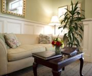
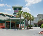
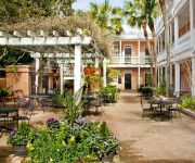
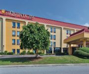
If you need a hotel, we compiled a list of available hotels close to the map centre further down the page.
While being here, you might want to pay a visit to some of the following locations: Moncks Corner, Walterboro, Saint George, Beaufort and Georgetown. To further explore this place, just scroll down and browse the available info.
Local weather forecast
Todays Local Weather Conditions & Forecast: 20°C / 68 °F
| Morning Temperature | 10°C / 50 °F |
| Evening Temperature | 16°C / 61 °F |
| Night Temperature | 16°C / 60 °F |
| Chance of rainfall | 0% |
| Air Humidity | 53% |
| Air Pressure | 1021 hPa |
| Wind Speed | Gentle Breeze with 5 km/h (3 mph) from North |
| Cloud Conditions | Few clouds, covering 11% of sky |
| General Conditions | Few clouds |
Monday, 18th of November 2024
21°C (70 °F)
16°C (61 °F)
Broken clouds, gentle breeze.
Tuesday, 19th of November 2024
22°C (71 °F)
20°C (67 °F)
Overcast clouds, gentle breeze.
Wednesday, 20th of November 2024
24°C (75 °F)
20°C (67 °F)
Broken clouds, gentle breeze.
Hotels and Places to Stay
86 Cannon
The Cannonboro Inn
The Governor's House Inn
Charleston Marriott
21 East Battery Bed & Breakfast
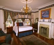
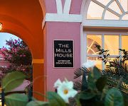
THE MILLS HOUSE WYNDHAM GRAND
Fulton Lane Inn
BEST WESTERN CHARLESTON INN
ELLIOTT HOUSE INN
La Quinta Inn and Suites Charleston Riverview
Videos from this area
These are videos related to the place based on their proximity to this place.
Holiday Festival of Lights in Charleston, SC
Highlights from Charleston, South Carolinas popular Christmas Holiday Festival of Lights which is held annually from November 14th to January 4th on beautiful James Island. Visit our daily...
HolidayFestival of Lights Magic in the Making
Let the spirit of the season embrace you as James Island County Park comes alive with illumination at Charleston's most beloved nighttime event - the Holiday Festival of Lights! Beginning November...
In The Foxhole! - Episode 38 - Part 2
Recommend watching in HD or at least full screen. Season's greetings from the foxhole everyone! Hope everyone had a very Merry Christmas/whatever Holiday you celebrate! We've got a colorful...
Burnside Explrtn. Goin'DownSouth
Garry and Cedric Burnside tear it up at the Low Country Blues Bash 2/14/09 BURNSIDE EXPLORATION go to youtube.com/snoutfacehound for more videos SEE THIS BAND LIVE !
How Do Reverse Mortgages Work? In South Carolina Call Franklin Funding To Learn More|(843) 762.2218
How Do Reverse Mortgages Work? Visit http://www.reversemortgagessc.com/how-do-reverse-mortgages-work or call (843) 762.2218 Lately, Reverse Mortgages have received negative press.
Festival of Lights in Charleston
James Island County Park Christmas Holiday Festival of Lights - created at http://animoto.com.
biking on beach in the Isle of Palms
Courtney and John biking down the beach on our trip to the Isle of Palms, 2008.
CSU Volleyball -- FLIPPED
Spend some time with Charleston Southern Volleyball in this edition of "Big South FLIPPED: On Campus." Laugh along with the Bucs as they practice, travel, eat, and enjoy being student-athletes...
Videos provided by Youtube are under the copyright of their owners.
Attractions and noteworthy things
Distances are based on the centre of the city/town and sightseeing location. This list contains brief abstracts about monuments, holiday activities, national parcs, museums, organisations and more from the area as well as interesting facts about the region itself. Where available, you'll find the corresponding homepage. Otherwise the related wikipedia article.
Ashley Hall (school)
Ashley Hall is an all-girls day school in downtown Charleston, South Carolina. It was founded in 1909 by Mary Vardrine McBee, who headed the institution for many years. It is the only girls college-preparatory school in the state. Originally accepting boarding students, Ashley Hall transitioned to a day school in 1974. Students today number 650 strong and range in grade level from two-year-olds in pre-primary to graduating seniors.
College of Charleston
The College of Charleston (informally known as C of C) is a public, sea-grant and space-grant university located in historic downtown Charleston, South Carolina, United States. The College was founded in 1770 and chartered in 1785, making it the oldest college or university in South Carolina, the 13th oldest institution of higher learning in the United States and the oldest municipal college in the country.
Medical University of South Carolina
The Medical University of South Carolina opened in Charleston, South Carolina in 1824 as a small private college for the training of physicians. It is one of the oldest continually operating schools of medicine in the United States and the oldest in the Deep South. The school's main building was designed by Charleston architect Albert W. Todd.
Porter-Gaud School
The Porter-Gaud School is an independent coeducational college preparatory day school in Charleston, in the U.S. state of South Carolina. Porter-Gaud has an enrollment of some 903 students in grades 1–12 and located on the banks of the Ashley River. The school has historic ties to the Episcopal Church. Porter-Gaud was formed in July 1964 from the merger of three schools: The Porter Military Academy (founded 1867), the Gaud School for Boys (founded 1908), and the Watt School (founded 1931).
Roman Catholic Diocese of Charleston
The Roman Catholic Diocese of Charleston is an ecclesiastical territory or diocese of the Roman Catholic Church in the southern United States and comprises the entire state of South Carolina, with Charleston as its see city. Currently, the diocese consists of 92 parishes and 24 missions throughout the state. It is led by the Most Rev. Robert Guglielmone, the Thirteenth Bishop of Charleston, who serves as pastor of the mother church, Cathedral of Saint John the Baptist in the City of Charleston.
Joseph P. Riley, Jr. Park
Joseph P. Riley, Jr. Park is a stadium located in Charleston, South Carolina. The stadium is named after Charleston's longest serving (and current) mayor, Joseph P. Riley, Jr.. The stadium replaced College Park. It was built in 1997 and seats 6,000 people. Nicknamed "The Joe" by locals, Joseph P. Riley, Jr.
Court House Square (Charleston)
Court House Square is the location of Charleston County Courthouse in downtown Charleston, South Carolina, USA, at the intersection of Meeting and Broad Streets. It is historically known as "the four corners of law" because the intersection hosted buildings from each level of government: the Courthouse (state law), City Hall (municipal law), the Federal Building and U.S. Post Office (federal law), and Saint Michael's Episcopal Church (canon law).
James Island (South Carolina)
James Island is one of South Carolina's most urban Sea Islands. The island is separated from peninsular downtown Charleston by the Ashley River, from the mainland by Wappoo Creek and the Wappoo Cut, and from Johns Island by the Stono River. It lies inshore of Morris Island and Folly Beach. Fort Sumter is located on an island just off the eastern tip of James Island and is the site of the first battle of the Civil War.
James Island, South Carolina
James Island is a town in Charleston County, South Carolina, United States. It is located in the central and southern parts of James Island. As defined by the U.S. Office of Management and Budget, and used by the U.S. Census Bureau for statistical purposes only, James Island is included within the Charleston-North Charleston-Summerville metropolitan area and the Charleston-North Charleston Urbanized Area.
Johnson Hagood Stadium
Johnson Hagood Stadium, is a 21,000-seat football stadium, the home field of The Citadel Bulldogs, in Charleston, South Carolina, USA. The stadium is named in honor of Brigadier General Johnson Hagood, CSA, class of 1847, who commanded Confederate forces in Charleston during the Civil War and later served as Comptroller and Governor of South Carolina.
Cathedral of Saint John the Baptist (Charleston, South Carolina)
The Cathedral of St. John the Baptist is the mother church of the Roman Catholic Diocese of Charleston, located in Charleston, South Carolina. The Most Reverend Robert E. Guglielmone, D.D. , the thirteenth Bishop of Charleston, was ordained and installed on March 25, 2009. The first brownstone cathedral was built in 1854 and named the Cathedral of Saint John and Saint Finbar. It burned down in a great fire in December 1861. After being rebuilt it was renamed the Cathedral of St.
Cathedral of St. Luke and St. Paul (Charleston, South Carolina)
The Cathedral of St. Luke and St. Paul is the cathedral of the Episcopal Diocese of South Carolina. Construction was begun in 1810 and was originally known as St. Paul's Radcliffeboro. It continued as St. Paul's until 1949 when it merged with St. Luke's, Charlotte Street. It was designated the Cathedral of the Diocese in 1963. It is located in Charleston on Coming Street, in the heart of the College of Charleston campus.
Paul Gelegotis Bridge
The Paul Gelegotis Bridge, also known as the Stono Bridge, is located in Charleston, South Carolina, USA; it connects James Island and Johns Island on SC 700. This bridge opened in late 2003, on the historically significant site of a series of former Stono Bridges.
WLTQ (AM)
WLTQ is a radio station licensed to Charleston, South Carolina, USA. The format is Catholic talk, with some programming shared with nearby WQIZ.
MUSC Medical Center
MUSC Medical CenterGeographyLocation Charleston, South Carolina, USACoordinates {{#invoke:Coordinates|coord}}{{#coordinates:32|47|10|N|79|56|52|W|type:landmark |primary |name= }}OrganisationCare system PublicHospital type General and TeachingAffiliated university Medical University of South CarolinaServicesEmergency department IBeds 865 Licensed BedsHistoryFounded 1850 as Roper Hospital1955 as Medical College of South Carolina Hospital1985 as MUSC Medical CenterLinksWebsite http://www.
City of Charleston Police Department
The City of Charleston Police Department (CPD) is the official police force of Charleston, South Carolina. It is South Carolina's largest police department, besides the state police, in terms of manpower, with 422 sworn officers, 137 civilians and numerous reserve officers and non-sworn volunteers. In July, 2011, the department was re-accredited through 2014 with the Accreditation with Excellence Award by the Commission on Accreditation for Law Enforcement Agencies.
Riverland Terrace
Riverland Terrace, developed in the 1940s, is James Island (South Carolina)'s oldest neighborhood. The Terrace is located just 10 minutes west of downtown Charleston, South Carolina along Wappoo Creek and the inland waterway. The neighborhood boasts a public boat landing, Charleston Municipal Golf Course, a playground, five restaurants and numerous antique shops. Leading into the neighborhood is the historic Avenue of Oaks, consisting of 73 live oak trees believed to be over 100 years old.
College of Charleston School of Business and Economics
The College of Charleston School of Business and Economics is an AACSB International accredited institution for business.
Charleston Library Society
Charleston Library Society, founded in 1748, is a subscription library in Charleston, South Carolina. The library is the third oldest subscription library in the United States after the Library Company of Philadelphia (founded 1731 by Benjamin Franklin) and the Redwood Library and Athenaeum of Newport, Rhode Island (1747). The Charleston Library was founded before The Providence Athenaeum (1753), the New York Society Library (1754), and the Boston Athenaeum (1807).
Cathedral of Saint John and Saint Finbar
The Cathedral of St. John and St. Finbar was the first Roman Catholic cathedral in Charleston, South Carolina. Begun in 1850 and consecrated on April 6, 1854, it was destroyed on December 11, 1861, in a fire that ravaged much of Charleston. A new cathedral—the Cathedral of Saint John the Baptist, built on the same site-was started on in 1890. It opened in 1907 and was completed in 2010.
Charles Town expedition
The Charles Town expedition (September 1706) was a combined French and Spanish attempt under Captain Jacques Fefebvre to capture the capital of the English Province of Carolina, Charles Town, during Queen Anne's War (as the North American theater of the War of the Spanish Succession is sometimes known). Organized and funded primarily by the French and launched from Havana, Cuba, the expedition reached Charles Town in early September 1706 after stopping at St.
Brittlebank Park
Brittlebank Park is a ten-acre park located between Lockwood Boulevard (to the east) and the Ashley River (to the west) in Charleston, South Carolina. To the south is a condominium project and to the north is the minor league baseball stadium, the Joseph P. Riley, Jr. Park.
Cannon Park (Charleston, SC)
Cannon Park is a 2.7 acre public park located in pensular Charleston, South Carolina. It is bounded to the north by Calhoun St. and to the south by Bennett St. To the east and west are Rutledge Ave. and Ashely Ave. respectively.
Moultrie Playground
Moultrie Playground is a public park in Charleston, South Carolina.
Mitchell Playground
Mitchell Playground is a public park in Charleston, South Carolina bounded by Fishburne St. (north), Perry St. (east), Sheppard St. (south), and Rutledge Ave. (west). It is named for the Julian Mitchell Elementary School to the immediate east of the playground.


