Safety Score: 2,7 of 5.0 based on data from 9 authorites. Meaning we advice caution when travelling to United States.
Travel warnings are updated daily. Source: Travel Warning United States. Last Update: 2024-08-13 08:21:03
Explore Lakeview
The district Lakeview of Gold Cup Springs in Berkeley County (South Carolina) is located in United States about 445 mi south of Washington DC, the country's capital.
If you need a place to sleep, we compiled a list of available hotels close to the map centre further down the page.
Depending on your travel schedule, you might want to pay a visit to some of the following locations: Charleston, Moncks Corner, Saint George, Walterboro and Kingstree. To further explore this place, just scroll down and browse the available info.
Local weather forecast
Todays Local Weather Conditions & Forecast: 27°C / 80 °F
| Morning Temperature | 22°C / 71 °F |
| Evening Temperature | 22°C / 72 °F |
| Night Temperature | 22°C / 71 °F |
| Chance of rainfall | 7% |
| Air Humidity | 60% |
| Air Pressure | 1021 hPa |
| Wind Speed | Gentle Breeze with 9 km/h (5 mph) from North-West |
| Cloud Conditions | Few clouds, covering 13% of sky |
| General Conditions | Light rain |
Wednesday, 6th of November 2024
28°C (82 °F)
22°C (72 °F)
Overcast clouds, light breeze.
Thursday, 7th of November 2024
25°C (77 °F)
23°C (73 °F)
Light rain, light breeze, overcast clouds.
Friday, 8th of November 2024
28°C (82 °F)
21°C (70 °F)
Scattered clouds, gentle breeze.
Hotels and Places to Stay
North Charleston Marriott
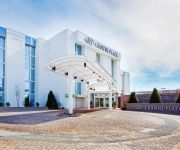
Crowne Plaza CHARLESTON AIRPORT - CONV CTR
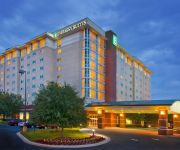
Embassy Suites North Charleston - Airport-Hotel - Convention
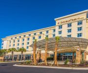
DoubleTree by Hilton North Charleston - Convention Center
Aloft Charleston Airport & Convention Center
TownePlace Suites Charleston Airport/Convention Center
Holiday Inn Express & Suites CHARLESTON ARPT-CONV CTR AREA
Courtyard North Charleston Airport/Coliseum
Fairfield Inn & Suites Charleston Airport/Convention Center
Hilton Garden Inn Charleston Airport
Videos from this area
These are videos related to the place based on their proximity to this place.
5039 Pittman Street, Park Circle, North Charleston, MLS# 15005722
Beautiful Mid-Century gem in the heart of Park Circle! Built in 1956, This beautiful three bedroom, two bath home features refinished oak hardwood and ceramic tile in the kitchen and baths....
600th Video: Otis Traction Elevators at the Radisson North Charleston
This is my 600th video!!! Riding the elevators and a tour of a hotel room at the Radisson in North Charleston, SC, where I stayed. This hotel was only $110 a night and had lots of amenities....
Murder in North Charleston
A North Charleston Patrolman by the name of Michael Thomas Slager was charged with murdering Walter Scott after a routine traffic stop. Officer Slager shot Mr. Scott 5 times in the back as...
1800 Wasp St North Charleston SC
http://www.exite-listings.com/67177 Fantastic Cameron Terrace home in popular Park Circle area of North Charleston This three bedroom home has more to offer than your traditional brick...
Boeing - Mayor Summey takes questions - North Charleston, SC
North Charleston Mayor R. Keith Summey speaks to the press shortly after Boeing announced to place Second 787 Assembly Line in North Charleston, SC.
Rent Cars Charleston SC | Cash Rentals Cars Summerville | Rent Cars For Cash Charleston
http://www.cheaprentalcarssc.com/cheap-rental-cars-sc/ 843-760-0006 Rent Cars Charleston SC Cash Rentals Cars Summerville Rent Cars For Cash Charleston5050 Rivers Ave North Charleston, SC.
norfolk southern train near charleston international airport carring army tanks
this is a train that went by and had alot of army vechicles on it cant go wrong with that its common to see csx do moves like these listen to the sound of the horn and the bell on the crossing...
Jackson Hamilton A Greener Gets Going
Jackson boards the Amtrak Silver Meteor in Charleston, SC to begin a 3000 mile transcontinental rail trip to The Evergreen State College in Olympia, WA on September 11, 2011, a significant...
Rent A Car Charleston | Cheap Rental Cars | Nifty Cash Car Rental | Rent A Car Summerville
http://www.cheaprentalcarssc.com/cheap-rental-cars-sc/ 5050 Rivers Ave North Charleston 843-760-0006 Rent A Car Charleston Cheap Rental cars Nifty Cash Car Rental Rent A Car Summerville. ...
4936 Rivers Ave North Charleston SC
http://www.exite-listings.com/67328 Commercial property on corner of Emden St and Rivers Avenue Property has building on it which is in need of rehab Owner has renovations plans in hand...
Videos provided by Youtube are under the copyright of their owners.
Attractions and noteworthy things
Distances are based on the centre of the city/town and sightseeing location. This list contains brief abstracts about monuments, holiday activities, national parcs, museums, organisations and more from the area as well as interesting facts about the region itself. Where available, you'll find the corresponding homepage. Otherwise the related wikipedia article.
H. L. Hunley (submarine)
H. L. Hunley was a submarine of the Confederate States of America that played a small part in the American Civil War, but a large role in the history of naval warfare. The Hunley demonstrated both the advantages and the dangers of undersea warfare. It was the first combat submarine to sink an enemy warship, although the Hunley was not completely submerged and was lost at some point following her successful attack.
Charleston International Airport
Charleston International Airport is a joint civil-military airport located in the city of North Charleston, Charleston County, South Carolina, USA. The airport serves the needs of the entire South Carolina Lowcountry. The airport has two runways and is operated under a joint-use agreement with Joint Base Charleston. It is South Carolina's busiest airport. In 2012, the airport served 2,593,063 passengers in its busiest year ever. The airport is approximately 13 miles north of downtown Charleston.
USS Sam Rayburn (SSBN-635)
USS Sam Rayburn (SSBN-635) was a James Madison-class fleet ballistic missile submarine named for Sam Rayburn (1882–1961), Speaker of the United States House of Representatives (1940–1947, 1949–1953, and 1955–1961).
Academic Magnet High School
Academic Magnet High School (AMHS) is a high school (grades 9-12) in North Charleston, South Carolina, USA. The school requires students to join through an admissions process based on middle school grades, test scores, teacher recommendations, and a written essay.
Charleston Field
Charleston Field is a United States military facility located in North Charleston, South Carolina. The facility is under the jurisdiction of the United States Air Force 628th Air Base Wing, Air Mobility Command (AMC) It is part of Joint Base Charleston, which combined the Air Force Base with Naval Support Activity Charleston.
North Charleston Coliseum
The North Charleston Coliseum is a 14,000-seat multi-purpose arena in North Charleston, South Carolina. It is part of the North Charleston Convention Center Complex, which also includes a Performing Arts Center, and is owned by the City of North Charleston and managed by SMG. The Coliseum was built in 1993 (the Performing Arts Center and Convention Center opened in 1999), and is located on the access road to the Charleston International Airport.
1886 Charleston earthquake
The Charleston Earthquake of 1886 was a powerful intraplate earthquake that hit Charleston, South Carolina and the East Coast of the US. After the 1811 and 1812 earthquakes in New Madrid, Missouri, it is one of the most powerful and damaging quakes to hit the southeastern United States. The shaking occurred at 9:50 p.m. on August 31, 1886 and lasted just under a minute.
Charleston Naval Shipyard
Charleston Naval Shipyard (formerly known as the Charleston Navy Yard) was a U.S. Navy ship building and repair facility located along the west bank of the Cooper River, in North Charleston, South Carolina and part of Naval Base Charleston. It began operations in 1901 as a drydock, and continued as a navy facility until 1996 when it was leased to Detyens Shipyards, Inc. during down-sizing.
WWWZ
WWWZ is a commercial radio station in Charleston, South Carolina. The station features the Mainstream Urban radio format that plays R&B and hip-hop music. The station often refers to Charleston as Chucktown.
Warren Lasch Conservation Center
The Warren Lasch Conservation Center is a building located at 1250 Supply Street at the former Charleston Navy Yard, in North Charleston, South Carolina. It is being used to excavate, examine, and preserve the submarine H. L. Hunley. The name sake of this building is Warren F. Lasch, who was chairmen of Friends of the Hunley during the Hunley's recovery. The Hunley is housed in a specially designed tank of freshwater to await conservation.
Hanahan High School
Hanahan High School is a public high school located in Hanahan, South Carolina, USA. It serves grades 9 through 12 and is a part of the Berkeley County School District. The principal is Richard Raycroft. The mascot is the hawk. Hanahan High School was opened in Fall 1958 with 282 students, but demand quickly exceeded its capacity. An additional eight-room portion was begun on June 20, 1960 along the northern side of the original building.
Naval Consolidated Brig, Charleston
The Naval Consolidated Brig (NAVCONBRIG CHASN), is a medium security U.S. military prison. The brig, Building #3107, is located in the south annex of Joint Base Charleston in the city of Hanahan, South Carolina. The Brig was commissioned on November 30, 1989 and accepted its first prisoners in January 1990. It has 400 cells and can hold 288 inmates. It houses prisoners from all branches of the US Armed Services and conducts the Navy’s Violent Offender Treatment Program.
Goose Creek High School (Goose Creek, South Carolina)
Goose Creek High School is a public high school located just outside of Goose Creek, South Carolina, USA. Goose Creek High school offers grades 9-12. The current principal is Jimmy Huskey. The school is a public high school that was founded in 1970. Former principals include John Fulmer. Their rival is Stratford High School. The school's colors are Black and gold. The "Gator" is the mascot of Goose Creek High School.
Charleston, South Carolina (Amtrak station)
The Charleston Amtrak station is a train station located in North Charleston, South Carolina, United States served by Amtrak, the national railroad passenger system. The North Charleston station was originally built by the Atlantic Coast Line Railroad in 1956, after a fire destroyed Charleston Union Station in 1947.
Don N. Holt Bridge
The Don N. Holt Bridge is a parallel chord, three-span continuous, modified Warren-type truss bridge that spans the Cooper River between Charleston and North Charleston. It was built in 1992 by the South Carolina Department of Transportation and was designed by HNTB Corporation. The bridge provides a connection between the communities east of the Cooper River, including Mount Pleasant and Daniel Island, to North Charleston and Interstate 26.
Charles Towne Square
Charles Towne Square was an indoor shopping mall located in North Charleston, South Carolina opened in 1976 by developer Melvin Simon & Associates. It was most noted for its large "town square" style clock and children's train ride during Christmas time. The mall's tenants included original anchors Montgomery Ward, JCPenney and Edward's, a local department store which would later be sold to Kuhn's-Big K and renamed "Big K-Edwards.
WMGL
WMGL (branded as "Magic @ 107.3") is a radio station that plays an urban adult contemporary in the Charleston, South Carolina area. It is under ownership of Citadel Broadcasting.
WTMZ
WTMZ (910 AM, "The Zone") is a radio station broadcasting a sports format. Licensed to Dorchester, South Carolina, USA, it serves the Charleston SC area. The station is currently owned by Kirkman Broadcasting, Inc..
Northwoods Mall (North Charleston, South Carolina)
Northwoods Mall is a 130 store regional 833,833-square-foot indoor shopping mall located in the City of North Charleston, South Carolina. Built in 1972, the mall is located at the intersection of Rivers Avenue, Ashley Phosphate Road and Interstate 26. Northwoods Mall was the first regional indoor shopping mall constructed in the South Carolina lowcountry and featured Belk, Sears, and the locally owned Kerrison's department stores as its original anchor tenants.
Trident Technical College
Trident Technical College (TTC) is a two-year college based in the City of North Charleston, Charleston and Dorchester counties in South Carolina. It is part of the South Carolina Technical College System. Enrollment for each semester is approximately 18,000 students working their way toward college transfer associate degrees and technical associate degrees, diplomas and certificates.
General William C. Westmoreland Bridge
The General William C. Westmoreland Bridge connects the city of North Charleston with the West Ashley area of Charleston in South Carolina. Composed of twin spans, it carries two lanes of Interstate 526 in each direction across the Ashley River and the surrounding marshes. It is often referred to as simply the "Westmoreland Bridge". The highway was named for General William C. Westmoreland, a South Carolina native and graduate of West Point.
Boeing Charleston Factory
The Boeing Charleston Factory located in North Charleston, South Carolina is the East Coast manufacturing, assembly and delivery site for Boeing commercial aircraft. The site is located adjacent to the Charleston Air Force Base / Charleston International Airport. Workers will have a 1,200,000 sq ft building to use for aircraft assembly. A separate 11,550-square-foot facility is being built where workers will paint airplane logos onto aircraft tail-fins.
North Charleston Air Force Station
North Charleston Air Force Station is a closed United States Air Force General Surveillance Radar station. It is located 4.0 miles northwest of Charleston, South Carolina. It was closed in 1980.
Joint Base Charleston
Joint Base Charleston is a United States military facility located in North Charleston, South Carolina. The facility is under the jurisdiction of the United States Air Force 628th Air Base Wing, Air Mobility Command (AMC) The facility is an amalgamation of the United States Air Force Charleston Air Force Base and the United States Navy Naval Support Activity Charleston, which were merged on 1 October 2010.
Naval Support Activity Charleston
Naval Support Activity Charleston is a base of the United States Navy formerly known as Naval Weapons Station Charleston located on the west bank of the Cooper River, in the cities of Goose Creek and Hanahan South Carolina. The base encompasses more than 17,000 acres (69 km²) of land with 10,000 acres (40 km²) of forest and wetlands, 16-plus miles of waterfront, four deep-water piers, 38.2 miles of railroad and 292 miles of road.


