Safety Score: 2,7 of 5.0 based on data from 9 authorites. Meaning we advice caution when travelling to United States.
Travel warnings are updated daily. Source: Travel Warning United States. Last Update: 2024-08-13 08:21:03
Discover Lands End
Lands End in Beaufort County (South Carolina) is a town in United States about 499 mi (or 803 km) south-west of Washington DC, the country's capital city.
Current time in Lands End is now 12:17 PM (Monday). The local timezone is named America / New York with an UTC offset of -5 hours. We know of 10 airports near Lands End, of which 5 are larger airports. The closest airport in United States is Savannah Hilton Head International Airport in a distance of 35 mi (or 56 km), West. Besides the airports, there are other travel options available (check left side).
Also, if you like playing golf, there are a few options in driving distance. We discovered 7 points of interest in the vicinity of this place. Looking for a place to stay? we compiled a list of available hotels close to the map centre further down the page.
When in this area, you might want to pay a visit to some of the following locations: Beaufort, Ridgeland, Savannah, Walterboro and Springfield. To further explore this place, just scroll down and browse the available info.
Local weather forecast
Todays Local Weather Conditions & Forecast: 20°C / 67 °F
| Morning Temperature | 9°C / 49 °F |
| Evening Temperature | 17°C / 63 °F |
| Night Temperature | 15°C / 59 °F |
| Chance of rainfall | 0% |
| Air Humidity | 49% |
| Air Pressure | 1022 hPa |
| Wind Speed | Light breeze with 5 km/h (3 mph) from North-East |
| Cloud Conditions | Clear sky, covering 0% of sky |
| General Conditions | Sky is clear |
Monday, 25th of November 2024
22°C (72 °F)
17°C (62 °F)
Scattered clouds, gentle breeze.
Tuesday, 26th of November 2024
20°C (68 °F)
18°C (64 °F)
Few clouds, light breeze.
Wednesday, 27th of November 2024
23°C (73 °F)
20°C (68 °F)
Overcast clouds, moderate breeze.
Hotels and Places to Stay
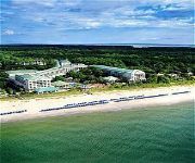
Marriott's Barony Beach Club
The Westin Hilton Head Island Resort & Spa
Royal Dunes
Hampton Inn Hilton Head
Ocean View at Island Club Resort
ISLAND LINKS RESORT
MAIN STREET INN
Videos from this area
These are videos related to the place based on their proximity to this place.
Port Royal South Carolina Tour April 2011
Port Royal South Carolina Tour April 2011 Port Royal South Carolina, a small village sandwich between Parris Island Marine Base, and downtown Beaufort. This little village contains some...
Gathering oysters at The Sands Part 1
Gathering oysters at The Sands Part 1 documents the first use of EHC (Estuarium Helmet Cam) and is your first trip with me into the intertidal zone at Sands Beach in Port Royal, SC where we...
Hermitage MCJROTC at Parris Island 1
Hermitage MCJROTC takes their orientation trip to Marine Corps Recruit Depot Parris Island. FAQ: Q: What/where is Parris Island? A: Parris Island is located in South Carolina. It serves...
Port Royal Flats of Hilton Head - Gulls, Black Skimmers, Terns, Plovers, and Herons
The Lowcountry Birder took along his video camera when he visited the Port Royal Flats on the north end of Hilton Head Island in May, 2010 - we saw lots of Laughing Gulls, Black Skimmers, various...
The beach inside Hilton Head Plantation
Inside Hilton Head Plantation where a path from the Dolphin Head Recreation Area leads to the community's beach on Port Royal Sound. Hilton Head Plantation is one of Hilton Head Island's best...
Videos provided by Youtube are under the copyright of their owners.
Attractions and noteworthy things
Distances are based on the centre of the city/town and sightseeing location. This list contains brief abstracts about monuments, holiday activities, national parcs, museums, organisations and more from the area as well as interesting facts about the region itself. Where available, you'll find the corresponding homepage. Otherwise the related wikipedia article.
Battle of Port Royal
The Battle of Port Royal was one of the earliest amphibious operations of the American Civil War, in which a United States Navy fleet and United States Army expeditionary force captured Port Royal Sound, South Carolina, between Savannah, Georgia and Charleston, South Carolina, on November 7, 1861. The sound was guarded by two forts on opposite sides of the entrance, Fort Walker on Hilton Head Island to the south and Fort Beauregard on Phillip's Island to the north.
Port Royal Sound
Port Royal Sound is a coastal sound, or inlet of the Atlantic Ocean, located in the Sea Islands region, in Beaufort County in the U.S. state of South Carolina. It is the estuary of several rivers, the largest of which is the Broad River.
Charlesfort-Santa Elena Site
Charlesfort-Santa Elena Site is an archeological site on Parris Island, South Carolina, which is also known as Ribaut Monument, San Marcos, San Felipe, or 38BU51 and 38BU162. It is the site of two settlements dating to the time of European colonization: Charlesfort, founded by the French explorer Jean Ribault in 1562, and Santa Elena, founded by the Spanish in 1566. For some background see Timeline of the colonization of North America.
Fort Fremont
Fort Fremont (sometimes misspelled 'Freemont') was a military installation on Saint Helena Island, South Carolina.


