Safety Score: 2,7 of 5.0 based on data from 9 authorites. Meaning we advice caution when travelling to United States.
Travel warnings are updated daily. Source: Travel Warning United States. Last Update: 2024-08-13 08:21:03
Explore Pettaquamscutt Lake Shores
Pettaquamscutt Lake Shores in Washington County (Rhode Island) is located in United States about 345 mi (or 556 km) north-east of Washington DC, the country's capital.
Local time in Pettaquamscutt Lake Shores is now 02:01 PM (Tuesday). The local timezone is named America / New York with an UTC offset of -5 hours. We know of 12 airports in the wider vicinity of Pettaquamscutt Lake Shores, of which 5 are larger airports. The closest airport in United States is Theodore Francis Green State Airport in a distance of 17 mi (or 27 km), North. Besides the airports, there are other travel options available (check left side).
Also, if you like golfing, there are multiple options in driving distance. We found 4 points of interest in the vicinity of this place. If you need a place to sleep, we compiled a list of available hotels close to the map centre further down the page.
Depending on your travel schedule, you might want to pay a visit to some of the following locations: Cranston, Providence, Johnston, North Providence and Taunton. To further explore this place, just scroll down and browse the available info.
Local weather forecast
Todays Local Weather Conditions & Forecast: 3°C / 37 °F
| Morning Temperature | -3°C / 26 °F |
| Evening Temperature | -1°C / 31 °F |
| Night Temperature | -2°C / 28 °F |
| Chance of rainfall | 0% |
| Air Humidity | 42% |
| Air Pressure | 1022 hPa |
| Wind Speed | Gentle Breeze with 6 km/h (4 mph) from South-East |
| Cloud Conditions | Few clouds, covering 10% of sky |
| General Conditions | Sky is clear |
Tuesday, 3rd of December 2024
2°C (36 °F)
5°C (42 °F)
Light rain, moderate breeze, clear sky.
Wednesday, 4th of December 2024
4°C (40 °F)
-2°C (29 °F)
Rain and snow, fresh breeze, overcast clouds.
Thursday, 5th of December 2024
0°C (33 °F)
-3°C (26 °F)
Sky is clear, moderate breeze, clear sky.
Hotels and Places to Stay
Holiday Inn SOUTH KINGSTOWN (NEWPORT AREA)
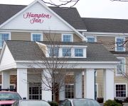
Hampton Inn South Kingstown - Newport Area
Ocean Rose Inn
VILLAGE INN HOTEL CONF CENTER
ATLANTIC HOUSE
WYNDHAMVR BAY VOYAGE INN
Videos from this area
These are videos related to the place based on their proximity to this place.
Hannah Robinson Tower in South Kingston, Rhode Island
From Wikipedia: The Hannah Robinson Tower is a 40 feet (12 m) tall wooden tower at the interchange between U.S. Route 1 (Tower Hill Road) and State Route 138 (Bridgetown Road) in the ...
North Kingstown Fire
A brush fire spread to a barn in North Kingstown around 9:30 p.m. Sunday evening.
Riding across the old Jamestown bridge 1.mpeg
Riding across the old Jamestown, RI bridge, eastbound in 1985, westbound in 1988, and its destruction in 2006.
The Buzz: Narragansett noise
The start of classes at URI has brought a flood of complaints about rowdy house parties, police said Monday.
narragansett wind turbine
GOVERNOR DON CARCIERI ANNOUNCED THAT THE D--E--M WILL BEGIN NEGOTIATIONS WITH CHEVRON ENERGY SOLUTIONS TO BUILD, OPERATE AND MAINTAIN ONSHORE TURBINES ...
Videos provided by Youtube are under the copyright of their owners.
Attractions and noteworthy things
Distances are based on the centre of the city/town and sightseeing location. This list contains brief abstracts about monuments, holiday activities, national parcs, museums, organisations and more from the area as well as interesting facts about the region itself. Where available, you'll find the corresponding homepage. Otherwise the related wikipedia article.
Jamestown Verrazzano Bridge
The Jamestown Verrazzano Bridge (often misspelled Jamestown-Verrazano Bridge) spans the West Passage of Narragansett Bay in Rhode Island, United States. It is part of Route 138 and is part of the route to Newport, Rhode Island for traffic heading northbound from Interstate 95. The bridge is a post-tensioned, double-cell concrete box girder bridge with four travel lanes separated by a concrete Jersey barrier (the original bridge was dangerous with two undivided lanes).
Saunderstown
Saunderstown is a small village and historic district in the towns of Narragansett and North Kingstown in Washington County, Rhode Island, United States. Saunderstown is known as the birthplace of the artist Gilbert Stuart, who is best known for painting the portrait of George Washington that is portrayed on the one-dollar bill.
Prout School
The Prout School is a Catholic, coeducational, college-preparatory high school located in Wakefield, Rhode Island. It is a member of the NEASC and an International Baccalaureate school. It is the only International Baccalaureate high school in Rhode Island. It services all of New England, but more specifically Connecticut, Rhode Island, and Massachusetts.
Casey Farm
Casey Farm is a historic farm established around 1750 in Saunderstown, Rhode Island, United States.
Indian Lake (Washington County, Rhode Island)
Indian Lake is a lake in South Kingstown, Washington County, Rhode Island.
Broad Rock Middle School
Broad Rock Middle School or BRMS is a Middle school in Wakefield, Rhode Island.
Curtis Corner Middle School
Curtis Corner Middle School or CCMS is a Middle school in Wakefield, Rhode Island.
Clarence M. Tarzwell
Clarence Matthew Tarzwell (1907–1993) was an aquatic biologist and water pollution researcher in the employ of the United States Public Health Service and later, the Environmental Protection Agency. He was the founding director of the National Marine Water Quality Laboratory in West Kingston, Rhode Island, and was a major contributor to the formulation of the Clean Water Act of 1972.


