Safety Score: 2,7 of 5.0 based on data from 9 authorites. Meaning we advice caution when travelling to United States.
Travel warnings are updated daily. Source: Travel Warning United States. Last Update: 2024-08-13 08:21:03
Discover North Quidnessett
North Quidnessett in Washington County (Rhode Island) is a place in United States about 351 mi (or 566 km) north-east of Washington DC, the country's capital city.
Current time in North Quidnessett is now 01:58 PM (Tuesday). The local timezone is named America / New York with an UTC offset of -5 hours. We know of 12 airports near North Quidnessett, of which 5 are larger airports. The closest airport in United States is Theodore Francis Green State Airport in a distance of 6 mi (or 10 km), North. Besides the airports, there are other travel options available (check left side).
Also, if you like playing golf, there are a few options in driving distance. We encountered 4 points of interest in the vicinity of this place. If you need a hotel, we compiled a list of available hotels close to the map centre further down the page.
While being here, you might want to pay a visit to some of the following locations: Cranston, Providence, Johnston, North Providence and Taunton. To further explore this place, just scroll down and browse the available info.
Local weather forecast
Todays Local Weather Conditions & Forecast: 2°C / 36 °F
| Morning Temperature | -4°C / 26 °F |
| Evening Temperature | -0°C / 32 °F |
| Night Temperature | -2°C / 29 °F |
| Chance of rainfall | 0% |
| Air Humidity | 39% |
| Air Pressure | 1022 hPa |
| Wind Speed | Gentle Breeze with 6 km/h (4 mph) from South-East |
| Cloud Conditions | Few clouds, covering 10% of sky |
| General Conditions | Sky is clear |
Tuesday, 3rd of December 2024
2°C (36 °F)
5°C (40 °F)
Light rain, moderate breeze, clear sky.
Wednesday, 4th of December 2024
4°C (39 °F)
-1°C (29 °F)
Rain and snow, moderate breeze, overcast clouds.
Thursday, 5th of December 2024
0°C (32 °F)
-3°C (26 °F)
Sky is clear, moderate breeze, clear sky.
Hotels and Places to Stay
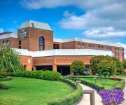
Crowne Plaza PROVIDENCE-WARWICK (AIRPORT)
TownePlace Suites Providence North Kingstown
BEST WESTERN AIRPORT INN
Hampton Inn - Suites Providence-Warwick Airport
Holiday Inn Express & Suites WARWICK-PROVIDENCE (AIRPORT)
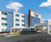
SpringHill Suites Providence West Warwick
AMERICAS BEST VALUE INN
Budget Inn North Kingstown
Extended Stay America Providence West Warwick
Videos from this area
These are videos related to the place based on their proximity to this place.
East Greenwich Cove, East Greenwich RI
Footage from DJI Phantom 2 Vision Plus, recorded at East Greenwich Cove, East Greenwich RI on September 27, 2014.
East Greenwich Rhode Island (RI) Real Estate Tour
http://www.eastgreenwichrihomes.com Tour East Greenwich, RI neighborhoods, condominium developments, subdivisions, schools, landmarks, recreational areas, and town offices. East Greenwich,...
TCW East Greenwich :: 934 Main Street, East Greenwich, RI
The Children's Workshop in East Greenwich, RI offers programs for infants, toddlers, preschool, pre-K, and before and after school as well as fun and exciting summer programs. Contact us...
Haze over Greenwich Cove (East Greenwich, Rhode Island)
The sun was warm enough to transform the dew into steam. It rose and collected in a thermal inversion over Greenwich Cove.
2002 Audi A8 #P-5759 in East Greenwich, RI 02818
http://www.autotrader.com/fyc/vdp.jsp?vin=WAUML44D12N001108 If you are looking for real value on a great used car, International Motor Group invites you to come in and test drive this 2002...
East Greenwich Police Searching for Armed Robbery Suspect
Police in East Greenwich are on the lookout for a male suspect in connection with an armed robbery at the Sunnybrook Farms, located at 1002 Main St.
Police investigate armed robbery in East Greenwich
Police investigate armed robbery in East Greenwich.
Videos provided by Youtube are under the copyright of their owners.
Attractions and noteworthy things
Distances are based on the centre of the city/town and sightseeing location. This list contains brief abstracts about monuments, holiday activities, national parcs, museums, organisations and more from the area as well as interesting facts about the region itself. Where available, you'll find the corresponding homepage. Otherwise the related wikipedia article.
Potowomut, Rhode Island
Potowomut is an isolated neighborhood and a peninsula in Warwick, Rhode Island. It is bordered by the Town of East Greenwich to the northwest, and by North Kingstown to the southeast. Greenwich Bay surrounds all other sides. Potowomut's name translates to "land of fires", the Narragansett Indian name for the neck of land.
Quonset State Airport
Quonset State Airport is a joint civil-military public airport located on Quonset Point, in northeastern North Kingstown, Rhode Island, adjacent to Narragansett Bay. It is a general aviation airport and there is no scheduled airline service available. It was the site of the Naval Air Station Quonset Point from 1941 until the early 1970s, when the military presence in Rhode Island was drastically scaled down.
Chepiwanoxet Point
Chepiwanoxet is a neighborhood in Warwick, Rhode Island, with an island peninsula in Greenwich Bay, an arm of Narragansett Bay. The neighborhood straddles the Amtrak railroad lines, which lie just east of Post Road. Its boundaries are Neptune Street to the north, Alger Avenue to the south, Post Road to the west and Greenwich Bay to the east. Chepiwanoxet Way, an underpass beneath the Amtrak lines, now serves as the only street access in and out of the neighborhood.
Naval Air Station Quonset Point
Naval Air Station Quonset Point was a United States Naval Base in Quonset Point, Rhode Island that was deactivated in 1974. Next to NAS Quonset Point was Camp Endicott at Davisville, home of the Naval Construction Battalions known as the Seabees. Quonset Point also gave its name to the Quonset hut, a standardized temporary structure used by the U.S. military starting in World War II. Former US President Richard M. Nixon went through basic naval officer training at Quonset Point in 1942.
Camp Endicott
Camp Endicott, later known as Davisville Naval Construction Battalion Center, was a United States Navy base Seabee base. It is now a historic site between Seventh and Tenth streets in North Kingstown, Rhode Island. The camp, also known as the Davisville Construction Battalion Center, was built in 1942 and added to the National Register of Historic Places in 1978. The vast training camp built at Davisville, Rhode Island in 1942 provided more than 100,000 men of the U.S.
Greenwich Bay (Rhode Island)
Greenwich Bay, is a bay on the coast of Rhode Island in the United States near East Greenwich, Rhode Island off of Narragansett Bay. The United States Navy seaplane tender USS Greenwich Bay, in commission from 1945 to 1966, was named for the bay.
Archie R. Cole Middle School
Archie R. Cole Middle School is located in East Greenwich Rhode Island.
Quonset Point Air National Guard Station
See: Quonset State Airport for civil airport information Quonset Point Air National Guard Station is the home base of the Rhode Island Air National Guard 143d Airlift Wing.


