Safety Score: 2,7 of 5.0 based on data from 9 authorites. Meaning we advice caution when travelling to United States.
Travel warnings are updated daily. Source: Travel Warning United States. Last Update: 2024-08-13 08:21:03
Touring Langworthy Corner
Langworthy Corner in Washington County (Rhode Island) is a town located in United States about 326 mi (or 524 km) north-east of Washington DC, the country's capital place.
Time in Langworthy Corner is now 09:55 AM (Saturday). The local timezone is named America / New York with an UTC offset of -5 hours. We know of 12 airports nearby Langworthy Corner, of which 5 are larger airports. The closest airport in United States is Groton New London Airport in a distance of 14 mi (or 23 km), West. Besides the airports, there are other travel options available (check left side).
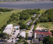
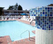
Also, if you like the game of golf, there are several options within driving distance. We collected 2 points of interest near this location. Need some hints on where to stay? We compiled a list of available hotels close to the map centre further down the page.
Being here already, you might want to pay a visit to some of the following locations: Johnston, Cranston, North Providence, Providence and Taunton. To further explore this place, just scroll down and browse the available info.
Local weather forecast
Todays Local Weather Conditions & Forecast: 13°C / 55 °F
| Morning Temperature | 3°C / 38 °F |
| Evening Temperature | 11°C / 52 °F |
| Night Temperature | 7°C / 44 °F |
| Chance of rainfall | 0% |
| Air Humidity | 33% |
| Air Pressure | 1008 hPa |
| Wind Speed | Moderate breeze with 9 km/h (6 mph) from South-East |
| Cloud Conditions | Clear sky, covering 0% of sky |
| General Conditions | Sky is clear |
Saturday, 16th of November 2024
13°C (56 °F)
9°C (47 °F)
Sky is clear, gentle breeze, clear sky.
Sunday, 17th of November 2024
11°C (52 °F)
9°C (47 °F)
Light rain, moderate breeze, overcast clouds.
Monday, 18th of November 2024
10°C (50 °F)
6°C (43 °F)
Sky is clear, moderate breeze, clear sky.
Hotels and Places to Stay
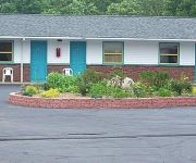
Pleasant View Inn
The Villa Bed & Breakfast
La Quinta Inn and Suites Stonington-Mystic Area
Aquastar Inn
Winnapaug Inn
Breezeway Resort
Sandy Shore Motel
Point 1 Motel
Misquamicut Beach Front Inn
WEEKAPAUG INN
Videos from this area
These are videos related to the place based on their proximity to this place.
Sunset time lapse at Quonochontaug Pond, Charlestown RI 7.11.14
Shot from Central Beach boat launch.
6 Beds Approved Beachfront Quonnie West
Truly a once in a lifetime opportunity. 33 acres of conservation land border almost 2 acres on 2 lots in Quonnie West beach to protect 360 degree views of ocean, beach, breachway, and sunsets...
Piper Arrow Landing at Westerly State Airport
Base to final in a Piper Arrow for rwy 25 at Westerly State Airport in Westerly RI.
Westerly Public Schools - Arts Alive
Promotional video for the Westerly Public Schools - "Arts Alive" show on April 6, 2013.
Westerly HS Unified Volleyball Promo
Westerly High School Unified Volleyball promo for game against WHS Faculty.
Westerly Rhode Island (RI) Real Estate Tour
http://www.westerlyrihomes.com Tour Westerly, RI neighborhoods, condominium developments, subdivisions, schools, landmarks, recreational areas, and town offices. Westerly, Rhode Island...
34 Ice Pond Road. Westerly, Rhode Island (MLS/Source ID: 1079959)
MLS/Source ID: 1079959 Aerial footage provided by Spur Media Solutions (www.myspurmedia.com)
Clogged Shower Drain Cleaning Westerly RI
If you need a Sewer & Drain Cleaning Service for your home or, business even at night on a weekend, Call All Things Sewer & Drain Care for prompt 24/7 Emergency Service, http://allthingsdrain.com...
TCW Westerly:: 42 Franklin Street, Westerly, RI
The Children's Workshop in Westerly, RI offers programs for infants, toddlers, preschool, and pre-Kindergarten as well as fun and exciting summer programs. Contact us at 401-315-5544 or westerly@...
Videos provided by Youtube are under the copyright of their owners.
Attractions and noteworthy things
Distances are based on the centre of the city/town and sightseeing location. This list contains brief abstracts about monuments, holiday activities, national parcs, museums, organisations and more from the area as well as interesting facts about the region itself. Where available, you'll find the corresponding homepage. Otherwise the related wikipedia article.
Westerly State Airport
Westerly State Airport is a public use airport in Washington County, Rhode Island, United States. It serves the town of Westerly and is located two nautical miles (3.7 km) southeast of its central business district. It is primarily a general aviation airport, but there is also scheduled airline service to Block Island provided by New England Airlines. Westerly State Airport is one of six active airports operated by the Rhode Island Airport Corporation. The other five airports include T.F.
Weekapaug, Rhode Island
Weekapaug is a small fire district in southern Washington County, Rhode Island. It is part of the town of Westerly, Rhode Island, and is a small beachfront community that is also a census-designated place. Weekapaug lies in the Eastern Time Zone and observes daylight saving time. Weekapaug has many private roads running through it and isn't as well known as neighboring Watch Hill, Rhode Island. It has had summer cottages since 1877. Weekapaug was known as Noyes Beach from 1701 to 1899.
Winnapaug Pond
Winnapaug Pond (also known as Brightman Pond) is a breached saltwater pond in Westerly, Rhode Island, United States, connected to Block Island Sound by the Weekapaug Breachway, which was constructed during the mid-1950s. The 2.5-mile lake is separated from the Atlantic by a large sandbar. In 2010, its overall water quality was assessed as "good". Winnapaug is relatively small and shallow, and is favorable for kayaking.


