Safety Score: 2,7 of 5.0 based on data from 9 authorites. Meaning we advice caution when travelling to United States.
Travel warnings are updated daily. Source: Travel Warning United States. Last Update: 2024-08-13 08:21:03
Delve into Woodlawn
Woodlawn in Providence County (Rhode Island) is located in United States about 361 mi (or 580 km) north-east of Washington DC, the country's capital town.
Current time in Woodlawn is now 06:16 AM (Thursday). The local timezone is named America / New York with an UTC offset of -5 hours. We know of 10 airports close to Woodlawn, of which 3 are larger airports. The closest airport in United States is Theodore Francis Green State Airport in a distance of 9 mi (or 15 km), South. Besides the airports, there are other travel options available (check left side).
Also, if you like playing golf, there are some options within driving distance. We encountered 3 points of interest near this location. If you need a hotel, we compiled a list of available hotels close to the map centre further down the page.
While being here, you might want to pay a visit to some of the following locations: Providence, North Providence, Cranston, Johnston and Taunton. To further explore this place, just scroll down and browse the available info.
Local weather forecast
Todays Local Weather Conditions & Forecast: 8°C / 47 °F
| Morning Temperature | 9°C / 48 °F |
| Evening Temperature | 9°C / 48 °F |
| Night Temperature | 8°C / 46 °F |
| Chance of rainfall | 27% |
| Air Humidity | 93% |
| Air Pressure | 1000 hPa |
| Wind Speed | Moderate breeze with 11 km/h (7 mph) from South-West |
| Cloud Conditions | Overcast clouds, covering 100% of sky |
| General Conditions | Heavy intensity rain |
Thursday, 21st of November 2024
10°C (50 °F)
4°C (40 °F)
Light rain, moderate breeze, overcast clouds.
Friday, 22nd of November 2024
5°C (42 °F)
6°C (42 °F)
Light rain, moderate breeze, overcast clouds.
Saturday, 23rd of November 2024
7°C (45 °F)
5°C (42 °F)
Broken clouds, moderate breeze.
Hotels and Places to Stay
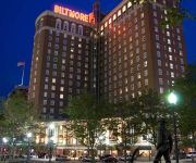
Providence Biltmore
Omni Providence Hotel
Renaissance Providence Downtown Hotel
Providence Marriott Downtown
Hilton Providence
Courtyard Providence Lincoln
Hotel Dolce Villa
Hilton Garden Inn Providence
The Dean Hotel
Hampton Inn-Pawtucket RI
Videos from this area
These are videos related to the place based on their proximity to this place.
One Pawtucket
A tribute to the life of the men and women of the Pawtucket Fire Department, Rhode Island By David Reed, PFD.
Pawtucket Couple In Court for Child Molestation
Curtis and Crystal Rogers of Pawtucket we charged with various counts of sexual assault and child molestation.
Pawtucket, RI | General Alarm Mill Fire 10/14/10
Pawtucket, RI | General Alarm Mill Fire October 13 - 14, 2010 | Federal, state and local investigators are examining the cause of a massive fire that ripped through a vacant section of a financiall...
Pawtucket Mill Fire - general alarm w/ collapse
October 13-14, 2010 A large mill fire on Goff street in Pawtucket, RI. Several portions of the building collapsed within the first few hours. Firefighters were able to keep the fire from...
General alarm mill fire in Pawtucket, RI
Shortly before 11:30pm on Wednesday Oct 13, 2010, firefighters were called to the former Union Wadding Company for a mill fire. With a glow in the sky, a 2nd and 3rd alarms were called as...
My America Q&A with Rod Webber & Joseph James Bellamy at Pawtucket Film Festival
MY AMERICA Q&A with Rod Webber & Joseph James Bellamy at Pawtucket Film Festival.
Pawtucket time lapse Blizzard Juno
Time lapse video from 2am-8am of Blizzard Juno. This is from Pawtucket, RI and filmed January 27, 2015.
Videos provided by Youtube are under the copyright of their owners.
Attractions and noteworthy things
Distances are based on the centre of the city/town and sightseeing location. This list contains brief abstracts about monuments, holiday activities, national parcs, museums, organisations and more from the area as well as interesting facts about the region itself. Where available, you'll find the corresponding homepage. Otherwise the related wikipedia article.
Rhode Island Auditorium
Rhode Island Auditorium was an indoor arena in Providence, Rhode Island, at 1111 North Main Street. It hosted the NBA's Providence Steamrollers from 1946 until 1949, and the Providence Reds ice hockey team until the Providence Civic Center was opened in 1972. The arena held 5,300 people and opened in 1926. It was torn down in 1989 and parking now occupies the old site.
Charles, Providence, Rhode Island
Charles is a neighborhood in northern Providence, Rhode Island. Along with Wanskuck, it comprises what is sometimes referred to as the North End. To the west Charles is partitioned from Wanskuck by Route 146, while the Chad Brown public housing complex separates Charles from Smith Hill to the south, and the West River and Interstate 95 bounds the area to the east. The city limits abutting the city of North Providence bound Charles to the north.
Bishop Keough Regional High School
Bishop Keough Regional High School is a private, Roman Catholic, all-girls high school in Pawtucket, Rhode Island. It is located in the Roman Catholic Diocese of Providence.
Hope, Providence, Rhode Island
Hope is a neighborhood on the northern border of Providence, Rhode Island. To the west, it is bounded by North Main Street, the North Burial Ground, and Interstate 95, while Rochambeau Ave, Hope Street, and the Providence-Pawtucket city line roughly delineate its boundaries to the south, east, and north respectively. Hope is sometimes referred to as Summit, named for the street that runs through the middle of the neighborhood.
Pawtucket-Central Falls (MBTA station)
Pawtucket/Central Falls is a disused railroad station located in the Rhode Island cities of Pawtucket and Central Falls. The station was originally built in either 1915 or 1916 by the New York, New Haven and Hartford Railroad as a replacement for two separate stations in both Pawtucket and Central Falls and was built over the tracks. The station was served by New Haven Railroad trains, then later by MBTA Commuter Rail until February 20, 1981.
National Register of Historic Places listings in Pawtucket, Rhode Island
This is a list of the National Register of Historic Places listings in Pawtucket, Rhode Island. This is intended to be a complete list of the properties and districts on the National Register of Historic Places in Pawtucket, Rhode Island, United States. Latitude and longitude coordinates are provided for many National Register properties and districts; these locations may be seen together in a Google map.
St. Mary's Church of the Immaculate Conception Complex (Pawtucket, Rhode Island)
St. Mary's Church of the Immaculate Conception Complex is an historic site at 103 Pine Street in Pawtucket, Rhode Island. The church was built in 1830. The building was added to the National Register of Historic Places in 1983. in 2009 the church's school closed, and students were allowed to transfer to the nearby regional school.
Blackstone Academy Charter School
Blackstone Academy Charter School, commonly known as Blackstone Academy or BACS, is an American secondary, public charter school in Pawtucket, Rhode Island.
Pawtucket Falls (Rhode Island)
Pawtucket Falls is a waterfall on the Blackstone River in Pawtucket, Rhode Island. Below the falls, the river becomes tidal and changes its name to the Seekonk River. The falls provided power for Samuel Slater’s cotton spinning mill, which was built in 1793 and is said to have been responsible for starting the Industrial Revolution in America.
Fairlawn, Rhode Island
Fairlawn is a village in Lincoln, Rhode Island USA.


