Safety Score: 2,7 of 5.0 based on data from 9 authorites. Meaning we advice caution when travelling to United States.
Travel warnings are updated daily. Source: Travel Warning United States. Last Update: 2024-08-13 08:21:03
Delve into Watchemoket
Watchemoket in Providence County (Rhode Island) is a town located in United States about 360 mi (or 580 km) north-east of Washington DC, the country's capital town.
Time in Watchemoket is now 06:10 AM (Thursday). The local timezone is named America / New York with an UTC offset of -5 hours. We know of 12 airports closer to Watchemoket, of which 5 are larger airports. The closest airport in United States is Theodore Francis Green State Airport in a distance of 7 mi (or 11 km), South. Besides the airports, there are other travel options available (check left side).
Also, if you like the game of golf, there are some options within driving distance. We saw 4 points of interest near this location. In need of a room? We compiled a list of available hotels close to the map centre further down the page.
Since you are here already, you might want to pay a visit to some of the following locations: Providence, Cranston, North Providence, Johnston and Taunton. To further explore this place, just scroll down and browse the available info.
Local weather forecast
Todays Local Weather Conditions & Forecast: 8°C / 47 °F
| Morning Temperature | 9°C / 48 °F |
| Evening Temperature | 9°C / 48 °F |
| Night Temperature | 8°C / 46 °F |
| Chance of rainfall | 27% |
| Air Humidity | 93% |
| Air Pressure | 1000 hPa |
| Wind Speed | Moderate breeze with 12 km/h (7 mph) from South-West |
| Cloud Conditions | Overcast clouds, covering 100% of sky |
| General Conditions | Heavy intensity rain |
Thursday, 21st of November 2024
10°C (50 °F)
5°C (40 °F)
Light rain, moderate breeze, overcast clouds.
Friday, 22nd of November 2024
5°C (42 °F)
6°C (42 °F)
Light rain, moderate breeze, overcast clouds.
Saturday, 23rd of November 2024
7°C (45 °F)
6°C (42 °F)
Broken clouds, moderate breeze.
Hotels and Places to Stay
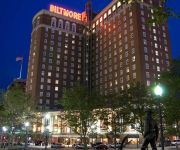
Providence Biltmore
Providence Marriott Downtown
Omni Providence Hotel
Renaissance Providence Downtown Hotel
Hilton Providence
Hilton Garden Inn Providence
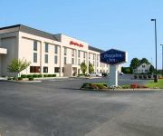
Hampton Inn-Pawtucket RI
Hampton Inn Seekonk
Courtyard Providence Downtown
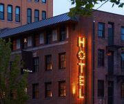
The Dean Hotel
Videos from this area
These are videos related to the place based on their proximity to this place.
Fire spreads in East Providence home
A fire spreads through a East Providence home, starting in the basement and moving to all three floors. One firefighter was sent to the hospital for a cut on the hand, but no other injuries...
Raid at East Providence home
An East Providence woman is due in court Thursday morning after police raided her Anthony Street home.
East Providence police investigate drive-by shooting
East Providence police are investigating a drive-by shooting on Orchard Street late Tuesday night.
East Providence woman leaps from burning building
A woman who jumped from a burning multi-family home in East Providence Wednesday said she had no other choice.
Sinkhole Creates Problems in East Providence
Wednesday's severe storms lead to flooding across the state, and in East Providence a sinkhole formed in one resident's backyard.
Videos provided by Youtube are under the copyright of their owners.
Attractions and noteworthy things
Distances are based on the centre of the city/town and sightseeing location. This list contains brief abstracts about monuments, holiday activities, national parcs, museums, organisations and more from the area as well as interesting facts about the region itself. Where available, you'll find the corresponding homepage. Otherwise the related wikipedia article.
Henderson Bridge (Rhode Island)
The Henderson Bridge (known by some locals as the New Red Bridge) is a bridge in Rhode Island which spans the Seekonk River, connecting the cities of Providence and East Providence.
WPRV
WPRV (790 AM, "AM 790") is a radio station located in Providence, Rhode Island. The station is owned by Cumulus Media, and airs a news/talk format.
WHJY
WHJY is a commercial radio station in Providence, Rhode Island owned by Clear Channel Media and Entertainment that broadcasts at 94.1 MHz. (Channel 231). WHJY plays classic and mainstream rock, and has been doing so since September 4, 1981. Its broadcast center, along with its sister stations, is at 75 Oxford Street, just west of Interstate 95 in Providence, and its transmitter is located at 115 Eastern Avenue in East Providence.
Washington Bridge (Providence, Rhode Island)
The Washington Bridge is a paired bridge carrying Interstate 195 over the Seekonk River from Providence to East Providence, Rhode Island.
Stevenson Field
Stevenson Field is a stadium in Providence, Rhode Island on the campus of Brown University. It is home to the Brown Bears soccer and lacrosse programs. Named in 1979 for longtime soccer coach Cliff Stevenson, the stadium seats 3,500 and has hosted games in both the NCAA soccer and lacrosse tournaments. Stevenson Field recently received an upgrade to add lights to the facility.
Blackstone, Providence, Rhode Island
Blackstone is a predominantly residential neighborhood in Providence, Rhode Island. It is in the northeast corner of the city and is bounded to the south and west by Lloyd Avenue and Hope Street respectively. It is one of six neighborhoods comprising the East Side of Providence.
India Point Park
India Point Park is a park in the Fox Point neighborhood of Providence, Rhode Island at the confluence of the Seekonk River and Providence River. The park takes its name from the maritime activity connecting Providence with the East and West Indies. In the 1960s, declines in the area's use for shipping led to its being redeveloped as recreational space.
WPMZ
WPMZ (1110 AM, "Poder 1110") is a radio station licensed to serve East Providence, Rhode Island. The station is owned by Video Mundo Broadcasting Co. , LLC. It airs a Spanish Tropical format. The station has been assigned these call letters by the Federal Communications Commission since November 1, 1995. WPMZ was known as WHIM from its inception in 1947 until the 1990s.
WSTL
WSTL (1220 AM, "Shine Radio 1220AM") is a radio station licensed to serve Providence, Rhode Island. The station is owned by New England Christian Media, a subsidiary of Faith Christian Center, a large charismatic church in nearby Seekonk, Massachusetts. It airs a Christian radio format. The station has been assigned these call letters by the Federal Communications Commission since July 7, 2006.
Blackstone Boulevard Realty Plat Historic District
Blackstone Boulevard Realty Plat Historic District is a historic district roughly bounded by Blackstone Blvd. , Rochambeau Ave. , Holly St. and Elmgrove Ave. in Providence, Rhode Island. The district features architecture by Marshall Martin, William T. Aldrich and other structures of late 19th and 20th century colonial revivals. It was added to the National Register of Historic Places in 1995.
Crook Point Bascule Bridge
The Crook Point Bascule Bridge (or the Seekonk River Drawbridge) is a defunct Scherzer rolling lift railway bridge which spans the Seekonk River, connecting the city of Providence, Rhode Island, to the suburb of East Providence. Stuck in the open position since its abandonment in 1976, it is known to nearby residents as the "Stuck-Up Bridge" and has become somewhat of a local icon of urban decay.
Murray Stadium
Murray Stadium is a baseball venue in Providence, Rhode Island, United States. It is home to the Brown Bears baseball team of the NCAA Division I Ivy League. Opened in 1959, it has a capacity of 1,000 spectators. Features of the stadium include dugouts, bullpens, batting cages, and a press box. On May 5, 2007, the stadium hosted Brown's first ever Ivy League Baseball Championship, a 1-0, 20-6 doubleheader win over Harvard. The game was played in front of over 1,500 spectators.


