Safety Score: 2,7 of 5.0 based on data from 9 authorites. Meaning we advice caution when travelling to United States.
Travel warnings are updated daily. Source: Travel Warning United States. Last Update: 2024-08-13 08:21:03
Delve into Rumford
Rumford in Providence County (Rhode Island) is a town located in United States about 362 mi (or 582 km) north-east of Washington DC, the country's capital town.
Time in Rumford is now 01:15 PM (Tuesday). The local timezone is named America / New York with an UTC offset of -5 hours. We know of 12 airports closer to Rumford, of which 5 are larger airports. The closest airport in United States is Theodore Francis Green State Airport in a distance of 9 mi (or 14 km), South-West. Besides the airports, there are other travel options available (check left side).
Also, if you like the game of golf, there are some options within driving distance. We saw 3 points of interest near this location. In need of a room? We compiled a list of available hotels close to the map centre further down the page.
Since you are here already, you might want to pay a visit to some of the following locations: Providence, Cranston, North Providence, Johnston and Taunton. To further explore this place, just scroll down and browse the available info.
Local weather forecast
Todays Local Weather Conditions & Forecast: 2°C / 36 °F
| Morning Temperature | -4°C / 25 °F |
| Evening Temperature | 0°C / 32 °F |
| Night Temperature | -2°C / 29 °F |
| Chance of rainfall | 0% |
| Air Humidity | 39% |
| Air Pressure | 1022 hPa |
| Wind Speed | Gentle Breeze with 6 km/h (4 mph) from South-East |
| Cloud Conditions | Few clouds, covering 10% of sky |
| General Conditions | Sky is clear |
Tuesday, 3rd of December 2024
2°C (36 °F)
4°C (39 °F)
Light rain, moderate breeze, clear sky.
Wednesday, 4th of December 2024
5°C (41 °F)
-1°C (30 °F)
Rain and snow, fresh breeze, overcast clouds.
Thursday, 5th of December 2024
-0°C (32 °F)
-3°C (26 °F)
Sky is clear, fresh breeze, clear sky.
Hotels and Places to Stay
Hilton Providence
Omni Providence Hotel
Renaissance Providence Downtown Hotel
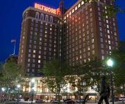
Providence Biltmore
Providence Marriott Downtown
Hotel Dolce Villa
Hampton Inn - Suites Providence Downtown
The Dean Hotel
Courtyard Providence Downtown
Five Bridge Inn
Videos from this area
These are videos related to the place based on their proximity to this place.
HGTV My house is worth what? Pawtucket, RI
pawtucket RI homeowners want to know how much their house is worth.
Roofers Pawtucket RI - FREE Estimates | Pawtucket Roofers
Roofers Pawtucket RI - (401) 262 - 0027 - CALL NOW - FREE Estimates http://www.rooferspawtucketri.com/ We are the Most Affordable and Trusted Roofing Contractors in Pawtucket for over 10 years...
Hot Leathers at the Pawtucket Red Sox Car & Bike Show!
Check out Hot Leathers, the leader in motorcycle apparel at the Car & Bike Show at McCoy Stadium, hosted by the Pawtucket Red Sox. Hot Leathers set up their prize wheel and hundreds of participant.
East Providence sketch released of bowling alley robber
East Providence police released a composite sketch of the man suspected of robbing two people at gunpoint outside a bowling alley late Wednesday.
East Providence police bust international check-cashing scam
Three suspects have been arrested in conjunction with a scam out of East Providence.
East Providence flooding closes roads, schools
Drenching rains flooded numerous roads across Rhode Island and Southeastern Massachusetts early Tuesday. Several local schools had to cancel classes.
Raid at East Providence home
An East Providence woman is due in court Thursday morning after police raided her Anthony Street home.
East Providence Public Works Vac-Truck
On my visit to the East Providence DPW Central Garage, they pulled out this truck for me. This is a 2006 Sterling. Photo: www.publicservicevehicles.com/dpw/ri/east-providence/highway/Truck%201880.
East Providence Labor Day Parade
East Providence, RI Labor Day Parade 9/03/12....10am Starts at EP High...left onto Pawtucket Avenue, right onto Waterman Avenue to Taunton Avenue...ending at City Hall. Total viewing time...approx....
2008 Dodge Avenger Used Cars East Providence RI
http://www.elmwoodscornerlot.com This 2008 Dodge Avenger is available from Elmwood's Corner Lot. For details, call us at 401-680-4841.
Videos provided by Youtube are under the copyright of their owners.
Attractions and noteworthy things
Distances are based on the centre of the city/town and sightseeing location. This list contains brief abstracts about monuments, holiday activities, national parcs, museums, organisations and more from the area as well as interesting facts about the region itself. Where available, you'll find the corresponding homepage. Otherwise the related wikipedia article.
Rumford, Rhode Island
Rumford, Rhode Island, is the northern section of the city of East Providence. It borders Seekonk, Massachusetts, Pawtucket, Rhode Island and the Ten Mile River. Roger Williams originally settled near (what is now) the intersection of Roger Williams and Wilson Avenues and long considered Phillipsdale. In April 1636, after the corn had been planted, the settlement was told that Plymouth Colony claimed all land to the Seekonk River which is just to the west.
WPRV
WPRV (790 AM, "AM 790") is a radio station located in Providence, Rhode Island. The station is owned by Cumulus Media, and airs a news/talk format.
WHJY
WHJY is a commercial radio station in Providence, Rhode Island owned by Clear Channel Media and Entertainment that broadcasts at 94.1 MHz. (Channel 231). WHJY plays classic and mainstream rock, and has been doing so since September 4, 1981. Its broadcast center, along with its sister stations, is at 75 Oxford Street, just west of Interstate 95 in Providence, and its transmitter is located at 115 Eastern Avenue in East Providence.
Ten Mile River
The Ten Mile River is a river within the U.S. states of Massachusetts and Rhode Island. It flows approximately 22 miles and drains a watershed of 54 square miles . The North Attleborough National Fish Hatchery is located in its upper reaches, and the river offers stocked trout fishing in the spring. The Ten Mile River was badly polluted in the mid 1900s but has subsequently been remediated.
Narragansett Race Track
Narragansett Park was an American race track for Thoroughbred horse racing in Pawtucket, Rhode Island. On May 18, 1934 a special Rhode Island election was held, where by a 4-1 margin, parimutuel wagering was made legal. Walter E. O'Hara formed the Narragansett Racing Association and was named president and manager. James Dooley (judge) was named Racing Secretary, while being acknowledged as the controlling interest.
Wannamoisett Country Club
The Wannamoisett Country Club is a private golf course located in Rumford, Rhode Island. The course was designed by Donald Ross in 1914 and played host to the 1931 PGA Championship (which was won by Tom Creavy) and hosts the prestigious Northeast Amateur every year. This par 69 course plays 6,688 yards long from the blue tees and 6,399 yards long from the white tees. The red tees play at a par of 75 and is 5,944 yards long.
Mildred H. Aitken Elementary School
Mildred H. Aitken Elementary School is an elementary school in Seekonk, Massachusetts, USA. It serves the K-5 student population of the town located north of Route 44. The school was founded as the Newman Avenue School in the early 20th century. The current building was built in 1959 and 1997.
Walter E. O'Hara
Walter E. O'Hara (1897-1941), formed the Narragansett Racing Association in 1934 and was named the first President and Manager. The organization owned and operated Narragansett Park, a Thoroughbred horse racing facility in Pawtucket, Rhode Island. A resident of Fall River, MA, O'Hara had owned and operated the Annawan Mills in that city. He also maintained an office in the Bennett Building on North Main Street, which sat kitty-corner across from the Hotel Mellen - "Fall River's Leading Hotel".


