Safety Score: 2,7 of 5.0 based on data from 9 authorites. Meaning we advice caution when travelling to United States.
Travel warnings are updated daily. Source: Travel Warning United States. Last Update: 2024-08-13 08:21:03
Explore Fiskeville
Fiskeville in Providence County (Rhode Island) is a city in United States about 349 mi (or 562 km) north-east of Washington DC, the country's capital.
Local time in Fiskeville is now 12:39 PM (Tuesday). The local timezone is named America / New York with an UTC offset of -5 hours. We know of 10 airports in the vicinity of Fiskeville, of which 3 are larger airports. The closest airport in United States is Theodore Francis Green State Airport in a distance of 7 mi (or 11 km), East. Besides the airports, there are other travel options available (check left side).
Also, if you like golfing, there are multiple options in driving distance. We found 5 points of interest in the vicinity of this place. If you need a place to sleep, we compiled a list of available hotels close to the map centre further down the page.
Depending on your travel schedule, you might want to pay a visit to some of the following locations: Johnston, Cranston, North Providence, Providence and Taunton. To further explore this place, just scroll down and browse the available info.
Local weather forecast
Todays Local Weather Conditions & Forecast: 2°C / 36 °F
| Morning Temperature | -4°C / 25 °F |
| Evening Temperature | -0°C / 31 °F |
| Night Temperature | -2°C / 28 °F |
| Chance of rainfall | 0% |
| Air Humidity | 39% |
| Air Pressure | 1022 hPa |
| Wind Speed | Gentle Breeze with 6 km/h (4 mph) from South-East |
| Cloud Conditions | Few clouds, covering 11% of sky |
| General Conditions | Few clouds |
Tuesday, 3rd of December 2024
2°C (35 °F)
4°C (39 °F)
Light rain, gentle breeze, clear sky.
Wednesday, 4th of December 2024
4°C (39 °F)
-2°C (29 °F)
Rain and snow, moderate breeze, overcast clouds.
Thursday, 5th of December 2024
-0°C (31 °F)
-3°C (26 °F)
Sky is clear, moderate breeze, clear sky.
Hotels and Places to Stay
Crowne Plaza PROVIDENCE-WARWICK (AIRPORT)
LA QUINTA INN STE COVENTRY PROVIDENCE
Hampton Inn Coventry-Warwick Area
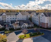
Residence Inn Providence Coventry
NYLO PROVIDENCE WARWICK
SpringHill Suites Providence West Warwick
BW WEST GREENWICH INN
Extended Stay America Providence Warwick
Comfort Suites West Warwick - Providence
Extended Stay America Providence West Warwick
Videos from this area
These are videos related to the place based on their proximity to this place.
Fire tears through West Warwick house
Crews are on the scene of a two-alarm house fire in West Warwick.
West Warwick Middle School Fire
A brief scare occurred today at West Warwick middle school where a small fire broke out in one of the student bathrooms.
West Warwick flooding along Pawtuxet River
Flooding along the Pawtuxet River continued to cause problems in West Warwick and Cranston Sunday night.
2001 Hyundai Tiburon Used Cars West Warwick RI
http://www.micklinautosales.com This 2001 Hyundai Tiburon is available from Micklin Auto Sales. For details, call us at 401-826-5500.
River Point Park West Warwick - Aaron
River Point Park athletes in West Warwick, Rhode Island. This video features Aaron.
Videos provided by Youtube are under the copyright of their owners.
Attractions and noteworthy things
Distances are based on the centre of the city/town and sightseeing location. This list contains brief abstracts about monuments, holiday activities, national parcs, museums, organisations and more from the area as well as interesting facts about the region itself. Where available, you'll find the corresponding homepage. Otherwise the related wikipedia article.
Fiskeville, Rhode Island
Fiskeville is a small village in the south west corner of Cranston, Rhode Island, United States, the south east corner of the Town of Scituate, Rhode Island and across the northern side of Coventry, Rhode Island. The village's Main Street forms the border between Cranston and Scituate.
River Point, Rhode Island
River Point in West Warwick, Rhode Island, United States, is a community made up of mill houses and three mills - the Valley Queen Mill, the Royal Mill and the Cotton Shed. Built in 1834 by the Greene Company, the Valley Queen Mill is the oldest of the three buildings. It originally operated as a cotton factory, producing coarse cotton cloths under the Greene Company name. In 1888, B.B. & R. Knight Company, the textile giant that made Fruit of the Loom products, purchased the Valley Queen Mill.
Jackson, Rhode Island
Jackson, Rhode Island is an unincorporated area outlying, to the northwest, West Warwick.
McCarthy Field
McCarthy Field is a baseball stadium in West Warwick, Rhode Island. The field is located in Riverpoint Park, where the north and south branches of the Pawtuxet River merge. The ballpark was constructed and mainly suited for high school, and amateur baseball. However in 1996 it would host minor league baseball for the first time. The newly formed Independent Northeast League (now known as the Can-Am League) was looking to expand and the Rhode Island Tiger Sharks were formed.
Lippitt, Rhode Island
Lippitt, Rhode Island is a village within the town of West Warwick, Rhode Island. It was founded by Revolutionary War General Christopher Lippitt and his brother Charles Lippitt when they and their partners constructed Lippitt Mill in 1809 and the surrounding mill village for their workers. During the Depression following of War of 1812 the Lippitt Manufacturing Company survived by supplying yarn to convict weavers in the Vermont prison.
Harris, Rhode Island
Harris (formerly known as Harrisville) is a village with the town of Coventry, Rhode Island on the north branch of the Pawtuxet River near West Warwick. The village was once part of the Burton and Potter farms. Around 1813 Caleb Atwood built a textile mill in the village, known as the Dumplin Mould, and later the building became the Lamphear Machine Shop in the 1840s.
Arkwright, Rhode Island
Arkwright is a village along Route 115 in the northeastern corner Coventry, Rhode Island touching Cranston, Rhode Island and Scituate, Rhode Island.. In the 1700s the Remington family owned a large parcel of land in the area, and the village became known as "Remington’s Run. " In the early nineteenth century the area was known as "Burlingame Mills" after the saw mill and grist mill run by Jabez Burlingame and James Burlingame.
Blackrock, Rhode Island
Blackrock is a village in Kent County, Rhode Island, United States, located in the town of Coventry between the villages of Anthony and Arkwright. The area was named after a large dark rock which was rumored to be the site of Native American marriage ceremonies. The rock is located on Blackrock Road.


