Dyerville
in Providence County of Rhode Island, United States

Noteable things around
Location Summary
Decimal Coordinates (Latitude, Longitude):
41.826 and -71.458 (Lat./Lng.)
Coordinates by Time:
N 41° 49' 33" and W -71° 27' 29"
Currency and Currency Code:
Dollar - USD
Spoken languages:
English, Spanish, French
Local electricity:
230 V - 50 Hz (plugs: G)
Mobile phone / cellular frequencies (MHz):
900 MHz, 1800 MHz, 3G, 4G
Local Time: 06:03 AM (Thursday)
Timezone: America/New_York
UTC/GMT offset: -10 hours
Sunrise and Sunset:
6:44 am and 4:20 pm
Antipode Coordinates:
-34.350 and 115.167 (Lat./Lng.)
Closest place to antipode coordinates:
Flinders Bay
References
This place on Geonames.org
Current travel safety evaluation for United States in Northern America

Safety Score: 2,7 of 5.0 based on data from 9 authorites. Meaning we advice caution when travelling to United States.

Travel warnings are updated daily. Source: Travel Warning United States. Last Update: 2024-08-13 08:21:03

Delve into Dyerville

Dyerville in Providence County (Rhode Island) is located in United States about 357 mi (or 574 km) north-east of Washington DC, the country's capital town.

Current time in Dyerville is now 06:03 AM (Thursday). The local timezone is named America / New York with an UTC offset of -5 hours. We know of 10 airports close to Dyerville, of which 3 are larger airports. The closest airport in United States is Theodore Francis Green State Airport in a distance of 7 mi (or 11 km), South. Besides the airports, there are other travel options available (check left side).

Also, if you like playing golf, there are some options within driving distance. We encountered 5 points of interest near this location. If you need a hotel, we compiled a list of available hotels close to the map centre further down the page.

While being here, you might want to pay a visit to some of the following locations: North Providence, Providence, Johnston, Cranston and Taunton. To further explore this place, just scroll down and browse the available info.

Local weather forecast

Todays Local Weather Conditions & Forecast: 8°C / 47 °F

Morning Temperature 9°C / 48 °F
Evening Temperature 9°C / 48 °F
Night Temperature 7°C / 45 °F
Chance of rainfall 26%
Air Humidity 93%
Air Pressure 1000 hPa
Wind Speed Moderate breeze with 11 km/h (7 mph) from South-West
Cloud Conditions Overcast clouds, covering 100% of sky
General Conditions Heavy intensity rain

Thursday, 21st of November 2024

10°C (49 °F)
5°C (40 °F)
Light rain, gentle breeze, overcast clouds.

Friday, 22nd of November 2024

5°C (41 °F)
6°C (42 °F)
Overcast clouds, moderate breeze.

Saturday, 23rd of November 2024

7°C (45 °F)
5°C (42 °F)
Broken clouds, moderate breeze.

Hotels and Places to Stay

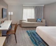
Providence Marriott Downtown

Address
2,4 mi
1 Orms Street
02904 Providence
United States

Time Information

Checkout: 11:00 - Checkin: 16:00
Reception
Weekday: -
Weekend: closed


Hilton Providence

Address
2,0 mi
21 Atwells Avenue
02903 Providence
United States

Time Information

Checkout: 12:00 - Checkin: 15:00
Reception
Weekday: -
Weekend: closed


Renaissance Providence Downtown Hotel

Address
2,2 mi
5 Avenue of the Arts
02903 Providence
United States

Time Information

Checkout: 12:00 - Checkin: 15:00
Reception
Weekday: -
Weekend: closed


Omni Providence Hotel

Address
2,2 mi
ONE WEST EXCHANGE ST
02903 Providence
United States

Time Information

Checkout: 12:00 - Checkin: 15:00
Reception
Weekday: 0:00 - 24:00
Weekend: 0:00 - 24:00


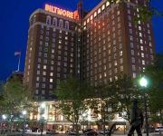
Providence Biltmore

Address
2,3 mi
11 Dorrance Street
02903 Providence
United States

Time Information

Checkout: 11:00 - Checkin: 16:00
Reception
Weekday: -
Weekend: closed


Hilton Garden Inn Providence

Address
3,5 mi
220 India Street
02903 Providence
United States

Time Information

Checkout: 11:00 - Checkin: 15:00
Reception
Weekday: -
Weekend: closed


La Quinta Inn and Suites Warwick Providence Airport

Address
5,2 mi
36 JEFFERSON BOULEVARD
02888 Warwick
United States

Time Information

Checkout: 12:00 - Checkin: 15:00
Reception
Weekday: 0:00 - 24:00
Weekend: 0:00 - 24:00


Courtyard Providence Warwick

Address
5,1 mi
55 Jefferson Park Road
02888 Warwick
United States

Time Information

Checkout: 12:00 - Checkin: 15:00
Reception
Weekday: -
Weekend: closed


Edgewood Manor Bed & Breakfast

Address
4,4 mi
232 Norwood Ave
02905 Providence
United States

Time Information

Checkout: 11:00 - Checkin: 15:00
Reception
Weekday: -
Weekend: closed


The Charles Newhall House

Address
4,4 mi
234 Norwood Avenue
02905 Providence
United States

Time Information

Checkout: 11:00 - Checkin: 15:00
Reception
Weekday: -
Weekend: closed


Videos from this area

These are videos related to the place based on their proximity to this place.

North Providence mayor decides not to hire fire chief

Published: February 18, 2010
Length: 20:50 min
Rating: 1 of 5
Author: WPRI

North Providence mayor Charles Lombardi has decided not to hire a new fire chief, and will instead rely on the town's battalion chiefs to fill leadership roles.


North Providence fire station

Published: November 29, 2009
Length: 20:12 min
Rating: 0 of 5
Author: WPRI

A North Providence fire station is slated to close.


North Providence Rollover Accident

Published: October 28, 2011
Length: 03:46 min
Rating: 0 of 5
Author: WPRI

3 people were sent to the hospital after they rolled over a pickup truck rolled over overnight Thursday.


North Providence house fire

Published: February 07, 2010
Length: 21:33 min
Rating: 0 of 5
Author: WPRI

Flames force evacuations at a North Providence mill building.


North Providence Accident

Published: September 18, 2010
Length: 27:55 min
Rating: 0 of 5
Author: WPRI

North Providence Accident.


NORTH PROVIDENCE CORRUPTION ARRAIGNMENTS

Published: August 25, 2010
Length: 53:00 min
Rating: 0 of 5
Author: WPRI

NORTH PROVIDENCE CORRUPTION ARRAIGNMENTS.


North Providence fire

Published: January 24, 2010
Length: 45:39 min
Rating: 0 of 5
Author: WPRI

Fire breaks out in the bedroom of a North Providence home.


North Providence Fire Station

Published: January 01, 2010
Length: 33:53 min
Rating: 0 of 5
Author: WPRI

Judge won't block closure of North Providence fire station.


North Providence Pedestrian Struck

Published: October 25, 2009
Length: 01:06 min
Rating: 0 of 5
Author: WPRI

North Providence Pedestrian Struck.


North Providence Home Hit by Lightening

Published: June 20, 2010
Length: 06:34 min
Rating: 5 of 5
Author: WPRI

North Providence Home Hit by Lightening.


Videos provided by Youtube are under the copyright of their owners.

Attractions and noteworthy things

Distances are based on the centre of the city/town and sightseeing location. This list contains brief abstracts about monuments, holiday activities, national parcs, museums, organisations and more from the area as well as interesting facts about the region itself. Where available, you'll find the corresponding homepage. Otherwise the related wikipedia article.

Rhode Island College

This article is about the current institution that has used this name since 1960. For the institution that used this name from 1764 until 1804, see Brown University. Rhode Island College {{#invoke:InfoboxImage|InfoboxImage|image=Riclogo. png|size=|sizedefault=frameless|alt=}}Established 1854Type PublicEndowment $16.4 millionStudents 9,000Location Providence, Rhode Island, United StatesCampus Suburban, 180 acres (688,000 m²)Website http://www. ric.

Located at 41.8422, -71.4612 (Lat. / Lng.), about 1 miles away.
Wikipedia Article, Homepage
Rhode Island College, Public universities and colleges in Rhode Island, American Association of State Colleges and Universities, Educational institutions established in 1854, Universities and colleges in Providence, Rhode Island, New England Association of Schools and Colleges

Messer Street Grounds

Messer Street Grounds (also known as Messer Park or Messer Field) is a former baseball park located in Providence, Rhode Island. The ground was home to the Providence Grays baseball club of the National League from 1878 to 1885. In 1878 the Providence Base Ball Association formed, and began scouting around the city for a good location for "the best baseball plant in the country".

Located at 41.8132, -71.4371 (Lat. / Lng.), about 1 miles away.
Wikipedia Article
Sports venues in Rhode Island, Defunct baseball venues, Sports in Providence, Rhode Island, History of Providence, Rhode Island, Buildings and structures in Providence, Rhode Island, Providence Grays

WWLI

WWLI is a radio station in Providence, Rhode Island that under ownership of Cumulus Media. This station is better known as "Lite Rock 105" and plays the adult contemporary format. Its transmitter is located in Johnston, Rhode Island.

Located at 41.807, -71.47 (Lat. / Lng.), about 1 miles away.
Wikipedia Article, Homepage
Radio stations in Providence, Rhode Island, Adult contemporary radio stations in the United States, Cumulus Media radio stations, Radio stations established in 1948

La Salle Academy, Providence

La Salle Academy is an independent, co-educational Roman Catholic college preparatory day school located in the Elmhurst neighborhood of Providence, Rhode Island. Founded in 1871, the Academy currently enrolls 1,478 students in seventh through twelfth grade, with the majority of students coming from the Providence metropolitan area.

Located at 41.8424, -71.4466 (Lat. / Lng.), about 1 miles away.
Wikipedia Article, Homepage
Educational institutions established in 1871, New England Association of Schools and Colleges, High schools in Providence, Rhode Island, Private middle schools in Rhode Island, Private high schools in Rhode Island, Roman Catholic secondary schools in Rhode Island, 1871 establishments in Rhode Island

Intercollegiate Athletic Arena

Intercollegiate Athletic Arena is a 8,000 seat multi-purpose arena in Providence, Rhode Island. It was built in 1995. It is the home of the Rhode Island College Anchormen basketball teams.

Located at 41.8428, -71.4669 (Lat. / Lng.), about 1 miles away.
Wikipedia Article
Indoor arenas in the United States, College basketball venues in the United States, Sports venues in Rhode Island, Buildings and structures in Providence, Rhode Island, Sports venues in Providence County, Rhode Island

Elmhurst, Providence, Rhode Island

Elmhurst is a primarily residential neighborhood in the northwest quadrant of Providence, Rhode Island. Douglas Avenue and Admiral Street bound Elmhurst to the northeast, Academy Avenue and Smith Street bound it to the west, while Chalkstone Avenue marks the southern border.

Located at 41.85, -71.45 (Lat. / Lng.), about 2 miles away.
Wikipedia Article
Neighborhoods in Providence, Rhode Island

Hartford, Providence, Rhode Island

Hartford is a neighborhood located along the western edge of Providence, Rhode Island. Route 6 and the Woonasquatucket River separates it from Olneyville.

Located at 41.82, -71.46 (Lat. / Lng.), about 0 miles away.
Wikipedia Article
Neighborhoods in Providence, Rhode Island

St. Adalbert's Parish (Providence, Rhode Island)

St. Adalbert Parish - designated for Polish immigrants in Providence, Rhode Island, United States.

Located at 41.8248, -71.4456 (Lat. / Lng.), about 1 miles away.
Wikipedia Article, Homepage
Roman Catholic parishes and churches in Rhode Island, Roman Catholic parishes of Diocese of Providence, Polish-American culture in Rhode Island, Polish-American Roman Catholic parishes in New England

Popular in vicinity

These are some bigger and more relevant cities in the wider vivinity of Dyerville.


This place is known by different names. Here the ones we know:
Triptown, Dyerville