Safety Score: 2,7 of 5.0 based on data from 9 authorites. Meaning we advice caution when travelling to United States.
Travel warnings are updated daily. Source: Travel Warning United States. Last Update: 2024-08-13 08:21:03
Delve into Pennypack
The district Pennypack of Rhawnhurst in Philadelphia County (Pennsylvania) is a district located in United States about 134 mi north-east of Washington DC, the country's capital town.
In need of a room? We compiled a list of available hotels close to the map centre further down the page.
Since you are here already, you might want to pay a visit to some of the following locations: Camden, Philadelphia, Woodbury, Doylestown and Mount Holly. To further explore this place, just scroll down and browse the available info.
Local weather forecast
Todays Local Weather Conditions & Forecast: 5°C / 41 °F
| Morning Temperature | 3°C / 37 °F |
| Evening Temperature | 3°C / 38 °F |
| Night Temperature | 4°C / 39 °F |
| Chance of rainfall | 1% |
| Air Humidity | 53% |
| Air Pressure | 997 hPa |
| Wind Speed | Gentle Breeze with 8 km/h (5 mph) from North-East |
| Cloud Conditions | Scattered clouds, covering 35% of sky |
| General Conditions | Light rain |
Saturday, 23rd of November 2024
7°C (44 °F)
8°C (46 °F)
Sky is clear, moderate breeze, clear sky.
Sunday, 24th of November 2024
9°C (48 °F)
6°C (44 °F)
Broken clouds, moderate breeze.
Monday, 25th of November 2024
8°C (46 °F)
10°C (49 °F)
Light rain, light breeze, broken clouds.
Hotels and Places to Stay
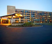
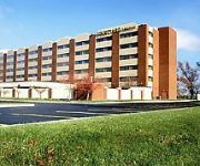
Four Points by Sheraton Philadelphia Northeast
BEST WESTERN PLUS PHILADELPHIA BENSALEM
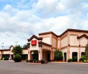
RAMADA PHILADELPHIA NE
Holiday Inn Express PHILADELPHIA NE - BENSALEM
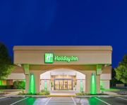
Holiday Inn BENSALEM-PHILADELPHIA AREA
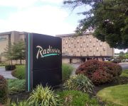
Radisson Hotel Philadelphia Northeast
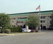
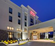
Hampton Inn - Suites Philadelphia-Bensalem
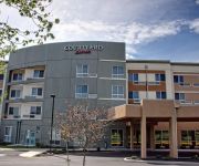
Courtyard Philadelphia Bensalem
Inn of the Dove
Sleep Inn & Suites
Videos from this area
These are videos related to the place based on their proximity to this place.
Opening Day Trout Fishing at the Pennypack Creek (Northeast Philadelphia, PA)
Click on "Show More" for full video description. For full fishing reports and other fishing posts, access my Blog: http://extremephillyfishing.blogspot.com/ Join my Facebook Page for my latest...
Fishing for Trout at the Pennypack Creek with Spinners (Northeast Philadelphia, PA)
Click on "Show More" for full video description. For full fishing reports and other fishing posts, access my Blog: http://extremephillyfishing.blogspot.com/ Join my Facebook Page for my latest...
Don't CALL locksmith philadelphia university city until watch this video
Call Now :215-858-5626 for 15% OFF or visit http://www.locallockman.com if you are looking for locksmith philadelphia university city area, or locksmith in central city area, local lockman...
Golden Rainbow Trout Swimming at Pennypack Creek (Northeast Philadelphia, PA)
Click on "Show More" for full video description. For full fishing reports and other fishing posts, access my Blog: http://extremephillyfishing.blogspot.com/ Join my Facebook Page for my latest...
The Mills of Pennypack Park
Video by Fred Moore. This video highlights the history of the Mills at Pennypack Park. Fred is a member of the Holmesburg Civic Association. This video was produced in partnership with Scribe...
Two Ducks fighting over a Female at Pennypack Creek (Northeast Philadelphia, PA)
Click on "Show More" for full video description. For full fishing reports and other fishing posts, access my Blog: http://extremephillyfishing.blogspot.com/ Join my Facebook Page for my latest...
Goodman Plumbing | Goodman Plumbing - Philadelphia, PA | Call: (215) 364-7775
http://www.goodmanplumbers.com Goodman Plumbing - Philadelphia, PA Emergency Philadelphia Plumber - Goodman Plumbing Contact Goodman Plumbing for expert residential plumbing services.
1989 Volvo 240 Used Cars Philadelphia PA
http://PHILLYAUTOFINDER.COM This 1989 Volvo 240 is available from Philly Auto Finder . For details, call us at 215-964-3751.
Videos provided by Youtube are under the copyright of their owners.
Attractions and noteworthy things
Distances are based on the centre of the city/town and sightseeing location. This list contains brief abstracts about monuments, holiday activities, national parcs, museums, organisations and more from the area as well as interesting facts about the region itself. Where available, you'll find the corresponding homepage. Otherwise the related wikipedia article.
Northeast Philadelphia Airport
Northeast Philadelphia Airport is a public airport located just north of the intersection of Grant Avenue and Ashton Road in the Ashton-Woodenbridge neighborhood of Northeast Philadelphia. It is part of the Philadelphia Airport System along with Philadelphia International Airport, and is the general aviation reliever airport for Philadelphia International Airport. Northeast Philadelphia Airport is the sixth busiest airport in Pennsylvania.
Fox Chase, Philadelphia
Fox Chase is a neighborhood in the Northeast Philadelphia section of the United States city of Philadelphia, Pennsylvania. The origin of the name comes from The "Fox Chase Inn" which opened in 1705. It throve on the Turnpike trade, but it also catered to the affluent who wanted to hunt fox, thus the name "Fox Chase".
Holmesburg, Philadelphia
Holmesburg is a neighborhood in the Northeast section of Philadelphia, Pennsylvania. Holmesburg was named for the descendants of John Holme (1632–1704) who immigrated to Philadelphia in the 1680s and had no known relation to Surveyor General Thomas Holme. John Holme's descendants acquired land in Lower Dublin, north and south of Frankford Avenue and west of the Pennypack Creek.
Mayfair, Philadelphia
Mayfair is a neighborhood located in the Lower Northeast section of Philadelphia, Pennsylvania centered on the intersection of Cottman and Frankford Avenues. It is bordered by Tacony and Wissinoming to the south and east, Holmesburg to the east, Pennypack Park to the north, and Oxford Circle and Rhawnhurst to the west.
Fox Chase (SEPTA station)
Fox Chase is the current terminus of SEPTA's Fox Chase Line. It is located just west of the intersection of Rhawn Street and Rockwell Avenue in the Fox Chase section of Philadelphia, Pennsylvania. Fox Chase Station, which has the largest number of parking spaces of any on the line (342), is the closest regional rail stop to the neighborhoods of Fox Chase, Bustleton, and Pine Valley, and Rockledge and Huntingdon Valley in Montgomery County, Pennsylvania.
Rhawnhurst, Philadelphia
Rhawnhurst is a residential neighborhood in the Northeast section of Philadelphia, named for George and William Rhawn by area real estate developers. Roughly bordered by Cottman Avenue to the south, Pennway Street to the west, the Pennypack Creek to the north, and Roosevelt Boulevard to the east, Rhawnhurst encompasses zip codes 19152 and part of zip code 19111. The geographic center of Rhawnhurst is at the intersection of Castor Avenue and Rhawn Street.
Bustleton, Philadelphia
The Bustleton section of Northeast Philadelphia is located in the Far Northeast, north of Rhawnhurst and Fox Chase and south of Somerton; sitting between Roosevelt Boulevard to the east, the city boundary to the west, Red Lion Road to the north, and Pennypack Park to the south, it is centered at the intersection of Grant Avenue and Bustleton Avenue and is completely included in the 19115 postal zip code. In the early history of the city, Bustleton was known as a rich farming area.
Ashton-Woodenbridge, Philadelphia
Ashton-Woodenbridge (also known as Ashton-Wooden Bridge and Pennypack) is a neighborhood in the Northeast section of Philadelphia, Pennsylvania. It is located on the eastern side of the Far Northeast, in the vicinity of Northeast Philadelphia Airport, including Wooden Bridge Run west to Academy Gardens, and south to Pennypack Park. Originally farm land, it was part of the holdings of Thomas Holme, surveyor for Philadelphia's founder, William Penn.
Pennypack Theatre
The Pennypack Theatre is an historic Art Deco style movie house located on the 8000 block of Frankford Avenue of Holmesburg in the northeast section of Philadelphia, Pennsylvania. Built in 1929 and designed by architect William Harold Lee, the theater was designed with a 1,364 seating capacity. Among its features is a sizable stage house at its back which suggests it was likely designed both for motion picture presentations as well as live performances.
Lexington Park, Philadelphia
Lexington Park is a neighborhood in the Northeast section of Philadelphia, Pennsylvania. It is bounded on the west by Roosevelt Boulevard, and on the north, east and south by Pennypack Park. The neighborhood is made up mostly of twin and single homes built in the years following the Second World War, and a few apartment buildings built not long thereafter. There are some commercial establishments along Rhawn Street and Roosevelt Boulevard.
Tacony, Philadelphia
Tacony is a historic neighborhood in Northeast Philadelphia, about 10 miles from downtown ("Center City") Philadelphia. It is the oldest continuously occupied neighborhood (by Europeans) in Philadelphia. It is bounded by Frankford Avenue on the northwest, Cottman Avenue on the northeast, Robbins Street on the southwest, and the Delaware River and Interstate 95 on the southeast. Early Swedish records spelled it Taokanick, a Lenape word for "forest" or "wilderness.
Father Judge High School
Father Judge High School is a Roman Catholic high school in Philadelphia, Pennsylvania, United States. It was established in 1954 by the Roman Catholic Archdiocese of Philadelphia and is run by the Oblates of St. Francis de Sales.
Frankford Avenue Bridge
The Frankford Avenue Bridge, also known as the Pennypack Creek Bridge, the Pennypack Bridge, the Holmesburg Bridge, and the King's Highway Bridge, erected in 1697 in the Holmesburg section of Northeast Philadelphia, Pennsylvania, is the oldest surviving roadway bridge in the United States. The three-span, 73-foot-long twin stone arch bridge carries Frankford Avenue, just north of Solly Avenue, over Pennypack Creek in Pennypack Park.
Pennypack Park
Pennypack Park is a municipal park, part of Philadelphia's Fairmount Park system, in Northeast Philadelphia in the U.S. state of Pennsylvania. Established in 1905 by ordinance of the City of Philadelphia, it includes about 1,600 acres of woodlands, meadows and wetlands. The Pennypack Creek runs through the park from Pine Road to the Delaware River. The park has playgrounds, hiking and bike trails, and bridle paths for horseback riding.
Northeast High School (Philadelphia)
Northeast High School is a high school located at 1601 Cottman Avenue (at Algon Avenue) in Philadelphia, Pennsylvania, United States. Northeast is one of the oldest high schools in Philadelphia, founded in 1890 as the Northeast Manual Training School. Before 1957, it was located at 8th Street and Lehigh Avenue in Philadelphia (later the home of Thomas Edison High School). As of 2011 Northeast High School will have had 170 Graduating Classes.
Empire Rock Club
Empire Rock Club was a live music venue in Philadelphia, Pennsylvania and an important influence on the 1980s east coast glam metal music scene.
Holme Circle, Philadelphia
Holme Circle is a neighborhood in Northeast Philadelphia. It is located in the loop of Pennypack Creek at Holme Avenue and Welsh Road.
Abraham Lincoln High School (Philadelphia)
Abraham Lincoln High School, a public school located in the Mayfair section of Northeast Philadelphia, Pennsylvania, and with its main entrance located at Ryan and Rowland Avenues. The current principal is Dr. Donald J. Anticoli.
St. Hubert Catholic High School for Girls
St. Hubert Catholic High School for Girls is a private, independent Roman Catholic preparatory school for girls located in Philadelphia, Pennsylvania. With over 1,000 students, it is the largest all-girls school in Philadelphia. The school is named after St. Hubert, the patron saint of hunters. The school is under direction of the Roman Catholic Archdiocese of Philadelphia.
Krewstown, Philadelphia
Krewstown is a neighborhood of Northeast Philadelphia close to both eastern Montgomery County, Pennsylvania and southern Bucks County, Pennsylvania located around Krewstown Road, west of the Roosevelt Boulevard. Uses of the name Krewstown include a bridge, a train station, a set of public horse stables, an apartment house complex (Krewstown Park), and the neighborhood around the apartment house complex.
St. Thomas Syro-Malabar Catholic Church
The St. Thomas Syro-Malabar Catholic Church in Philadelphia, Pennsylvania, is a parish of the St. Thomas Syro-Malabar Catholic Diocese of Chicago.
Roosevelt Mall
Roosevelt Mall is a medium-sized outdoor shopping mall, located along PA 73 (Cottman Avenue) between Bustleton Avenue and the Roosevelt Boulevard in the Castor Gardens neighborhood of Northeast Philadelphia, Pennsylvania. The mall is owned and managed by Centro Properties Group and is anchored by a large, 3-level department store on its east end, that currently houses Macy's.
Pennypack, Philadelphia
Pennypack is a neighborhood in Northeast Philadelphia. It is located between Northeast Philadelphia Airport and Pennypack Park. The Greenbelt Knoll Historic District and Holme Avenue Bridge are listed on the National Register of Historic Places.
Winchester Park, Philadelphia
Winchester Park is a neighborhood in Northeast Philadelphia. It is located in the vicinity of Pennypack Park, north and west of Holmesburg. It is primarily a neighborhood of single family homes. The first part of the development, on Winchester Avenue between Albion Street and 75' east of Holmehurst Ave was built in 1940. The remainder of the area west of of Welsh Road was built between 1947- 1955.
Insectarium (Philadelphia)
The Insectarium is a museum about insects located in the Northeast part of Philadelphia, Pennsylvania. The museum opened in 1992 and features displays of many types of live insects, mounted specimens, exhibits and hands-on activities. Examples of the live insects include honeybees, tarantulas, cockroaches, scorpions, spiders, praying mantis, millipedes, beetles, water bugs, ants, crickets and more.


