Safety Score: 2,7 of 5.0 based on data from 9 authorites. Meaning we advice caution when travelling to United States.
Travel warnings are updated daily. Source: Travel Warning United States. Last Update: 2024-08-13 08:21:03
Discover Ludlow
The district Ludlow of Philadelphia in Philadelphia County (Pennsylvania) is a district in United States about 125 mi north-east of Washington DC, the country's capital city.
Looking for a place to stay? we compiled a list of available hotels close to the map centre further down the page.
When in this area, you might want to pay a visit to some of the following locations: Camden, Woodbury, Norristown, Media and Doylestown. To further explore this place, just scroll down and browse the available info.
Local weather forecast
Todays Local Weather Conditions & Forecast: 13°C / 55 °F
| Morning Temperature | 6°C / 43 °F |
| Evening Temperature | 14°C / 56 °F |
| Night Temperature | 11°C / 51 °F |
| Chance of rainfall | 0% |
| Air Humidity | 36% |
| Air Pressure | 1019 hPa |
| Wind Speed | Light breeze with 5 km/h (3 mph) from South-East |
| Cloud Conditions | Broken clouds, covering 59% of sky |
| General Conditions | Broken clouds |
Monday, 18th of November 2024
15°C (60 °F)
12°C (53 °F)
Few clouds, gentle breeze.
Tuesday, 19th of November 2024
13°C (56 °F)
14°C (57 °F)
Scattered clouds, light breeze.
Wednesday, 20th of November 2024
16°C (61 °F)
15°C (59 °F)
Sky is clear, gentle breeze, clear sky.
Hotels and Places to Stay
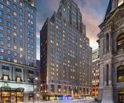
Le Meridien Philadelphia
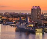
Hilton Philadelphia at Penn*s Landing
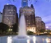
The Franklin Hotel at Independence Park
Sheraton Philadelphia Society Hill Hotel
Four Points by Sheraton Philadelphia City Center
Loews Philadelphia Hotel
Philadelphia Marriott Downtown
Aloft Philadelphia Downtown
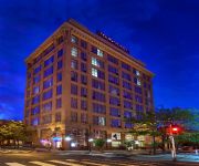
THE WINDSOR SUITES
Residence Inn Philadelphia Center City
Videos from this area
These are videos related to the place based on their proximity to this place.
1992 Chrysler Town & Country Used Cars Philadelphia PA
http://www.doublemautosales.com This 1992 Chrysler Town & Country is available from Double M Auto Sales. For details, call us at 215-495-2661.
SEPTA Center City Tunnel Reading to Pennsylvania Rear View
Rear View from the back of the Silverliner II Charter in former Reading car #9016 as it runs from just south of the Temple University Station, through the phase brake and into the mouth of...
Why Philly? New York to Northern Liberties
http://www.SusannaKunkel.com The new owner of the first completed unit at THE STABLES in Northern Liberties shares why they moved from Manhattan to Philadelphia. For more details about THE...
945 N 5th St - Northern Liberties, Philadelphia real estate
Why strap your budget with a monthly condo fee when you can collect rent instead? This two-unit building can be used in multiple ways, any of which will bring you a nice chunk of income.
PhillyIn.com visits Honey's Sit 'N Eat
During their March, "In Your Neighborhood" review of Northern Liberties, the PhillyIn Cast visits Honey's Sit 'N Eat and share their thoughts. For more go to www.phillyin.com and click on "In...
PhillyIn visits The Little Candy Shoppe
During their March, "In Your Neighborhood" review of Northern Liberties, the PhillyIn Cast visits The Little Candy Shoppe and share their thoughts on phillyin.com. For more go to www.phillyin.com...
PhillyIn visits Darling's DIner
During their March, "In Your Neighborhood" review of Northern Liberties, the PhillyIn Cast visits Darling's Diner. For more go to www.phillyin.com and click on "In Your Neighborhood."
PhillyIn visits the Velvet Lily: Part I
During their March, "In Your Neighborhood" review of Northern Liberties, the PhillyIn Cast visits The Velvet Lily and share their thoughts. For more go to www.phillyin.com and click on "In...
PhillyIn visits The Velvet Lily: Part II
Justin from PhillyIn dares to try this adult swing at the Velvet Lily during The PhillyIn Cast's March "In Your Neighborhood" review of Northern Liberties. For more go to www.phillyin.com and...
Videos provided by Youtube are under the copyright of their owners.
Attractions and noteworthy things
Distances are based on the centre of the city/town and sightseeing location. This list contains brief abstracts about monuments, holiday activities, national parcs, museums, organisations and more from the area as well as interesting facts about the region itself. Where available, you'll find the corresponding homepage. Otherwise the related wikipedia article.
Philadelphia Nativist Riots
The Philadelphia Nativist Riots (also known as the Philadelphia Prayer Riots, the Bible Riots and the Native American Riots) were a series of riots that took place between May 6 and 8 and July 6 and 7, 1844, in Philadelphia, Pennsylvania, United States, and the adjacent districts of Kensington and Southwark. The riots were a result of rising anti-Catholic sentiment at the growing population of Irish Catholic immigrants.
Fishtown, Philadelphia
Fishtown is a neighborhood in Philadelphia, Pennsylvania, United States. Located immediately northeast of Center City, its borders are somewhat disputed today due to many factors, but are roughly defined by the triangle created by the Delaware River, Frankford Avenue, and York Street. Some newer residents expand the area to Lehigh Avenue, while some older residents shrink the area to Norris Street. It is served by the Market–Frankford Line rapid transit subway/elevated of the SEPTA system.
Reading Viaduct
The Reading Viaduct is the common name for an railroad right-of-way (now abandoned) viaduct in Philadelphia, Pennsylvania, formerly owned by the Philadelphia and Reading Railway and later Southeastern Pennsylvania Transportation Authority after they took over railroad operations from Conrail. It opened in 1893, and was built by the Philadelphia and Reading Terminal Railroad as an approach to the new Reading Terminal.
Yards Brewing Company
Yards Brewing Company is a craft microbrewery in Philadelphia, Pennsylvania, specializing in ales. The brewery was established founded in 1994 by friends Tom Kehoe and Jon Bovit, who began producing their own homebrews in 1988. Within the first few months, "the Yards Guys" were producing one six-keg batch at a time out of their 3.5-barrel brewhouse, and supplying ESA, Entire Porter, and several other cask-conditioned ales to bars clamoring for their wares.
Tyler School of Art
The Stella Elkins Tyler School of Art, also known as Tyler School of Art, is an art school at Temple University. The school was originally founded by sculptors Stella Elkins Tyler and Boris Blai on a separate 14-acre estate in Elkins Park. In 2009 the school's campus was consolidated to a new purpose-built building on Temple University's main campus in Philadelphia despite objections from alumni, faculty, and students.
Temple University (SEPTA station)
Temple University station is an above-ground SEPTA Regional Rail station located at the eastern edge of the Temple University campus at 915 West Berks Street between 9th and 10th Streets, in North Philadelphia.
Hartranft, Philadelphia
Hartranft is a neighborhood in the central part of North Philadelphia section of Philadelphia, Pennsylvania, United States. Hartranft is on the border of the predominantly Black central region of North Philadelphia and the predominantly Hispanic eastern region of North Philadelphia. Bounded by 6th Street to the west, Front Street to the east, York Street to the north, and Cecil B. Moore Avenue to the south.
St. Andrew's Cathedral, Philadelphia
St. Andrew's Cathedral, is a Russian Orthodox cathedral in Philadelphia, Pennsylvania, in the United States. Established in 1897, it is the oldest Orthodox Christian Church in Philadelphia. The current rector is the Archpriest Mark Shinn. It is located at 5th Street & Fairmount Avenue. The church was built by members of the Russian Navy who were awaiting completion of two Russian warships which were being built at Cramp's Shipyard for use in the Russo Japanese War, the Variag and Retvizan.
Olde Kensington, Philadelphia
Olde Kensington is a neighborhood located in the Kensington section of Philadelphia, Pennsylvania, United States. Olde Kensington is north of Northern Liberties, south of Hartranft, east of Ludlow, and west of Fishtown. The boundaries of the neighborhood are roughly between Cecil B Moore Ave (north), Girard Ave (south), Front St (east) and 6th St. (west).
Spring Garden (SEPTA Market–Frankford Line station)
Spring Garden Station is an elevated stop on the Market-Frankford Line, above the corner of 2nd Street and Spring Garden Street in Philadelphia, Pennsylvania, in the Northern Liberties neighborhood. It is the final above-ground/outdoor stop for trains before heading into central Philadelphia. Though SEPTA gives the address as being at 600 North Front Street, the actual location is the median of Interstate 95 over Spring Garden Street.
Girard (SEPTA Market–Frankford Line station)
Girard Station is an elevated rapid transit stop on the Market-Frankford Line, above the corner of Front Street and Girard Avenue in Philadelphia, Pennsylvania, in the Fishtown neighborhood. It is an "All-Stop" station and the first station to run above Front Street. Access to and from the station is on the northwest and northeast corners of Front & Girard. Three SEPTA surface routes serve Girard station, most notably Route 15, the historic Girard Avenue Trolley.
National Shrine of Saint John Neumann
The National Shrine of St. John Neumann is a Roman Catholic National shrine dedicated to St. John Neumann, who was the fourth Bishop of Philadelphia and the first American male to be canonized. The shrine is located in the lower church of St. Peter the Apostle Church at 1019 North 5th Street, in Philadelphia, Pennsylvania, in the United States. The main church was built in 1843. Adjoining the lower church is a small museum, which displays exhibits relating to the life of the saint.
Philadelphia Fire Department
The Philadelphia Fire Department (PFD) provides firefighting and Emergency Medical Services (EMS) within the City of Philadelphia, Pennsylvania. One of the oldest fire departments in the United States, the Philadelphia Fire Department began as the volunteer Union Fire Company, established on December 7, 1736. After 134 years, the City Council decided the growing city needed a professional fire department, and passed a December 1870 ordinance to create one.
The Blue Horizon
The Blue Horizon is a historic 1,500-seat boxing venue in the city of Philadelphia, Pennsylvania. The Ring magazine voted it the number-one boxing venue in the world, and Sports Illustrated noted it as the last great boxing venue in the country. The Blue Horizon was originally constructed as three four-story Second Empire style houses in 1865. Originally built to house the nouveau riche, the properties were eventually sold to the Loyal Order of Moose.
Fox School of Business and Management
The Richard J. Fox School of Business and Management is the business school of Temple University. Located in Philadelphia, the Fox School offers several Master of Business Administration programs (full-time MBA, part-time MBA, international MBA, executive MBA and online MBA); several other master's degree programs; and several Ph.D.
Cecil B. Moore Avenue
Cecil B. Moore Avenue, also known as Columbia Avenue, is a major arterial street in Philadelphia, Pennsylvania which is divided East and West between the city's Fishtown and Overbrook communities. East of Frankford Avenue, the street is known by its original name, East Columbia Avenue, from Frankford to Beach Street past Interstate 95. West Columbia begins at the unit block at Frankford but turns into what is today called Cecil B.
Bridgman's View Tower
Bridgman's View Tower is a proposed 66-story mixed use skyscraper in the Northern Liberties neighborhood of Philadelphia, Pennsylvania. Planned to rise 749 feet (228 meters), the building would be the fifth tallest in the city. The building, designed by Philadelphia-based architecture firm Agoos/Lovera, would rise near the city's Delaware River waterfront. It is being developed by Marc Stien with the support of the Ironworker's Union Local 401.
William Penn High School (Philadelphia)
William Penn High School was a public high school located in Philadelphia, Pennsylvania. The school served about 900 students in grades 9 to 12 in the School District of Philadelphia. In 2009 Penn had 633 students. That year, the school district proposed closing Penn. If the closing is approved, it would close on June 30, 2010.
Cecil B. Moore (SEPTA station)
Cecil B. Moore, also known as Cecil B. Moore / Temple University, formerly Columbia, is a subway stop on the SEPTA Broad Street Line in Philadelphia, Pennsylvania. It is a local station that has four tracks, with only the outer two being served. There are separate fare control areas for northbound and southbound trains, with no crossover, and a large pavilion entrance with an escalator on the northbound side.
Girard (SEPTA Broad Street Line station)
Girard is a subway station on the SEPTA Broad Street Line in Philadelphia, Pennsylvania. It is an express station, with four tracks and two central platforms. This is the last station where southbound riders can transfer freely between the Ridge Spur line and the Main Line, and the two trains commonly meet here and wait for one another.
Ludlow, Philadelphia
The neighborhood of Ludlow is a small neighborhood in Philadelphia, Pennsylvania. It is bordered by Girard Avenue to the south and Jefferson Street to the north. It extends from 6th Street west to 16th Street. Ludlow is about 65.9% African American, 18.9% Hispanic, 10% White, 4.8% Asian, and 1.4% all other.
Poplar, Philadelphia
Poplar is a neighborhood in North Philadelphia. It is located north of Callowhill, between Spring Garden/Fairmount and Northern Liberties, bound roughly by Girard Avenue to the north, North Broad Street to the West, Spring Garden Street to the south, and 5th Street to the east. The neighborhood is mostly residential with commercial frontage on Broad Street and Girard Avenue and some industrial facilities to the west of the railroad tracks along Percy St. and 9th St.
Yorktown, Philadelphia
Yorktown is a neighborhood in North Philadelphia. It is located north of Poplar and west of Ludlow. The James R. Ludlow School and William H. Harrison School were listed on the National Register of Historic Places in 1988.
Philadelphia Gas Works
Philadelphia Gas Works (PGW) is the nation's largest municipally owned natural gas utility.
Immaculate Conception Roman Catholic Church (Northern Liberties), Philadelphia
The Immaculate Conception Roman Catholic Church is located at Front and Allen Streets in Philadelphia, PA 19123 in the Northern Liberties, Philadelphia, Pennsylvania section of the city. The parish was founded in 1869, under the leadership of Bishop James Frederick Wood. Twenty-five years earlier, two Catholic parishes within about a mile of the church—St. Augustine Church, Philadelphia at 4th and Vine and St. Michael http://www. saintmichael. catholicweb.


