Safety Score: 2,7 of 5.0 based on data from 9 authorites. Meaning we advice caution when travelling to United States.
Travel warnings are updated daily. Source: Travel Warning United States. Last Update: 2024-08-13 08:21:03
Discover Oxford Circle
Oxford Circle in Philadelphia County (Pennsylvania) is a town in United States about 132 mi (or 212 km) north-east of Washington DC, the country's capital city.
Current time in Oxford Circle is now 05:08 PM (Sunday). The local timezone is named America / New York with an UTC offset of -5 hours. We know of 11 airports near Oxford Circle, of which 4 are larger airports. The closest airport in United States is Philadelphia International Airport in a distance of 15 mi (or 25 km), South-West. Besides the airports, there are other travel options available (check left side).
There are two Unesco world heritage sites nearby. The closest heritage site in United States is Independence Hall in a distance of 14 mi (or 22 km), South-East. Also, if you like playing golf, there are a few options in driving distance. We discovered 2 points of interest in the vicinity of this place. Looking for a place to stay? we compiled a list of available hotels close to the map centre further down the page.
When in this area, you might want to pay a visit to some of the following locations: Camden, Philadelphia, Woodbury, Doylestown and Norristown. To further explore this place, just scroll down and browse the available info.
Local weather forecast
Todays Local Weather Conditions & Forecast: 11°C / 51 °F
| Morning Temperature | 8°C / 46 °F |
| Evening Temperature | 10°C / 50 °F |
| Night Temperature | 7°C / 45 °F |
| Chance of rainfall | 0% |
| Air Humidity | 51% |
| Air Pressure | 1014 hPa |
| Wind Speed | Moderate breeze with 10 km/h (6 mph) from East |
| Cloud Conditions | Broken clouds, covering 82% of sky |
| General Conditions | Broken clouds |
Sunday, 24th of November 2024
10°C (50 °F)
11°C (51 °F)
Scattered clouds, light breeze.
Monday, 25th of November 2024
10°C (51 °F)
7°C (45 °F)
Moderate rain, moderate breeze, overcast clouds.
Tuesday, 26th of November 2024
5°C (42 °F)
7°C (45 °F)
Broken clouds, gentle breeze.
Hotels and Places to Stay
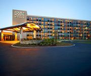
Four Points by Sheraton Philadelphia Northeast
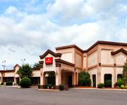
RAMADA PHILADELPHIA NE
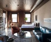
Wm. Mulherin's Sons Hotel
Hallmark Inn
Garden State Inn
Genes Motel
ROOSEVELT INN
DAYS INN PHILADELPHIA
Sleep Inn Cinnaminson Philadelphia East
THE CONWELL INN
Videos from this area
These are videos related to the place based on their proximity to this place.
Amata Spring Country Club
Amata Spring Country Club สนามกอล์ฟระดับโลกที่จะทดสอบความสามารถของคุณอย่างถึงแก่น...
สุวรรณกอล์ฟแอนด์คันทรีคลับ(Suwan Golf & Country Club)
สุวรรณกอล์ฟแอนด์คันทรีคลับ(Suwan Golf & Country Club) สนามกอล์ฟสุวรรณแอนด์คันทรี่คลั...
Friendship Meadows Country Club เฟรนด์ชิพ เมโดวส์ คันทรี คลับ
Friendship Meadows Country Club เฟรนด์ชิพ เมโดวส์ คันทรี คลับ เป็นสนามกอล์ฟ 18 หลุม อยู่บนเส...
เซอร์เจมส์รีสอร์ทคันทรีคลับ(SIR JAMES RESORT AND COUNTRY CLUB)
เซอร์เจมส์รีสอร์ทคันทรีคลับ(SIR JAMES RESORT AND COUNTRY CLUB) สนามกอล์ฟ 18 หลุม ที่ผสมผสานระ...
ดรากอนฮิลส์กอล์ฟคลับ ( Dragon Hills Golf and Country Club)
ดรากอนฮิลส์กอล์ฟคลับ - Dragon Hills Golf and Country Club ดราก้อน ฮิลล์ กอล์ฟ แอนด์ คันทรี คลั...
สนามกอล์ฟที่ถูกปิดไปแล้ว Friendship Meadows Country Club
สนามกอล์ฟที่ถูกปิดไปแล้ว Friendship Meadows Country Club.
กรีนซ้อมพัต ก่อนออกรอบ Riverdale Golf and Country Club
กรีนซ้อมพัต ก่อนออกรอบ Riverdale Golf and Country Club.
Videos provided by Youtube are under the copyright of their owners.
Attractions and noteworthy things
Distances are based on the centre of the city/town and sightseeing location. This list contains brief abstracts about monuments, holiday activities, national parcs, museums, organisations and more from the area as well as interesting facts about the region itself. Where available, you'll find the corresponding homepage. Otherwise the related wikipedia article.
Roosevelt Boulevard (Philadelphia)
Roosevelt Boulevard (official name, Theodore Roosevelt Memorial Boulevard), often referred to simply as "the Boulevard," is a major traffic artery through North and Northeast Philadelphia.
Ryers (SEPTA station)
Ryers is a station located along SEPTA's Fox Chase Line. It is located at Cottman and Rockwell Avenues and has a 71-space parking lot. The station itself consists of a new high-level platform and shelter, completed in early 2012.
Northeast High School (Philadelphia)
Northeast High School is a high school located at 1601 Cottman Avenue (at Algon Avenue) in Philadelphia, Pennsylvania, United States. Northeast is one of the oldest high schools in Philadelphia, founded in 1890 as the Northeast Manual Training School. Before 1957, it was located at 8th Street and Lehigh Avenue in Philadelphia (later the home of Thomas Edison High School). As of 2011 Northeast High School will have had 170 Graduating Classes.
Empire Rock Club
Empire Rock Club was a live music venue in Philadelphia, Pennsylvania and an important influence on the 1980s east coast glam metal music scene.
Ryers, Philadelphia
Ryers is a neighborhood in Northeast Philadelphia. Ryers is bounded by Cottman Avenue (Rt. 73) on the southwest, Fillmore Street on the northwest. Both of these highways separate Philadelphia from Cheltenham and Rockledge, Montgomery County. The Fox Chase Line separates Ryers from Burholme and Fox Chase borders it via Hartel St. on the northeast. The name Ryers comes from the Ryerss Estate which is located in Burholme Park along Central Avenue.
Roosevelt Mall
Roosevelt Mall is a medium-sized outdoor shopping mall, located along PA 73 (Cottman Avenue) between Bustleton Avenue and the Roosevelt Boulevard in the Castor Gardens neighborhood of Northeast Philadelphia, Pennsylvania. The mall is owned and managed by Centro Properties Group and is anchored by a large, 3-level department store on its east end, that currently houses Macy's.
Har Nebo Cemetery
Har Nebo Cemetery is a Jewish cemetery in the Oxford Circle neighborhood of Philadelphia, Pennsylvania.
Old Trinity Church
Old Trinity Church, also known as Trinity Church, Oxford, is a historic Episcopal church founded around the turn of the 18th century in Oxford Township, Pennsylvania, which is now part of Philadelphia.


