Safety Score: 2,7 of 5.0 based on data from 9 authorites. Meaning we advice caution when travelling to United States.
Travel warnings are updated daily. Source: Travel Warning United States. Last Update: 2024-08-13 08:21:03
Explore Mechanicsville
Mechanicsville in Philadelphia County (Pennsylvania) is located in United States about 139 mi (or 223 km) north-east of Washington DC, the country's capital.
Local time in Mechanicsville is now 05:36 PM (Thursday). The local timezone is named America / New York with an UTC offset of -5 hours. We know of 10 airports in the wider vicinity of Mechanicsville, of which 4 are larger airports. The closest airport in United States is Trenton Mercer Airport in a distance of 14 mi (or 23 km), North-East. Besides the airports, there are other travel options available (check left side).
There are two Unesco world heritage sites nearby. The closest heritage site in United States is Independence Hall in a distance of 13 mi (or 20 km), South-East. Also, if you like golfing, there are multiple options in driving distance. We found 2 points of interest in the vicinity of this place. If you need a place to sleep, we compiled a list of available hotels close to the map centre further down the page.
Depending on your travel schedule, you might want to pay a visit to some of the following locations: Mount Holly, Camden, Trenton, Philadelphia and Doylestown. To further explore this place, just scroll down and browse the available info.
Local weather forecast
Todays Local Weather Conditions & Forecast: 6°C / 43 °F
| Morning Temperature | 8°C / 46 °F |
| Evening Temperature | 6°C / 42 °F |
| Night Temperature | 5°C / 41 °F |
| Chance of rainfall | 18% |
| Air Humidity | 83% |
| Air Pressure | 999 hPa |
| Wind Speed | Moderate breeze with 13 km/h (8 mph) from South-East |
| Cloud Conditions | Overcast clouds, covering 99% of sky |
| General Conditions | Heavy intensity rain |
Thursday, 21st of November 2024
5°C (42 °F)
4°C (39 °F)
Rain and snow, gentle breeze, scattered clouds.
Friday, 22nd of November 2024
7°C (45 °F)
8°C (46 °F)
Few clouds, moderate breeze.
Saturday, 23rd of November 2024
9°C (49 °F)
6°C (43 °F)
Broken clouds, moderate breeze.
Hotels and Places to Stay
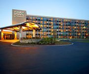
Four Points by Sheraton Philadelphia Northeast
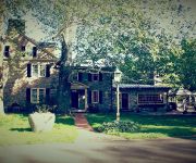
Bridgetown Mill House Restaurant and Inn
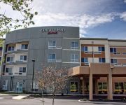
Courtyard Philadelphia Bensalem
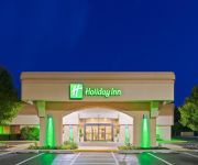
Holiday Inn BENSALEM-PHILADELPHIA AREA
BEST WESTERN PLUS PHILADELPHIA BENSALEM
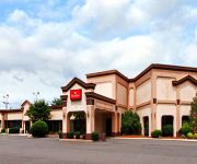
RAMADA PHILADELPHIA NE
Holiday Inn Express PHILADELPHIA NE - BENSALEM
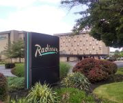
Radisson Hotel Philadelphia Northeast
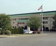
Hampton Inn - Suites Philadelphia-Bensalem
SCOTTISH INNS AND SUITES BENSALEM
Videos from this area
These are videos related to the place based on their proximity to this place.
Bucks Meadow Apartments For Rent - Bensalem, PA
Bensalem apartments - Bucks Meadow apartments for rent in Bensalem, PA. Get into the swing of things! Call 888.883.8119 or Visit ...
2013 Chevrolet Impala Used Cars Feasterville Trevose PA
http://www.bigjoesautosalespa.com This 2013 Chevrolet Impala is available from Big Joes Auto Sales. For details, call us at 215-245-5300.
2007 Chrysler Town & Country Used Cars Feasterville Trevose
http://www.bigjoesautosalespa.com This 2007 Chrysler Town & Country is available from Big Joes Auto Sales. For details, call us at 215-245-5300.
2007 BMW 7-Series Used Cars Feasterville Trevose PA
http://www.bigjoesautosalespa.com This 2007 BMW 7-Series is available from Big Joes Auto Sales. For details, call us at 215-245-5300.
2012 GMC Sierra 2500HD Used Cars Feasterville Trevose PA
http://www.bigjoesautosalespa.com This 2012 GMC Sierra 2500HD is available from Big Joes Auto Sales. For details, call us at 215-245-5300.
2009 Chrysler Town & Country Used Cars Feasterville Trevose
http://www.bigjoesautosalespa.com This 2009 Chrysler Town & Country is available from Big Joes Auto Sales. For details, call us at 215-245-5300.
2008 Chrysler Town & Country Used Cars Trevose PA
http://www.amacars.com This 2008 Chrysler Town & Country is available from AMA Cars. For details, call us at 215-638-4430.
2008 Chrysler Sebring Used Cars Feasterville Trevose PA
http://www.bigjoesautosalespa.com This 2008 Chrysler Sebring is available from Big Joes Auto Sales. For details, call us at 215-245-5300.
2009 Chrysler Town & Country Used Cars Trevose PA
http://www.amacars.com This 2009 Chrysler Town & Country is available from AMA Cars. For details, call us at 215-638-4430.
2011 Honda Accord Used Cars Feasterville Trevose PA
http://www.bigjoesautosalespa.com This 2011 Honda Accord is available from Big Joes Auto Sales. For details, call us at 215-245-5300.
Videos provided by Youtube are under the copyright of their owners.
Attractions and noteworthy things
Distances are based on the centre of the city/town and sightseeing location. This list contains brief abstracts about monuments, holiday activities, national parcs, museums, organisations and more from the area as well as interesting facts about the region itself. Where available, you'll find the corresponding homepage. Otherwise the related wikipedia article.
Parx Casino and Racing
Parx Casino and Racing (formerly Philadelphia Park Racetrack and Casino) is the largest casino gaming complex in Pennsylvania. Owned and operated by Greenwood Gaming and Entertainment, Inc. , Parx features 24 hour gaming; 3,500 slot machines; 140 live table games; a poker room with 60 poker tables; live racing and simulcast action; several dining options and bars.
Northeast Philadelphia
Northeast Philadelphia, nicknamed Northeast Philly, the Northeast and the Great Northeast, is a section of the city of Philadelphia, Pennsylvania. According to the 2000 Census, the Northeast has a sizable percentage of the city's 1.547 million people — a population of between 300,000 and 450,000, depending on how the area is defined. Beginning in the 1980s, many of the Northeast's middle class children graduated from college and settled in suburbs, especially nearby Bucks County.
Franklin Mills
Franklin Mills is an enclosed shopping mall located in northeast Philadelphia, Pennsylvania, bordering Bensalem in Bucks County and 15 miles outside Center City. Named for Benjamin Franklin, the mall houses 200 stores, a movie theatre, two food courts, and seven theme restaurants and was visited by an estimated 18 million people in 2006. Opened in 1989, Franklin Mills was the second built and formerly owned by the Mills Corporation and is now managed by the Simon Property Group.
Byberry, Philadelphia
Byberry is a place name in Northeast Philadelphia that can have several references. Byberry is a neighborhood in the far northeast section of Philadelphia, Pennsylvania. Originally it was incorporated as the Township of Byberry and was the northeasternmost municipality of Philadelphia County before the City and County consolidated in 1854. Byberry had a strong abolitionist presence and may have been an original stop on the Underground Railroad.
Philadelphia State Hospital at Byberry
The Philadelphia State Hospital at Byberry was a psychiatric hospital located in the Byberry neighborhood of Northeast Philadelphia in Pennsylvania. The name of the institution was changed several times during its history being variously named Philadelphia State Hospital, Byberry State Hospital, Byberry City Farms, and the Philadelphia Hospital for Mental Diseases. It was home to people ranging from the mentally challenged to the criminally insane.
Liberty Bell Park Racetrack
Liberty Bell Park was an American race track that held harness racing and Thoroughbred horse racing located in Northeast Philadelphia, Pennsylvania from 1963 until 1986. The site, northeast of the intersection of Knights and Woodhaven Roads, was derived from several farms and smaller farmettes. Gordon's Mill Rd, a street off of Knights Road east to the bridge over the Poquessing Creek, was stricken and vacated from the Philadelphia city plan in 1962 to make way for the racing facility.
Parkwood, Philadelphia
Parkwood is a neighborhood located in the Far Northeast section of Philadelphia, Pennsylvania, United States. The neighborhood is generally bound by Red Lion Road to the east of the Roosevelt Boulevard, Knights Road to the northwest and Academy Road to the southeast. The community is situated between the Poquessing Creek and Woodhaven Expressway. The neighborhood was developed in the late 1950s as a planned residential community. The predominant housing type is the brick row house.
Normandy, Philadelphia
Normandy is a neighborhood in Northeast Philadelphia. It is located east of Roosevelt Boulevard, in the vicinity of Woodhaven and Byberry Roads, built in 1955- 1956. All of the streets in this neighborhood begin with the letter N. The neighborhood is made up of cape cod style single family homes, with frame construction. Most of the homes have received additions over the years. The original landowners were Joseph Buckman, who owned 73 acres and John Rieger, who owned 18 acres .


