Safety Score: 2,7 of 5.0 based on data from 9 authorites. Meaning we advice caution when travelling to United States.
Travel warnings are updated daily. Source: Travel Warning United States. Last Update: 2024-08-13 08:21:03
Discover West Kensington
The district West Kensington of Kensington in Philadelphia County (Pennsylvania) is a district in United States about 126 mi north-east of Washington DC, the country's capital city.
Looking for a place to stay? we compiled a list of available hotels close to the map centre further down the page.
When in this area, you might want to pay a visit to some of the following locations: Philadelphia, Camden, Woodbury, Norristown and Media. To further explore this place, just scroll down and browse the available info.
Local weather forecast
Todays Local Weather Conditions & Forecast: 2°C / 36 °F
| Morning Temperature | -1°C / 31 °F |
| Evening Temperature | 4°C / 39 °F |
| Night Temperature | 5°C / 42 °F |
| Chance of rainfall | 0% |
| Air Humidity | 47% |
| Air Pressure | 1025 hPa |
| Wind Speed | Moderate breeze with 10 km/h (6 mph) from North-East |
| Cloud Conditions | Broken clouds, covering 59% of sky |
| General Conditions | Broken clouds |
Thursday, 5th of December 2024
1°C (34 °F)
-1°C (31 °F)
Rain and snow, fresh breeze, broken clouds.
Friday, 6th of December 2024
0°C (33 °F)
-0°C (31 °F)
Sky is clear, moderate breeze, clear sky.
Saturday, 7th of December 2024
1°C (33 °F)
0°C (33 °F)
Sky is clear, light breeze, clear sky.
Hotels and Places to Stay
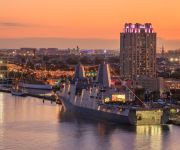
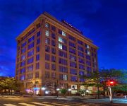
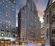
Le Meridien Philadelphia
The Franklin Hotel at Independence Park
Hilton Philadelphia at Penn*s Landing
Loews Philadelphia Hotel
Four Points by Sheraton Philadelphia City Center
Sheraton Philadelphia Society Hill Hotel
Philadelphia Marriott Downtown
Aloft Philadelphia Downtown
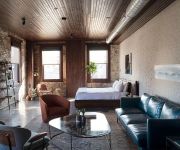
Wm. Mulherin's Sons Hotel
Residence Inn Philadelphia Center City
Videos from this area
These are videos related to the place based on their proximity to this place.
1992 Chrysler Town & Country Used Cars Philadelphia PA
http://www.doublemautosales.com This 1992 Chrysler Town & Country is available from Double M Auto Sales. For details, call us at 215-495-2661.
SEPTA Post Blizzard - Reading Main Line North Broad to Temple U Station via Silverliner V
The SEPTA Main Line towards Center City on the day after the Boxing Day Blizzard of 2010. While Monday the 27th was clear and sunny, bitter cold and strong winds made clearing the snow a ...
Storm & Weather Damage Services Dry-Tech http://www.restore-911.com
Storm & Weather Damage Services http://www.restore-911.com City of Philadelphia PA Flood Storm Weather damage from God Ambler Ardmore Audubon Blue Bell Bridgeport Bryn Athyn Bryn Mawr ...
2005 Chrysler Town & Country Used Cars Philadelphia PA
http://www.rdautopa.net This 2005 Chrysler Town & Country is available from Real Deal Auto Sales. For details, call us at 215-221-6220.
1998 Chrysler Town & Country Used Cars Philadelphia PA
http://www.doublemautosales.com This 1998 Chrysler Town & Country is available from Double M Auto Sales. For details, call us at 215-495-2661.
SEPTA Main Line Temple U to Jenkintown SL-V
View form the front of an outbound Silverliner V equipped R5 as it runs on the SEPTA Main Line between Temple University and Jenkintown. I had started this trip on a SL-IV set, but we were...
Philadelphia Precious Places Norris Square
In 2003 the Philadelphia Redevelopment Authority claimed hundreds of properties during John Street's "Neighborhood Transformation Initiative". Some residents are evicted from homes they own...
1800 Frankford Ave Philadelphia Complex
For more details click here: http://www.visualtour.com/showvt.asp?t=3196088 1800 Frankford Ave Philadelphia, PA 19125 $2200, 2 bed, 2.0 bath, 1000 SF Take a look at this unique New Constuction...
Guided Meditation w/ Teena Geist -- The Feeling of Flow
Work-day too stressful? Having tough family issues or medical problems? Shut your eyes and relax. Let Teena Geist of Shady Maple, New Jersey take you on a trip through the bowels of the inner...
2003 Chrysler Town & Country Used Cars Philadelphia PA
http://www.doublemautosales.com This 2003 Chrysler Town & Country is available from Double M Auto Sales. For details, call us at 215-495-2661.
Videos provided by Youtube are under the copyright of their owners.
Attractions and noteworthy things
Distances are based on the centre of the city/town and sightseeing location. This list contains brief abstracts about monuments, holiday activities, national parcs, museums, organisations and more from the area as well as interesting facts about the region itself. Where available, you'll find the corresponding homepage. Otherwise the related wikipedia article.
Philadelphia Nativist Riots
The Philadelphia Nativist Riots (also known as the Philadelphia Prayer Riots, the Bible Riots and the Native American Riots) were a series of riots that took place between May 6 and 8 and July 6 and 7, 1844, in Philadelphia, Pennsylvania, United States, and the adjacent districts of Kensington and Southwark. The riots were a result of rising anti-Catholic sentiment at the growing population of Irish Catholic immigrants.
Oakdale Park
Oakdale Park is a former baseball field located in Philadelphia, Pennsylvania, United States. The field was home to the Philadelphia Athletics in their first season of the American Association in 1882. The site of the park had been used for amateur baseball since the Civil War. The AA Athletics played a single season at the park, located at Huntingdon Street (north), 11th Street (east), Cumberland Street (south), and 12th Street (west), relocating to Jefferson Street Grounds in 1883.
Tyler School of Art
The Stella Elkins Tyler School of Art, also known as Tyler School of Art, is an art school at Temple University. The school was originally founded by sculptors Stella Elkins Tyler and Boris Blai on a separate 14-acre estate in Elkins Park. In 2009 the school's campus was consolidated to a new purpose-built building on Temple University's main campus in Philadelphia despite objections from alumni, faculty, and students.
Kensington, Philadelphia
Kensington is a neighborhood in the United States city of Philadelphia, Pennsylvania. It is between the Lower Northeast section of Philadelphia and North Philadelphia. Not to be confused with the former Kensington District, now commonly referred to as Fishtown, the area modernly referred to as "Kensington" is more of a section of smaller sub-neighborhoods than a clearly defined area. As such, there are disputes among locals as to the boundaries of the area.
Temple University (SEPTA station)
Temple University station is an above-ground SEPTA Regional Rail station located at the eastern edge of the Temple University campus at 915 West Berks Street between 9th and 10th Streets, in North Philadelphia.
West Kensington, Philadelphia
West Kensington is a neighborhood in the North Philadelphia section of Philadelphia. It is north of Olde Kensington. The Market Frankford El above Front Street forms the line between West Kensington and its bordering neighborhoods are Kensington to the southeast, Harrowgate to the north, and Fairhill to the west. It is bounded by Kensington Avenue to the southeast, Front Street to the west, and Allegheny Avenue to the north.
Hartranft, Philadelphia
Hartranft is a neighborhood in the central part of North Philadelphia section of Philadelphia, Pennsylvania, United States. Hartranft is on the border of the predominantly Black central region of North Philadelphia and the predominantly Hispanic eastern region of North Philadelphia. Bounded by 6th Street to the west, Front Street to the east, York Street to the north, and Cecil B. Moore Avenue to the south.
Fairhill, Philadelphia
Fairhill is a neighborhood on the east side of the North Philadelphia section of Philadelphia, Pennsylvania, United States. Fairhill is bordered by Front Street to the east, Germantown Avenue to the west, York Street to the south, and Glenwood Avenue to the north and northwest. The neighborhood serves as the center of the Hispanic community of Philadelphia, and is locally known as "El Centro de Oro.
Area codes 215 and 267
Error: Image is invalid or non-existent. 215 and 267 are the North American telephone area codes for the Commonwealth of Pennsylvania which serve its southeast corner, including the city of Philadelphia and its northern and eastern suburbs. Area code 215 was one of the original area codes established in 1947 and originally included the entire southeastern part of the Commonwealth.
Olde Kensington, Philadelphia
Olde Kensington is a neighborhood located in the Kensington section of Philadelphia, Pennsylvania, United States. Olde Kensington is north of Northern Liberties, south of Hartranft, east of Ludlow, and west of Fishtown. The boundaries of the neighborhood are roughly between Cecil B Moore Ave (north), Girard Ave (south), Front St (east) and 6th St. (west).
Girard (SEPTA Market–Frankford Line station)
Girard Station is an elevated rapid transit stop on the Market-Frankford Line, above the corner of Front Street and Girard Avenue in Philadelphia, Pennsylvania, in the Fishtown neighborhood. It is an "All-Stop" station and the first station to run above Front Street. Access to and from the station is on the northwest and northeast corners of Front & Girard. Three SEPTA surface routes serve Girard station, most notably Route 15, the historic Girard Avenue Trolley.
Berks (SEPTA station)
Berks Station is an elevated rapid transit stop on the Market-Frankford Line, above the corner of Front Street and Berks Street in Philadelphia, Pennsylvania, in the Kensington neighborhood. The station is reserved for "A" Trains only. Access to and from the station is on the southwest corner of Berks & Front Streets, as well as the opposite side of the terminus of Berks Street. One SEPTA bus route serves Berks station: route 3.
York–Dauphin (SEPTA station)
York-Dauphin Station is an elevated rapid transit stop on the Market-Frankford Line, of the The Southeastern Pennsylvania Transportation Authority (SEPTA) transit system. It is a station in Philadelphia, Pennsylvania, in the Kensington neighborhood. The station is reserved for "B" Trains only, and is also used as a terminal for buses.
Huntingdon (SEPTA station)
Huntingdon Station is an elevated rapid transit stop on the Market-Frankford Line, above the intersection of Kensington Avenue and Huntingdon Street in Philadelphia, Pennsylvania, in the Kensington neighborhood. The station is reserved for "A" Trains only. The station is the first stop to run above Kensington Avenue after leaving Front Street. The station is located over a five-way intersection.
Somerset (SEPTA station)
Somerset Station is an elevated stop on the Market-Frankford Line, above the intersection of Kensington Avenue and Somerset Street in Philadelphia, Pennsylvania, in the Kensington neighborhood. The station is reserved for "B" Trains only. Like the nearby Huntingdon Station, Somerset is located over a five-way intersection, which is northeast of a high cantaliever bridge over Tacony Creek.
Forepaugh Park
Forepaugh Park was a baseball ground located in Philadelphia, Pennsylvania, at Broad and Dauphin Streets in North Philadelphia. The ground was home to the Philadelphia Athletics of the American Association, and the Philadelphia Quakers of the Players League in 1890. The location was named for Adam Forepaugh, the owner of the Forepaugh Circus. The circus' previous site had been the site occupied by the Union Association club, Keystone Park.
Susquehanna–Dauphin (SEPTA station)
Susquehanna–Dauphin is a subway station on SEPTA's Broad Street Line in Philadelphia, Pennsylvania. The station is located at the 2200 block of North Broad Street in North Philadelphia, between Susquehanna Avenue at the south end and Dauphin Street at the north end. Four tracks travel through the station, however the station is only served by local trains, which travel on the outer two tracks. Along with Cecil B.
Philadelphia Badlands
The Philadelphia Badlands is a section of North Philadelphia, Pennsylvania, United States that in the 1980s and '90s became known for an abundance of open-air recreational drug markets and drug-related violence. It has amorphous and somewhat disputed boundaries, but is generally agreed to include the 25th police district.
Fox School of Business and Management
The Richard J. Fox School of Business and Management is the business school of Temple University. Located in Philadelphia, the Fox School offers several Master of Business Administration programs (full-time MBA, part-time MBA, international MBA, executive MBA and online MBA); several other master's degree programs; and several Ph.D.
St. Laurentius Parish, Philadelphia
Saint Laurentius Parish (Polish: Parafia św. Wawrzyńca) is a Roman Catholic parish established in 1882 that largely serves people of Polish background in Philadelphia, Pennsylvania, United States. It is the oldest Polish Roman Catholic Church within the city and Archdiocese of Philadelphia.
North Philadelphia (SEPTA Broad Street Line station)
North Philadelphia is a rapid transit passenger rail station on SEPTA's Broad Street Line. It serves both the local line and the Broad-Ridge Spur. The North Philadelphia BSL Station provides connections to two commuter rail stations, both of which are listed on the National Register of Historic Places.
Ludlow, Philadelphia
The neighborhood of Ludlow is a small neighborhood in Philadelphia, Pennsylvania. It is bordered by Girard Avenue to the south and Jefferson Street to the north. It extends from 6th Street west to 16th Street. Ludlow is about 65.9% African American, 18.9% Hispanic, 10% White, 4.8% Asian, and 1.4% all other.
Philadelphia Gas Works
Philadelphia Gas Works (PGW) is the nation's largest municipally owned natural gas utility.
National Register of Historic Places listings in Northeast Philadelphia
This is a list of the National Register of Historic Places listings in Northeast Philadelphia. This is intended to be a complete list of the properties and districts on the National Register of Historic Places in Northeast Philadelphia, Pennsylvania, United States. The locations of National Register properties and districts for which the latitude and longitude coordinates are included below, may be seen in a Google map.
Philadelphia Doll Museum
The Philadelphia Doll Museum is located in Philadelphia at 2253 North Broad Street along the Avenue of the Arts. It is the only known museum in the United States that emphasizes the collection and preservation of black dolls as artifacts of history and culture.


