Safety Score: 2,7 of 5.0 based on data from 9 authorites. Meaning we advice caution when travelling to United States.
Travel warnings are updated daily. Source: Travel Warning United States. Last Update: 2024-08-13 08:21:03
Delve into Elmwood
Elmwood in Philadelphia County (Pennsylvania) is a city located in United States about 120 mi (or 193 km) north-east of Washington DC, the country's capital town.
Current time in Elmwood is now 12:13 AM (Sunday). The local timezone is named America / New York with an UTC offset of -5 hours. We know of 12 airports closer to Elmwood, of which 5 are larger airports. The closest airport in United States is Philadelphia International Airport in a distance of 3 mi (or 5 km), South. Besides the airports, there are other travel options available (check left side).
There are two Unesco world heritage sites nearby. The closest heritage site in United States is Independence Hall in a distance of 20 mi (or 32 km), East. Also, if you like playing golf, there are some options within driving distance. We saw 2 points of interest near this location. In need of a room? We compiled a list of available hotels close to the map centre further down the page.
Since you are here already, you might want to pay a visit to some of the following locations: Philadelphia, Camden, Woodbury, Media and Norristown. To further explore this place, just scroll down and browse the available info.
Local weather forecast
Todays Local Weather Conditions & Forecast: 9°C / 49 °F
| Morning Temperature | 7°C / 45 °F |
| Evening Temperature | 9°C / 49 °F |
| Night Temperature | 7°C / 45 °F |
| Chance of rainfall | 0% |
| Air Humidity | 61% |
| Air Pressure | 1015 hPa |
| Wind Speed | Moderate breeze with 11 km/h (7 mph) from East |
| Cloud Conditions | Scattered clouds, covering 48% of sky |
| General Conditions | Scattered clouds |
Sunday, 24th of November 2024
12°C (54 °F)
12°C (53 °F)
Few clouds, light breeze.
Monday, 25th of November 2024
14°C (57 °F)
5°C (40 °F)
Light rain, moderate breeze, overcast clouds.
Tuesday, 26th of November 2024
4°C (39 °F)
4°C (39 °F)
Overcast clouds, moderate breeze.
Hotels and Places to Stay
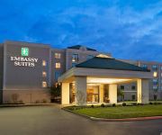
Embassy Suites by Hilton Philadelphia Airport
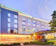
Four Points by Sheraton Philadelphia Airport
Aloft Philadelphia Airport
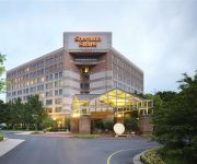
Sheraton Suites Philadelphia Airport
DoubleTree by Hilton Philadelphia Airport
The Rittenhouse
UrHip @ Rittenhouse
Sheraton Philadelphia University City Hotel
Sheraton Philadelphia Downtown Hotel
The Inn at Penn a Hilton Hotel
Videos from this area
These are videos related to the place based on their proximity to this place.
Real Estate Video Tours PA NJ Philadelphia Philly Metro Home Tours
http://www.PhillyMetroHomeTours.com (267) 888-PMHT The East Coast's leading VIDEO tour solution for your real estate sale.
Fire! 61st & Passyunk Ave. Phila. PA
Fire at 61st & Passyunk Ave. Phila. PA March 26th 2011 Somehow some tires ignited and the flames spread to some junk cars. From TwitVid - http://twitvid.com/V7JTV.
Train Simulator 2014 [HD] - Amtrak derailed near Philadelphia
Amtrak derailed near Philadelphia, if you speed up and not slow down to the 50 mph in this curve. Taken in the "bugged" standard mission Northeast Corridor - Early Clocker. Just get out of...
Philadelphia for Kids by Context Travel
Discover great family friendly places to visit in Philadelphia, PA.
Capital Region Skinny-September 2011
Where has the Capital Region's real estate market been and where is it heading? This monthly summary from the Greater Capital Association of REALTORS® provides an overview of current trends...
108 N 3rd St Darby, PA 19023 - YLLCO Property Walkthrough
Video tour of Darby property offered by YLLCO. For more information on leasing and property management in Darby visit http://www.yllco.com/property-management-delaware-county/
319 Berbro Street, Darby, PA 19023 www.YLLCO.com
Your Local Leasing Company is offering this rental property in Darby, PA. http://www.yllco.com/properties/?uid=95519038 877-4-RENT-21 INFO@YLLCO.COM.
Videos provided by Youtube are under the copyright of their owners.
Attractions and noteworthy things
Distances are based on the centre of the city/town and sightseeing location. This list contains brief abstracts about monuments, holiday activities, national parcs, museums, organisations and more from the area as well as interesting facts about the region itself. Where available, you'll find the corresponding homepage. Otherwise the related wikipedia article.
Mount Moriah (SEPTA station)
Mt. Moriah is a trolley stop on the SEPTA Subway Surface 13 trolley in Southwest Philadelphia. Located at Kingsessing Ave & Cemetery Ave, there is a loop there for trolleys that do not go on the full route to Yeadon or Darby to turn around and go back to Center City Philadelphia. The stop is named for the Mount Moriah Cemetery next to the stop. The cemetery is named after Mount Moriah in Jerusalem, Israel and the Biblical Book of Genesis.
Elmwood Park, Philadelphia
Elmwood Park, also known simply as Elmwood, is a neighborhood in the Southwest section of Philadelphia, Pennsylvania, United States. It borders the city line with Delaware County at Cobbs Creek, and extends to the Schuylkill River. The Eastwick neighborhood borders it to the southwest, and Kingsessing borders it on the northeast. Poles and Irish Americans had long been the majority in the neighborhood, organized around Catholic parishes established throughout the early to mid 20th century.
WURD
WURD is an AM radio station in Philadelphia, Pennsylvania. It broadcasts at 900 kHz with a talk format primarily targeted to African-Americans, and is currently under the ownership of Inc.
Mount Moriah Cemetery (Philadelphia)
Mount Moriah Cemetery is a historic cemetery in southwest Philadelphia, Pennsylvania, along Cobbs Creek. It was incorporated on March 27, 1855 and established by an act of the Pennsylvania Legislature. The cemetery, which originally occupied 54 acres, was among a number of cemeteries established along the "rural ideal" popular at that time. An ornate Romanesque entrance and gatehouse were built of brownstone on Islington Lane, today known as Kingsessing Avenue.
Bartram Village, Philadelphia
Bartram Village is a small neighborhood in Southwest Philadelphia. It is located in the vicinity of South 56th Street and Lindbergh Boulevard. The neighborhood takes its name from noted botanist John Bartram, whose historical home and gardens, Bartram's Garden, are located nearby. Bartram's Garden, also known as the John Bartram House, is a National Historic Landmark.
Mount Moriah, Philadelphia
Mount Moriah is a neighborhood in Southwest Philadelphia, east of Cobbs Creek in the vicinity of Kingsessing Avenue. The neighborhood shares it name with the Mount Moriah Cemetery which was founded next to Cobs Creek in 1855. The Joseph W. Catharine School was added to the National Register of Historic Places in 1988.
Paschall, Philadelphia
Paschall is a neighborhood in Southwest Philadelphia, in the U.S. state of Pennsylvania. It is located in the vicinity of Cobbs Creek Park and Chester Avenue. The William J. Tilden Junior High School was added to the National Register of Historic Places in 1986.
Elmwood Carhouse (SEPTA station)
The Elmwood Carhouse, also known as Elmwood Loop and Elmwood Avenue Loop, is a storage facility and alternate terminus for the SEPTA Route 36 Subway-Surface Trolley Line, in the Elmwood Park section of Southwest Philadelphia. Besides cars from Route 36, the facility is used to store and maintain cars from SEPTA Routes 11, 13, and 34. Its official address is at 73rd Street and Elmwood Avenue, but the yard stretches to Island Road and north to Amtrak's Northeast Corridor line.
National Register of Historic Places listings in Southwest Philadelphia
This is a list of the National Register of Historic Places listings in Southwest Philadelphia. This is intended to be a complete list of the properties and districts on the National Register of Historic Places in Southwest Philadelphia, Pennsylvania, United States. The locations of National Register properties and districts for which the latitude and longitude coordinates are included below may be seen in a Google map.








!['Train Simulator 2014 [HD] - Amtrak derailed near Philadelphia' preview picture of video 'Train Simulator 2014 [HD] - Amtrak derailed near Philadelphia'](https://img.youtube.com/vi/PPsDkD6Avig/mqdefault.jpg)


