Safety Score: 2,7 of 5.0 based on data from 9 authorites. Meaning we advice caution when travelling to United States.
Travel warnings are updated daily. Source: Travel Warning United States. Last Update: 2024-08-13 08:21:03
Delve into East Oak Lane
East Oak Lane in Philadelphia County (Pennsylvania) is a town located in United States about 129 mi (or 208 km) north-east of Washington DC, the country's capital town.
Time in East Oak Lane is now 06:43 PM (Thursday). The local timezone is named America / New York with an UTC offset of -5 hours. We know of 10 airports closer to East Oak Lane, of which 3 are larger airports. The closest airport in United States is Philadelphia International Airport in a distance of 14 mi (or 22 km), South-West. Besides the airports, there are other travel options available (check left side).
There are two Unesco world heritage sites nearby. The closest heritage site in United States is Independence Hall in a distance of 17 mi (or 27 km), South-East. Also, if you like the game of golf, there are some options within driving distance. We saw 3 points of interest near this location. In need of a room? We compiled a list of available hotels close to the map centre further down the page.
Since you are here already, you might want to pay a visit to some of the following locations: Philadelphia, Camden, Woodbury, Norristown and Doylestown. To further explore this place, just scroll down and browse the available info.
Local weather forecast
Todays Local Weather Conditions & Forecast: 6°C / 43 °F
| Morning Temperature | 7°C / 45 °F |
| Evening Temperature | 6°C / 43 °F |
| Night Temperature | 5°C / 41 °F |
| Chance of rainfall | 16% |
| Air Humidity | 82% |
| Air Pressure | 1000 hPa |
| Wind Speed | Fresh Breeze with 13 km/h (8 mph) from South-East |
| Cloud Conditions | Overcast clouds, covering 98% of sky |
| General Conditions | Heavy intensity rain |
Thursday, 21st of November 2024
5°C (41 °F)
4°C (39 °F)
Light rain, gentle breeze, scattered clouds.
Friday, 22nd of November 2024
7°C (44 °F)
8°C (46 °F)
Sky is clear, moderate breeze, clear sky.
Saturday, 23rd of November 2024
9°C (48 °F)
6°C (43 °F)
Broken clouds, moderate breeze.
Hotels and Places to Stay
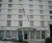
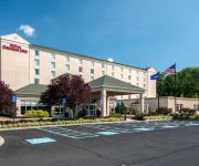
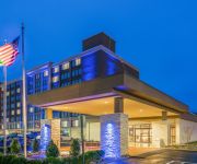
Hilton Philadelphia City Avenue
CHESTNUT HILL HOTEL
Wm. Mulherin's Sons Hotel
Courtyard Philadelphia City Avenue
Homewood Suites by Hilton Philadelphia-City Avenue
Hilton Garden Inn Philadelphia-Ft Washington
Holiday Inn Express & Suites FT. WASHINGTON - PHILADELPHIA
BEST WESTERN FORT WASHINGTON INN
DAYS INN PHILADELPHIA
THE CONWELL INN
Videos from this area
These are videos related to the place based on their proximity to this place.
2009 Chrysler Town & Country Used Cars Philadelphia PA
http://www.tristateautoinc.com This 2009 Chrysler Town & Country is available from Tri-State Auto. For details, call us at 215-549-2000.
2007 Chrysler Town & Country Used Cars Philadelphia PA
http://www.tristateautoinc.com This 2007 Chrysler Town & Country is available from Tri-State Auto. For details, call us at 215-549-2000.
2006 Chrysler Town & Country Used Cars Philadelphia PA
http://www.tristateautoinc.com This 2006 Chrysler Town & Country is available from Tri-State Auto. For details, call us at 215-549-2000.
2008 Chrysler Town & Country Used Cars Philadelphia PA
http://bestbuyimports.net This 2008 Chrysler Town & Country is available from Best Buy Imports Broad St. For details, call us at 215-927-3100.
2004 Chrysler Town & Country Used Cars Philadelphia PA
http://www.bestbuyimports.net This 2004 Chrysler Town & Country is available from Best Buy Motors. For details, call us at 215-927-3100.
2007 Chrysler Town & Country Used Cars Philadelphia PA
http://www.tristateautoinc.com This 2007 Chrysler Town & Country is available from Tri-State Auto. For details, call us at 215-549-2000.
2006 Chrysler Town & Country Used Cars Philidelphia PA
http://www.bestbuyimports.net This 2006 Chrysler Town & Country is available from Best Buy Imports. For details, call us at 215-927-3100.
2006 Chrysler Town & Country Used Cars Philadelphia PA
http://www.bestbuyimports.net This 2006 Chrysler Town & Country is available from Best Buy Motors. For details, call us at 215-927-3100.
SEPTA AEM7-Push-Pull pre-peak hour inbound deadhead 8/16/12
SEPTA Push -Pull set being leaded by AEM7 #2305 deadheading inbound to Center City before peak hour. Watch as this train makes an unscheduled stop at Fern Rock Station.
Regional Rail at Fern Rock Transportation Center 1/20/11 - SEPTA Action Series
SEPTA Regional Rail Action at Fern Rock Transportation Center, with a SEPTA Subway Bonus toward the end (Not the last clip, you gotta watch the whole video chumps) Features Silverliner IVs,...
Videos provided by Youtube are under the copyright of their owners.
Attractions and noteworthy things
Distances are based on the centre of the city/town and sightseeing location. This list contains brief abstracts about monuments, holiday activities, national parcs, museums, organisations and more from the area as well as interesting facts about the region itself. Where available, you'll find the corresponding homepage. Otherwise the related wikipedia article.
Fern Rock, Philadelphia
Fern Rock is a neighborhood in the upper North Philadelphia section of Philadelphia, Pennsylvania bounded by Olney to the east, Ogontz to the west, Logan to south, and East Oak Lane to the north. It is approximately situated between Broad Street, Tabor Road, 7th Street, Godfrey Avenue and Fisher Park. The northern terminus of the Broad Street Line subway is located in Fern Rock at the Fern Rock Transportation Center. Three SEPTA Regional Rail lines also run through this station.
Melrose Park (SEPTA station)
Melrose Park station is a SEPTA Regional Rail station located along the SEPTA Main Line operated by the Southeastern Pennsylvania Transportation Authority. Originally known as Oak Park Station, Melrose Park is located in at the intersection of Valley Road and Mill Road in the neighborhood of Melrose Park in Cheltenham Township, Montgomery County, Pennsylvania.
Ogontz, Philadelphia
Ogontz is a neighborhood in the North Philadelphia section of Philadelphia, Pennsylvania, United States that borders suburban Cheltenham Township, Montgomery County. Ogontz gets its name from Ogontz Avenue, a thoroughfare which runs diagonally through the uniform grid of streets in the city. Many of the commercial and residential properties on Ogontz Ave.
West Oak Lane, Philadelphia
West Oak Lane is a neighborhood in the Northwest Philadelphia section of Philadelphia. It is located between East Mount Airy, East Germantown, Cheltenham, Montgomery County, East Oak Lane, and Fern Rock. Ogontz Avenue runs generally north, then northwest as the spine of the neighborhood and the main business strip. The neighborhood was developed primarily between the early 1920s and late 1930s, with the areas near to Cedarbrook constructed after World War II.
East Oak Lane, Philadelphia
East Oak Lane is a neighborhood at the northern end of the North Philadelphia planning district of Philadelphia, Pennsylvania, United States. Many of the houses in the neighborhood are large single homes or twins built at a later period than much of central North Philadelphia. There is also a fair share of typical Philadelphia rowhouses. This area of Philadelphia was first settled in 1683 as William Penn's first neighborhood. In the late 19th century, this area was considered a resort.
Fern Rock Transportation Center
The Fern Rock Transportation Center is a SEPTA rail and bus transportation center located at 10th Street and Nedro Avenue in the Fern Rock neighborhood of Philadelphia, Pennsylvania. Fern Rock serves as the northern terminus and yard for SEPTA's Broad Street Line, as well as a stop for the Lansdale/Doylestown, Warminster, and West Trenton SEPTA Regional Rail Lines. Four SEPTA bus lines also serve Fern Rock Transportation Center.
Logan, Philadelphia
Logan is a neighborhood in the upper North Philadelphia section of the city of Philadelphia, in the U.S. state of Pennsylvania.
Olney Transportation Center
The Olney Transportation Center (also called Olney Terminal) is a SEPTA bus terminal and the last Broad Street Line subway station before the Fern Rock Transportation Center terminus. Trains in the other direction go to South Philadelphia. It is located on Broad Street in the Olney neighborhood of Northern Philadelphia near Einstein Medical Center, La Salle University, Central High School, and the Philadelphia High School for Girls.
Cardinal Dougherty High School
Cardinal Dougherty High School was a private, Roman Catholic high school in Philadelphia, Pennsylvania. It was located in the Roman Catholic Archdiocese of Philadelphia. At the time of its closing, it was the only Archdiocesan high school to offer Intensive Scheduling, a medical careers health academy curriculum HOSA, and a Catholic school teachers academy program.
Newtown Junction
Newtown Junction is the rail junction point where the Newtown Branch joins the SEPTA Main Line. The Warminster Line, West Trenton Line, and Lansdale/Doylestown Line all continue north toward Fern Rock along the old Reading trunk while the Fox Chase heads east toward Olney. North of Fox Chase, the line crossed over the West Trenton Line between the Meadowbrook and Bethayres stations and had its terminus in Newtown, hence the name Newtown Junction.
Northwood Cemetery
Northwood Cemetery is a cemetery located in the West Oak Lane neighborhood of Philadelphia, Pennsylvania, United States. It was established in 1878.
Albert Einstein Medical Center
Albert Einstein Medical Center is a tertiary care teaching hospital in Philadelphia, Pennsylvania. An important aspect of the medical center is that of educating graduating physicians. The medical center offers residency and fellowship training programs in many specialized areas. It also includes a Level I Regional Resource Trauma Center and a Level III Neonatal Care Unit.


