Safety Score: 2,7 of 5.0 based on data from 9 authorites. Meaning we advice caution when travelling to United States.
Travel warnings are updated daily. Source: Travel Warning United States. Last Update: 2024-08-13 08:21:03
Delve into Ashford Green
Ashford Green in Montgomery County (Pennsylvania) is located in United States about 121 mi (or 195 km) north-east of Washington DC, the country's capital town.
Current time in Ashford Green is now 04:32 AM (Tuesday). The local timezone is named America / New York with an UTC offset of -5 hours. We know of 12 airports close to Ashford Green, of which 5 are larger airports. The closest airport in United States is Reading Regional Carl A Spaatz Field in a distance of 24 mi (or 39 km), North-West. Besides the airports, there are other travel options available (check left side).
There are two Unesco world heritage sites nearby. The closest heritage site in United States is Independence Hall in a distance of 41 mi (or 67 km), South-East. Also, if you like playing golf, there are some options within driving distance. We encountered 1 points of interest near this location. If you need a hotel, we compiled a list of available hotels close to the map centre further down the page.
While being here, you might want to pay a visit to some of the following locations: Norristown, West Chester, Media, Allentown and Reading. To further explore this place, just scroll down and browse the available info.
Local weather forecast
Todays Local Weather Conditions & Forecast: 20°C / 67 °F
| Morning Temperature | 9°C / 48 °F |
| Evening Temperature | 19°C / 66 °F |
| Night Temperature | 17°C / 63 °F |
| Chance of rainfall | 0% |
| Air Humidity | 64% |
| Air Pressure | 1024 hPa |
| Wind Speed | Moderate breeze with 9 km/h (6 mph) from North-East |
| Cloud Conditions | Broken clouds, covering 81% of sky |
| General Conditions | Broken clouds |
Tuesday, 5th of November 2024
24°C (75 °F)
18°C (64 °F)
Sky is clear, moderate breeze, clear sky.
Wednesday, 6th of November 2024
16°C (62 °F)
9°C (48 °F)
Sky is clear, gentle breeze, clear sky.
Thursday, 7th of November 2024
14°C (57 °F)
10°C (50 °F)
Overcast clouds, gentle breeze.
Hotels and Places to Stay
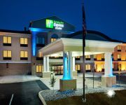
Holiday Inn Express & Suites LIMERICK - POTTSTOWN
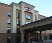
Hampton Inn Limerick-Philadelphia Area PA
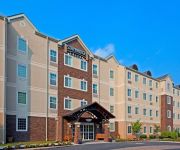
Staybridge Suites PHILADELPHIA VALLEY FORGE 422
Courtyard Philadelphia Valley Forge/Collegeville
Residence Inn Philadelphia Valley Forge/Collegeville
The Anuva Hotel
French Creek Inn
DAYS INN
Videos from this area
These are videos related to the place based on their proximity to this place.
144 Connor Drive Royersford PA 19468
144 Connor Drive Royersford PA 19468 Peg Chism (Call us at:- 610-489-6021) Beautiful 4BDR 2.5BA Colonial located in Walnut Farms, Limerick Twp., Spring-Ford SD with a Fabulous Finished ...
Quiropractico Royersford y la Neuropatia
http://www.centreforhealingarts.com Dr. Michael Connelly and Dr. Kyle Kopicki Tel: 610-495-4550 La neurópatia es una condición en cual los nervios en el cuerpo están dañados. Esos nervios...
Limerick Eye Associates-Your Nearby Eye Doctor | Limerick, Royersford, Collegeville and Pottstown
At Limerick Eye Associates, Dr. Jason Paist, together with our experienced eye care team, believe you deserve the best eyecare possible. We have earned a reputation for excellence in vision...
119 WInged Foote Road Royersford PA
119 Winged Foot Rd Royersford PA 19468 is a home for sale in Bucks County Pennsylvania. This one just shot to the top of your list! This end unit Townhome is ready to go, fresh paint throughout...
Kia Holiday Sales Event Page Philadelphia 2014
Kia Holiday Sales Event Page Philadelphia 2014 | http://www.Kialimerick.com | CALL 888-485-0484 If a clean, meticulously maintained used car in the Limerick PA area is what you seek, buying...
Arriving at Heritage Field (KPTW) from Rutland - Southern VT Regional Airport (KRUT)
Cessna 182 landing runway 28 into the sun at KPTW.
Philadelphia Premium Outlets Limerick PA Nuclear Power Plant
Centrale nucleare vicino al centro commerciale Premium Outlets Limerick in Pennsylvania.
2013 Kia Forte Koup Review Limerick PA
2013 Kia Forte Koup Review | http://www.Kialimerick.com | CALL (888) 485-0484 If a clean, meticulously maintained used car in the Limerick PA area is what you seek, buying from the extensive...
Videos provided by Youtube are under the copyright of their owners.
Attractions and noteworthy things
Distances are based on the centre of the city/town and sightseeing location. This list contains brief abstracts about monuments, holiday activities, national parcs, museums, organisations and more from the area as well as interesting facts about the region itself. Where available, you'll find the corresponding homepage. Otherwise the related wikipedia article.
Royersford, Pennsylvania
Royersford is a borough in Montgomery County, Pennsylvania, 32 miles northwest of Philadelphia, on the Schuylkill River.
Sanatoga, Pennsylvania
Sanatoga is a community and census-designated place (CDP) in Montgomery County, Pennsylvania, United States. It is immediately east of the borough of Pottstown, Pennsylvania on route US 422. The population was 8,378 at the 2010 census.
Chapel Christian Academy
Chapel Christian Academy was an educational ministry of Limerick Chapel in Limerick Township, Pennsylvania. The school provided a Fundamentalist Christian education to students in grades K–12. The Academy, better known as "CCA" by its students, was founded in 1974 as a ministry of Limerick Chapel, and as a part of the Christian School movement. Parents were encouraged to remove their children from the public school system due to lack of Biblical influence in the public school curriculum.
Pennhurst State School and Hospital
Pennhurst State School and Hospital, originally known as the Eastern Pennsylvania State Institution for the Feeble-Minded and Epileptic is positioned on the border between Chester County and Montgomery County in Pennsylvania. Pennhurst was an institution for the mentally and physically disabled individuals of Southeastern Pennsylvania. After a decade of controversy, it closed on December 9, 1987.
Linfield, Pennsylvania
Linfield is an unincorporated village, part of Limerick Township, Montgomery County, Pennsylvania. It is located approximately 35 miles north-west of Philadelphia, along the Schuylkill River. Located on the Reading Railroad line to Philadelphia, Linfield was the industrial hub of Limerick Township into the 1960s. Kinseys Distillery, Sanitary Corporation of America and Trinley Mill provided the industrial base for the area.
Parker Ford, Pennsylvania
Parker Ford is an unincorporated community in East Coventry Township, Chester County, Pennsylvania. Maps show it at the intersection of Pennsylvania Route 724 and Bethel Church Road/Linfield Road. Linfield Road crosses the Schuylkill River to Linfield, Pennsylvania, an unincorporated village, part of Limerick Township, Montgomery County, Pennsylvania. {{#invoke:Coordinates|coord}}{{#coordinates:40.1998|-75.58358|region:US_type:landmark|||||| |primary |name= }}


