Safety Score: 2,7 of 5.0 based on data from 9 authorites. Meaning we advice caution when travelling to United States.
Travel warnings are updated daily. Source: Travel Warning United States. Last Update: 2024-08-13 08:21:03
Delve into Shrader
Shrader in Mifflin County (Pennsylvania) is located in United States about 128 mi (or 205 km) north of Washington DC, the country's capital town.
Current time in Shrader is now 09:14 PM (Saturday). The local timezone is named America / New York with an UTC offset of -5 hours. We know of 13 airports close to Shrader, of which 5 are larger airports. The closest airport in United States is University Park Airport in a distance of 19 mi (or 30 km), North-West. Besides the airports, there are other travel options available (check left side).
Also, if you like playing golf, there are some options within driving distance. If you need a hotel, we compiled a list of available hotels close to the map centre further down the page.
While being here, you might want to pay a visit to some of the following locations: Lewistown, Mifflintown, Bellefonte, Lock Haven and New Bloomfield. To further explore this place, just scroll down and browse the available info.
Local weather forecast
Todays Local Weather Conditions & Forecast: 6°C / 43 °F
| Morning Temperature | 6°C / 43 °F |
| Evening Temperature | 6°C / 43 °F |
| Night Temperature | 4°C / 40 °F |
| Chance of rainfall | 0% |
| Air Humidity | 83% |
| Air Pressure | 1017 hPa |
| Wind Speed | Moderate breeze with 9 km/h (6 mph) from South-East |
| Cloud Conditions | Overcast clouds, covering 100% of sky |
| General Conditions | Overcast clouds |
Sunday, 24th of November 2024
10°C (51 °F)
9°C (49 °F)
Broken clouds, light breeze.
Monday, 25th of November 2024
7°C (45 °F)
1°C (33 °F)
Light rain, moderate breeze, overcast clouds.
Tuesday, 26th of November 2024
3°C (37 °F)
-1°C (31 °F)
Overcast clouds, moderate breeze.
Hotels and Places to Stay
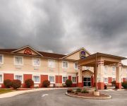
BEST WESTERN NITTANY INN MILRO
Holiday Inn Express & Suites REEDSVILLE - STATE COLL AREA
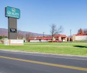
Quality Inn & Suites
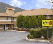
SUPER 8 MOTEL - BURNHAM-LEWIST
Videos from this area
These are videos related to the place based on their proximity to this place.
An Hour Fifteen at Lewistown
We spend a little over an hour at Lewistown Station in Lewistown, PA. And catch six trains. 36A: Conway, PA - Wilmington, DE. - 9254 (Operation Lifesaver 25th Anniversary): D9-40CW. - 6585:...
Nickel Plate Road 765 at Lewistown
Nickel Plate road 765 returning back to Lewistown,PA Taken on 5/25/13.
How Specialist Jeremy Oburn Coped with Combat Stress
Specialist Jeremy Oburn, a motor transport operator with 131st Transportation Company, 213th Regional Support Group, from Lewistown, Pa., talks about the hardest part of his deployment to Afghanist.
GE Inspections Academy
A video announcing the new GE Inspections Academy. Shot on location at the Inspections Technology Center in Lewistown PA.
Into The Woods Witches Rant
Highland Park Elementary, Lewistown PA presents "Into The Wood May 21, 2007.
131st Transportation Company Soldiers Prepare for Canada Mission
Footage of Soldiers from the 131st Transportation Company loading equipment and supplies for a training exercise in Canada. This b-roll goes with the "Our Military Heroes" interviews from Spc....
Videos provided by Youtube are under the copyright of their owners.
Attractions and noteworthy things
Distances are based on the centre of the city/town and sightseeing location. This list contains brief abstracts about monuments, holiday activities, national parcs, museums, organisations and more from the area as well as interesting facts about the region itself. Where available, you'll find the corresponding homepage. Otherwise the related wikipedia article.
Milroy, Pennsylvania
Milroy is a census-designated place (CDP) in the Kishacoquillas Valley of Mifflin County, Pennsylvania, United States. The population was 1,386 at the 2000 census.
Reedsville, Pennsylvania
Brown Township Elementary School (Now Closed) Indian Valley Elementary/Intermediate School (Was Indian Valley Middle School and Kishaquiallquis High School) Both property of the Mifflin County School District Reedsville is a census-designated place (CDP) in the Kishacoquillas Valley of Mifflin County, Pennsylvania, United States. The population was 858 at the 2000 census. Reedsville has a high Amish population.
WCHX
WCHX is a classic rock music formatted radio station from Lewistown, Pennsylvania, market. The station is owned by Mifflin County Communications, Inc.
Church Hill, Pennsylvania
Church Hill is a census-designated place located in Armagh and Brown Townships in Mifflin County in the state of Pennsylvania. It is located north of the borough of Burnham. As of the 2010 census the population was 1,627 residents.
Siglerville, Pennsylvania
Siglerville is a census-designated place located in central Armagh Township, Mifflin County in the state of Pennsylvania. It is located just to the southwest of Bald Eagle State Forest. As of the 2010 census the population was 106 residents.


