Safety Score: 2,7 of 5.0 based on data from 9 authorites. Meaning we advice caution when travelling to United States.
Travel warnings are updated daily. Source: Travel Warning United States. Last Update: 2024-08-13 08:21:03
Delve into Pleasant Hill
Pleasant Hill in Lebanon County (Pennsylvania) with it's 2,643 habitants is a city located in United States about 104 mi (or 168 km) north of Washington DC, the country's capital town.
Current time in Pleasant Hill is now 01:01 AM (Monday). The local timezone is named America / New York with an UTC offset of -5 hours. We know of 12 airports closer to Pleasant Hill, of which 5 are larger airports. The closest airport in United States is Lancaster Airport in a distance of 17 mi (or 27 km), South-East. Besides the airports, there are other travel options available (check left side).
There is one Unesco world heritage site nearby. It's Independence Hall in a distance of 88 mi (or 142 km), East. Also, if you like playing golf, there are some options within driving distance. We saw 1 points of interest near this location. In need of a room? We compiled a list of available hotels close to the map centre further down the page.
Since you are here already, you might want to pay a visit to some of the following locations: Lebanon, Lancaster, Pottsville, Harrisburg and York. To further explore this place, just scroll down and browse the available info.
Local weather forecast
Todays Local Weather Conditions & Forecast: 9°C / 49 °F
| Morning Temperature | 3°C / 37 °F |
| Evening Temperature | 10°C / 51 °F |
| Night Temperature | 9°C / 49 °F |
| Chance of rainfall | 0% |
| Air Humidity | 58% |
| Air Pressure | 1020 hPa |
| Wind Speed | Light breeze with 5 km/h (3 mph) from North-West |
| Cloud Conditions | Scattered clouds, covering 27% of sky |
| General Conditions | Scattered clouds |
Monday, 25th of November 2024
10°C (51 °F)
3°C (38 °F)
Moderate rain, fresh breeze, overcast clouds.
Tuesday, 26th of November 2024
4°C (39 °F)
3°C (37 °F)
Overcast clouds, moderate breeze.
Wednesday, 27th of November 2024
4°C (40 °F)
3°C (37 °F)
Light rain, light breeze, overcast clouds.
Hotels and Places to Stay
Hampton Inn Lebanon
DAYS INN LEBANON VALLEY
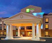
Holiday Inn Express & Suites LEBANON
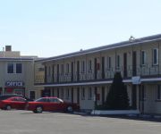
TRAVEL INN LEBANON
Videos from this area
These are videos related to the place based on their proximity to this place.
Assessment Appeal Board Officers Chosen for Lebanon County.wmv
Lebanon PA 6.8.12: Lebanon County Commissioners chose 20 hearing officers for assessment appeal Boards from a pool of 44 applicants. We were fortunate to have so many qualified applicants....
Freight Train - Norfolk Southern
Ok, NS trains through Lebanon is no rare occurrence. These guys bisect the city nearly once an hour. But for train lovers who cannot see enough, I submit to you this one, headed west through...
Maniac Drivers!
Speed limit is 25, according to the sign. Some nut has tripped the city's radar at a wild 6 mph (wish the camera had made that clearer). Who is the maniac zipping down this street? (For those...
sledding accidents
we had so much fun doing this the songs are all credit to SEGA and sonic the hedge hog with crush 40 from sonic adventure 2 battle People in this video: arthur joey random guy adam...
Metal in Toasted Oats Cereal
So I did the experiment everybody else is doing with cereals. I had toasted oats and a magnet - this is my video. LOL.
Videos provided by Youtube are under the copyright of their owners.
Attractions and noteworthy things
Distances are based on the centre of the city/town and sightseeing location. This list contains brief abstracts about monuments, holiday activities, national parcs, museums, organisations and more from the area as well as interesting facts about the region itself. Where available, you'll find the corresponding homepage. Otherwise the related wikipedia article.
Lebanon, Pennsylvania
Lebanon, formerly known as Steitztown, is a city in and the county seat of Lebanon County, Pennsylvania, United States. The population was 25,477 at the 2010 census, a 4.2% increase from the 2000 count of 24,461. Lebanon is located in the central part of the Lebanon Valley, 26 miles east of Harrisburg and 29 miles west of Reading.
North Cornwall Township, Lebanon County, Pennsylvania
North Cornwall Township is a township in Lebanon County, Pennsylvania, United States. It is part of the Lebanon, PA Metropolitan Statistical Area.
Pleasant Hill, Pennsylvania
Pleasant Hill is a census-designated place (CDP) in Lebanon County, Pennsylvania, United States. The population was 2,301 at the 2000 census.
Union Canal (Pennsylvania)
The Union Canal was a towpath canal that existed in southeastern Pennsylvania in the United States during the 19th century. First proposed in 1690 to connect Philadelphia with the Susquehanna River, it ran approximately 75 mi (120 km) from Middletown on the Susquehanna below Harrisburg to Reading on the Schuylkill River. Although construction began in 1792 during the George Washington Administration, financial difficulties delayed its completion until 1828.
WQIC
WQIC is Soft Rock 100.1 in Lebanon, Pennsylvania serving the Lebanon Valley region of Pennsylvania. It has an AM sister station, WLBR, broadcasting on AM 1270, out of the same building. The radio signal can be heard as far as Harrisburg to the west, Reading to the east, Lancaster to the south, and along I-81 in Schuylkill County to the north. WQIC began as WLBR-FM. In the 1970s, the call sign changed to WUFM with a soft rock format.
Lebanon High School (Pennsylvania)
Lebanon Senior High School (LHS) houses grades nine through twelve for the Lebanon School District, and is located in Lebanon, Pennsylvania. The current building, which also serves as district headquarters, opened to students for the 1969-70 school year. The school, with a unique architecture featuring three circular buildings, underwent extensive renovations completed in early 2013. The school's mascot is the cedar tree.
Lebanon Catholic High School
Lebanon Catholic High School is a private, Roman Catholic high school in Lebanon, Pennsylvania, USA. It is located in the Roman Catholic Diocese of Harrisburg.
WLBR
WLBR (1270 AM, "Full Service Radio Station") is a radio station broadcasting a News Talk Information format. Licensed to Lebanon, Pennsylvania, USA, the station is currently owned by Lebanon Broadcasting Co. and features programing from Cumulus Media Networks. WLBR's studio shares the same building with sister station, 100.1 WQIC along Pennsylvania Route 72 in Ebenezer, 2 miles northwest of Lebanon. The building has been the home of the station since the 1950s.


