Safety Score: 2,7 of 5.0 based on data from 9 authorites. Meaning we advice caution when travelling to United States.
Travel warnings are updated daily. Source: Travel Warning United States. Last Update: 2024-08-13 08:21:03
Discover Waynesboro
Waynesboro in Lancaster County (Pennsylvania) is a city in United States about 87 mi (or 141 km) north of Washington DC, the country's capital city.
Local time in Waynesboro is now 11:48 AM (Tuesday). The local timezone is named America / New York with an UTC offset of -5 hours. We know of 11 airports in the vicinity of Waynesboro, of which 4 are larger airports. The closest airport in United States is Lancaster Airport in a distance of 12 mi (or 19 km), East. Besides the airports, there are other travel options available (check left side).
There is one Unesco world heritage site nearby. It's Independence Hall in a distance of 89 mi (or 143 km), East. Also, if you like golfing, there are a few options in driving distance. We discovered 1 points of interest in the vicinity of this place. Looking for a place to stay? we compiled a list of available hotels close to the map centre further down the page.
When in this area, you might want to pay a visit to some of the following locations: Lancaster, York, Lebanon, Harrisburg and Bel Air. To further explore this place, just scroll down and browse the available info.
Local weather forecast
Todays Local Weather Conditions & Forecast: 20°C / 67 °F
| Morning Temperature | 9°C / 48 °F |
| Evening Temperature | 20°C / 68 °F |
| Night Temperature | 20°C / 69 °F |
| Chance of rainfall | 0% |
| Air Humidity | 63% |
| Air Pressure | 1023 hPa |
| Wind Speed | Moderate breeze with 12 km/h (7 mph) from North |
| Cloud Conditions | Broken clouds, covering 83% of sky |
| General Conditions | Broken clouds |
Tuesday, 5th of November 2024
23°C (74 °F)
16°C (60 °F)
Scattered clouds, moderate breeze.
Wednesday, 6th of November 2024
16°C (60 °F)
10°C (51 °F)
Light rain, light breeze, overcast clouds.
Thursday, 7th of November 2024
14°C (56 °F)
12°C (53 °F)
Overcast clouds, light breeze.
Hotels and Places to Stay
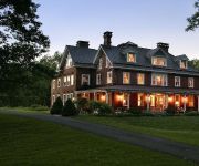
Olde Square Inn Bed and Breakfast
Cameron Estate Inn & Restaurant
Holiday Inn Express ELIZABETHTOWN (HERSHEY AREA)
Hampton Inn - Suites Mount Joy-Lancaster West PA
Comfort Inn Lancaster County
Videos from this area
These are videos related to the place based on their proximity to this place.
Maytown Sport Parachute Club 3-way
Jump starts at 2:05. 3 way from 10k out of a Cessna 182. Only our second jump together. Jason (B license), Dan (C license), Steve (D license and IAD instructor). Thanks to Steve for the fantastic...
Mount Joy Road Race Cat 4 Attempted Bridge
Had 3 strong teammates in the break and knew they were gonna runaway with the race. I tried to bridge to them but in the end I didn't have it in the legs.
2000 Honda Civic Used Cars Mount Joy PA
http://www.yournextautollc.com This 2000 Honda Civic is available from Your Next Auto LLC. For details, call us at 717-653-6221.
Juniper Communities cuts ribbon at its new facility in Mount Joy
Juniper Communities cuts ribbon at its new facility in Mount Joy. View article at http://lancasteronline.com/article/local/815010.
Students still learning at long-closed school in Mount Joy
As Mount Joy Historical Society seeks ways to finance a schoolhouse renovation project, students from Lancaster County Career & Technology Center are lending helping hands. Read more: ...
Blizzard Mount Joy Pennsylvania 2010
Blizzard on February 10, 2010. We were getting 12-18 inches on top of 24-26 on the ground.
Mount Joy's Fire and Ice Festival 2013
As Mount Joy kicked off its fifth annual Fire and Ice Festival on Friday, reaction to the live ice sculpting and hot chili was anything but lukewarm. Read more: http://lancasteronline.com/article/l...
Kids share ideas for new Mount Joy playground
Kids share ideas for new Mount Joy playground View article at http://lancasteronline.com/article/local/842585.
Mount Joy rebounds from playground arson
Mount Joy rebounds from playground arson. View article at http://lancasteronline.com/article/local/778316.
1996 Chevrolet Suburban Used Cars Mount Joy PA
http://www.yournextautollc.com This 1996 Chevrolet Suburban is available from Your Next Auto LLC. For details, call us at 717-653-6221.
Videos provided by Youtube are under the copyright of their owners.
Attractions and noteworthy things
Distances are based on the centre of the city/town and sightseeing location. This list contains brief abstracts about monuments, holiday activities, national parcs, museums, organisations and more from the area as well as interesting facts about the region itself. Where available, you'll find the corresponding homepage. Otherwise the related wikipedia article.
Mount Joy, Pennsylvania
Mount Joy is a borough in Lancaster County, Pennsylvania, United States. The population was 6,765 at the 2000 census.
Marietta, Pennsylvania
Marietta is a borough in Lancaster County, Pennsylvania, United States. The population was 2,689 at the 2000 census. It is located on the east bank of the Susquehanna River just north of Columbia.
Forry's Mill Covered Bridge
The Forry's Mill Covered Bridge is a covered bridge that spans Chiques Creek in West Hempfield in Lancaster County, Pennsylvania, United States. A county-owned and maintained bridge, its official designation is the Big Chiques #7 Bridge. (Chiques Creek was known as Chickies Creek until 2002). The bridge has a single span, wooden, double Burr arch trusses design with the addition of steel hanger rods. The deck is made from oak planks.
Mount Joy (Amtrak station)
Mount Joy Station is an Amtrak rail station located about 13 miles northwest of Lancaster, Pennsylvania at East Henry Street and North Market Street in Mount Joy, Pennsylvania. It is served by most Amtrak Keystone Service trains. The station is a makeshift bus shelter in a railroad cut. There is no ticket office at this station. Red Rose Transit Authority, based in Lancaster, operates its Route 18 bus through Mount Joy one block (less than 1/10 mile) from the station.


