Safety Score: 2,7 of 5.0 based on data from 9 authorites. Meaning we advice caution when travelling to United States.
Travel warnings are updated daily. Source: Travel Warning United States. Last Update: 2024-08-13 08:21:03
Discover Oregon
Oregon in Lancaster County (Pennsylvania) is a city in United States about 94 mi (or 151 km) north-east of Washington DC, the country's capital city.
Local time in Oregon is now 12:02 PM (Monday). The local timezone is named America / New York with an UTC offset of -5 hours. We know of 10 airports in the vicinity of Oregon, of which 4 are larger airports. The closest airport in United States is Lancaster Airport in a distance of 3 mi (or 4 km), West. Besides the airports, there are other travel options available (check left side).
There is one Unesco world heritage site nearby. It's Independence Hall in a distance of 75 mi (or 120 km), East. Also, if you like golfing, there are a few options in driving distance. Looking for a place to stay? we compiled a list of available hotels close to the map centre further down the page.
When in this area, you might want to pay a visit to some of the following locations: Lancaster, Lebanon, Reading, York and Pottsville. To further explore this place, just scroll down and browse the available info.
Local weather forecast
Todays Local Weather Conditions & Forecast: 10°C / 49 °F
| Morning Temperature | 2°C / 36 °F |
| Evening Temperature | 10°C / 51 °F |
| Night Temperature | 10°C / 49 °F |
| Chance of rainfall | 0% |
| Air Humidity | 57% |
| Air Pressure | 1019 hPa |
| Wind Speed | Gentle Breeze with 6 km/h (4 mph) from North |
| Cloud Conditions | Few clouds, covering 13% of sky |
| General Conditions | Few clouds |
Monday, 25th of November 2024
12°C (53 °F)
3°C (38 °F)
Moderate rain, fresh breeze, broken clouds.
Tuesday, 26th of November 2024
7°C (45 °F)
6°C (42 °F)
Overcast clouds, gentle breeze.
Wednesday, 27th of November 2024
4°C (40 °F)
4°C (40 °F)
Light rain, gentle breeze, overcast clouds.
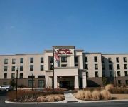
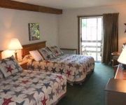
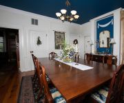
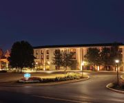
Hotels and Places to Stay
THE INN AT LEOLA VILLAGE
Lancaster Marriott at Penn Square
Hampton Inn - Suites Ephrata - Mountain Springs
THE COUNTRY INN OF LANCASTER
E J Bowman House Bed & Breakfast
Hampton Inn Lancaster
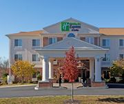
Holiday Inn Express & Suites LANCASTER-LITITZ
Courtyard Lancaster
BW PREMIER EDEN RESORT AND STE
Historic Smithton Inn
Videos from this area
These are videos related to the place based on their proximity to this place.
Truck fire shuts Route 222
A portion of Route 222 was shut down Thursday night because of a tractor-trailer fire. Northbound and southbound lanes of travel were closed from Oregon Pike to the Route 772 (Brownstown) ...
Behind-The-Lines-Recruiting-and-Retention-2010.wmv
Unemployment is high but small business employers still report that they are struggling to find skilled and qualified workers? What can employers do differently to find talent and what can...
Warwick school bus, armored car collide [raw video]
A group of Warwick High School students escaped injury Thursday when their school bus was struck by an armored vehicle, police said. The 3:50 p.m. crash took place as the bus was stopping...
2-alarm fire strikes business on farm in West Earl [raw video]
A two-alarm fire struck a large construction business on a farm in West Earl Township Wednesday morning. The blaze broke out at 3888 Oregon Pike, Brownstown, at 1:12 a.m., according to a county...
Fire damages business in West Earl Township [raw video]
Fire caused $5000 in damage to a West Earl Township business Tuesday afternoon. Firefighters dispatched at 4:15 p.m. to Keystone Construction, 3888 Oregon Pike, arrived to find smoke coming...
Pole Barns Lititz
http://www.stoltzfus-builders.com Stoltzfus Builders 50 North View Rd Lititz PA 17543 (717) 664-3540 Your pole building specialists!
Alien UFO attack at Lancaster County RC Club!!
Andy Wargo's flying kite and quad copter make for some odd-looking flying things! This video taken at the club field on August 31, 2011. Other cast members include Charlie Zirkel (triplane)...
FMS/RocHobby V-Tail Glider Soaring 10/12/14
Soaring at LCRCC on a beautiful fall Sunday afternoon. Highest altitude I've reached so far. Trying to keep up with Robin Church, who left me in the dust with his Radian!
D&E Build a Bike
This is a video of a teambuilding exercise that we did at D&E Communication. The teams had to earn the tools, pedals and helmets for their bikes by completti...
Red Road Run.mpg
This is one of my favorite areas for a short ride - along Warwick Road (aka the Red Road because of the reddish color of the asphalt) through the Millport Conservancy area, and then over toward...
Videos provided by Youtube are under the copyright of their owners.
Attractions and noteworthy things
Distances are based on the centre of the city/town and sightseeing location. This list contains brief abstracts about monuments, holiday activities, national parcs, museums, organisations and more from the area as well as interesting facts about the region itself. Where available, you'll find the corresponding homepage. Otherwise the related wikipedia article.
Hunsecker's Mill Covered Bridge
The Hunsecker's Mill Covered Bridge is a covered bridge located in Lancaster County, Pennsylvania, United States. The bridge has a single span, wooden, double Burr arch trusses design. The bridge, which spans the Conestoga River, is 180 feet (54.9 m) long, making it the longest single span covered bridge in the county. The bridge's WGCB Number is 38-36-06. Unlike most historic covered bridges in the county, it is not listed on the National Register of Historic Places.
Pinetown Bushong's Mill Covered Bridge
The Pinetown Bushong's Mill Covered Bridge is a covered bridge that spans the Conestoga River in Lancaster County, Pennsylvania, United States. A county-owned and maintained bridge, its official designation is the Big Conestoga #6 Bridge. The bridge is also known as Pinetown Covered Bridge, Nolte's Point Mill Bridge and Bushong's Mill Bridge. The bridge has a single span, wooden, double Burr arch trusses design with the addition of steel hanger rods. The deck is made from oak planks.
Zook's Mill Covered Bridge
The Zook's Mill Covered Bridge is a covered bridge that spans Cocalico Creek in Lancaster County, Pennsylvania, United States. A county-owned and maintained bridge, its official designation is the Cocalico #7 Bridge. The bridge is also known as Wenger Covered Bridge or Rose Hill Covered Bridge. It is located west of Brownstown on T 797, near the Warwick and West Earl Townships. The bridge has a single span, wooden, double Burr arch trusses design with the addition of steel hanger rods.
Manheim Township, Lancaster County, Pennsylvania
Manheim Township is a township in Lancaster County, Pennsylvania established in 1729, which southernmost border meets the city limits of Lancaster. The population as of the 2000 census was 33,697.
Rothsville, Pennsylvania
Rothsville is a census-designated place (CDP), associated with the town of Lititz, PA, in Lancaster County, Pennsylvania, United States. Lititz, PA, is the town for residents' mailing addresses. The cdp is located entirely within Warwick Township. The population was 3,044 at the 2010 census.
Warwick Township, Lancaster County, Pennsylvania
Warwick Township is a township in north central Lancaster County, Pennsylvania, United States. The population was 15,475 at the 2000 census. It completely surrounds the borough of Lititz and contains the following villages: Brunnerville, Disston, Kissel Hill, Lexington, Millway, and Rothsville.
Lancaster Bible College
Lancaster Bible College (LBC) is a private, coeducational Bible college and graduate school in Lancaster, Pennsylvania that "exists to educate Christian students to think and live a biblical worldview and to proclaim Christ by serving him in the Church and society. " Traditional undergraduate students graduate with a Bachelor of Science degree in Bible. The college offers several Master of Arts and Master of Education degree programs, along with a Doctorate in Leadership.
Ephrata Fair
The Ephrata Fair is held each year in Ephrata, Lancaster County, and is the largest street fair in Pennsylvania. In 2010, the 92nd Annual fair was held on September 21 - 25, 2010.





!['Warwick school bus, armored car collide [raw video]' preview picture of video 'Warwick school bus, armored car collide [raw video]'](https://img.youtube.com/vi/V2OYrzq7dVQ/mqdefault.jpg)
!['2-alarm fire strikes business on farm in West Earl [raw video]' preview picture of video '2-alarm fire strikes business on farm in West Earl [raw video]'](https://img.youtube.com/vi/6oHvRTG52U4/mqdefault.jpg)
!['Fire damages business in West Earl Township [raw video]' preview picture of video 'Fire damages business in West Earl Township [raw video]'](https://img.youtube.com/vi/O7nIU0ifncc/mqdefault.jpg)


