Safety Score: 2,7 of 5.0 based on data from 9 authorites. Meaning we advice caution when travelling to United States.
Travel warnings are updated daily. Source: Travel Warning United States. Last Update: 2024-08-13 08:21:03
Delve into Leacock-Leola-Bareville
Leacock-Leola-Bareville in Lancaster County (Pennsylvania) is located in United States about 94 mi (or 152 km) north-east of Washington DC, the country's capital town.
Current time in Leacock-Leola-Bareville is now 09:19 AM (Friday). The local timezone is named America / New York with an UTC offset of -5 hours. We know of 10 airports close to Leacock-Leola-Bareville, of which 4 are larger airports. The closest airport in United States is Lancaster Airport in a distance of 6 mi (or 10 km), West. Besides the airports, there are other travel options available (check left side).
There is one Unesco world heritage site nearby. It's Independence Hall in a distance of 72 mi (or 115 km), East. Also, if you like playing golf, there are some options within driving distance. If you need a hotel, we compiled a list of available hotels close to the map centre further down the page.
While being here, you might want to pay a visit to some of the following locations: Lancaster, Lebanon, Reading, York and Bel Air. To further explore this place, just scroll down and browse the available info.
Local weather forecast
Todays Local Weather Conditions & Forecast: 2°C / 36 °F
| Morning Temperature | 0°C / 32 °F |
| Evening Temperature | 2°C / 35 °F |
| Night Temperature | 1°C / 34 °F |
| Chance of rainfall | 0% |
| Air Humidity | 95% |
| Air Pressure | 996 hPa |
| Wind Speed | Moderate breeze with 11 km/h (7 mph) from North-East |
| Cloud Conditions | Overcast clouds, covering 100% of sky |
| General Conditions | Rain and snow |
Friday, 22nd of November 2024
5°C (41 °F)
6°C (43 °F)
Scattered clouds, moderate breeze.
Saturday, 23rd of November 2024
8°C (46 °F)
3°C (37 °F)
Light rain, moderate breeze, broken clouds.
Sunday, 24th of November 2024
7°C (45 °F)
8°C (47 °F)
Light rain, light breeze, overcast clouds.
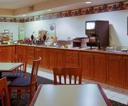
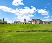
Hotels and Places to Stay
THE INN AT LEOLA VILLAGE
PA Lancaster Country Inn and Suites by Radisson
La Quinta Inn and Suites Lancaster
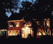
Candlelight Inn Bed & Breakfast
Comfort Inn Lancaster - Rockvale Outlets
Tru by Hilton Lancaster East PA
Fairfield Inn & Suites Lancaster East at The Outlets
Eastbrook Inn
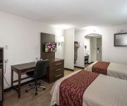
Red Roof Inn Lancaster
Mill Creek Homestead
Videos from this area
These are videos related to the place based on their proximity to this place.
Truck fire shuts Route 222
A portion of Route 222 was shut down Thursday night because of a tractor-trailer fire. Northbound and southbound lanes of travel were closed from Oregon Pike to the Route 772 (Brownstown) ...
SOLD - 8 Blaine Avenue, Leola, Pa 17540, $209,000, MLS 172547
Bring your Time Machine & Imagination! This home in Conestoga Valley School District offers a spacious floor plan & with the help of a $5000 re-decorating allowance (w/acceptable offer) you'll...
HayLoft Candles & Petting Zoo
http://hayloftcandles.com/ Enjoy the wonderful fragrances of our 4000 square foot candle shop. One look at our well-stocked shelves and you know you will find almost any type and style of...
2-alarm fire strikes business on farm in West Earl [raw video]
A two-alarm fire struck a large construction business on a farm in West Earl Township Wednesday morning. The blaze broke out at 3888 Oregon Pike, Brownstown, at 1:12 a.m., according to a county...
Leola man charged with homicide in death of his infant son
A Leola man has been charged with homicide in the death of his infant son. Jesus Manuel LaSanta, 27, of 462 Brendon Drive, Leola, was taken into custody Wednesday and committed to Lancaster...
Fire damages business in West Earl Township [raw video]
Fire caused $5000 in damage to a West Earl Township business Tuesday afternoon. Firefighters dispatched at 4:15 p.m. to Keystone Construction, 3888 Oregon Pike, arrived to find smoke coming...
Reno in trail class
See http://equinenow.com/821038 This is Reno in an Extreme Trail class. The video starts with him in the upper right corner side passes over a poll in both directions, the video was taken...
Project of Sat 12 Feb 2011 10:13:32 AM PST (Rip City Clip Funny)
I created this video at http://www.youtube.com/editor.
Amish Sleigh
Amish sleigh on a wintery day in Lancaster County, Pa Gotta love living in Amish country in the winter... This is on the road we live on, taken from my shop at my mother in law, Rhoda's, place.
Videos provided by Youtube are under the copyright of their owners.
Attractions and noteworthy things
Distances are based on the centre of the city/town and sightseeing location. This list contains brief abstracts about monuments, holiday activities, national parcs, museums, organisations and more from the area as well as interesting facts about the region itself. Where available, you'll find the corresponding homepage. Otherwise the related wikipedia article.
Zook's Mill Covered Bridge
The Zook's Mill Covered Bridge is a covered bridge that spans Cocalico Creek in Lancaster County, Pennsylvania, United States. A county-owned and maintained bridge, its official designation is the Cocalico #7 Bridge. The bridge is also known as Wenger Covered Bridge or Rose Hill Covered Bridge. It is located west of Brownstown on T 797, near the Warwick and West Earl Townships. The bridge has a single span, wooden, double Burr arch trusses design with the addition of steel hanger rods.
Leacock-Leola-Bareville, Pennsylvania
Leacock-Leola-Bareville is a census-designated place (CDP) in Lancaster County, Pennsylvania, in the United States. As of the 2000 census, the CDP population was 6,625. The area is heavily populated by the Amish and Mennonites. Bareville is often named in lists of "delightfully-named towns" in Pennsylvania Dutchland, along with Intercourse, Blue Ball, Lititz, Mount Joy, Bird-in-Hand and Paradise.
Upper Leacock Township, Lancaster County, Pennsylvania
Upper Leacock Township is a township in east central Lancaster County, Pennsylvania, United States. The population was 8,229 at the 2000 census. The township includes a village called Mascot, named by Annie Groff, a deceased member of the Ressler family, owners of the Mascot Roller Mills. She dedicated the name of the village to a canine actor she watched at a Broadway theatre show on her honeymoon.
West Earl Township, Lancaster County, Pennsylvania
West Earl Township is a township in northeastern Lancaster County, Pennsylvania, United States. The population was 6,766 at the 2000 census. Floyd Landis, winner of the 2006 Tour de France, is from the unincorporated village of Farmersville in West Earl Township.
Leola, Pennsylvania
Leola formerly part of the Leacock-Leola-Bareville CDP before consolidating into the current census-designated place for the 2010 census, is a community in Upper Leacock and West Earl Townships in Lancaster County in the state of Pennsylvania. It is located along Pennsylvania Route 23 between the city of Lancaster and the borough of New Holland. As of the 2010 census the population was 7,214 residents.
Ephrata Fair
The Ephrata Fair is held each year in Ephrata, Lancaster County, and is the largest street fair in Pennsylvania. In 2010, the 92nd Annual fair was held on September 21 - 25, 2010.
Conestoga Valley High School
Conestoga Valley High School is a public secondary school in the Conestoga Valley School District in Lancaster, Pennsylvania. It consisted of 1,334 students in the 2010–11 academic year and its current principal is Michael Thornton, who was hired in 2008.
Witmer, Pennsylvania
Witmer is a census-designated place located in East Lampeter Township in Lancaster County in the state of Pennsylvania. It is located just to the north of Pennsylvania Route 340, very close to the communities of Smoketown and Bird-in-Hand. As of the 2010 census the population was 492 residents.







!['2-alarm fire strikes business on farm in West Earl [raw video]' preview picture of video '2-alarm fire strikes business on farm in West Earl [raw video]'](https://img.youtube.com/vi/6oHvRTG52U4/mqdefault.jpg)

!['Fire damages business in West Earl Township [raw video]' preview picture of video 'Fire damages business in West Earl Township [raw video]'](https://img.youtube.com/vi/O7nIU0ifncc/mqdefault.jpg)


