Safety Score: 2,7 of 5.0 based on data from 9 authorites. Meaning we advice caution when travelling to United States.
Travel warnings are updated daily. Source: Travel Warning United States. Last Update: 2024-08-13 08:21:03
Discover Mayfield
Mayfield in Lackawanna County (Pennsylvania) with it's 1,737 citizens is a place in United States about 199 mi (or 320 km) north-east of Washington DC, the country's capital city.
Current time in Mayfield is now 04:44 PM (Thursday). The local timezone is named America / New York with an UTC offset of -5 hours. We know of 13 airports near Mayfield, of which 5 are larger airports. The closest airport in United States is Wilkes Barre Scranton International Airport in a distance of 17 mi (or 27 km), South-West. Besides the airports, there are other travel options available (check left side).
There are two Unesco world heritage sites nearby. The closest heritage site in United States is Statue of Liberty in a distance of 101 mi (or 163 km), South-East. Also, if you like playing golf, there are a few options in driving distance. If you need a hotel, we compiled a list of available hotels close to the map centre further down the page.
While being here, you might want to pay a visit to some of the following locations: Scranton, Honesdale, Tunkhannock, Montrose and Binghamton. To further explore this place, just scroll down and browse the available info.
Local weather forecast
Todays Local Weather Conditions & Forecast: 1°C / 33 °F
| Morning Temperature | 4°C / 39 °F |
| Evening Temperature | -0°C / 31 °F |
| Night Temperature | -1°C / 30 °F |
| Chance of rainfall | 7% |
| Air Humidity | 99% |
| Air Pressure | 1002 hPa |
| Wind Speed | Moderate breeze with 10 km/h (6 mph) from South-East |
| Cloud Conditions | Overcast clouds, covering 100% of sky |
| General Conditions | Rain and snow |
Thursday, 21st of November 2024
-1°C (30 °F)
-8°C (18 °F)
Snow, gentle breeze, overcast clouds.
Friday, 22nd of November 2024
-0°C (31 °F)
0°C (33 °F)
Overcast clouds, gentle breeze.
Saturday, 23rd of November 2024
0°C (33 °F)
-3°C (26 °F)
Rain and snow, gentle breeze, overcast clouds.
Hotels and Places to Stay
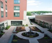
The Carbondale Grand Hotel & Conference Center
Videos from this area
These are videos related to the place based on their proximity to this place.
Jermyn Real Estate - Patio & Pagoda...
3 Old Mill Road, Jermyn ~ Link to this home: http://goo.gl/ibr3e A truly beautiful home in a lovely wooded development. A rare opportunity since homes in thi...
Pine Street Gas Leak Audio - 5/12/12
On Saturday, May 12, 2012 at 9:50 am Station 58 along with Rescue and EMS 59 were dispatched to 325 Pine Street in Archbald Borough (Nebraska Section) for a gas leak.
Fully involved structure fire in Jermyn, PA
This info was taken directly from the Jermyn Fire Department's website. I am not a member at this department, just happened to be in the area when the call came in. For more information, pictures,...
Possible Structure Fire Dispatch Audio - 07.31.12
On Tuesday, July 31, 2012 at 3:36 pm Station 58 along with Rescue and EMS 59 were dispatched for a possible structure fire on the 500 block of Washington Avenue in Jermyn.
Washington Ave. 2 Alarm Structure Fire Video - 2/25/2012
On Saturday, February 25 Station 58 along with Rescue and EMS 59 were dispatched for a fire in a wall at 534 Washington Avenue. Chief 58 arrived on-scene confirming a working fire.
Garbage Truck Fuel Leak Audio - 1/23/12
on January 23, 2012 Station 58 along with Rescue and EMS 59 were dispatched for fuel leaking out of a garbage truck on the corner of Washington Avenue and Division Street.
Jermyn Mill & Grain - June 8, 1993
Jermyn Mill & Grain gas station in Jermyn, PA caught fire around 5 PM on June 8, 1993 Over 200 firefighters from Lackawanna, Susquehanna, and Wayne counties battled the blaze. It took 2 hours...
Jermyn Mill and Grain Fire - Part 1
June 8, 1993 Station 58 would be dispatched for a reported fire at the Jermyn Mill and Grain on the 700 block of Washington Avenue. The fire ended up destroying the business and was one of...
2nd Annual Jermyn Christmas Parade (2012)
The entire 2nd Annual Jermyn Christmas Parade on video..... Every year the Jermyn/Mayfield Girl Scouts hold a town Christmas parade.
Videos provided by Youtube are under the copyright of their owners.
Attractions and noteworthy things
Distances are based on the centre of the city/town and sightseeing location. This list contains brief abstracts about monuments, holiday activities, national parcs, museums, organisations and more from the area as well as interesting facts about the region itself. Where available, you'll find the corresponding homepage. Otherwise the related wikipedia article.
Jermyn, Pennsylvania
Jermyn, known as "The Birthplace of First Aid in America," is a borough in Lackawanna County, Pennsylvania, on the Lackawanna River, 12 miles northeast of Scranton. A productive anthracite coal field was in the region in 1900 when 2,567 people lived here. In 1910, 3,158 residents of Jermyn were tallied. In the early years of the twentieth century, coal mines, cut-glass works, silk, powder, grist, planing, and saw mills, bottling works, and fertilizer factories dotted the borough.
Mayfield, Pennsylvania
Mayfield is a borough in Lackawanna County, Pennsylvania, United States, about 14 miles northeast of Scranton. In the past, it contained a silk mill and a coal mining industry. In 1900, 2,300 people lived here, and in 1910, 3,662 people inhabited Mayfield. The population was 1,807 at the 2010 census.
Valley View High School (Pennsylvania)
Valley View High School is a high school located in Archbald, Pennsylvania.
East Jermyn
East Jermyn is a small section of Jermyn, Pennsylvania east of the Lackawanna River and west of the Nebraska section of Archbald, Pennsylvania commonly referred to as "The Lane"


