Safety Score: 2,7 of 5.0 based on data from 9 authorites. Meaning we advice caution when travelling to United States.
Travel warnings are updated daily. Source: Travel Warning United States. Last Update: 2024-08-13 08:21:03
Delve into Westbrook Park
Westbrook Park in Delaware County (Pennsylvania) is a town located in United States about 117 mi (or 188 km) north-east of Washington DC, the country's capital town.
Time in Westbrook Park is now 03:23 PM (Thursday). The local timezone is named America / New York with an UTC offset of -5 hours. We know of 12 airports closer to Westbrook Park, of which 5 are larger airports. The closest airport in United States is Philadelphia International Airport in a distance of 6 mi (or 9 km), South-East. Besides the airports, there are other travel options available (check left side).
There are two Unesco world heritage sites nearby. The closest heritage site in United States is Independence Hall in a distance of 24 mi (or 39 km), East. Also, if you like the game of golf, there are some options within driving distance. We saw 2 points of interest near this location. In need of a room? We compiled a list of available hotels close to the map centre further down the page.
Since you are here already, you might want to pay a visit to some of the following locations: Media, Philadelphia, Woodbury, Norristown and Camden. To further explore this place, just scroll down and browse the available info.
Local weather forecast
Todays Local Weather Conditions & Forecast: 7°C / 44 °F
| Morning Temperature | 7°C / 44 °F |
| Evening Temperature | 8°C / 47 °F |
| Night Temperature | 5°C / 41 °F |
| Chance of rainfall | 15% |
| Air Humidity | 74% |
| Air Pressure | 1001 hPa |
| Wind Speed | Fresh Breeze with 15 km/h (9 mph) from South-East |
| Cloud Conditions | Overcast clouds, covering 100% of sky |
| General Conditions | Heavy intensity rain |
Thursday, 21st of November 2024
5°C (41 °F)
4°C (39 °F)
Rain and snow, moderate breeze, scattered clouds.
Friday, 22nd of November 2024
7°C (44 °F)
7°C (45 °F)
Light rain, moderate breeze, clear sky.
Saturday, 23rd of November 2024
9°C (48 °F)
6°C (44 °F)
Broken clouds, moderate breeze.
Hotels and Places to Stay
Four Points by Sheraton Philadelphia Airport
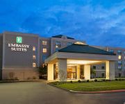
Embassy Suites by Hilton Philadelphia Airport
Renaissance Philadelphia Airport Hotel
Holiday Inn Express PHILADELPHIA AIRPORT
Courtyard Philadelphia Airport
Comfort Inn Philadelphia Airport
Residence Inn Philadelphia Airport
SpringHill Suites Philadelphia Airport/Ridley Park
Clarion Hotel Philadelphia International Airport
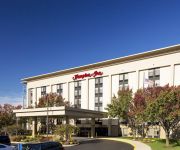
Hampton Inn Philadelphia-Airport
Videos from this area
These are videos related to the place based on their proximity to this place.
UDFD Tower 74 in response
Here is Upper Darby Fire Department's Tower 74 (Primos-Secane-Westbrook Park Fire Co) driving by Bishop Ave and Harwarden Rd as they, as well as Co's 20 (Garrettford-Drexel Hill), 26 (Highland...
2009 Toyota Corolla Used Cars Springfield PA
http://www.fellahofspringfield.com This 2009 Toyota Corolla is available from Fellah Auto Group Springfield. For details, call us at 484-461-7800.
2011 GMC Sierra Used Cars Springfield PA
http://www.fellahofspringfield.com This 2011 GMC Sierra is available from Fellah Auto Group Springfield. For details, call us at 484-461-7800.
2002 Cadillac Escalade EXT Used Cars Springfield PA
http://www.fellahofspringfield.com This 2002 Cadillac Escalade EXT is available from Fellah Auto Group Springfield. For details, call us at 484-461-7800.
2010 Dodge Charger Used Cars Springfield PA
http://www.fellahofspringfield.com This 2010 Dodge Charger is available from Fellah Auto Group Springfield. For details, call us at 484-461-7800.
2000 Ford F-150 Used Cars Springfield PA
http://www.fellahofspringfield.com This 2000 Ford F-150 is available from Fellah Auto Group Springfield. For details, call us at 484-461-7800.
2013 Ford Fusion Used Cars Springfield PA
http://www.fellahofspringfield.com This 2013 Ford Fusion is available from Fellah Auto Group Springfield. For details, call us at 484-461-7800.
2002 Subaru Forester Used Cars Springfield PA
http://www.fellahofspringfield.com This 2002 Subaru Forester is available from Fellah Auto Group Springfield. For details, call us at 484-461-7800.
2007 Jeep Compass Used Cars Springfield PA
http://www.fellahofspringfield.com This 2007 Jeep Compass is available from Fellah Auto Group Springfield. For details, call us at 484-461-7800.
2011 BMW 550i Used Cars Springfield PA
http://www.fellahofspringfield.com This 2011 BMW 550i is available from Fellah Auto Group Springfield. For details, call us at 484-461-7800.
Videos provided by Youtube are under the copyright of their owners.
Attractions and noteworthy things
Distances are based on the centre of the city/town and sightseeing location. This list contains brief abstracts about monuments, holiday activities, national parcs, museums, organisations and more from the area as well as interesting facts about the region itself. Where available, you'll find the corresponding homepage. Otherwise the related wikipedia article.
Clifton Heights, Pennsylvania
(Ch ch) Clifton Heights is a borough in Delaware County, Pennsylvania, six miles (10 km) west of downtown Philadelphia and on Darby Creek. The population was at 2,330 in 1900, and 3,155 in 1910 and had grown to 6,779 at the 2000 census.
Drexel Hill, Pennsylvania
Drexel Hill is a census-designated place in Upper Darby Township, Delaware County, Pennsylvania, United States. Drexel Hill is located southwest of Center City, Philadelphia and is part of the Philadelphia metropolitan area. The population was 30,036 at the 2007 census.
Garrettford (SEPTA Route 102 station)
Garrettford is a station on the SEPTA Route 102 trolley in Drexel Hill, Pennsylvania. It is officially located Edmonds Avenue & Garrett Road, however, the actual location is at the intersection of Edmonds Avenue, Jones Street and Mill Lane, which is south of Garrett Road. The trolley line crosses the aforementioned intersection at the southwest corner of Edmonds Avenue & Jones Street, to the northeast corner of Edmonds Avenue and Mill Lane.
Huey Avenue (SEPTA Route 101 station)
Huey Avenue is a stop along the SEPTA Media (Route 101) trolley line in Pennsylvania, United States. It is officially located near Huey & Edmonds Avenues in Drexel Hill, but in reality is closer to the intersection of Huey Avenue and Mason Avenue. Trolleys arriving at this station travel between 69th Street Terminal in Upper Darby, Pennsylvania and Orange Street in Media, Pennsylvania. The station has a shed with a roof where people can go inside when it is raining.
Baltimore Pike (SEPTA Route 102 station)
Baltimore Pike is a station on the SEPTA Route 102 trolley in Clifton Heights, Pennsylvania. It is officially located near Baltimore Pike & Odgen Street, however the shed is located on the opposite side of this intersection between Glenwood and Bridge Avenues. Trolleys arriving at this station travel between 69th Street Terminal in Upper Darby, Pennsylvania and Sharon Hill, Pennsylvania. The station has a shed with a roof where people can go inside when it is raining.
Drexel Manor (SEPTA Route 102 station)
Drexel Manor is a stop on the SEPTA Route 102 trolley line in Drexel Hill, Pennsylvania. The station is officially located near Burmont Road and Cheswold Road. Like the Marshall Road stop, the Route 102 line runs in between Cheswold and Blanchard Roads, both of which terminate at Burmont Road. Two schools are located in the vicinity of this station. Trolleys arriving at this station travel between 69th Street Terminal in Upper Darby, Pennsylvania and Sharon Hill, Pennsylvania.
Creek Road (SEPTA Route 102 station)
Creek Road (formerly Oakview) is a stop on the SEPTA Route 102 trolley line in Drexel Hill, Pennsylvania. It is located at the end of Station Road north of Creek Road(although SEPTA gives the address as being at Darby Creek Road at Railroad) within Indian Rock Park, a 21.9-acre Natural Environmental Park in Drexel Hill, containing picnic tables, playground equipment, basketball courts, and Darby Creek.
Marshall Road (SEPTA Route 102 station)
Marshall Road is a stop on the SEPTA Route 102 trolley line in Drexel Hill, Pennsylvania. The station is officially located near Marshall & Cheswold Roads, but in fact it is located halfway between Cheswold and Blanchard Roads on Marshall Road. Trolleys arriving at this station travel between 69th Street Terminal in Upper Darby, Pennsylvania and Sharon Hill, Pennsylvania. The station has a shed with a roof where people can go inside when it is raining on one platform and a bench on the other.
Anderson Avenue (SEPTA Route 101 station)
Anderson Avenue is a stop along the SEPTA Media trolley line in the Aronimink section of Drexel Hill, Pennsylvania. It is officially located near Anderson & Woodland Avenues, though the actual location is on Anderson Avenue south of Woodlawn Avenue. Trolleys arriving at this station travel between 69th Street Terminal in Upper Darby, Pennsylvania and Orange Street in Media, Pennsylvania. Anderson Avenue is a dead end street at this station which contains platforms on both sides of the tracks.
Aronimink (SEPTA Route 101 station)
Aronimink is a stop along the SEPTA Media trolley line in the Aronimink section of Drexel Hill, Pennsylvania. It is located on Burmont Road & Morgan Avenue, although SEPTA gives the address as being near that intersection. Aronimink is one of two stops for the Media-Sharon Hill Line that cross Burmont Road. The other is south of Garrett Road at Drexel Manor along the Sharon Hill trolley line.
Drexelbrook (SEPTA Route 101 station)
Drexelbrook is a stop along the SEPTA Media trolley line in the Drexelbrook section of Drexel Hill, Pennsylvania. It is officially located near Stanbridge Road & Woodland Avenue, however the actual grade crossing and platforms are on Wildell Road south of Woodland Avenue and north of Revere Road and Drexelbrook Drive. Trolleys arriving at this station travel between 69th Street Terminal in Upper Darby, Pennsylvania and Orange Street in Media, Pennsylvania.
School Lane (SEPTA Route 101 station)
School Lane is a stop along the SEPTA Media (Route 101) trolley line. It is located on School Lane west of Edmonds Avenue in Drexel Hill, Pennsylvania, with SEPTA giving the address as "near School Lane & Edmonds Avenue". The station is next to a church on the northwest corner of the aforementiond intersection. Trolleys arriving at this station travel between 69th Street Terminal in Upper Darby, Pennsylvania, and Orange Street in Media, Pennsylvania.


