Safety Score: 2,7 of 5.0 based on data from 9 authorites. Meaning we advice caution when travelling to United States.
Travel warnings are updated daily. Source: Travel Warning United States. Last Update: 2024-08-13 08:21:03
Explore Kirklyn
Kirklyn in Delaware County (Pennsylvania) is a city in United States about 119 mi (or 192 km) north-east of Washington DC, the country's capital.
Local time in Kirklyn is now 04:56 PM (Thursday). The local timezone is named America / New York with an UTC offset of -5 hours. We know of 12 airports in the vicinity of Kirklyn, of which 5 are larger airports. The closest airport in United States is Philadelphia International Airport in a distance of 7 mi (or 12 km), South. Besides the airports, there are other travel options available (check left side).
There are two Unesco world heritage sites nearby. The closest heritage site in United States is Independence Hall in a distance of 23 mi (or 38 km), East. Also, if you like golfing, there are multiple options in driving distance. We found 2 points of interest in the vicinity of this place. If you need a place to sleep, we compiled a list of available hotels close to the map centre further down the page.
Depending on your travel schedule, you might want to pay a visit to some of the following locations: Media, Philadelphia, Norristown, Camden and Woodbury. To further explore this place, just scroll down and browse the available info.
Local weather forecast
Todays Local Weather Conditions & Forecast: 7°C / 44 °F
| Morning Temperature | 7°C / 44 °F |
| Evening Temperature | 8°C / 46 °F |
| Night Temperature | 5°C / 41 °F |
| Chance of rainfall | 15% |
| Air Humidity | 77% |
| Air Pressure | 1000 hPa |
| Wind Speed | Fresh Breeze with 16 km/h (10 mph) from South-East |
| Cloud Conditions | Overcast clouds, covering 100% of sky |
| General Conditions | Heavy intensity rain |
Thursday, 21st of November 2024
5°C (41 °F)
4°C (39 °F)
Rain and snow, moderate breeze, scattered clouds.
Friday, 22nd of November 2024
7°C (44 °F)
8°C (46 °F)
Sky is clear, moderate breeze, clear sky.
Saturday, 23rd of November 2024
9°C (48 °F)
7°C (44 °F)
Broken clouds, moderate breeze.
Hotels and Places to Stay
Hilton Philadelphia City Avenue
DoubleTree by Hilton Philadelphia Airport
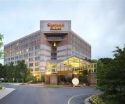
Sheraton Suites Philadelphia Airport
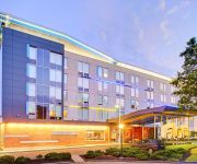
Aloft Philadelphia Airport
Four Points by Sheraton Philadelphia Airport
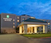
Embassy Suites by Hilton Philadelphia Airport
HAWTHORN SUITES BY WYNDHAM PHI
Courtyard Philadelphia Springfield
THE RADNOR HOTEL
Courtyard Philadelphia Airport
Videos from this area
These are videos related to the place based on their proximity to this place.
2012 Drexel Hill Raiders Winter Classic
Marquise Allsup born 11/22/03, Not his best wrestling but not bad either. He finished 2-2, his 2nd match he lost by 3 to the kid that placed 1st and his 4th match he lost by 2 to the kid the...
4069 LASHER RD, DREXEL HILL, PA Presented by The McKnight Team.
Click to see more: http://www.searchallproperties.com/listings/2049084/4069-LASHER-RD-DREXEL-HILL-PA/auto?reqpage=video 4069 LASHER RD DREXEL HILL, PA 19026 Contact The McKnight ...
Fixed Index Annuities in Radnor PA - Need Fixed Index Annuities in Radnor PA?
Fixed Index Annuities in Radnor PA Serving Delaware County PA including Radnor, Villanova, St Davids, and Spring Field Compass Financial Partners LLC is located at: 514 Irvington Road Drexel...
KENSINGTON TURK, PHILADELPHIA NEW PLAYGROUND
New playground in McSquare park, Kensington. Rebuilt for a better Philadelphia. Special thanks to Kensington Buisness Association (K&A), 2900 block of kensington ave. small buisnesses, City...
513 Mill Rd Havertown, PA 19083 - YLLCO Walkthrough
Havertown property walkthrough by YLLCO. Information on property management and leasing services in Havertown at http://www.yllco.com/property-management-in-havertown-pa/
513 Mill Rd Havertown, PA 19083 Backyard - YLLCO Walkthrough
Great backyard at this Havertown rental listing from YLLCO. Get more info on property management and leasing in Havertown at http://www.yllco.com/property-management-in-havertown-pa/
Havertown Hail Storm 3-29-09
We don't get a lot of hail around here so this was exciting. Biggest hail I've ever seen in person. It was about the size of average marbles. Nothing too impressive for people used to hail,...
Videos provided by Youtube are under the copyright of their owners.
Attractions and noteworthy things
Distances are based on the centre of the city/town and sightseeing location. This list contains brief abstracts about monuments, holiday activities, national parcs, museums, organisations and more from the area as well as interesting facts about the region itself. Where available, you'll find the corresponding homepage. Otherwise the related wikipedia article.
Upper Darby High School
Upper Darby High School (UDHS) is a four-year public high school located in Upper Darby Township, Pennsylvania, United States, as part of the Upper Darby School District. UDHS is also the oldest high school in Delaware County, PA, having been established in 1895. It is adjacent to Drexel Hill. As of the 2010–11 school year, the school had an enrollment of 3,762 students and 256.85 classroom teachers (on an FTE basis), for a student-teacher ratio of 17.0.
WHHS
WHHS is the student-run high school radio station of Haverford Senior High School, in Havertown, Pennsylvania (a suburb of Philadelphia). WHHS is the oldest high school radio station in the country. The station itself is located within the High School, and the transmitter is located nearby, covering a 5 to 10 mile radius around the High School.
Parkview (SEPTA station)
Parkview Station is an interurban rapid transit station on the SEPTA Norristown High Speed Line (Route 100). The station is located at Parkview Avenue and Pennock Road in Upper Darby Township, Pennsylvania, although SEPTA gives the address as Fairview Avenue & Parkview Road. Only local trains stop at Parkview. This station is zone 1 of the two fare zones. The station lies 0.7 track miles from 69th Street Terminal.
Township Line Road (SEPTA station)
Township Line Road Station, formerly known as West Overbrook Station, is an interurban rapid transit station on the SEPTA Norristown High Speed Line (Route 100). The station is located at Township Line Road and Grove Place in Haverford Township, Pennsylvania, although SEPTA gives the address as being at City & Grove Place. Only local trains stop at Township Line Rd. This station is zone 1 of the two fare zones. The station lies 1.4 track miles from 69th Street Terminal.
Penfield (SEPTA station)
Penfield Station is an interurban rapid transit station on the SEPTA Norristown High Speed Line (Route 100). The station is located at Manoa Road and Lawson Avenue in Haverford Township, Pennsylvania. Both local trains and Norristown Express trains stop at Penfield. This station is zone 1 of the two fare zones. The station lies 1.9 track miles from 69th Street Terminal.
Beechwood–Brookline (SEPTA station)
Beechwood-Brookline Station is an interurban rapid transit station on the SEPTA Norristown High Speed Line (Route 100). The station is located at Edgewood and Strathmore Roads in Haverford Township, Pennsylvania, although SEPTA gives the address as Beechwood & Karakung Drives. Both local trains and Hughes Park Express trains stop at Beechwood-Brookline. This station is zone 1 of the two fare zones. The station lies 2.5 track miles from 69th Street Terminal.
Archbishop Prendergast High School
Archbishop Prendergast High School is an all-girl Catholic High School in the Roman Catholic Archdiocese of Philadelphia. It is located in Drexel Hill, Pennsylvania. The school is often referred to by its nickname, "Prendie". The school operates in a landmark building that formerly served as St. Vincent Orphanage. The school mascot is a panda bear.
Haverford High School
Haverford Senior High School is the public high school of Haverford Township, Pennsylvania, United States, operated by the School District of Haverford Township. It is at 200 Mill Road in Havertown.
Arlington Cemetery Co
The Arlington Cemetery Company was founded in 1895. It is located on State Road in Drexel Hill, Pennsylvania and occupies roughly 130 acres . The Arlington Cemetery now consists of the Mount Vernon Office, Topitzer Funeral Home, Williamsburg Chapel, The Museum of Mourning Art, The Garden Mausoleum, The Monticello Mausoleum, and a greenhouse. In addition, the cemetery itself is divided up into about 18 sections, each individually named.
Congress Avenue (SEPTA station)
Congress Avenue is a stop along SEPTA's Media-Sharon Hill Trolley Lines in Upper Darby, Pennsylvania. It is located at Garrett Road & Congress Avenue, and serves both Routes 101 and 102. Only local service is provided on both lines. The station is located on the north side of the terminus of the Congress Avenue intersection. It contains two platforms, but only one pre-fabricated shelter on the south side of the tracks.
Beverly Boulevard (SEPTA station)
Beverly Boulevard (formerly Beverly Hills) is a stop along SEPTA's Media-Sharon Hill Trolley Lines in Upper Darby, Pennsylvania. It is officially located at Garrett Road & Bywood Avenue, but also includes Beverly Boulevard. The station serves both Routes 101 and 102. Only local service is provided on both lines. The station contains two platforms with plexiglass bus-type shelters on both sides of the tracks.
Monsignor Bonner High School
Monsignor Bonner High School is an all-male Augustinian Catholic High School in the Roman Catholic Archdiocese of Philadelphia. It is located in Drexel Hill, Pennsylvania, United States. Bonner was created in 1953 as Archbishop Prendergast High School for Boys. In 1955, the current building was constructed and subsequently entitled Monsignor Bonner High School.


