Safety Score: 2,7 of 5.0 based on data from 9 authorites. Meaning we advice caution when travelling to United States.
Travel warnings are updated daily. Source: Travel Warning United States. Last Update: 2024-08-13 08:21:03
Explore Addingham
Addingham in Delaware County (Pennsylvania) is a city in United States about 117 mi (or 189 km) north-east of Washington DC, the country's capital.
Local time in Addingham is now 08:13 AM (Sunday). The local timezone is named America / New York with an UTC offset of -5 hours. We know of 12 airports in the vicinity of Addingham, of which 5 are larger airports. The closest airport in United States is Philadelphia International Airport in a distance of 6 mi (or 10 km), South-East. Besides the airports, there are other travel options available (check left side).
There are two Unesco world heritage sites nearby. The closest heritage site in United States is Independence Hall in a distance of 24 mi (or 39 km), East. Also, if you like golfing, there are multiple options in driving distance. We found 2 points of interest in the vicinity of this place. If you need a place to sleep, we compiled a list of available hotels close to the map centre further down the page.
Depending on your travel schedule, you might want to pay a visit to some of the following locations: Media, Philadelphia, Norristown, Woodbury and Camden. To further explore this place, just scroll down and browse the available info.
Local weather forecast
Todays Local Weather Conditions & Forecast: 9°C / 48 °F
| Morning Temperature | 7°C / 45 °F |
| Evening Temperature | 9°C / 48 °F |
| Night Temperature | 7°C / 45 °F |
| Chance of rainfall | 0% |
| Air Humidity | 62% |
| Air Pressure | 1015 hPa |
| Wind Speed | Moderate breeze with 10 km/h (6 mph) from East |
| Cloud Conditions | Scattered clouds, covering 39% of sky |
| General Conditions | Scattered clouds |
Sunday, 24th of November 2024
12°C (53 °F)
12°C (53 °F)
Few clouds, light breeze.
Monday, 25th of November 2024
14°C (57 °F)
4°C (40 °F)
Light rain, moderate breeze, overcast clouds.
Tuesday, 26th of November 2024
4°C (39 °F)
4°C (39 °F)
Overcast clouds, moderate breeze.
Hotels and Places to Stay
Four Points by Sheraton Philadelphia Airport
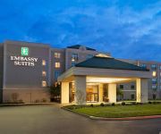
Embassy Suites by Hilton Philadelphia Airport
Renaissance Philadelphia Airport Hotel
Courtyard Philadelphia Springfield
Residence Inn Philadelphia Airport
Holiday Inn Express PHILADELPHIA AIRPORT
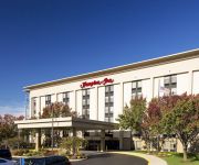
Hampton Inn Philadelphia-Airport
Courtyard Philadelphia Airport
Fairfield Inn Philadelphia Airport
Clarion Hotel Philadelphia International Airport
Videos from this area
These are videos related to the place based on their proximity to this place.
UDFD 74-2 & T-74 Building Fire Response
Here is the Upper Darby Fire Department's Engine 74-2 and Tower 74 (Primos-Secane-Westbrook Park) responding through Drexel Hill on their way to the east side of Upper Darby for a building fire alarm.
1011 Wilde Avenue Drexel Hill PA 19026
1011 Wilde Ave Drexel Hill PA 19026 Pat Gildea Call 610-565-1995 Listing: http://www.reveeo.com/video/BQrfsdvDLTu8c9HekZON Fabulous stone Tudor home at a great price on one of the nicest ...
Tony Roni's Week at Drexel Hill Little League
During Tony Roni's Week at Dermond Field, we asked some Drexel Hill Little Leaguers what they thought of the food. Their response was exuberant, to put it mildly!
Drexel Hill Fire On the 10! Show.
Drexel Hill Fire Co members Vinny Procopio and Steve Castellano Jr on NBC 10'S 10! Show advertising the Hero Scholarship Softball Game between NBC10 and the fire company.
4069 LASHER RD, DREXEL HILL, PA Presented by The McKnight Team.
Click to see more: http://www.searchallproperties.com/listings/2049084/4069-LASHER-RD-DREXEL-HILL-PA/auto?reqpage=video 4069 LASHER RD DREXEL HILL, PA 19026 Contact The McKnight ...
Top Real Estate Agents in Drexel Hill PA - Dowd Group
Looking for the Top Realtor in Drexel Hill PA? Call 610.571.2526 Please visit http://www.delawarevalleyrealty.com/top-realtor-drexel-hill.cfm Our team at the Dowd Group includes award winning...
735 Drexel Avenue, Drexel Hill
A beautiful home in Drexel Hill, updated kitchen, new baths and lots of character. You can check out more details at www.tylerwagner.com.
Adam Mechanical LLC | Furnace Repair | Rheem | Drexel Hill, PA
Adam Mechanical LLC provides you with the absolute best HVAC service around. Our team of highly trained HVAC tech's are pros when it comes to furnace repair and any other heating and air ...
UDFD Tower 74 in response
Here is Upper Darby Fire Department's Tower 74 (Primos-Secane-Westbrook Park Fire Co) driving by Bishop Ave and Harwarden Rd as they, as well as Co's 20 (Garrettford-Drexel Hill), 26 (Highland...
Videos provided by Youtube are under the copyright of their owners.
Attractions and noteworthy things
Distances are based on the centre of the city/town and sightseeing location. This list contains brief abstracts about monuments, holiday activities, national parcs, museums, organisations and more from the area as well as interesting facts about the region itself. Where available, you'll find the corresponding homepage. Otherwise the related wikipedia article.
Clifton Heights, Pennsylvania
(Ch ch) Clifton Heights is a borough in Delaware County, Pennsylvania, six miles (10 km) west of downtown Philadelphia and on Darby Creek. The population was at 2,330 in 1900, and 3,155 in 1910 and had grown to 6,779 at the 2000 census.
Drexel Hill, Pennsylvania
Drexel Hill is a census-designated place in Upper Darby Township, Delaware County, Pennsylvania, United States. Drexel Hill is located southwest of Center City, Philadelphia and is part of the Philadelphia metropolitan area. The population was 30,036 at the 2007 census.
Drexel Hill Junction (SEPTA station)
Drexel Hill Junction (a.k.a. Shadeland Avenue) is a stop along SEPTA's Media-Sharon Hill Trolley Lines in Drexel Hill, Pennsylvania. It is located near Hillcrest Road & Shadeland Avenue (hence the alternate name), and serves both Routes 101 and 102. Drexel Hill Junction is the last stop where Routes 101 and 102 share the same right-of-way.
Garrettford (SEPTA Route 102 station)
Garrettford is a station on the SEPTA Route 102 trolley in Drexel Hill, Pennsylvania. It is officially located Edmonds Avenue & Garrett Road, however, the actual location is at the intersection of Edmonds Avenue, Jones Street and Mill Lane, which is south of Garrett Road. The trolley line crosses the aforementioned intersection at the southwest corner of Edmonds Avenue & Jones Street, to the northeast corner of Edmonds Avenue and Mill Lane.
Huey Avenue (SEPTA Route 101 station)
Huey Avenue is a stop along the SEPTA Media (Route 101) trolley line in Pennsylvania, United States. It is officially located near Huey & Edmonds Avenues in Drexel Hill, but in reality is closer to the intersection of Huey Avenue and Mason Avenue. Trolleys arriving at this station travel between 69th Street Terminal in Upper Darby, Pennsylvania and Orange Street in Media, Pennsylvania. The station has a shed with a roof where people can go inside when it is raining.
Drexel Manor (SEPTA Route 102 station)
Drexel Manor is a stop on the SEPTA Route 102 trolley line in Drexel Hill, Pennsylvania. The station is officially located near Burmont Road and Cheswold Road. Like the Marshall Road stop, the Route 102 line runs in between Cheswold and Blanchard Roads, both of which terminate at Burmont Road. Two schools are located in the vicinity of this station. Trolleys arriving at this station travel between 69th Street Terminal in Upper Darby, Pennsylvania and Sharon Hill, Pennsylvania.
Creek Road (SEPTA Route 102 station)
Creek Road (formerly Oakview) is a stop on the SEPTA Route 102 trolley line in Drexel Hill, Pennsylvania. It is located at the end of Station Road north of Creek Road(although SEPTA gives the address as being at Darby Creek Road at Railroad) within Indian Rock Park, a 21.9-acre Natural Environmental Park in Drexel Hill, containing picnic tables, playground equipment, basketball courts, and Darby Creek.
Marshall Road (SEPTA Route 102 station)
Marshall Road is a stop on the SEPTA Route 102 trolley line in Drexel Hill, Pennsylvania. The station is officially located near Marshall & Cheswold Roads, but in fact it is located halfway between Cheswold and Blanchard Roads on Marshall Road. Trolleys arriving at this station travel between 69th Street Terminal in Upper Darby, Pennsylvania and Sharon Hill, Pennsylvania. The station has a shed with a roof where people can go inside when it is raining on one platform and a bench on the other.
Anderson Avenue (SEPTA Route 101 station)
Anderson Avenue is a stop along the SEPTA Media trolley line in the Aronimink section of Drexel Hill, Pennsylvania. It is officially located near Anderson & Woodland Avenues, though the actual location is on Anderson Avenue south of Woodlawn Avenue. Trolleys arriving at this station travel between 69th Street Terminal in Upper Darby, Pennsylvania and Orange Street in Media, Pennsylvania. Anderson Avenue is a dead end street at this station which contains platforms on both sides of the tracks.
Aronimink (SEPTA Route 101 station)
Aronimink is a stop along the SEPTA Media trolley line in the Aronimink section of Drexel Hill, Pennsylvania. It is located on Burmont Road & Morgan Avenue, although SEPTA gives the address as being near that intersection. Aronimink is one of two stops for the Media-Sharon Hill Line that cross Burmont Road. The other is south of Garrett Road at Drexel Manor along the Sharon Hill trolley line.
Drexelbrook (SEPTA Route 101 station)
Drexelbrook is a stop along the SEPTA Media trolley line in the Drexelbrook section of Drexel Hill, Pennsylvania. It is officially located near Stanbridge Road & Woodland Avenue, however the actual grade crossing and platforms are on Wildell Road south of Woodland Avenue and north of Revere Road and Drexelbrook Drive. Trolleys arriving at this station travel between 69th Street Terminal in Upper Darby, Pennsylvania and Orange Street in Media, Pennsylvania.
School Lane (SEPTA Route 101 station)
School Lane is a stop along the SEPTA Media (Route 101) trolley line. It is located on School Lane west of Edmonds Avenue in Drexel Hill, Pennsylvania, with SEPTA giving the address as "near School Lane & Edmonds Avenue". The station is next to a church on the northwest corner of the aforementiond intersection. Trolleys arriving at this station travel between 69th Street Terminal in Upper Darby, Pennsylvania, and Orange Street in Media, Pennsylvania.


