Safety Score: 2,7 of 5.0 based on data from 9 authorites. Meaning we advice caution when travelling to United States.
Travel warnings are updated daily. Source: Travel Warning United States. Last Update: 2024-08-13 08:21:03
Delve into New Homestead
The district New Homestead of Pittsburgh in Allegheny County (Pennsylvania) is a subburb in United States about 185 mi north-west of Washington DC, the country's capital town.
If you need a hotel, we compiled a list of available hotels close to the map centre further down the page.
While being here, you might want to pay a visit to some of the following locations: Washington, Greensburg, Butler, Beaver and Uniontown. To further explore this place, just scroll down and browse the available info.
Local weather forecast
Todays Local Weather Conditions & Forecast: 11°C / 52 °F
| Morning Temperature | 3°C / 37 °F |
| Evening Temperature | 10°C / 50 °F |
| Night Temperature | 8°C / 46 °F |
| Chance of rainfall | 0% |
| Air Humidity | 50% |
| Air Pressure | 1019 hPa |
| Wind Speed | Light breeze with 4 km/h (3 mph) from North-East |
| Cloud Conditions | Overcast clouds, covering 100% of sky |
| General Conditions | Overcast clouds |
Monday, 18th of November 2024
12°C (54 °F)
11°C (51 °F)
Overcast clouds, light breeze.
Tuesday, 19th of November 2024
13°C (56 °F)
12°C (54 °F)
Moderate rain, light breeze, overcast clouds.
Wednesday, 20th of November 2024
16°C (60 °F)
7°C (45 °F)
Light rain, moderate breeze, overcast clouds.
Hotels and Places to Stay
Mansions on Fifth Hotel
The Inn on Negley
Courtyard Pittsburgh West Homestead/Waterfront
SpringHill Suites Pittsburgh Bakery Square
Residence Inn Pittsburgh Oakland/University Place
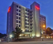
Hampton Inn Pittsburgh University-Medical Center PA
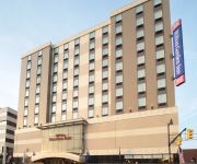
Hilton Garden Inn Pittsburgh University Place
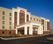
Hampton Inn - Suites Pittsburgh-Waterfront-West Homestead PA
WYNDHAM PITTSBURG UNIVERSITY CENTER
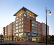
HYATT house Pittsburgh South Side
Videos from this area
These are videos related to the place based on their proximity to this place.
NS Trains in winter snow on the Mon Line in Homestead, PA
February 16, 2014 Norfolk Southern's Mon Line headed southbound begins at CP-BELL where the Fort Wayne Line turns into the Pittsburgh Line. Here, trains can be routed to either the Mainline,...
CSX Trains on the Pittsburgh Subdivision in Homestead, PA
May 9, 2014 From McKeesport to New Castle the CSX Baltimore Division branches off into the Pittsburgh Subdivision. Many commodities are transported over 60 miles of track. Here we are located...
4020 Fairfield Avenue
For more details click here: http://www.visualtour.com/showvt.asp?t=3236796 4020 Farifield Avenue Munhall, PA 15120 $84900, 3 bed, 1.5 bath, 1150 SF, MLS# ...
CSX Q368 Mixed Freight at Homestead, PA
CSX Q368 Mixed Freight Chicago, IL—Cumberland, MD Baltimore Division, Pittsburgh Sub. Homestead, PA (mp. PLY7.5) 5/30/2009 9:35 AM BNSF #7508 (ES44DC) + BNSF #747 (C44-9W) + 86 cars.
CSX ES40DC and Norfolk Southern NS ES44AC pull intermmodal through the Waterfront, Homestead, PA
Many trains roll by here and I was lucky to see t wo at one time. Amity St. Railroad crossing.
Stuck U Haul
This U-Haul got hung up trying to go up a steep hill in Homestead, PA. (Outside of Pittsburgh). This could have gotten a LOT more interesting.
Sandcastle Connection 130430
The connection in Pittsburgh between the South Side Trail and the Waterfront in Homestead through Sandcastle Water Park is nearing completion. It is due to be completed and dedicated in mid...
Pittsburgh
Pittsburgh, sightseeing adventure from the West End Overlook, Mt. Washington and The North Shore set to the disco hit Funky Town.
Pyrotopia: Festival of Fire Arts
Promotional video for Pyrotopia, Pittsburgh's annual festival celebrating fire and electrical art, held April 28, 2012 at the Pump House in the Homestead Waterfront.
Fire Fighter Challenge Kenny
These are the guys from Monroeville Station One at the Fire Fighter Challenge at Rock Bottom in Homestead at the Waterfront on March 15 2009. The Challenge contained five stations 1.Hose Care;...
Videos provided by Youtube are under the copyright of their owners.
Attractions and noteworthy things
Distances are based on the centre of the city/town and sightseeing location. This list contains brief abstracts about monuments, holiday activities, national parcs, museums, organisations and more from the area as well as interesting facts about the region itself. Where available, you'll find the corresponding homepage. Otherwise the related wikipedia article.
Homestead, Pennsylvania
Homestead is a borough in Allegheny County, Pennsylvania, USA, in the Monongahela River valley 7 miles southeast of downtown Pittsburgh and directly across the river from the city limit line. The borough is known for the Homestead Strike of 1892, an important event in the history of labor relations in the United States. The population of Homestead was 3,165 at the 2010 census.
Munhall, Pennsylvania
Munhall is a borough in Allegheny County, Pennsylvania, on the west bank of the Monongahela River, 8 miles south of the confluence of the Monongahela and the Allegheny rivers where the Ohio River begins. It abuts the borough of Homestead. A large part of the Homestead Works of the Carnegie Steel Company existed in Munhall. Steel products were the only items made in Munhall in 1910 when 5,185 people lived here. In 1940, 13,900 people lived in Munhall.
West Homestead, Pennsylvania
West Homestead is a borough in Allegheny County, Pennsylvania, 8 miles southeast of Pittsburgh, on the Monongahela River. Heavy industries associated with nearby steel mills existed here. Established were axle works, brickworks, and manufactories of machinery, car wheels, etc. In 1910, 3,009 people lived in west Homestead. The population was 1,929 at the 2010 census.
Whitaker, Pennsylvania
Whitaker is a borough in Allegheny County, Pennsylvania, United States, and is on the Monongahela River 3 miles upriver from Pittsburgh. The population was 1,271 at the 2010 census. The borough is named for James Whitaker, who was deeded the land in 1788.
Bettis Atomic Power Laboratory
Bettis Atomic Power Laboratory is a U.S. Government-owned research and development facility operated by Bechtel and located in the Pittsburgh suburb of West Mifflin, Pennsylvania. It solely focuses on the design and development of nuclear power for the U.S. Navy. The laboratory was founded in 1949 on the site of the former Bettis Field and is named after Cyrus Bettis.
Allegheny County Airport
Allegheny County Airport is located in West Mifflin, Pennsylvania, four miles (6 km) southeast of the city of Pittsburgh. It is the fifth busiest airport in Pennsylvania following Philadelphia, Pittsburgh, Allentown, and Harrisburg. The airport is owned by the Allegheny County Airport Authority and serves as the primary FAA designated reliever airport for Pittsburgh International Airport. The Allegheny County Airport dedication took place on September 11, 1931.
WKST-FM
WKST-FM is a Rhythmic-leaning top 40 outlet based in Pittsburgh, Pennsylvania. Owned by Clear Channel Communications, the station broadcasts at 96.1 MHz, with an ERP of 44 kW. Its transmitter is located in Baldwin.
WDDZ (AM)
For the current ESPN Radio affiliate in Pittsburgh, please see WBGG (AM) WDDZ WDDZ logoCity of license Pittsburgh, PennsylvaniaBroadcast area Pittsburgh metropolitan areaBranding Radio Disney AM 1250Slogan "Your Music, Your Way"Frequency 1250First air date May 4, 1922Format Children's radioPower 5,000 wattsClass BFacility ID 65691Transmitter coordinates {{#invoke:Coordinates|coord}}{{#coordinates:40|23|50.00|N|79|57|43.00|W|region:US-PA_type:landmark | |name=WDDZ }}Callsign meaning DZ = DisneyFormer callsigns 1998–2010: WEAE1966–1998: WTAE1961–1966: WRYT1922–1961: WCAEFormer frequencies 1928–1941: 1220 (kHz)1927-1928: 650 (kHz)1927: 560 (kHz)1923–1927: 650 (kHz)1922–1923: 750 (kHz)1922: 833 (kHz)Affiliations Radio DisneyOwner The Walt Disney Company Website radiodisney.
WYEP-FM
WYEP-FM is a non-commercial radio station that specializes in eclectic music and programming. The community radio station, which is run by the Pittsburgh Community Broadcasting Corporation, operates on 91.3 MHz with an ERP of 18 kW, and is licensed to Pittsburgh, Pennsylvania.
Squirrel Hill Tunnel
The Squirrel Hill Tunnel is a tunnel in Pittsburgh, Pennsylvania, United States. It serves as an eastern gateway to the city for I-376 and was completed in 1953 after 8 years of construction and at a cost of US$18 million 1953 dollars. At the time of opening it was the single largest investment by the State of Pennsylvania Transportation Department (PennDOT). It is 4,225 feet long and is a twin-bore tunnel with 8 cross passages.
Sandcastle Waterpark
Sandcastle is a water park located in the Pittsburgh suburb of West Homestead. The park is located on a 67-acre piece of land along the banks of the Monongahela River. Sandcastle is owned by Parques Reunidos, who purchased Kennywood Entertainment. The company runs its original sister parks, Kennywood, Idlewild Park, and Lake Compounce. The park contains fourteen water slides, several swimming pools, and a handful of other attractions.
The Waterfront
This article is about the open air shopping center in the Pittsburgh metropolitan area. For other uses, please see Waterfront The Waterfront 200pxThe open hearth stacks from US Steel's Homestead Works, left to pay homage to the complex's former use as a steel millLocation Homestead, West Homestead and MunhallOpening date 1999Developer Continental Real Estate Companies and Nationwide Realty Investors Ltd. Owner Developers Diversified Realty CorporationNo. of stores and services 50No.
Taylor Allderdice High School
Taylor Allderdice High School, also referred to by the Pittsburgh Public Schools as “Pittsburgh Allderdice”, is a public high school located in the Squirrel Hill neighborhood of Pittsburgh, Pennsylvania. Allderdice has the largest student population in the school district.
Pinkerton's Landing Bridge
The Pinkerton's Landing Bridge (also known as the Munhall Pike & Lake Erie Railroad Bridge) is a truss bridge that carries CSX Transportation's Pittsburgh Subdivision across the Monongahela River between Munhall, Pennsylvania and Rankin, Pennsylvania, USA.
Frick Park
Frick Park is the largest municipal park in Pittsburgh, Pennsylvania, covering 561 acres . It is one of Pittsburgh's four historic large parks. The park began when Henry Clay Frick, upon his death in 1919, bequeathed 380 acres south of Clayton, his Point Breeze mansion (which is now part of the Frick Art & Historical Center). He also arranged for a $2 million trust fund ($ million today) for long-term maintenance for the park, which opened on June 25, 1927.
Allegheny Intermediate Unit
The Allegheny Intermediate Unit (AIU) is a branch of the Pennsylvania Department of Education, and is the largest of the 29 intermediate units in Pennsylvania. It was created by the state’s General Assembly in 1971, and is headquartered in Homestead. The AIU provides specialized education services to 42 suburban public school districts and five vocational and technical schools in Allegheny County.
Calvary Catholic Cemetery (Pittsburgh)
Calvary Catholic Cemetery is located at 718 Hazelwood Avenue in the Greenfield and Hazelwood neighborhoods of Pittsburgh, Pennsylvania, USA. It was founded in 1886 with the purchase of a 200-acre (80-hectare) tract. The first official interment occurred in 1888, though there are graves with earlier dates. As of 2001, 146,301 entombments have been recorded at Calvary Cemetery. It remains the largest of the cemeteries in the Roman Catholic Diocese of Pittsburgh.
St. John Chrysostom Byzantine Catholic Church (Pittsburgh)
St. John Chrysostom Byzantine Catholic Church is a historic Eastern Catholic church in Pittsburgh, Pennsylvania, United States. It is located in the neighborhood of Four Mile Run, which is an isolated section of Greenfield at the bottom of Junction Hollow. Its address is 506 Saline Street. Today it is best known for having been the family church of the artist Andy Warhol.
Mellon Square
Mellon Square is an urban park in Downtown Pittsburgh, Pennsylvania. It is the first Modernist park built above a parking garage. With its distinctive black-and-white geometric pavement, it is a prominent feature and gathering spot of Downtown Pittsburgh.
St. John the Baptist Byzantine Catholic Cathedral (Pittsburgh)
St. John the Baptist Byzantine Catholic Cathedral is the mother church of Byzantine Catholic Metropolitan Church of Pittsburgh, the American branch of the Ruthenian Catholic Church. It is located at 210 Greentree Road in Munhall, Pennsylvania, a suburb of Pittsburgh in the Monongahela River valley.
WRRK
WRRK (96.9 BOB-FM) is a Variety Hits radio station serving the Pittsburgh, Pennsylvania market. The station, which is owned by Steel City Media, broadcasts at 96.9 MHz with an ERP of 45 kW, and is licensed to Braddock, Pennsylvania.
Becks Run
Becks Run is a tributary of the Monongahela River. As an urban stream, it is heavily polluted, receiving combined sewer outflow from Carrick (Pittsburgh) and Mount Oliver, Pennsylvania. There is a waterfall on a tributary, just downstream from a slate dump, near the intersection of Wagner Avenue and Mountain Avenue. There were coal mines along the stream, including Becks Run #2, owned by the estate of James H. Hays, served by an incline and the H.B. Hays and Brothers Coal Railroad.
Streets Run
Streets Run is a 5.2-mile-long tributary of the Monongahela River in Allegheny County, Pennsylvania. This urban stream drains portions of the communities of Pittsburgh, Baldwin, Brentwood, West Mifflin and Whitehall, an area of about ten square miles.
Carnegie Library of Homestead
The Carnegie Library of Homestead is a public library founded by Andrew Carnegie in 1896. The branch is one of 2,500 Carnegie libraries constructed worldwide, and the third one to be built in the USA. In addition to the library holding over 34,000 volumes, the building also contains a 1,000 seat music hall and an athletic wing with a heated indoor pool.
Bettis Field
Bettis Field was an airstrip in West Mifflin, Pennsylvania, southeast of Pittsburgh, Pennsylvania, from 1924 that was named for U.S. Army Air Corps Lieutenant Cyrus Bettis following his fatal accident on Jack's Mountain near Bellefonte, Pennsylvania in 1926.


