Safety Score: 2,7 of 5.0 based on data from 9 authorites. Meaning we advice caution when travelling to United States.
Travel warnings are updated daily. Source: Travel Warning United States. Last Update: 2024-08-13 08:21:03
Discover Bon Meade
Bon Meade in Allegheny County (Pennsylvania) is a city in United States about 205 mi (or 330 km) north-west of Washington DC, the country's capital city.
Local time in Bon Meade is now 10:40 AM (Saturday). The local timezone is named America / New York with an UTC offset of -4 hours. We know of 12 airports in the vicinity of Bon Meade, of which 5 are larger airports. The closest airport in United States is Pittsburgh International Airport in a distance of 4 mi (or 6 km), South. Besides the airports, there are other travel options available (check left side).
Also, if you like golfing, there are a few options in driving distance. Looking for a place to stay? we compiled a list of available hotels close to the map centre further down the page.
When in this area, you might want to pay a visit to some of the following locations: Beaver, Pittsburgh, New Cumberland, Washington and Steubenville. To further explore this place, just scroll down and browse the available info.
Local weather forecast
Todays Local Weather Conditions & Forecast: 13°C / 56 °F
| Morning Temperature | 4°C / 39 °F |
| Evening Temperature | 9°C / 48 °F |
| Night Temperature | 7°C / 44 °F |
| Chance of rainfall | 0% |
| Air Humidity | 46% |
| Air Pressure | 1030 hPa |
| Wind Speed | Calm with 3 km/h (2 mph) from South-West |
| Cloud Conditions | Clear sky, covering 7% of sky |
| General Conditions | Sky is clear |
Saturday, 2nd of November 2024
14°C (57 °F)
11°C (52 °F)
Overcast clouds, light breeze.
Sunday, 3rd of November 2024
21°C (70 °F)
16°C (61 °F)
Overcast clouds, gentle breeze.
Monday, 4th of November 2024
24°C (75 °F)
15°C (59 °F)
Moderate rain, moderate breeze, overcast clouds.
Hotels and Places to Stay
Baywood Country Club
DoubleTree by Hilton Pittsburgh Airport
Embassy Suites by Hilton Pittsburgh International Airport
Pittsburgh Airport Marriott
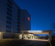
Sheraton Pittsburgh Airport Hotel
Hilton Garden Inn Pittsburgh Airport
Hampton Inn Pittsburgh-Airport
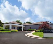
Courtyard Pittsburgh Airport
WYNDHAM GARDEN PITTSBURGH ARPT
LA QUINTA INN PITTSBURGH AIRPORT
Videos from this area
These are videos related to the place based on their proximity to this place.
Richard's Power 90 (by Beachbody) wrap up.
My power 90 journey has come to a close! Bring on THE X!!!!
NS 11A at Leets with 2 PRR Units
After a long wait, the 11A finally made its way through Leetsdale as he follows the C2T. A little fun fact the lead unit NS 3433 is original PRR 6082.
Sky Zone Indoor Trampoline Park Movie - Leetsdale
Sky Zone Indoor Trampoline Park Movie - Leetsdale.
Skyzone Trampoline main room- Leetsdale Pennsylvania MAY 2013
Skyzone Trampoline main room- Leetsdale Pennsylvania MAY 2013.
Ready to Jump @ Skyzone Trampoline Park Leetsdale Pennsylvania May 2013
Ready to Jump @ Skyzone Trampoline Park Leetsdale Pennsylvania May 2013 - Getting a view of the fun before we go jump. So Much Fun !
Skyzone Foam Zone Trampoline Park Leetsdale Pennsylvania may 2013
Skyzone Foam Zone Trampoline Park Leetsdale Pennsylvania may 2013.
CO-OP Shared Branch
Clearview Federal Credit Union is part of a shared branching network called CO-OP Shared Branch that links thousands of credit unions nationwide. The CO-OP Shared Branch network is a great...
Robert Morris vs Pittsburgh (Sept. 30, 2014)
MOON TOWNSHIP, PA -- Goals from Hamish Law and Dan Prete gave the Pittsburgh Panthers a 2-0 win at city rival Robert Morris in non-conference play.
Leetsdale, PA (9-20-14) Canadian National and Triple Crown
In my 11 years of filming I have never: Filmed a train as quickly as I have on arrival of a major mainline Filmed or seen a Canadian National locomotive Filmed or seen the NS Triple Crown train...
Videos provided by Youtube are under the copyright of their owners.
Attractions and noteworthy things
Distances are based on the centre of the city/town and sightseeing location. This list contains brief abstracts about monuments, holiday activities, national parcs, museums, organisations and more from the area as well as interesting facts about the region itself. Where available, you'll find the corresponding homepage. Otherwise the related wikipedia article.
Leetsdale, Pennsylvania
Leetsdale is a borough in Allegheny County, Pennsylvania, along the Ohio River. It is part of the Pittsburgh Metro Area. The population was 1,218 at the 2010 census. The town has gained a certain popularity due to its name, a coincidence with Leetspeak, a common Internet sociolect. Leetsdale at one time had a formidable industrial manufacturing base, with a Bethlehem Steel mill that closed in the late 1970s.
South Heights, Pennsylvania
South Heights is a borough in Beaver County, Pennsylvania, along the Ohio River. The population was 542 at the 2000 census. South Heights was first known as Ethel's Landing, a docking point on the Ohio River. The name of the town was changed to Shannopin when the Pittsburgh and Lake Erie Railroad established a station there. When the name of the town was changed to South Heights, the station became known as South Heights Station.
Robert Morris University
Robert Morris University (RMU) is a private, coeducational university in suburban Pittsburgh, Pennsylvania, United States. The school was founded in 1921. Like its Illinois namesake, Robert Morris University is named after Robert Morris, a signer of the Declaration of Independence and financier of the American Revolution. However, the two like-named universities are not affiliated with each other.
Charles L. Sewall Center
Charles L. Sewall Center, commonly referred to as the Sewall Center, is a 3,056-seat multi-purpose arena in the Pittsburgh suburb of Moon Township, Pennsylvania. It is home to the Robert Morris Colonials basketball team. The Northeast Conference men's basketball tournament was held there four times. The inaugural game was held on November 30th, 1985, when Robert Morris lost to Duquesne 80-65. It replaced the John Jay Center in 1985.
Quaker Valley High School
Quaker Valley High School is a high school located in Leetsdale, Pennsylvania. The school is one of the four National Blue Ribbon Schools that comprise the Quaker Valley School District. The high school serves an average of 640 students in grades 9 through 12 and has a 99% graduation rate. Ninety percent of graduates go on to post secondary education at a two or four-year college or university. Quaker Valley High School offers a college-preparatory core curriculum with elective courses.
Joe Walton Stadium
Joe Walton Stadium is a 3,000-seat multi-purpose stadium in Moon Township, Pennsylvania. It is home to the Robert Morris University Colonials football team. The facility opened in 2005 and is named for Colonials head football coach Joe Walton. The inaugural game was played on September 17th, 2005 when Robert Morris defeated Butler 49-13. The team formerly played its home games at Moon Area High School's Moon Stadium.
John Jay Center
The John Jay Center is an athletic facility on the campus of Robert Morris University in the Pittsburgh suburb of Moon Township, PA. Built in 1965, it features a capacity of 1,000 spectators. It was the primary campus indoor athletic venue until the Charles L. Sewall Center opened for the 1985-1986 season. The Colonials men's basketball team played their first game as an NCAA Division I team at the center on November 30, 1976, a win over Delaware State.
Gringo, Pennsylvania
Gringo is an unincorporated community in Hopewell Township, Beaver County, Pennsylvania, United States. It is located along Pennsylvania Route 151, near the border with Raccoon Township. The area was the site of an oil field in the late 19th and early 20th centuries; there was at least one functioning well operating until the 1960s. The community has disappeared from most modern maps, but lives on in the name of Gringo Road and a few business names.


