Safety Score: 2,7 of 5.0 based on data from 9 authorites. Meaning we advice caution when travelling to United States.
Travel warnings are updated daily. Source: Travel Warning United States. Last Update: 2024-08-13 08:21:03
Delve into Chapman Corner
Chapman Corner in Polk County (Oregon) is a town located in United States about 2,371 mi (or 3,815 km) west of Washington DC, the country's capital town.
Time in Chapman Corner is now 04:11 AM (Thursday). The local timezone is named America / Los Angeles with an UTC offset of -8 hours. We know of 10 airports closer to Chapman Corner, of which 3 are larger airports. The closest airport in United States is Tillamook Airport in a distance of 48 mi (or 77 km), North-West. Besides the airports, there are other travel options available (check left side).
Also, if you like the game of golf, there are some options within driving distance. In need of a room? We compiled a list of available hotels close to the map centre further down the page.
Since you are here already, you might want to pay a visit to some of the following locations: Salem, Dallas, McMinnville, Albany and Corvallis. To further explore this place, just scroll down and browse the available info.
Local weather forecast
Todays Local Weather Conditions & Forecast: 7°C / 45 °F
| Morning Temperature | 6°C / 43 °F |
| Evening Temperature | 8°C / 46 °F |
| Night Temperature | 6°C / 43 °F |
| Chance of rainfall | 3% |
| Air Humidity | 90% |
| Air Pressure | 1013 hPa |
| Wind Speed | Gentle Breeze with 7 km/h (4 mph) from South |
| Cloud Conditions | Overcast clouds, covering 100% of sky |
| General Conditions | Moderate rain |
Thursday, 21st of November 2024
10°C (50 °F)
5°C (41 °F)
Moderate rain, gentle breeze, overcast clouds.
Friday, 22nd of November 2024
7°C (44 °F)
7°C (44 °F)
Light rain, moderate breeze, overcast clouds.
Saturday, 23rd of November 2024
7°C (44 °F)
4°C (39 °F)
Overcast clouds, light breeze.
Hotels and Places to Stay
THE GRAND HOTEL IN SALEM
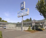
SALEM TRAVELODGE
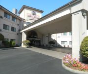
BEST WESTERN PLUS MILL CREEK
Hampton Inn - Suites Salem
Residence Inn Salem
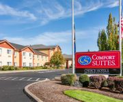
Comfort Suites Salem
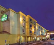
La Quinta Inn and Suites Salem
Holiday Lodge Salem
TRAVELERS INN MOTEL
Phoenix Inn Suites South Salem
Videos from this area
These are videos related to the place based on their proximity to this place.
City Center Salem oregon Centro de la ciudad (downtown)
http://preguntameaqui.com Las calles del centro de la ciudad de Salem oregon ahora les tocó salir. Tenía días queriendo hacerlo y hoy aunque haya llovido de todos modos salió. En Inglés...
Salem, Oregon Walk With Me to Governor's Mansion
Walking map from the book "Oregon Townscape Walks" by Tyler Burgess. Guidebook of walks in 22 Oregon towns, with 13 bicycle paths. Available at Amazon.com, www.walk-with-me.com Walk directly ...
Downtown area Salem oregon State Street
http://mvvideos.com This is the State Street and Liberty Street in the City of Salem Oregon. This is in the Downtown Area. Date of our video is July 14th 2012.
Big Hits From West Salem vs Sprague High School Football 10/9/09 from KWVT TV
If you would like more information on upcoming games and air times please vist www.kwvtsalem.com.
Gasolinera en Salem Oregon
http://preguntameaqui.com Esta es una gasolinera aqui en la ciuadad de Salem oregon. La intersección es en la Commercial y la Mission Street (calles). Para si quieren como está el precio...
Salem to HWY 101, part 1, 4k
This is the trip from Salem, Oregon to highway 101 via Highway 22 and Highway 18.
Amtrak's#134 Coast Starlight (2-17-09) Salem Oregon
Coast Starlight going to Portland Oregon. A little bit of my home town Salem, Oregon. People at the train station. If you like my videos, rate, comment and subscribe to my channel.
Salem Center Mall at Chemeketa Street Salem Oregon
This is the Entrance to the Mall (Salem Center you can read) the street is Chemeketa for all of you. I recorded this videos today July 5 2012 the time was around 1 pm. City: Salem State:...
Videos provided by Youtube are under the copyright of their owners.
Attractions and noteworthy things
Distances are based on the centre of the city/town and sightseeing location. This list contains brief abstracts about monuments, holiday activities, national parcs, museums, organisations and more from the area as well as interesting facts about the region itself. Where available, you'll find the corresponding homepage. Otherwise the related wikipedia article.
West Salem High School (Salem, Oregon)
West Salem High School (WSHS) is a public high school located in Salem, Oregon, United States.
West Salem, Salem, Oregon
West Salem is a neighborhood in Salem, Oregon, United States, located in the far northwest part of the city. West Salem is the only part of the city that is located in Polk County. The neighborhood is separated from the rest of Salem by the Willamette River, which serves as West Salem's southeast border. In 1889 a plat for West Salem was filed, and the city incorporated in 1913. In 1949, the city was officially merged with Salem.
John Minto (Oregon pioneer)
John Minto IV (October 10, 1822 - February 25, 1915) was an American pioneer born in Wylam, England. He was a prominent sheep farmer in the U.S. state of Oregon and a four-time Republican representative in the state legislature. Minto also volunteered for the militia during the Cayuse War and years later helped locate Minto and Santiam passes through the Cascade Mountains east of Salem, Oregon.
Union Street Railroad Bridge
The Union Street Railroad Bridge is a vertical lift, Pratt through truss bridge that spans the Willamette River in Salem, Oregon, United States, built in 1912–13. It was last used by trains in the early 1990s and was sold for one dollar to the City of Salem in 2003, which converted it to bicycle and pedestrian use.
Marion Street Bridge
The Marion Street Bridge is an automobile bridge located in Salem, Oregon, United States. It spans the Willamette River to connect Salem and West Salem, and acts as a conduit for Oregon Route 22. The bridge carries vehicular traffic one way westbound. Traffic includes two lanes that flow onto the bridge from Marion Street, vehicles turning right from Commercial Street, and traffic from a quarter-loop on-ramp from Front Street that was added in 1981.
Center Street Bridge
The Center Street Bridge is an automobile bridge located in Salem, Oregon, United States. It spans the Willamette River, connecting West Salem and Oregon Route 22 to Salem. It carries vehicle traffic eastbound from Route 22 and directly from Wallace Road. The bridge was widened in 1983 to four lanes. Traffic exits onto Center Street directly, and onto Front Street via an off-ramp, which was built in 1977. Construction of the bridge started in 1917.
KWOD
KWOD (1390 AM is an American radio station licensed to serve Salem, Oregon, USA. The station, founded in 1934 as KSLM, is currently owned by Entercom Communications and the broadcast license is held by Entercom Portland License, LLC. KWOD broadcasts a sports format with programming from ESPN Radio, simulcasting with sister station KFXX 1080 AM. The station was assigned the KWOD call sign by the Federal Communications Commission on May 29, 2009.
KBZY
KBZY is a radio station licensed to serve Salem, Oregon, USA. The station, established in 1957, has been owned by Capital Broadcasting, Inc. , since 1982.


