Safety Score: 2,7 of 5.0 based on data from 9 authorites. Meaning we advice caution when travelling to United States.
Travel warnings are updated daily. Source: Travel Warning United States. Last Update: 2024-08-13 08:21:03
Delve into Gilbert
The district Gilbert of in Multnomah County (Oregon) is a subburb in United States about 2,341 mi west of Washington DC, the country's capital town.
If you need a hotel, we compiled a list of available hotels close to the map centre further down the page.
While being here, you might want to pay a visit to some of the following locations: Oregon City, Portland, Vancouver, Hillsboro and Saint Helens. To further explore this place, just scroll down and browse the available info.
Local weather forecast
Todays Local Weather Conditions & Forecast: 7°C / 45 °F
| Morning Temperature | 0°C / 32 °F |
| Evening Temperature | 4°C / 39 °F |
| Night Temperature | 3°C / 37 °F |
| Chance of rainfall | 0% |
| Air Humidity | 48% |
| Air Pressure | 1024 hPa |
| Wind Speed | Calm with 2 km/h (1 mph) from West |
| Cloud Conditions | Clear sky, covering 0% of sky |
| General Conditions | Sky is clear |
Thursday, 5th of December 2024
7°C (44 °F)
4°C (40 °F)
Overcast clouds, calm.
Friday, 6th of December 2024
8°C (46 °F)
8°C (47 °F)
Overcast clouds, calm.
Saturday, 7th of December 2024
9°C (49 °F)
6°C (44 °F)
Moderate rain, calm, overcast clouds.
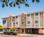
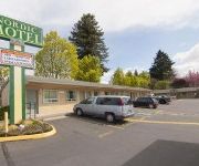
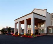
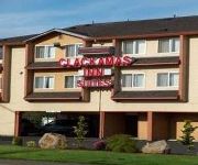
Hotels and Places to Stay
MONARCH HOTEL AND CONFERENCE CENTER
Comfort Inn Portland
Comfort Suites Clackamas
NORDIC MOTEL
Four Points by Sheraton Portland East
CLACKAMAS INN AND SUITES
Hampton Inn - Portland-Clackamas
Courtyard Portland Southeast/Clackamas
Best Value Inns
Portland Value Inn
Videos from this area
These are videos related to the place based on their proximity to this place.
Happy Valley Real Estate - Spring 2015
Patrick Sheehan with Better Homes & Gardens Real Estate talks about why marketing matters, and how he set a record for the 4th highest residential sales price in Happy Valley history.
Happy Valley Appraiser - A Quality Appraisal - 503 781 5646
http://www.aqualityappraisal.com/HappyValleyAppraiser If you need a residential home appraiser in Happy Valley, Oregon, you should consider hiring A Quality Appraisal, LLC. The owner of A...
Street of Dreams 2014 / Northern Heights in Happy Valley / Oregon real estate
by HomeStarVideoTours.com Street of Dreams 2014 - Build your Dream Home! Westlake Development Group gives us this sneak peek at the 2014 site for the Street of Dreams. The elegant Northern...
Arbor Ridgecrest Happy Valley Real Estate
On the top of the hill in Happy Valley - a 5 bedroom, 3 bath home built in 2012, listed by Patrick Sheehan with Better Homes & Gardens Real Estate.
Happy Valley Home Appraiser - A Quality Appraisal - 503.781.5646
http://www.aqualityappraisal.com/HappyValleyAppraiser Are you looking for a residential real estate appraiser in Happy Valley, Oregon? You should consider hiring A Quality Appraisal, LLC....
Beautiful Happy Valley Home | Oregon homes and real estate
A beautiful place to call home in an ideal Happy Valley neighborhood. This is a well cared for home with tons of extras! Tall ceilings throughout let the light in. Gourmet kitchen with nook,...
Happy Valley Bank Owned Steal! 4500+SF, $394,900
Go to: http://www.ezmeetingsonline.com/knilsen/shirley-nilsen-view-on-demand-home-buyer-university-1/ for my library of free online real estate workshops go to http://BankOwnedList.Info...
Centerstone Grand Opening.mp4
Martha Spiers and other speakers at the grand opening and ribbon-cutting ceremony for Centerstone Mental Health Clinic in Happy Valley, OR on June 1, 2012.
GoPro HD Hero test - Getting high in the morning...
Testing my new GoPro HD Hero on the Parkzone Trojan T-28... a quick flight one morning up to about 1200 feet to touch a cloud... Really impressed with how this camera records. Filmed at...
Videos provided by Youtube are under the copyright of their owners.
Attractions and noteworthy things
Distances are based on the centre of the city/town and sightseeing location. This list contains brief abstracts about monuments, holiday activities, national parcs, museums, organisations and more from the area as well as interesting facts about the region itself. Where available, you'll find the corresponding homepage. Otherwise the related wikipedia article.
Clackamas Town Center
Clackamas Town Center is a shopping mall on unincorporated land in the Clackamas area of Clackamas County, in the U.S. state of Oregon. It opened in 1981. It is managed and co-owned by General Growth Properties and is currently anchored by J.C. Penney, Macy's (including a separate home store), Nordstrom, and Sears. It also includes a 20-screen Century movie theater.
Leach Botanical Garden
Leach Botanical Garden is a 16-acre botanical garden located in outer southeast Portland, Oregon. It was acquired by the Portland Park Bureau in 1971. The garden was established in 1931 as landscaping for the private home of botanist Lilla Leach and pharmacist John Leach, and subsequently donated to the city. The garden was originally named Sleepy Hollow.
I-205 Transitway
The I-205 Transitway was a partially built busway along the wide right-of-way of the Interstate 205 freeway in Portland, Oregon. Although it never opened as a busway, its right-of-way is now in use by light rail lines. The transitway, which was physically separate from the parallel freeway lanes, was planned in the mid- and late-1970s as part of the final segment of I-205. Only a graded route with several entrance ramps and two underpass tunnels under I-205 were built.
Willamette National Cemetery
Willamette National Cemetery is a United States National Cemetery located about 10 miles southeast of the city of Portland, Oregon. The cemetery encompasses 269.4 acres straddling the county line between Multnomah and Clackamas Counties. Up to the end of 2005, there had been 126,561 interments.
David Douglas School District
David Douglas School District No. 40 is a school district in eastern Portland, Oregon, United States. Its administrative offices are at 1500 Southeast 130th Avenue. The district was formed in 1959 as a consolidation of the Gilbert, Powellhurst, and Russellville elementary school districts and the David Douglas Union High School District. As of 2012, it operates nine elementary schools, three middle schools and one high school with an alternative school campus.
Clackamas Town Center Transit Center
The Clackamas Town Center Transit Center is bus transit center and light rail station on the MAX Green Line, located in the unincorporated Clackamas, Oregon area, in the southeastern part of the Portland metropolitan area. It is the southern terminus for the I-205 MAX branch. Owned by regional transit agency TriMet, the current transit center opened in 2009 and is located on the east side of the Clackamas Town Center mall, adjacent to Interstate 205.
KDZR
KDZR is a radio station broadcasting a Children's Radio format. Licensed to Lake Oswego, Oregon, USA, the station serves the Portland area. The station is currently owned by The Walt Disney Company and features programing from Radio Disney. Like most affiliates, KDZR has local programming on weekends. They run public affairs programming that addresses the needs of the community. The station has lots of remote events where they have games and prizes for local listeners.
Oregon's 3rd congressional district
Oregon's 3rd congressional district covers most of Multnomah County, including Portland east of the Willamette River, Gresham, and Troutdale. It also includes the northern part of Clackamas County, including Milwaukie. Parts of northwest Portland also lie within the district. Before the 2002 redistricting, the whole of Multnomah County was included in the district; it lost southwest Portland to the 1st and 5th districts, but it gained most of its current portion of Clackamas County.
Franciscan Montessori Earth School & Saint Francis Academy
The Franciscan Montessori Earth School & Saint Francis Academy (FMES/SFA) is located in Portland, Oregon, United States. FMES/SFA is the only accredited pre-K through grade 8 Catholic Montessori school in the United States. It is operated by the Franciscan Sisters of the Eucharist from Bridal Veil, Oregon.
Village Free School
The Village Free School (VFS) is a non-profit private school located in Portland, Oregon, United States. The school offers enrollment to students ages 5–18. The educational philosophy at the Village Free School is based upon the idea that if children are given freedom and access to resources they will learn. Students at VFS choose what they want to learn and how they want to spend their time. Admissions are designed so that many ages are represented, and enrollment in each age group is limited.
Mall 205
Mall 205 is an enclosed shopping mall located at the junction of Interstate 205 and S.E. Washington Street in Portland, Oregon, United States. The mall features over 40 stores and a food court; anchor stores include Bed Bath & Beyond, The Home Depot, Target, and 24 Hour Fitness. The mall's two-story Target store is the largest Target in the state of Oregon, and its Bed Bath & Beyond is the chain's second location to feature an interior mall entrance.
KKPZ
KKPZ (1330 AM, "The Truth") is a radio station broadcasting a religious radio format. Licensed to Portland, Oregon, USA, it serves the greater Portland, OR / Vancouver, WA metro area. The station is currently owned by KPHP Radio, Inc (Crawford Broadcasting Company) & is located at 9700 SE Eastview Dr, Happy Valley, OR 97086, 503-242-1950 Office Number, 503-242-1330 Studio Number.
Cub Port Airport
Cub Port Airport is a private Airport located 1 miles north of Happy Valley in Clackamas County, Oregon, USA.
Happy Valley Airport
Happy Valley Airport is a closed Airport located 2 miles southeast of Happy Valley in Clackamas County, Oregon, USA. It was constructed in 1964 as "Troh's Nest" airfield by Hank Troh after he closed his first airport. {{#invoke:citation/CS1|citation |CitationClass=web }} As of June 2009, aerial photos of the airport show that its runway is closed with X's painted on the asphalt. Additionally, the runway is now being used as a driveway for a large house built at its southern end.
Portland Adventist Medical Center Heliport
Portland Adventist Medical Center Heliport is a private Heliport located east of Portland in Multnomah County, Oregon, United States.
Springwater Corridor
The Springwater Corridor Trail is a bicycle and pedestrian rail trail in the Portland metropolitan area in Oregon, United States. It follows a former railway line of the same name from Boring through Gresham to Portland, where it ends south of the Eastbank Esplanade. Most of the trail, about 21 miles long, is paved, though about 1 mile overlaps city streets in Sellwood, and about 2 miles near Boring is gravel.
Clatsop Butte
Clatsop Butte is an upland butte lying directly south of Powell Butte in southeast Portland, Oregon, United States. Clatsop Butte City Park, which occupies part of the butte, is at coordinates {{#invoke:Coordinates|coord}}{{#coordinates:45.47456|-122.50676||||||| |primary |name= }} at an elevation of 571 feet . Johnson Creek, Southeast Foster Road, and the Springwater Corridor Trail pass between Powell Butte and Clatsop Butte near Southeast 152nd Avenue.
Southeast Main Street (MAX station)
The Southeast Main Street station is a light rail station on the MAX Green Line in Portland, Oregon. It is the first stop southbound on the I-205 MAX branch, following the Green Line's split from the Red and Blue lines at the Gateway Transit Center. The station is located at the intersection of SE 96th Avenue and Main Street. It is adjacent to Interstate 205, and is located near Mall 205, Adventist Medical Center, and surrounding businesses.
Southeast Division Street (MAX station)
The Southeast Division Street station is a light rail station on the MAX Green Line in Portland, Oregon. It is the 2nd stop southbound on the I-205 MAX branch. The station is located at the intersection of Interstate 205 and Division Street, and offers connections to the I-205 Bike Path. It is adjacent to the I-205 exit ramps to Powell Boulevard. This station has a center platform.
Southeast Powell Boulevard (MAX station)
The Southeast Powell Boulevard station is a light rail station on the MAX Green Line in Portland, Oregon. It is the 3rd stop southbound on the I-205 MAX branch. The station is located off of SE 92nd Avenue and Powell Boulevard. It is adjacent to Interstate 205, and offers connections to the I-205 Bike Path. This station has a center platform, and is surrounded by a park-and-ride facility.
Southeast Holgate Boulevard (MAX station)
Southeast Holgate Boulevard station is a light rail station on the MAX Green Line in Portland, Oregon. It is the 4th stop southbound on the I-205 MAX branch. The station is at the intersection of Interstate 205 and Holgate Boulevard. This station has a center platform, and is surrounded by a park-and-ride facility. Also Lents park is by the station on 92nd and SW Hogate Blvd.
Lents Town Center / Southeast Foster Road
The Lents Town Center/Southeast Foster Road station is a light rail station on the MAX Green Line in Portland, Oregon. It is the 5th stop southbound on the I-205 MAX branch. The station is at the intersection of Interstate 205 and Foster Road. It is located in the Lents neighborhood's town center business district. It also provides access to the Springwater Corridor, which was once a transit line to the suburbs and is now a dedicated bikeway through southeast Portland.
Southeast Flavel Street (MAX station)
The Southeast Flavel Street station is a light rail station on the MAX Green Line in Portland, Oregon. It is the 6th stop southbound on the I-205 MAX branch. The station is located at SE Flavel Street, adjacent below Interstate 205. This station has a center platform.
Southeast Fuller Road (MAX station)
The Southeast Fuller Road station is a light rail station on TriMet's MAX Green Line in Portland, Oregon, located between SE 82nd Avenue and Interstate 205. It is the 7th stop southbound on the Interstate 205 MAX branch. The station has a center platform and is surrounded by a park and ride facility.
Kelly Butte Natural Area
Kelly Butte Natural Area is a city park of about 23 acres in southeast Portland in the U.S. state of Oregon, just east of Interstate 205. The park is named after pioneer Clinton Kelly, who settled the area east of the Willamette River in 1848. The butte contains a now-sealed concrete bunker built as a civil defense emergency operations center in 1955-56 and later used for emergency dispatching. It appears in the film A Day Called X.


