Safety Score: 2,7 of 5.0 based on data from 9 authorites. Meaning we advice caution when travelling to United States.
Travel warnings are updated daily. Source: Travel Warning United States. Last Update: 2024-08-13 08:21:03
Touring Eastmoreland
The district Eastmoreland of in Multnomah County (Oregon) is a subburb located in United States about 2,345 mi west of Washington DC, the country's capital place.
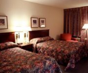
Need some hints on where to stay? We compiled a list of available hotels close to the map centre further down the page.
Being here already, you might want to pay a visit to some of the following locations: Portland, Oregon City, Vancouver, Hillsboro and Saint Helens. To further explore this place, just scroll down and browse the available info.
Local weather forecast
Todays Local Weather Conditions & Forecast: 8°C / 47 °F
| Morning Temperature | 2°C / 36 °F |
| Evening Temperature | 6°C / 43 °F |
| Night Temperature | 5°C / 40 °F |
| Chance of rainfall | 0% |
| Air Humidity | 46% |
| Air Pressure | 1024 hPa |
| Wind Speed | Calm with 2 km/h (1 mph) from West |
| Cloud Conditions | Clear sky, covering 0% of sky |
| General Conditions | Sky is clear |
Thursday, 5th of December 2024
8°C (46 °F)
6°C (43 °F)
Overcast clouds, calm.
Friday, 6th of December 2024
9°C (49 °F)
10°C (49 °F)
Overcast clouds, calm.
Saturday, 7th of December 2024
11°C (52 °F)
8°C (46 °F)
Moderate rain, calm, overcast clouds.
Hotels and Places to Stay
Kimpton RiverPlace Hotel
The Porter Portland Curio Collection by Hilton
Rivers Edge Hotel and Spa
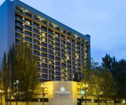
DoubleTree by Hilton Portland
Portland Marriott Downtown Waterfront
Jupiter
HOTEL LUCIA
The Fulton House Bed and Breakfast
UNIVERSITY PLACE
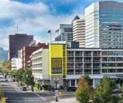
Hotel Rose
Videos from this area
These are videos related to the place based on their proximity to this place.
What to Expect When Appraiser Visits -- Portland Appraisal - 503.781.5646
http://www.AQualityAppraisal.com Portland appraiser, with A Quality Appraisal, LLC explains what to expect when the appraiser comes to inspect your home. Many homeowners have anxiety about...
2015-2-14 Bridge City & the Mustang Lounge
"Blessing & Serving at Milwaukie High School" Kerry McCombs shares his vision for serving kids at the Milwaukie High School Mustang Lounge. Other volunteers share their experiences This...
Milwaukie Vintage Rotating Commercial Corner Sign
The vintage rotating sign at the corner of SE 42nd Avenue and Harrison Street in Milwaukie. Currently advertising a Papa Murphy's Pizza store and and jeweler's that occupy the building.
Milwaukie, OR Dentist (Christina Blatchford, DMD)
Smile With the Confidence You Deserve! Call (503) 659-1337 or visit http://www.christinablatchford.com/ If you are looking for a great place to smile, look no further than the office of...
2014-11-15 The Land We Travel Through, Expedition Wk 4
"The Land We Travel Through" The Expedition Home, Week 4 In this presentation Marc Schelske presents 2 different perspectives that Christians have about the world around them and the people...
2014-11-22 Faith on the Journey, Expedition Wk 5
"Faith on the Journey" The Expedition Home, Week 5 Marc Schelske closes this series by presenting two different perspectives on faith. Is your faith about securing yourself, your comfort,...
2012-12-22 The Christmas Journey
"The Christmas Journey" Stand-Alone Message Marc Schelske looks closely at the wise men in the Christmas story. What do we really know about them? Who were they? Most importantly, how can...
2007 Chrysler Town & Country Used Cars Portland OR
http://autobestmotors.com This 2007 Chrysler Town & Country is available from Autobest Motors. For details, call us at 503-516-9364.
2000 Country Coach Intrigue Used Cars Portland OR
http://www.autobestmotors.com This 2000 Country Coach Intrigue is available from Autobest Motors. For details, call us at 503-473-8455.
Killing Floor Slow-mo Compilation Christmas edition
Killing Floor Slow-mo Compilation Christmas edition or KFSMCCE :D I took a break(NOT!) I was sick (NOT!) I was on holiday(NOT!) I am a lazy bastard....jup :D.
Videos provided by Youtube are under the copyright of their owners.
Attractions and noteworthy things
Distances are based on the centre of the city/town and sightseeing location. This list contains brief abstracts about monuments, holiday activities, national parcs, museums, organisations and more from the area as well as interesting facts about the region itself. Where available, you'll find the corresponding homepage. Otherwise the related wikipedia article.
Reed College
Reed College is a private and independent, liberal arts college located in southeast Portland, Oregon. Founded in 1908, Reed is a residential college with a campus located in Portland's Eastmoreland neighborhood, featuring architecture based on the Tudor-Gothic style, and a forested canyon nature preserve at its center.
Lambert Gardens
Lambert Gardens was a private botanical garden of over 30 acres (120,000 m²) in the Reed neighborhood of Portland, Oregon, United States, north of Reed College at SE 28th Ave. and SE Steele St. It was a significant attraction, drawing tens of thousands of visitors a year. It was owned by Andrew Lambert, who turned the grounds of his former landscaping business into a series of thematic garden settings, such as the Sunken Rose Gardens and the Italian Court, complete with peacocks and flamingos.
Blue Bridge (Oregon)
The Blue Bridge (also known as the Cross Canyon Bridge) is a curved pedestrian and bicycle bridge connecting the north and south halves of the Reed College campus in Portland, Oregon, United States. The bridge crosses Reed Lake, located within the 28-acre watershed on campus known as the "canyon"; this includes part of the course of Crystal Springs Creek, a tributary of Johnson Creek.
Sellwood, Portland, Oregon
Sellwood-Moreland is a neighborhood on a bluff overlooking the Willamette River in Southeast Portland, Oregon, bordering Westmoreland to the north, Eastmoreland to the east, and the city of Milwaukie to the south. Sellwood originated as an independent city, as a rival of nearby early Portland on the 1,320-acre Donation Land Claim of Reverend John Sellwood, who sold the claim in 1882 to the Sellwood Real Estate Company.
Crystal Springs Rhododendron Garden
Crystal Springs Rhododendron Gardens are botanical gardens located between Reed College and the Eastmoreland Golf Course in southeastern Portland in the U.S. state of Oregon. The gardens, at Southeast 28th Avenue and Woodstock Boulevard, cover 9.49 acres, and are named for Crystal Springs Creek, which flows along its western side.
Milwaukie High School
Milwaukie High School is a public high school located in Milwaukie, Oregon, United States. It is one of three high schools within the North Clackamas School District. The school mascot is the mustang, and its school colors are maroon and gold.
Westmoreland, Portland, Oregon
Westmoreland is a neighborhood of Southeast Portland, bordering Brooklyn to the north, the Willamette River to the west, Eastmoreland to the east, and Sellwood to the south. The isolation caused by being bounded on two sides by the river and Oregon Route 99E (a major artery) have produced a distinct small-town atmosphere, despite its being relatively close to downtown Portland.
Mount Scott Alternative High School
Mount Scott Alternative High School is an alternative high school in Portland, Oregon. It is designed to provide a non-traditional learning environment for high school students. Mount Scott currently conducts same-sex only classes, the goal being to make students as comfortable as possible. The school enrolls 80 students with an average teacher-to-student ratio of 1 to 15. Thematic, integrated courses are offered in languages, arts, math, social studies, science, health and P.E.
People's Food Co-op (Portland)
People's Food Co-op is a food cooperative located in Portland, Oregon. Founded in 1970 by the members of a food-buying club, the co-op is owned by over 3000 member owners and is a member of the National Cooperative Grocers Association and the United States Federation of Worker Cooperatives.
Eastmoreland Hospital
Eastmoreland Hospital was a 100-bed medical center in Portland, Oregon, United States. Closed in January 2004 along with sister hospital Woodland Park, the facility was purchased by Reed College and torn down.
Oregon Sports Hall of Fame
The Oregon Sports Hall of Fame honors Oregon athletes, teams, coaches, and others who have made a significant contribution to sports in Oregon. The first class was inducted in 1980, with new inductees added in the fall. Operated by the Oregon Sports Trust, the museum is currently closed in preparation for moving to another facility.
KRRC
KRRC is the student-run radio station of Reed College in Portland, Oregon, United States. It used to broadcast a Variety format, with various students hosting shows in different formats. It was on the air from 10:00 AM to 2:00 AM daily. The station now airs online at krrcfm. com . The station is owned by the Reed Institute. KRRC has applied for an FCC construction permit to move to 91.1 MHz, increase ERP to 60 watts and decrease HAAT to -25.8 meters.
KXPD (AM)
KXPD is a commercial radio station licensed to serve Tigard, Oregon, USA. The station, established in 1993, is currently owned by Churchill Communications, LLC.
PGE Service Center Heliport
PGE Service Center Heliport is a private heliport located in southeast Portland in Multnomah County, Oregon, USA.
Milwaukie Academy of the Arts
Milwaukie Academy of the Arts, known as MAA, is a public charter school in Milwaukie, Oregon, United States. It is on the campus of Milwaukie High School, so students have access to classes taught in the main school.
Portland Waldorf School
Portland Waldorf School is a private Waldorf school in Milwaukie, Oregon, United States. The school has been accredited by the Associated Waldorf Schools of North America since 2002, and by the Northwest Association of Accredited Schools since 2005.
Milwaukie eSchool
Milwaukie eSchool is a public high school in Milwaukie, Oregon, United States. It is located on the campus of the Milwaukie High School.
Johnson Creek Park
Johnson Creek Park is a city park of about 4.5 acres in southeast Portland, in the U.S. state of Oregon. Located at Southeast 21st Avenue and Clatsop Street, the park takes its name from Johnson Creek, which flows through the park. The creek is named for William Johnson, who settled upstream from the park in what is now Portland's Lents neighborhood, where he operated a sawmill in the mid-19th century.
Tideman Johnson Natural Area
Tideman Johnson Natural Area is a city park of about 7.7 acres in southeast Portland, in the U.S. state of Oregon. Located at Southeast 37th Avenue and Tenino Street along Johnson Creek, the site is named for a mid-19th century family named Johnson that encouraged public use of its land along the creek. The park has paved and unpaved paths for hiking. A loop trail and boardwalk off the Springwater Corridor runs through the park.
Oaks Bottom Wildlife Refuge
Oaks Bottom Wildlife Refuge is a city park of about 141 acres in southeast Portland, in the U.S. state of Oregon. Located in a floodplain along the east bank of the Willamette River near Sellwood, the park is known for attracting a wide variety of birds. In 1988, the park was named Portland's first wildlife refuge, and in 2004, it was designated the city's first migratory bird park.
Sellwood Park
Sellwood Park is a city park of about 17 acres in southeast Portland, in the U.S. state of Oregon. Located at Southeast Seventh Avenue and Miller Street, the park includes courts for tennis and basketball; fields for soccer, baseball, softball, and football; picnic areas; a horseshoe pit; a playground; paved and unpaved paths, and restrooms. The Springwater Corridor trail runs north–south along the west side of the park between it and Sellwood Riverfront Park and Oaks Amusement Park.
Bybee Bridge
The Bybee Bridge is a bridge over McLoughlin Boulevard in southeast Portland, Oregon connecting the Eastmoreland and Westmoreland neighborhoods. The bridge is named after James Francis Bybee.
Oregon Rail Heritage Center
The Oregon Rail Heritage Center (ORHC) is a railway museum in Portland, Oregon. Along with other rolling stock, the museum houses three steam locomotives owned by the City of Portland: Southern Pacific 4449, Spokane, Portland & Seattle 700, and Oregon Railroad & Navigation Co. 197, the first two of which are restored and operable. The center opened to the public on September 22, 2012.
Woodstock Park (Portland, Oregon)
Woodstock Park is a public park located in the Woodstock neighborhood of southeast Portland, Oregon, United States. Operated by Portland Parks & Recreation, the park was acquired in 1921 and measures 14.11 acres . SE 47th Avenue and SE 50th Avenue form the west and east boundaries; Woodstock Park is bounded by SE Steele Street to the north and by SE Harold Street and Woodstock School to the south.
Country Bill's
Country Bill's Restaurant was a family-owned American-style steakhouse and seafood restaurant located in the Woodstock neighborhood of southeast Portland, Oregon, United States. Adjacent to the restaurant was a bar known as CB's Lounge. The restaurant opened in 1964 when ownership transferred from Bill Blake to Ron Thomas' family. Though Thomas was not particularly fond of the business' name, established by Blake in 1960, he was unable to afford new signage and kept the lounge's title.


