Safety Score: 2,7 of 5.0 based on data from 9 authorites. Meaning we advice caution when travelling to United States.
Travel warnings are updated daily. Source: Travel Warning United States. Last Update: 2024-08-13 08:21:03
Delve into Draperville
Draperville in Linn County (Oregon) is located in United States about 2,371 mi (or 3,816 km) west of Washington DC, the country's capital town.
Current time in Draperville is now 04:16 AM (Thursday). The local timezone is named America / Los Angeles with an UTC offset of -8 hours. We know of 8 airports close to Draperville, of which one is a larger airport. The closest airport in United States is Mahlon Sweet Field in a distance of 37 mi (or 60 km), South. Besides the airports, there are other travel options available (check left side).
Also, if you like playing golf, there are some options within driving distance. If you need a hotel, we compiled a list of available hotels close to the map centre further down the page.
While being here, you might want to pay a visit to some of the following locations: Albany, Corvallis, Salem, Dallas and McMinnville. To further explore this place, just scroll down and browse the available info.
Local weather forecast
Todays Local Weather Conditions & Forecast: 8°C / 46 °F
| Morning Temperature | 6°C / 43 °F |
| Evening Temperature | 8°C / 46 °F |
| Night Temperature | 6°C / 43 °F |
| Chance of rainfall | 4% |
| Air Humidity | 90% |
| Air Pressure | 1013 hPa |
| Wind Speed | Gentle Breeze with 6 km/h (4 mph) from South |
| Cloud Conditions | Overcast clouds, covering 94% of sky |
| General Conditions | Light rain |
Thursday, 21st of November 2024
11°C (52 °F)
5°C (41 °F)
Moderate rain, moderate breeze, overcast clouds.
Friday, 22nd of November 2024
7°C (45 °F)
6°C (42 °F)
Light rain, moderate breeze, broken clouds.
Saturday, 23rd of November 2024
6°C (43 °F)
4°C (38 °F)
Scattered clouds, light breeze.
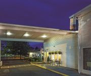
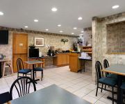
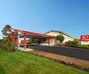
Hotels and Places to Stay
LA QUINTA INN ALBANY
Comfort Suites Linn County Fairground and Expo
Holiday Inn Express & Suites ALBANY
SUPER 8 ALBANY
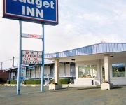
BUDGET INN ALBANY
Rodeway Inn Albany
BEST WESTERN PLUS PRAIRIE INN
Phoenix Inn Suites Albany
MOTEL 6 ALBANY OR
Videos from this area
These are videos related to the place based on their proximity to this place.
N3N Biplane at Albany Municipal Airport - S12
N3N Biplane taking off from Runway 34 at Albany Municipal Airport - S12 in Oregon.
Carbon Cub at Albany Municipal Airport - S12
Carbon Cub intersection take off on Runway 34 at Albany Municipal Airport - S12 in Oregon.
Toy Poodle - Lucy at the Albany Dog Show
Toy Poodle Kandyland Skygem in the Sky with Diamonds aka: "Lucy" wins her class and Winners Bitch at the Albany, OR. dog show in March 2008.
2004-04-17-2 OE+W&P Speeder Trip
This video is the second of four videos from a speeder trip after purchasing my speeder. It was on April 17th and 18th, 2004. On Saturday we set on in Harrisburg OR, ran south to Junction...
NORDPAC @ Albany Art & Air Festival 2014
Northwest Division Pacific Armored Corps performing at the Albany Oregon Art & Air Festival on August 23 & 24, 2014.
Jackson Soto, West Albany vs Terry Walling, South Albany
MWC 2012 Wrestling Championships - 195 lbs.
Toy Poodles Blondie and Lucy at Albany Dog Show
Ch. Kandyland's Kream of the Krop aka: "Blondie" and Kandyland Skygem In the Sky with Diamonds aka: "Lucy" winning Best of Breed and Best of Winners at the Albany, OR. Dog Show in March, 2008.
Two N3Ns taking off from Albany Municipal Airport - S12
Two N3Ns taking off from Albany Municipal Airport.
WWFM #4 Albany Oregon USA
A bunch of rowdy SWAGsters gathered for some WWFM fun at an unnamed variety store. It seems someone forgot to let the management in on the fun. NOTE: Target Stores, Inc. are not associated...
Videos provided by Youtube are under the copyright of their owners.
Attractions and noteworthy things
Distances are based on the centre of the city/town and sightseeing location. This list contains brief abstracts about monuments, holiday activities, national parcs, museums, organisations and more from the area as well as interesting facts about the region itself. Where available, you'll find the corresponding homepage. Otherwise the related wikipedia article.
Albany Municipal Airport (Oregon)
Albany Municipal Airport is a general aviation airport located 3 nautical miles east of the city of Albany in Linn County, Oregon, United States. It is publicly owned and operated by the City of Albany. It is the oldest known operating airfield in Oregon, opening in 1920. There are 58 aircraft based at the municipal airport; 49 Single engine airplanes, 7 multi engine, and 2 jet airplanes. On average there are 62 aircraft operations per day.
South Albany High School
South Albany High School (or SAHS) is a public high school located in Albany, Oregon, United States. Built in 1970, South Albany occupies the largest facility in the Greater Albany Public School District, encompassing more than 167,000 square feet of classrooms and other facilities.
Propst Airport
Propst Airport is a private airport located 3 miles east of Albany in Linn County, Oregon, USA.
Roppair Airport
Roppair Airport is a private airport located 2 miles southeast of Albany in Linn County, Oregon, USA.
KWIL
KWIL (790 AM, "AM 790 Word") is a radio station licensed to serve Albany, Oregon, USA. The station is owned by Extra Mile Media, Inc.
KRAD-LP
KRAD-LP (94.9 FM, "94.9 KRAD") is a low-power radio station broadcasting a Christian music format. Licensed to Millersburg, Oregon, USA, the station is currently owned by Transformation International, Inc.


