Safety Score: 2,7 of 5.0 based on data from 9 authorites. Meaning we advice caution when travelling to United States.
Travel warnings are updated daily. Source: Travel Warning United States. Last Update: 2024-08-13 08:21:03
Delve into Westfir
Westfir in Lane County (Oregon) with it's 257 habitants is located in United States about 2,353 mi (or 3,786 km) west of Washington DC, the country's capital town.
Current time in Westfir is now 09:41 AM (Thursday). The local timezone is named America / Los Angeles with an UTC offset of -8 hours. We know of 9 airports close to Westfir, of which one is a larger airport. The closest airport in United States is Mahlon Sweet Field in a distance of 44 mi (or 70 km), North-West. Besides the airports, there are other travel options available (check left side).
Also, if you like playing golf, there are some options within driving distance. If you need a hotel, we compiled a list of available hotels close to the map centre further down the page.
While being here, you might want to pay a visit to some of the following locations: Eugene, Roseburg, Albany, Corvallis and Bend. To further explore this place, just scroll down and browse the available info.
Local weather forecast
Todays Local Weather Conditions & Forecast: 8°C / 46 °F
| Morning Temperature | 6°C / 42 °F |
| Evening Temperature | 7°C / 45 °F |
| Night Temperature | 9°C / 47 °F |
| Chance of rainfall | 9% |
| Air Humidity | 96% |
| Air Pressure | 1014 hPa |
| Wind Speed | Light breeze with 5 km/h (3 mph) from West |
| Cloud Conditions | Overcast clouds, covering 100% of sky |
| General Conditions | Moderate rain |
Thursday, 21st of November 2024
9°C (49 °F)
5°C (41 °F)
Moderate rain, gentle breeze, overcast clouds.
Friday, 22nd of November 2024
6°C (42 °F)
2°C (36 °F)
Rain and snow, light breeze, overcast clouds.
Saturday, 23rd of November 2024
6°C (43 °F)
0°C (32 °F)
Light rain, light breeze, overcast clouds.
Hotels and Places to Stay
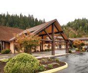
BEST WESTERN OAKRIDGE INN - OAKRIDGE
Videos from this area
These are videos related to the place based on their proximity to this place.
Oakridge, OR by train
Oakridge, OR, elevation 1200' (365m), on the Amtrak Coast Starlight northbound, Friday, June 11, 2010. Town starts one minute into the video.
Hitting silly speeds down the Alpine trail in Oakridge, Oregon
First visit to Oakridge in Oregon, riding Alpine, Flat Creek, Aubrey and Heckletooth = over 10000ft of descending in a day and highest registered speed of nearly 38mph. This section can't...
GoPro Mountain Biking on Flat Creek Trail - Oakridge, Oregon
Flat Creek Trail on Dead Mountain just outside of Oakridge, Oregon. Filmed on June 7, 2014 using GoPro's Hero3+ Black Edition 1080p @ 60fps. bike, cycling, bicycle, yeti,...
OES PEP Assembly 1/23/2014
Pep Assembly for the Oakridge Elementary School to promote playing Basketball, getting involved in Upper Willamette Youth and inviting the students to watch the OHS Basketball games at the High School.
The Beer Engine and True Imperial Pint Measure
Publican Ted Sobel of the Brewers Union Local 180, shows his cask-conditioned beer engine, and how the beer is hand-pulled into a full imperial pint or half pint jar that he serves to his customers...
NativeForestCouncil/Hecocta 1995
NativeForestCouncil board member Calvin Hecocta speaks and sings to over 100 forest defenders outside the Oakridge ranger station in August of 1995.
NativeForestCouncil/Hermach 1995
Tim Hermach, director of the NativeForestCouncil speaks to over 100 forest defenders outside the Oakridge ranger station in August of 1995.
Dad and I trying out the new GOPro 2! DAD CRASHES NEW BIKE!
Riding on some soupy dirt up in Huckleberry Flats near Oakridge, Oregon.
Videos provided by Youtube are under the copyright of their owners.
Attractions and noteworthy things
Distances are based on the centre of the city/town and sightseeing location. This list contains brief abstracts about monuments, holiday activities, national parcs, museums, organisations and more from the area as well as interesting facts about the region itself. Where available, you'll find the corresponding homepage. Otherwise the related wikipedia article.
Oakridge State Airport
Oakridge State Airport, is a public airport located 1 mile (1.6 km) west of Oakridge, in Lane County, Oregon, USA.
Office Bridge
The Office Bridge (also called Westfir Covered Bridge) is a covered bridge in Westfir, Lane County, Oregon, U.S. crossing the North Fork Middle Fork Willamette River at the south end of the Aufderheide National Scenic Byway and edge of the Willamette National Forest. It is Oregon's longest covered bridge at 180 ft (55 m), and is one of only two in the state using triple Howe truss construction. It is the only covered bridge west of the Mississippi River which has a separate pedestrian walkway.
Oakridge High School (Oregon)
Oakridge High School is a public high school in Oakridge, Oregon, United States. It is the only high school in the Oakridge School District.


