Safety Score: 2,7 of 5.0 based on data from 9 authorites. Meaning we advice caution when travelling to United States.
Travel warnings are updated daily. Source: Travel Warning United States. Last Update: 2024-08-13 08:21:03
Discover Burns
Burns in Harney County (Oregon) with it's 2,757 citizens is a town in United States about 2,183 mi (or 3,514 km) west of Washington DC, the country's capital city.
Current time in Burns is now 02:33 AM (Thursday). The local timezone is named America / Los Angeles with an UTC offset of -8 hours. We know of 3 airports near Burns. The closest airport in United States is Roberts Field in a distance of 114 mi (or 184 km), North-West. Besides the airports, there are other travel options available (check left side).
Looking for a place to stay? we compiled a list of available hotels close to the map centre further down the page.
When in this area, you might want to pay a visit to some of the following locations: Canyon City, Baker City, Fossil, Heppner and Vale. To further explore this place, just scroll down and browse the available info.
Local weather forecast
Todays Local Weather Conditions & Forecast: 7°C / 45 °F
| Morning Temperature | 3°C / 37 °F |
| Evening Temperature | 5°C / 41 °F |
| Night Temperature | 7°C / 44 °F |
| Chance of rainfall | 9% |
| Air Humidity | 86% |
| Air Pressure | 1014 hPa |
| Wind Speed | Moderate breeze with 12 km/h (7 mph) from North |
| Cloud Conditions | Overcast clouds, covering 100% of sky |
| General Conditions | Moderate rain |
Thursday, 21st of November 2024
9°C (47 °F)
5°C (41 °F)
Moderate rain, fresh breeze, overcast clouds.
Friday, 22nd of November 2024
3°C (37 °F)
0°C (32 °F)
Rain and snow, moderate breeze, overcast clouds.
Saturday, 23rd of November 2024
1°C (35 °F)
-0°C (31 °F)
Light snow, moderate breeze, overcast clouds.
Hotels and Places to Stay
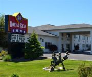
BEST WESTERN RORY AND RYAN INNS-HINES
Americas Best Value Inn Burns
RORY AND RYAN INN
DAYS INN BURNS
Videos from this area
These are videos related to the place based on their proximity to this place.
BLM Horses (mares) 007.avi
Horses available at the Burns BLM Corrals as of today. Walk up adoption Friday June 1st and Saturday June 2nd For more information about any of the horses in this video please call the BLM...
Boiling-Water-at-High-Elevations-part-2.mp4
The second part to boiling water... and more information on the high desert region including natural hot springs that have minerals that are good for your skin.
Horse Tripping Abuse in Harney County, Oregon
Again, and in spite of rodeo thugs' attempts to stop us (that will be another video), SHARK filmed brutal horse tripping in Oregon.
Wanda’s Journey Part 10: The Lonely Road
We avoided major cities for about 800 miles. The backroads of America.
Videos provided by Youtube are under the copyright of their owners.
Attractions and noteworthy things
Distances are based on the centre of the city/town and sightseeing location. This list contains brief abstracts about monuments, holiday activities, national parcs, museums, organisations and more from the area as well as interesting facts about the region itself. Where available, you'll find the corresponding homepage. Otherwise the related wikipedia article.
KBNH
KBNH is a radio station licensed to serve Burns, Oregon, USA. The station, established in 1957, is owned by Harney County Radio, LLC. KBNH and sister station KORC are the two of only four radio stations with Burns as their community of license.
Burns High School (Oregon)
Burns High School is a public high school in Burns, Oregon, United States.
KBWR-LP
KBWR-LP is a radio station broadcasting a religious music format. Licensed to Burns, Oregon, USA, the station is currently owned by Desert Broadcasting.
Burns Paiute Tribe
The Burns Paiute Tribe of the Burns Paiute Indian Colony of Oregon is a federally recognized tribe of Northern Paiute Indians in Harney County, Oregon, United States. They are primarily the descendants of the Wadatika band of Northern Paiutes who traditionally lived in Central and Southern Oregon.
Old Camp Casino
The Old Camp Casino is a tribal casino near Burns, Oregon, United States, owned by the Burns Paiute Tribe.


