Safety Score: 2,7 of 5.0 based on data from 9 authorites. Meaning we advice caution when travelling to United States.
Travel warnings are updated daily. Source: Travel Warning United States. Last Update: 2024-08-13 08:21:03
Touring Empire
The district Empire of North Bend in Coos County (Oregon) is a subburb located in United States about 2,444 mi west of Washington DC, the country's capital place.
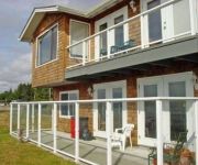
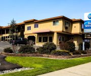
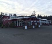
Need some hints on where to stay? We compiled a list of available hotels close to the map centre further down the page.
Being here already, you might want to pay a visit to some of the following locations: Coquille, Roseburg, Gold Beach, Newport and Grants Pass. To further explore this place, just scroll down and browse the available info.
Local weather forecast
Todays Local Weather Conditions & Forecast: 14°C / 56 °F
| Morning Temperature | 8°C / 46 °F |
| Evening Temperature | 9°C / 48 °F |
| Night Temperature | 8°C / 47 °F |
| Chance of rainfall | 0% |
| Air Humidity | 62% |
| Air Pressure | 1022 hPa |
| Wind Speed | Light breeze with 4 km/h (2 mph) from North |
| Cloud Conditions | Clear sky, covering 0% of sky |
| General Conditions | Sky is clear |
Thursday, 5th of December 2024
13°C (56 °F)
10°C (49 °F)
Broken clouds, light breeze.
Friday, 6th of December 2024
15°C (59 °F)
13°C (55 °F)
Overcast clouds, light breeze.
Saturday, 7th of December 2024
12°C (53 °F)
10°C (50 °F)
Moderate rain, light breeze, overcast clouds.
Hotels and Places to Stay
PLAINVIEW MOTEL
BW HOLIDAY HOTEL
City Center Motel
Captain John's Motel
Bay Bridge Motel
The New Terrace Hotel
EDGEWATER INN COOS BAY
Quality Inn & Suites at Coos Bay
MOTEL 6 COOS BAY
RED LION COOS BAY
Videos from this area
These are videos related to the place based on their proximity to this place.
Landing at North Bend, Oregon in Cessna 172RG
Not my best landing, but great views! I landed long on purpose because someone was on the taxiway off to the left getting in-flight pics of the plane.
North Bend Drivers Ed | Oregon Driver Training
North Bend Drivers Ed | Oregon Driver Training http://OregonDriverTraining.com/north-bend or call us 888-553-7483 Oregon Driver Training has provided the city of North Bend with the best teen...
Another sunset at Horsfall Beach Drone Video!
Flying my DJI Phantom 2 Vision at sunset over Horsfall Beach in North Bend Oregon.
Light sparring at Ludus Gym
Brian and Paul light sparring in the cage at Ludus Gym in North Bend Oregon.
2004 Chrysler Town & Country LX center console light fix
A walk through of me disassembling the center dash cluster to repair a light that works intermittently. The whole thing took about 55 minutes with filming, mistakes and putting it all back...
The Gay 90's Celebration Event in Coquille, Oregon
The City of Coquille, Oregon presents the annual Gay 90's Celebration weekend of events!
2015 Black Rock 19B #008210
5 season travel trailer from Outdoors RV with aluminum frame construction and 2' this laminated sidewalls. Rear dinette with big rear window.. perfect for your favorite view campsite.
Oregon Coast Digest presents Steamboats at the Gay 90's
Oregon Coast Digest takes a trip down the Coquille River on Steamboats provided by the city of Coquille for the Gay 90's celebration! The Steamboats are owned by individuals from the Northwest...
Oregon Coast Digest visits Prehistoric Gardens
Oregon Coast Digest takes a trip into the loooooong distant past and visits Prehistoric Gardens! Plus we are joined by a very special co-host!
Videos provided by Youtube are under the copyright of their owners.
Attractions and noteworthy things
Distances are based on the centre of the city/town and sightseeing location. This list contains brief abstracts about monuments, holiday activities, national parcs, museums, organisations and more from the area as well as interesting facts about the region itself. Where available, you'll find the corresponding homepage. Otherwise the related wikipedia article.
Coos Bay
Coos Bay is an S-shaped inlet where the Coos River enters the Pacific Ocean, approximately 10 miles (16 km) long and two miles (three km) wide, on the Pacific Ocean coast of southwestern Oregon in the United States. The estuary is situated south of the Salmon River. The city of Coos Bay, once named Marshfield, was renamed for the bay and is located on its inner side. The Port of Coos Bay is the largest and deepest port between San Francisco, California and the Columbia River.
Southwest Oregon Regional Airport
The Southwest Oregon Regional Airport, formerly known as the North Bend Municipal Airport, is a public airport located in the city of North Bend, in Coos County, Oregon, USA. It is operated by the Coos County Airport District and serves the entire county. The airport changed its name in April 2006 to avoid confusion with Bend, a city in central Oregon.
Coos Art Museum
Coos Art Museum is a museum in Coos Bay, operating on the southern coast of Oregon since 1950. Located in a historic former US Post Office, it offers tour exhibits, art classes, lectures, and community events. The museum holds 477 permanent collections and rotates its displays throughout the year, which can also be viewed via the museum's website.
Southwestern Oregon Community College
Southwestern Oregon Community College is a college in Coos Bay, Oregon, United States. It is Oregon's oldest community college, founded in 1961. The college has about 14,500 students annually and has 69 full-time faculty (as of 2008) and 275 part-time instructors. As of 2008, students from several other countries and states have attended this community college.
New Carissa
The M/V New Carissa was a freighter that ran aground on a beach near Coos Bay, Oregon, United States, during a storm in February 1999 and subsequently broke apart. An attempt to tow the bow section of the ship out to sea failed when the tow line broke, and the bow was grounded again. Eventually, the bow was successfully towed out to sea and sunk. The stern section remained on the beach near Coos Bay.
Port of Coos Bay
The Oregon International Port of Coos Bay is a port of the Pacific coast of the United States, located in Coos Bay near the city of Coos Bay, Oregon. It is the largest deep-draft coastal harbor between San Francisco Bay and Puget Sound, and is Oregon's second busiest maritime commerce center after the Port of Portland. In the mid-1900s, the Port of Coos Bay proudly held the title of "World's largest lumber shipping port.
Charleston, Oregon
Charleston is an unincorporated community in Coos County, Oregon, United States. It is located at the ocean entrance to Coos Bay. According to the local chamber of commerce, it is the area's "commercial and sport fishing center", and the community also provides services for the seafood processing and marine support industries. Charleston is the site of the Oregon Institute of Marine Biology and the United States Coast Guard Charleston Lifeboat Station.
ANT Coos Bay
The United States Coast Guard Aids To Navigation Team, ANT Coos Bay was established in 1976 and is located near the mouth of Coos Bay in the fishing and tourist community of Charleston, Oregon, southwest of the city of Coos Bay. ANT Coos Bay's area of responsibility ranges over 240 miles of the Oregon coast and includes 3 lighthouses, 18 primary buoys, 43 secondary buoys and 156 other lights, day beacons and fog signals.
KMHS (AM)
KMHS is a high school radio station broadcasting a classic country music format. Licensed to Coos Bay, Oregon, USA, the station is currently owned by Coos Bay Public Schools. The station broadcasts from studios at Marshfield High School.
North Bend High School
North Bend High School is a public high school in North Bend, Oregon, United States.
Marshfield High School (Coos Bay, Oregon)
Marshfield High School is a public high school in Coos Bay, Oregon, United States. Coos Bay is located on the southern Oregon coast. The campus consists of four major buildings, including an Intermediate building which opened in 2000 that serves as a math and science building. It also has a gymnasium that seats 3,000. There is also a separate facility that houses the Drama program.
Oregon Institute of Marine Biology
The Oregon Institute of Marine Biology (or OIMB) is the marine station of the University of Oregon. It is located in Charleston, Oregon at the mouth of Coos Bay. This 100-acre marine station was first deeded to the University of Oregon in 1931. However, university students had been studying marine science in the summer from tents at nearby Sunset Bay since 1924. Currently OIMB is home to several permanent faculty members and a number of graduate students.
Bay Area Hospital Heliport
Bay Area Hospital Heliport is a private heliport located one mile east of Coos Bay in Coos County, Oregon, United States.
Menasha Pad
Menasha Pad Heliport is a private heliport located northeast of North Bend in Coos County, Oregon, USA.
Coast Guard Air Station North Bend
Coast Guard Air Station North Bend (CGAS North Bend) was established September 28, 1974 at Southwest Oregon Regional Airport in North Bend, Oregon, United States. The unit houses 153 active duty, nine reserve duty and five civilian personnel. The unit operates five Eurocopter HH-65 Dolphin helicopters.
KBBR
KBBR is a radio station broadcasting a progressive talk format. Licensed to North Bend, Oregon, USA. The station is currently owned by Bicoastal Media, the broadcast license is held by Bicoastal Media Licenses III, LLC, and features programming from ABC Radio, Jones Radio Network and Westwood One.
KHSN
KHSN (1230 AM, "SportsRadio AM1230") is a radio station licensed to serve Coos Bay, Oregon, USA. The station, which began broadcasting in March 1928, is currently owned by W7 Broadcasting, LLC.
KDCQ
KDCQ (92.9 FM, "K-Dock 92.9") is a radio station licensed to serve Coos Bay, Oregon, USA. The station, established in 1995, is owned by Bay Cities Building Company, Inc. The station's transmitting facilities were damaged in a March 2008 fire and the station is operating at a reduced effective radiated power of just 500 watts on a temporary basis.
Oregon Coast Technology School
Oregon Coast Technology School, known as ORCO TECH, is a public charter school in North Bend, Oregon, United States. ORCO TECH serves students in grades 6-12; middle school students (grades 6-8) attend classes at North Bend Middle School, while grades 9-12 attend classes at North Bend High School.
Destinations Academy
Destinations Academy is a public alternative high school in Coos Bay, Oregon, United States.
Resource Link Charter School
Resource Link Charter School is a public charter school in Coos Bay, Oregon, United States.
KBAV-LP
KBAV-LP is a radio station licensed to Coos Bay, Oregon, USA. The station is currently owned by Coos Bay Gospel Ministry, Inc.
KMHS-FM
KMHS-FM (91.3 FM, "Pirate Radio 91.3") is a radio station broadcasting a Pop Contemporary Hit Radio music format. Licensed to Coos Bay, Oregon, USA, the station is currently owned by Coos Bay School District No. 9.
Jordan Cove Energy Project
The Jordan Cove Energy Project is a proposal to build a receiving facility for liquefied natural gas in Coos Bay, Oregon.
Camp Castaway
Camp Castaway was a military encampment at what is now Coos Bay, Oregon, United States. Camp Castaway was established by the survivors of the wreck of the Captain Lincoln, a U.S. transport schooner, on January 3, 1852. The ship began taking on water during a storm while en route from San Francisco to Fort Orford at the town of Port Orford. To avoid sinking, the captain decided to beach the ship north of Cape Arago. All of the roughly 30 troops (U.S.


