Safety Score: 2,7 of 5.0 based on data from 9 authorites. Meaning we advice caution when travelling to United States.
Travel warnings are updated daily. Source: Travel Warning United States. Last Update: 2024-08-13 08:21:03
Delve into Main Meadows Mobile Home Park
Main Meadows Mobile Home Park in Montgomery County (Ohio) is a town located in United States about 393 mi (or 633 km) west of Washington DC, the country's capital town.
Time in Main Meadows Mobile Home Park is now 01:37 PM (Thursday). The local timezone is named America / New York with an UTC offset of -5 hours. We know of 8 airports closer to Main Meadows Mobile Home Park, of which 5 are larger airports. The closest airport in United States is James M Cox Dayton International Airport in a distance of 9 mi (or 14 km), North-East. Besides the airports, there are other travel options available (check left side).
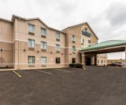
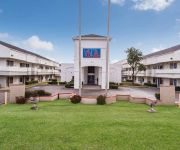
Also, if you like the game of golf, there are some options within driving distance. In need of a room? We compiled a list of available hotels close to the map centre further down the page.
Since you are here already, you might want to pay a visit to some of the following locations: Dayton, Troy, Eaton, Lebanon and Xenia. To further explore this place, just scroll down and browse the available info.
Local weather forecast
Todays Local Weather Conditions & Forecast: 1°C / 33 °F
| Morning Temperature | 3°C / 37 °F |
| Evening Temperature | -1°C / 31 °F |
| Night Temperature | 0°C / 32 °F |
| Chance of rainfall | 3% |
| Air Humidity | 62% |
| Air Pressure | 1007 hPa |
| Wind Speed | Moderate breeze with 12 km/h (7 mph) from East |
| Cloud Conditions | Overcast clouds, covering 100% of sky |
| General Conditions | Snow |
Thursday, 21st of November 2024
3°C (38 °F)
6°C (43 °F)
Overcast clouds, moderate breeze.
Friday, 22nd of November 2024
8°C (47 °F)
4°C (39 °F)
Overcast clouds, moderate breeze.
Saturday, 23rd of November 2024
10°C (50 °F)
9°C (47 °F)
Overcast clouds, gentle breeze.
Hotels and Places to Stay
Hampton Inn - Suites Dayton-Airport
Comfort Inn & Suites
Clarion Inn Dayton Airport
Homeplace Suites Irving
MOTEL 6 DAYTON
BW PLUS DAYTON NORTHWEST
SUPER 8 ENGLEWOOD
Videos from this area
These are videos related to the place based on their proximity to this place.
Oak Park @ 2013 Trotwood Competition
Oak Park High School's field show at the 2013 Trotwood Competition.
River Rouge @ 2013 Trotwood Competition
River Rouge High School's field show at the 2013 Trotwood Competition.
Northwest Church of Christ in Trotwood, OH w/ Dr. Cleavon Matthews
The Cross: Victory...Not Victim; 1 Peter 3:18-22 August 10, 2014 Sunday Morning Sermon & Singing Check out our website at www.northwestchurchofchristfamily.com for more info about the Lord's...
M.L. King @ 2013 Trotwood Competition
Detroit Martin Luther King Jr. High School's field show at the 2013 Trotwood Competition.
Shaw High School @ 2013 Trotwood Competition
Shaw High School's field show at the 2013 Trotwood Competition.
Trotwood High band
This trotwoods Madison Highs Marching band at the battle of the bands at trotwood high school on 4/24/10. They was killing everybody but Shaw high. comment the vid.
Videos provided by Youtube are under the copyright of their owners.
Attractions and noteworthy things
Distances are based on the centre of the city/town and sightseeing location. This list contains brief abstracts about monuments, holiday activities, national parcs, museums, organisations and more from the area as well as interesting facts about the region itself. Where available, you'll find the corresponding homepage. Otherwise the related wikipedia article.
Trotwood, Ohio
Trotwood is a city in Montgomery County, Ohio, United States. The population was 27,431 at the 2010 census. It is part of the Dayton Metropolitan Statistical Area. The city is served by the Trotwood-Madison City School District. It is named for Betsy Trotwood, the Charles Dickens character.
Salem Mall
Salem Mall was the first enclosed shopping center in the Dayton, Ohio area. It was located at the intersection of Shiloh Springs Road and Salem Avenue, in the northwest Dayton suburb of Trotwood. The center opened in 1966, and in its early stages had 60 retailers. The original mall was anchored by the Rike's and Sears department stores. There was also a Liberal supermarket, a smaller department store called The Metropolitan, and a multi-screen cinema.
United Theological Seminary
United Theological Seminary is a United Methodist seminary in Trotwood, Ohio just outside of Dayton in the Dayton metropolitan area. Founded in 1871 by Milton Wright (the father of Orville and Wilbur Wright), it was originally sponsored by the Church of the United Brethren in Christ. In 1946 members of the Church of the United Brethren in Christ started a new denomination, the Evangelical United Brethren Church, with which the seminary then became affiliated.
Dahio Trotwood Airport
Dahio Trotwood Airport, also known as Dayton-New Lebanon Airport, is a public-use airport located seven miles (11 km) west of the central business district of Dayton, in Montgomery County, Ohio, United States. It is privately owned by Gary Ridell. The airport is situated between Trotwood to the northeast and New Lebanon to the southwest.


