Safety Score: 2,7 of 5.0 based on data from 9 authorites. Meaning we advice caution when travelling to United States.
Travel warnings are updated daily. Source: Travel Warning United States. Last Update: 2024-08-13 08:21:03
Delve into Southwood Colony
Southwood Colony in Ashtabula County (Ohio) is located in United States about 283 mi (or 455 km) north-west of Washington DC, the country's capital town.
Current time in Southwood Colony is now 12:52 PM (Thursday). The local timezone is named America / New York with an UTC offset of -5 hours. We know of 8 airports close to Southwood Colony, of which 3 are larger airports. The closest airport in United States is Erie International Tom Ridge Field in a distance of 29 mi (or 47 km), North-East. Besides the airports, there are other travel options available (check left side).
Also, if you like playing golf, there are some options within driving distance. We encountered 1 points of interest near this location. If you need a hotel, we compiled a list of available hotels close to the map centre further down the page.
While being here, you might want to pay a visit to some of the following locations: Jefferson, Chardon, Painesville, Meadville and Erie. To further explore this place, just scroll down and browse the available info.
Local weather forecast
Todays Local Weather Conditions & Forecast: 4°C / 39 °F
| Morning Temperature | 2°C / 36 °F |
| Evening Temperature | 1°C / 34 °F |
| Night Temperature | 1°C / 34 °F |
| Chance of rainfall | 2% |
| Air Humidity | 55% |
| Air Pressure | 1003 hPa |
| Wind Speed | Moderate breeze with 12 km/h (7 mph) from North-East |
| Cloud Conditions | Overcast clouds, covering 100% of sky |
| General Conditions | Rain and snow |
Thursday, 21st of November 2024
7°C (44 °F)
6°C (43 °F)
Rain and snow, fresh breeze, overcast clouds.
Friday, 22nd of November 2024
8°C (46 °F)
7°C (44 °F)
Light rain, fresh breeze, overcast clouds.
Saturday, 23rd of November 2024
7°C (45 °F)
5°C (41 °F)
Overcast clouds, moderate breeze.
Hotels and Places to Stay
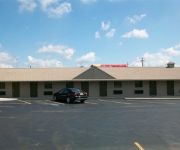
ECONOMY INN AND SUI
Videos from this area
These are videos related to the place based on their proximity to this place.
Greyhound bus trip through northern U.S.: (13) Ashtabula, Ohio to Erie Pennsylvania 2010-08-31
A Greyhound bus arriving at the lakeside city of Ashtabula. Columbus, Ohio makes a quick stop before returning to Interstate 90 several miles south to resume its trek east towards Erie, Pennsylvani...
Ashtabula Ohio Railfanning Part Two! By Jim Gray
Part two of CSX action in Ashtabula, Ohio at CP128. Filmed by Jim Gray.
2250 Center Rd, Ashtabula, OH Presented by Debbie Lake.
Click to see more: http://www.searchallproperties.com/listings/2054211/2250-Center-Rd-Ashtabula-OH/auto?reqpage=video 2250 Center Rd Ashtabula, OH 44004 Contact Debbie Lake for more ...
St. Patrick's Day Solar Storm 2015
22 Still image sequence from the St. Patrick's Day Solar Storm of 2015. Taken near Walnut Beach, Ashtabula, OH. Nikon D7100, Tamron 10-24mm @ 10mm, f/3.5, ISO-1600, 10 Sec.
United Eastern Lenape Nation Chief Quiet Wolf
Native Americans from the United Eastern Lenape Nation performed at the 4th Annual Downtown Ashtabula Multi-Cultural Festival. Chief Quiet Wolf told about his and other clans and about the...
United Eastern Lenape Nation blessing at Festival
Native Americans from the United Eastern Lenape Nation blessed the 4th Annual Downtown Ashtabula Multi-Cultural Festival with a drum circle and dance performance. The Rapid Rivers Drum has...
Going West
Two men meet in the old west, one has a question. sorry about the lack of muzzle flashes. We could have added them but didn't have to time to bother.
Highway time lapse. [Uncompressed]
Highway time lapse video. Taken with the GoPro Hero3 at 1 frame every 2 seconds. Uploaded uncompressed.
Bridge Over Troubled Waters
Views of the America's newest and longest covered bridge under construction. A brief history of covered bridges around the World.
Videos provided by Youtube are under the copyright of their owners.
Attractions and noteworthy things
Distances are based on the centre of the city/town and sightseeing location. This list contains brief abstracts about monuments, holiday activities, national parcs, museums, organisations and more from the area as well as interesting facts about the region itself. Where available, you'll find the corresponding homepage. Otherwise the related wikipedia article.
North Kingsville, Ohio
North Kingsville is a village in Ashtabula County, Ohio, United States. The population was 2,923 at the 2010 census.
WZKW
WZKW is a non-commercial, non-profit low power FM community radio station in Kingsville Township, Ohio. It broadcasts on 106.7 MHz, and streams from its website. EdgeRadio commenced broadcasting on June 21, 2004. The bulk of the station's programming features contemporary Indie/Alternative/Progressive music. In addition, EdgeRadio features independently produced, progressive news and informational programs, many of which originate with the Pacifica Radio Network.
Edgewood Senior High School
Edgewood High School is a public high school near Ashtabula, Ohio. It is the only high school in the Buckeye Local Schools district in Ashtabula County, Ohio.
Olin's Covered Bridge
Olin's Bridge, or Olin Bridge, or Olin-Dewey Road Bridge is a covered bridge that carries Dewey Road over the Ashtabula River in Plymouth Township, Ashtabula County, Ohio, United States. The bridge, one of currently 16 drivable bridges in the county, is a single span Town truss design, and is currently the only bridge in the county named for a family. The Olin family has owned property next to the bridge since it was built.
Kingsville, Ohio
Kingsville is a census-designated place in central Kingsville Township, Ashtabula County, Ohio, United States. Although it is unincorporated, it has a post office, with the ZIP code of 44048. It lies at the intersection of State Routes 84 and 193 less than one mile northwest of Interstate 90.


!['Highway time lapse. [Uncompressed]' preview picture of video 'Highway time lapse. [Uncompressed]'](https://img.youtube.com/vi/GeOaPE_BKNk/mqdefault.jpg)

