Safety Score: 2,7 of 5.0 based on data from 9 authorites. Meaning we advice caution when travelling to United States.
Travel warnings are updated daily. Source: Travel Warning United States. Last Update: 2024-08-13 08:21:03
Delve into Summit Ridge
The district Summit Ridge of New Hope in Wake County (North Carolina) is a subburb in United States about 228 mi south of Washington DC, the country's capital town.
If you need a hotel, we compiled a list of available hotels close to the map centre further down the page.
While being here, you might want to pay a visit to some of the following locations: Raleigh, Durham, Louisburg, Smithfield and Oxford. To further explore this place, just scroll down and browse the available info.
Local weather forecast
Todays Local Weather Conditions & Forecast: 15°C / 60 °F
| Morning Temperature | 19°C / 66 °F |
| Evening Temperature | 16°C / 61 °F |
| Night Temperature | 14°C / 57 °F |
| Chance of rainfall | 0% |
| Air Humidity | 45% |
| Air Pressure | 1028 hPa |
| Wind Speed | Gentle Breeze with 7 km/h (5 mph) from South-West |
| Cloud Conditions | Overcast clouds, covering 100% of sky |
| General Conditions | Overcast clouds |
Sunday, 3rd of November 2024
18°C (64 °F)
12°C (54 °F)
Sky is clear, gentle breeze, clear sky.
Monday, 4th of November 2024
17°C (62 °F)
16°C (61 °F)
Overcast clouds, light breeze.
Tuesday, 5th of November 2024
22°C (71 °F)
18°C (64 °F)
Sky is clear, gentle breeze, clear sky.
Hotels and Places to Stay
Four Points by Sheraton Raleigh North
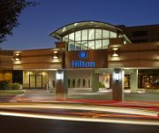
Hilton North Raleigh-Midtown
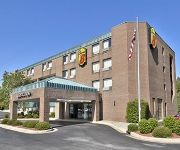
SUPER 8 RALEIGH NORTH EAST
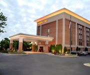
Hampton Inn Raleigh-Capital Blvd N
Quality Inn Raleigh
Fairfield Inn & Suites Raleigh Capital Blvd./I-540
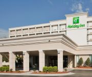
Holiday Inn RALEIGH NORTH - MIDTOWN
BEST WESTERN RALEIGH N DWNTN
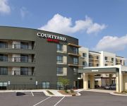
Courtyard Raleigh North/Triangle Town Center
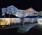
Hilton Garden Inn Raleigh Triangle Town Center
Videos from this area
These are videos related to the place based on their proximity to this place.
2003 Nissan Pathfinder Used Cars Raleigh NC
http://www.anchorautoofraleigh.com This 2003 Nissan Pathfinder is available from Anchor Auto of Raleigh. For details, call us at 919-803-5384.
Grim Dawn-gameplay footage
Hello all. Thanks for checking out this video on Grim Dawn Grim Dawn is an ARPG from Crate which snagged the engine from the Titan Quest series. It's your typical hack and slash type game...
2005 Infiniti QX56 available from Triangle Imports
This 2005 Infiniti QX56 is available from Triangle Imports. For details, call us at 877-508-8504 or visit us at http://www.triangle-imports.com.
5309 Wenesly Ct, Raleigh, NC 27616
http://5309weneslyct.epropertysites.com?rs=youtube LOCATION couldn't be better, 3 Blocks from: Triangle Town Center, Shopping, New Wal-Mart Supercenter to op...
2006 Chrysler Town & Country Used Cars Raleigh NC
http://www.farmandranchauto.com This 2006 Chrysler Town & Country is available from Farm & Ranch Auto Sales. For details, call us at (919)876-7286.
2005 Chrysler Town and Country available from Farm & Ranch A
This 2005 Chrysler Town and Country is available from Farm & Ranch Auto Sales. For details, call us at (919)876-7286 or visit us at http://www.farmandranchau...
2008 Chrysler Town & Country Used Cars Raleigh NC
http://www.anchorautoofraleigh.com This 2008 Chrysler Town & Country is available from Anchor Auto of Raleigh. For details, call us at 919-803-5384.
2005 Chrysler Town and Country Used Cars Raleigh NC
http://www.importsperformancenc.com This 2005 Chrysler Town and Country is available from Imports Performance Inc.. For details, call us at 919-878-4611.
2008 Chrysler Town & Country Used Cars Raleigh NC
http://www.farmandranchauto.com This 2008 Chrysler Town & Country is available from Farm & Ranch Auto Sales. For details, call us at (919)876-7286.
2005 Chrysler Town and Country Used Cars Raleigh NC
http://www.farmandranchauto.com This 2005 Chrysler Town and Country is available from Farm & Ranch Auto Sales. For details, call us at (919)876-7286.
Videos provided by Youtube are under the copyright of their owners.
Attractions and noteworthy things
Distances are based on the centre of the city/town and sightseeing location. This list contains brief abstracts about monuments, holiday activities, national parcs, museums, organisations and more from the area as well as interesting facts about the region itself. Where available, you'll find the corresponding homepage. Otherwise the related wikipedia article.
WakeMed
WakeMed Health and Hospitals is a 870-bed healthcare system with multiple facilities placed around the metropolitan Raleigh, North Carolina area. WakeMed’s main campus is located on New Bern Avenue in Raleigh, North Carolina. WakeMed serves multiple counties throughout the state and specializes in a variety of services including cardiology, neurology, orthopedics, high-risk pregnancy, children’s care, trauma, physical rehabilitation and critical care transport.
Neuse Township, Wake County, North Carolina
Neuse Township (also designated Township 13) is one of twenty townships within Wake County, North Carolina. As of the 2010 census, Neuse Township had a population of 73,617, a 52.6% increase over 2000. Neuse Township, occupyingBad rounding here{{#invoke:Math|precision_format| 71.2*1,000,000/2,589,988.110336 | 1-1 }} square miles (71.2 km) in north-central Wake County, is almost completely occupied by portions of the city of Raleigh.
William G. Enloe High School
The William G. Enloe GT/IB Center for the Humanities, Sciences, and the Arts, also called Enloe High School, is a Wake County public magnet, Gifted & Talented, and International Baccalaureate high school located in east Raleigh, North Carolina. The school is named after William Gillmore Enloe, the Mayor of Raleigh, at the time the school was opened.
Millbrook, North Carolina
Millbrook, North Carolina, USA, was a village in Wake County at that time in the intersection of then Wake Forest Road and then Main Street, which is now part of East Millbrook Road. However the recent growth of Raleigh from the 1970s through today has swallowed up the village. Millbrook although never made it as a town.
Raleigh Charter High School
Raleigh Charter High School is a free, independent public school chartered by the North Carolina State Board of Education. In the summer of 1998, some parents of 8th graders at The Magellan Charter School decided to establish a new charter high school so that their students could continue to learn in a nurturing and academically rich environment.
St. Augustine's University
Saint Augustine's University is a historically black college located in Raleigh, North Carolina, USA. The college was founded in 1867 in Raleigh, North Carolina by prominent Episcopal clergy for the education of freed slaves.
WAUG-LP
WAUG-LP is a low-power commercial television station that serves the greater Raleigh, North Carolina area. Branded as WAUG-TV 68, the station is owned and operated by St. Augustine's College and can be seen on Time Warner Cable digital tier channel 168 throughout much of the greater Raleigh service area. Much of its programming is oriented towards the African-American community, which include gospel music, religious programming, and community affairs.
WRAL Soccer Center
The WRAL Soccer Center is a soccer complex featuring a 3,200-seat, lighted soccer-specific stadium located on Perry Creek Road in Raleigh, North Carolina. It is situated between Capital Boulevard (US Route 1) and Louisburg Road (NC Route 401), and just north of Interstate 540. The complex features a total of 25 soccer pitches. Two of the 25 fields are configurable into smaller pitches and are composed of FieldTurf). The stadium is located in the middle of the park.
Millbrook High School (North Carolina)
Millbrook High School is a public high school located in Raleigh, North Carolina. The school is part of the Wake County Public School System. It is located near East Millbrook Middle School. In 2006, MHS finished its renovation of its campus which includes a new three-level building, a new courtyard for students, and a larger cafeteria making MHS one of the largest and up to date facilities in the WCPSS system.
WAUG
WAUG is a radio station broadcasting a Talk/Personality format. Licensed to New Hope, North Carolina, USA (a locale in the northeastern part of Raleigh), the station serves the Raleigh area. The station is currently owned by Saint Augustine's College and features programing from American Urban Radio Networks and Syndication One. WAUG radio is a daytime only operation, shutting down at sunset to make way for the 50,000-watt WSB in Atlanta.
Ravenscroft School
Ravenscroft School is an independent, formerly Episcopal, college preparatory school located in Raleigh, North Carolina. It enrolls students from pre-school through grade 12. Founded in 1862 by members of Christ Episcopal Church, the school continued under their principles until 1969 when it became non-sectarian.
Historic Oakwood Cemetery
Historic Oakwood Cemetery was founded in 1869 in Raleigh, North Carolina near the North Carolina State Capitol in Historic Oakwood. Historic Oakwood Cemetery contains two special areas within its 102 acres, the Confederate Cemetery, located on the original two and one-half acres (1 ha), and the Hebrew Cemetery, both given for that purpose by Henry Mordecai in 1867.
Raleigh Speedway
Raleigh Speedway (officially Southland Speedway nicknamed Dixie Speedway by fans) was a one-mile (1.6 km) oval race track which opened in 1952 one mile (1.6 km) north of Raleigh, North Carolina in Wake County. It was the second superspeedway ever built (the first being the 1.366-mile Darlington Raceway at Darlington, South Carolina). It was also the first lighted superspeedway and the first track on which NASCAR sanctioned night-time races.
Triangle Town Center
Triangle Town Center is a shopping mall in Raleigh, North Carolina. It is located in North Raleigh off U.S. Highway 1 (Capital Boulevard) and Interstate 540. The mall is owned by CBL & Associates Properties, Inc.
St. Thomas More Academy
St. Thomas More Academy (STMA) is a private, co-educational, college preparatory high school operated by Catholic laymen. It is operated independent of the Roman Catholic Diocese of Raleigh. It serves students and their families in the Raleigh, North Carolina area. The goal of STMA is to build good Christian leaders that will be a beacon to all who encounter them as stated in its mission statement.
North Raleigh Christian Academy
North Raleigh Christian Academy (NRCA) is a private, Christian, coeducational, primary and secondary day school located in Raleigh, North Carolina, United States. Also referred to as simply North Raleigh, the school was founded in 1996.
Raleigh Christian Academy
Raleigh Christian Academy (RCA) is a private, Christian, coeducational, primary and secondary day school located in Raleigh, North Carolina, United States. Also referred to as simply Raleigh Christian, the school seeks to educate students in a traditional Christian environment.
Neuse, North Carolina
Neuse is an unincorporated community in Wake County, North Carolina, United States. Located on the Neuse River, it is south of Wyatt, North Carolina.
Light Time Tower
The Light + Time Tower is a sculpture located in the city of Raleigh, North Carolina designed to diffract the morning and afternoon sunlight into vibrant colors visible to the commuters who pass by it. It is located in the median of Capital Boulevard just northeast of the Fairview Road overpass. The Light + Time Tower consists of a 40-foot tower supporting 20 panels of clear glass.
Friendship Christian School (North Carolina)
Friendship Christian School (FCS) is a private, Baptist, coeducational, primary and secondary day school located in Raleigh, North Carolina, United States. Also known as simply Friendship, the school seeks to educate students in a traditional Christian environment. The current administrator of the school is Ric Nelson.
Captrust Tower
CapTrust Tower at North Hills is a 17-story 260 feet mixed use skyscraper located at North Hills in Raleigh, North Carolina. The tower opened in the fall of 2009. It has 274,000 square feet of office space and 28,400 square feet of retail space. The tallest building in suburban Raleigh, it is named for CapTrust Financial Advisors, the first tenant, which uses 51,000 square feet on the top two floors for its headquarters. CapTrust Tower was built by Duke Realty Corp.
Phillips High School
Mary E. Phillips High School, more commonly known as Phillips High School, is an alternative education high school in eastern Raleigh, North Carolina, USA. It is located east of St. Augustine's college and less than a mile from William G. Enloe High School. The school is geared towards students in grades 9 through 12 who are struggling in regular school programs.
North Ridge Country Club
North Ridge Estates & Country Club is a residential neighborhood and country club located in northern Raleigh, North Carolina off Falls of the Neuse Road. Besides the two golfcourses, North Ridge Country Club has a pool and swim clubhouse, a 70,000-square-foot club house, tennis courts, restaurant, tennis club house, and a fitness center.
Battery Heights Historic District
The Battery Heights Historic District is a historic neighborhood southeast of downtown Raleigh, North Carolina, USA. Named for the earthen batteries stationed in the area during the Civil War, the neighborhood has a suburban character, despite its close proximity to the city center. The district is roughly bounded by East Martin Street on the north, Battery Drive on the east, East Davie Street on the south, and Sherrybrook Drive (originally Cox Street) on the west.
Capitol Heights Historic District (Raleigh, North Carolina)
Located in Raleigh, North Carolina, Capitol Heights Historic District is a historic post-World War II neighborhood just north of the city. It is roughly bounded by Penn Road, North State Street, Glascock Street, and Madison Road. The subdivision was platted in 1946 and developed as a result of the postwar housing demand. Its homes are homogenous in form and design: small one-story two- and three-bedroom houses constructed in the Minimal Traditional-style. Ernest I.


