Safety Score: 2,7 of 5.0 based on data from 9 authorites. Meaning we advice caution when travelling to United States.
Travel warnings are updated daily. Source: Travel Warning United States. Last Update: 2024-08-13 08:21:03
Delve into Wesser
Wesser in Swain County (North Carolina) is a city located in United States about 437 mi (or 703 km) south-west of Washington DC, the country's capital town.
Current time in Wesser is now 06:19 AM (Sunday). The local timezone is named America / New York with an UTC offset of -5 hours. We know of 8 airports closer to Wesser, of which 6 are larger airports. The closest airport in United States is McGhee Tyson Airport in a distance of 40 mi (or 64 km), North-West. Besides the airports, there are other travel options available (check left side).
There is one Unesco world heritage site nearby. It's Great Smoky Mountains National Park in a distance of 61 mi (or 97 km), East. Also, if you like playing golf, there are some options within driving distance. In need of a room? We compiled a list of available hotels close to the map centre further down the page.
Since you are here already, you might want to pay a visit to some of the following locations: Bryson City, Robbinsville, Franklin, Hayesville and Sylva. To further explore this place, just scroll down and browse the available info.
Local weather forecast
Todays Local Weather Conditions & Forecast: 16°C / 60 °F
| Morning Temperature | 3°C / 37 °F |
| Evening Temperature | 9°C / 48 °F |
| Night Temperature | 7°C / 45 °F |
| Chance of rainfall | 0% |
| Air Humidity | 38% |
| Air Pressure | 1020 hPa |
| Wind Speed | Calm with 2 km/h (1 mph) from South |
| Cloud Conditions | Clear sky, covering 6% of sky |
| General Conditions | Sky is clear |
Sunday, 24th of November 2024
16°C (62 °F)
14°C (56 °F)
Overcast clouds, light breeze.
Monday, 25th of November 2024
12°C (54 °F)
3°C (38 °F)
Light rain, light breeze, few clouds.
Tuesday, 26th of November 2024
13°C (55 °F)
8°C (46 °F)
Overcast clouds, light breeze.
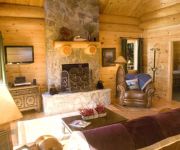
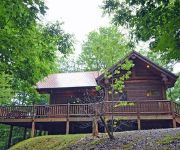
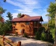
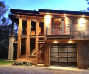
Hotels and Places to Stay
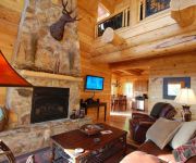
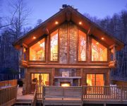
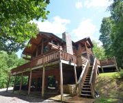
Watershed 07 2 Br cabin by RedAwning
Moonstruck 1 Br cabin by RedAwning
Watershed 10 by RedAwning
Watershed 03 1 Br cabin by RedAwning
Watershed 08 2 Br cabin by RedAwning
Watershed 09 2 Br cabin by RedAwning
Watershed 01 1 Br cabin by RedAwning
Watershed 02 2 Br cabin by RedAwning
Watershed 05 4 Br cabin by RedAwning
Nantahala Village
Videos from this area
These are videos related to the place based on their proximity to this place.
2013 Freestyle Kayaking World Championships - Nantahala River - Bryson City NC USA
The ultimate whitewater competition is coming to the Nantahala River on September 2--8, 2013 — the International Canoe Federation's (ICF) Canoe Freestyle World Championships. This premier...
NOC Zip Line Adventure Park: Nantahala Ziplines
http://noc.com/plan-your-trip/zip-lines Video of NOC's new Zip Line Adventure Park in the Nantahala Gorge. The fast, fun course features a 550' zip line and sixteen aerial obstacles requiring...
Drone Video Nantahala River Kayaking
Just a short aerial video clip on the Nantahala River @ Nantahala Outdoor Center. NOC Bryson City, NC.
C-1 Freestyle at NOC - Tad Dennis
Tad Dennis having fun in a C-1 on the Nantahala River in Bryson City, North Carolina. This is the location of the 2013 Canoe/Kayak Freestyle World Championships.
Nantahala Falls: Class III (fig.3)
From noc.com: Nantahala Falls is the longest, swiftest and most fun rapid on the Nantahala River. There are a number of ways to run this rapid, some are a bit more thrilling than others. The...
Nantahala Outdoor Center: Leaders in Adventure Since 1972
Meet NOC's guides and leaders and learn about our important role in the outdoor industry. This video reviews the breadth of NOC's activities and explains our contributions to competitive paddlespor...
Flint Ridge Trail - Short Loop (from the top) - GoPro Chesty
I ride the Flint Ridge short loop from the top of the switchbacks. I get off the bike to hike back up to the top of the switchbacks and ride down them. I'm out of shape, so the climbs are something...
Nantahala Falls: Class III (fig.6)
From noc.com: Nantahala Falls is the longest, swiftest and most fun rapid on the Nantahala River. There are a number of ways to run this rapid, some are a bit more thrilling than others. The...
Deadly Class IV Kayaking: Greater Wesser Falls ( Worser Wesser )
Eric Brown running the Greater Wesser Falls (Class IV-V depending on guide source) on the Nantahala River in North Carolina. Videography by Stephen Garner. Special thanks to Roy from 3dlux.com...
Videos provided by Youtube are under the copyright of their owners.
Attractions and noteworthy things
Distances are based on the centre of the city/town and sightseeing location. This list contains brief abstracts about monuments, holiday activities, national parcs, museums, organisations and more from the area as well as interesting facts about the region itself. Where available, you'll find the corresponding homepage. Otherwise the related wikipedia article.
Nantahala Outdoor Center
The Nantahala Outdoor Center (NOC) is a commercial outdoor guide service and retail store. It opened in 1972 when Payson and Aurelia Kennedy and Horace Holden Sr. took over the old Tote 'N Tarry Motel. NOC is based in western North Carolina near Bryson City, near the Great Smoky Mountains on the Nantahala River. NOC is surrounded by Nantahala National Forest. The Appalachian Trail passes directly through the heart of the NOC, crossing the Nantahala River on a bridge next to the outfitter.


