Safety Score: 2,7 of 5.0 based on data from 9 authorites. Meaning we advice caution when travelling to United States.
Travel warnings are updated daily. Source: Travel Warning United States. Last Update: 2024-08-13 08:21:03
Discover Cherokee
Cherokee in Swain County (North Carolina) with it's 2,138 citizens is a place in United States about 419 mi (or 674 km) south-west of Washington DC, the country's capital city.
Current time in Cherokee is now 10:12 AM (Monday). The local timezone is named America / New York with an UTC offset of -5 hours. We know of 8 airports near Cherokee, of which 5 are larger airports. The closest airport in United States is Asheville Regional Airport in a distance of 44 mi (or 70 km), East. Besides the airports, there are other travel options available (check left side).
There is one Unesco world heritage site nearby. It's Great Smoky Mountains National Park in a distance of 43 mi (or 69 km), East. Also, if you like playing golf, there are a few options in driving distance. We encountered 2 points of interest in the vicinity of this place. If you need a hotel, we compiled a list of available hotels close to the map centre further down the page.
While being here, you might want to pay a visit to some of the following locations: Sylva, Bryson City, Franklin, Waynesville and Sevierville. To further explore this place, just scroll down and browse the available info.
Local weather forecast
Todays Local Weather Conditions & Forecast: 16°C / 60 °F
| Morning Temperature | 6°C / 42 °F |
| Evening Temperature | 12°C / 53 °F |
| Night Temperature | 13°C / 55 °F |
| Chance of rainfall | 0% |
| Air Humidity | 52% |
| Air Pressure | 1020 hPa |
| Wind Speed | Light breeze with 4 km/h (2 mph) from North-East |
| Cloud Conditions | Broken clouds, covering 62% of sky |
| General Conditions | Broken clouds |
Monday, 25th of November 2024
11°C (52 °F)
6°C (43 °F)
Moderate rain, light breeze, overcast clouds.
Tuesday, 26th of November 2024
14°C (57 °F)
10°C (50 °F)
Overcast clouds, light breeze.
Wednesday, 27th of November 2024
13°C (55 °F)
6°C (43 °F)
Moderate rain, light breeze, overcast clouds.
Hotels and Places to Stay
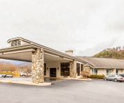
Holiday Inn Express & Suites CHEROKEE/CASINO
Rodeway Inn & Suites On The River
Quality Inn Cherokee
Hampton Inn Cherokee
Fairfield Inn & Suites Cherokee
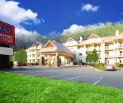
Comfort Suites Cherokee
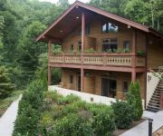
The Chalet Suites Boutique Hotel
Qualla Motel Near Cherokee Casino
Stonebrook Lodge
Rolling Hills Lodge
Videos from this area
These are videos related to the place based on their proximity to this place.
old guys riding skateboards at Cherokee North Carolina Skatepark
too hot for much anything when it's summer in da'sowf. but swimmin in a chilly trout stream'll ease yer post sk8 phunk.
Agriculture and Forest Management at the Ancient Maya City of Tikal
This is a presentation at the joint meeting of the Society for Economic Botany and Society of Ethnobiology: "The Energy of People, Places, and Life". Cherokee, NC. May 11-14, 2014. Author(s):...
Inside Harrah's Cherokee Creek Tower
A look inside our complimentary free hotel room Creek Tower at Harrah's Cherokee Casino & Hotel. Very modern, clean and comfortable. The large hotel was very nice with an exercise room, indoor...
Elk cherokee nc
Happens all the time. . Blue ridge parkway entrance from Cherokee reservation. Beautiful!!
Oconaluftee Islands Park, Cherokee NC, Swain County
This is a short clip of the Oconaluftee Islands Park in Cherokee NC in Swain County. It is a very nice family oriented park with swimming and picnicking and just great outdoor relaxing fun....
Cherokee, NC Show Introduction
Cherokee Show Introduction by The Visitors' Information Channel online TV Station The Visitors' Information Channel showcasing Smoky Mountains, Harrah's Casino, kids friendly, activities...
Travel Bites: Mingo Falls
Mingo Falls is located on the Qualla Indian Reservation in Cherokee, NC. The area is absolutely beautiful but not easily accessible from a major highway which makes it a less crowded and somewhat...
Blue Ridge Parkway approaching Cherokee, NC at dusk. Part 2
Coming home from the Meltdown in Hendersonville, NC. Blue Ridge Parkway westward towards Cherokee, NC. Great sunset!
Videos provided by Youtube are under the copyright of their owners.
Attractions and noteworthy things
Distances are based on the centre of the city/town and sightseeing location. This list contains brief abstracts about monuments, holiday activities, national parcs, museums, organisations and more from the area as well as interesting facts about the region itself. Where available, you'll find the corresponding homepage. Otherwise the related wikipedia article.
Cherokee, North Carolina
Cherokee is a census-designated place (CDP) in Swain County and Jackson counties in western North Carolina, United States, within the Qualla Boundary land trust. It is located in the Oconaluftee River Valley around the intersection of U.S. Route 19 and U.S. Route 441. As of the 2010 census, the CDP had a population of 2,138. Cherokee is the headquarters for the Eastern Band of Cherokee Indians.
Harrah's Cherokee
Harrah's Cherokee Casino is a casino located on the Qualla Boundary in Cherokee, North Carolina. The casino is owned by the Eastern Band of Cherokee Indians and operated by Caesars Entertainment Corporation. This is currently the only casino in the state of North Carolina.
Oconaluftee Indian Village
The Oconaluftee Indian Village is a replica of an 18th century eastern Cherokee community located in Cherokee, North Carolina, USA. This "living museum" is operated by the Cherokee Historical Association. Guides take visitors through the village explaining the history and culture of the Cherokee and also demonstrate the making of such items as arrowheads, baskets, and blowguns.
Oconaluftee (Great Smoky Mountains)
Oconaluftee is the name of a river valley in the Great Smoky Mountains of North Carolina, located in the Southeastern United States. Formerly the site of a Cherokee village and Appalachian community, the valley's bottomland is now home to the main entrance to the North Carolina side of the Great Smoky Mountains National Park. The Oconaluftee area parallels the Oconaluftee River as its basin gradually broadens from Smokemont in the north to the southern tip of the Qualla Boundary.


