Safety Score: 2,7 of 5.0 based on data from 9 authorites. Meaning we advice caution when travelling to United States.
Travel warnings are updated daily. Source: Travel Warning United States. Last Update: 2024-08-13 08:21:03
Delve into Beulah
Beulah in Surry County (North Carolina) is located in United States about 264 mi (or 425 km) south-west of Washington DC, the country's capital town.
Current time in Beulah is now 10:28 AM (Thursday). The local timezone is named America / New York with an UTC offset of -5 hours. We know of 8 airports close to Beulah, of which 3 are larger airports. The closest airport in United States is Smith Reynolds Airport in a distance of 39 mi (or 62 km), South-East. Besides the airports, there are other travel options available (check left side).
Also, if you like playing golf, there are some options within driving distance. We encountered 3 points of interest near this location. If you need a hotel, we compiled a list of available hotels close to the map centre further down the page.
While being here, you might want to pay a visit to some of the following locations: Dobson, Galax, Hillsville, Sparta and Yadkinville. To further explore this place, just scroll down and browse the available info.
Local weather forecast
Todays Local Weather Conditions & Forecast: 3°C / 38 °F
| Morning Temperature | 0°C / 33 °F |
| Evening Temperature | -0°C / 31 °F |
| Night Temperature | -1°C / 30 °F |
| Chance of rainfall | 0% |
| Air Humidity | 56% |
| Air Pressure | 1007 hPa |
| Wind Speed | Fresh Breeze with 14 km/h (8 mph) from South-East |
| Cloud Conditions | Broken clouds, covering 56% of sky |
| General Conditions | Light snow |
Thursday, 21st of November 2024
2°C (36 °F)
3°C (37 °F)
Light snow, moderate breeze, overcast clouds.
Friday, 22nd of November 2024
4°C (40 °F)
0°C (33 °F)
Overcast clouds, fresh breeze.
Saturday, 23rd of November 2024
13°C (56 °F)
4°C (40 °F)
Overcast clouds, light breeze.
Hotels and Places to Stay
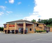
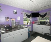
BEST WESTERN BRYSON INN
Hampton Inn - Suites Dobson
Surry Inn
Videos from this area
These are videos related to the place based on their proximity to this place.
Corvette Auto Show, Shelton Vineyards, Dobson NC
This is a photo slideshow of the Corvette Auto Show, 2014, held at Shelton Vineyards in Dobson NC in Surry County.
Dobson Cyclocross kids race, fall 2008
Cyclocross race in Dobson, North Carolina on Nov 9, 2008. A few scenes from the kids race.
Spitfire and Vanguard Autocross
Great time at the autocross event of the 25th annual Gathering British car show in Dobson, NC on April 18,2010. Notice how the right rear wheel on the Spitfire moves off the ground near the...
My sister and her friend singing
They were goofing off on a church trip, so I thought I would tape it.
Hospital Bed Reconditioning Process by Piedmont Medical,Inc.
Piedmont Medical Inc. was founded in 1992. We are the leading supplier of reconditioned hospital beds, stretchers, and furniture worldwide! Our name stands for quality and customer satisfaction!...
Surry County First Lego League Competition 2013
Seven North Carolina based organizations have teamed up with the Mount Airy, Elkin and Surry County school systems to form the area's first LEGO® robotic program. The Surry FIRST® LEGO®...
The country way of having fun in the snow ;)
Kids love it, and we have hoods for sale at ur cost of shipping you can contact us at 3366486635.
Gully Creek Trail-Cumberland Knob-Blue Ridge Parkway-Video#6
Gulley Creek Trail-Cumberland Knob-Blue Ridge Parkway- Great waterfall and creek shot See the entire trip at http://www.blueridgehikingtrails.com.
Videos provided by Youtube are under the copyright of their owners.
Attractions and noteworthy things
Distances are based on the centre of the city/town and sightseeing location. This list contains brief abstracts about monuments, holiday activities, national parcs, museums, organisations and more from the area as well as interesting facts about the region itself. Where available, you'll find the corresponding homepage. Otherwise the related wikipedia article.
Round Peak, North Carolina
Round Peak is a small unincorporated community in Surry County, North Carolina, United States, near Mount Airy, North Carolina with an elevation of 1,280 feet. It is located in the southern Appalachian Mountains and gives its name to the Round Peak style of old-time music practiced in the area. The community of Round Peak is named for the nearby summit of Round Peak which has an elevation 2,094 feet {{#invoke:Footnotes | harvard_citation }}.
Oak Grove, Surry County, North Carolina
Oak Grove is an unincorporated community in northern Surry County, North Carolina near Bottom.
Bottom, North Carolina
Bottom is a small unincorporated community in the Stewarts Creek Township of northern Surry County, North Carolina. The community is more commonly known as Beulah locally and is centered around the intersection of Beulah Road/Beulah Church Road and North Carolina Highway 89 (West Pine Street). Prominent landmarks in the area include Beulah United Methodist Church and the former Beulah Elementary School.


