Safety Score: 2,7 of 5.0 based on data from 9 authorites. Meaning we advice caution when travelling to United States.
Travel warnings are updated daily. Source: Travel Warning United States. Last Update: 2024-08-13 08:21:03
Discover Walls Landing
Walls Landing in Richmond County (North Carolina) is a city in United States about 313 mi (or 504 km) south-west of Washington DC, the country's capital city.
Local time in Walls Landing is now 08:26 AM (Saturday). The local timezone is named America / New York with an UTC offset of -4 hours. We know of 10 airports in the vicinity of Walls Landing, of which 5 are larger airports. The closest airport in United States is Simmons Army Air Field in a distance of 54 mi (or 86 km), East. Besides the airports, there are other travel options available (check left side).
Also, if you like golfing, there are a few options in driving distance. Looking for a place to stay? we compiled a list of available hotels close to the map centre further down the page.
When in this area, you might want to pay a visit to some of the following locations: Rockingham, Wadesboro, Chesterfield, Troy and Bennettsville. To further explore this place, just scroll down and browse the available info.
Local weather forecast
Todays Local Weather Conditions & Forecast: 22°C / 71 °F
| Morning Temperature | 18°C / 64 °F |
| Evening Temperature | 17°C / 62 °F |
| Night Temperature | 14°C / 58 °F |
| Chance of rainfall | 0% |
| Air Humidity | 43% |
| Air Pressure | 1025 hPa |
| Wind Speed | Gentle Breeze with 7 km/h (4 mph) from South-West |
| Cloud Conditions | Overcast clouds, covering 97% of sky |
| General Conditions | Overcast clouds |
Saturday, 2nd of November 2024
21°C (69 °F)
14°C (58 °F)
Scattered clouds, gentle breeze.
Sunday, 3rd of November 2024
22°C (72 °F)
17°C (62 °F)
Overcast clouds, light breeze.
Monday, 4th of November 2024
26°C (79 °F)
18°C (65 °F)
Sky is clear, gentle breeze, clear sky.
Hotels and Places to Stay
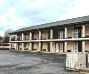
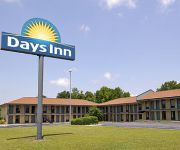
Fairfield Inn & Suites Rockingham
Regal Inn
DAYS INN ROCKINGHAM
Quality Inn & Suites Rockingham
Videos from this area
These are videos related to the place based on their proximity to this place.
SS4 Rockingham stages December 14 Car 22 Andy Vey Richard Fletcher 1st in Class & 4th overall
Gopro in the front spoiler captured the stage with car 22 driven by Andy Vey, navigator (go faster) Richard Fletcher.
Smoke Out Rally # 15 Bean're Mini Bike Race Rockingham Dragway
The Horse Back Street Choppers Smoke Out Rally # 15 Bean're Mini Bike Race Rockingham Dragway.
2013 Rockingham Hauler Parade
NASCAR Camping World Truck Series hauler parade that took place on U.S. 1 en route to Rockingham Speedway.
Hugo Besley | Formula Ford ecoboost 2013 | Rockingham Highlights
My first time in a single seater; testing at Rockingham with SWB motorsport http://swbmotorsport.co.uk/ . It was a very successful day and now I am looking towards racing in 2014. I desperately...
BARC Rockingham Sprint March 2015 - Radical PR6
Great early season event venue with good weather for March. Not able to match time from last year (68.85) even though I kicked of P1 with a 69.66....only cut off 1/3 sec in next 3 runs to...
Rockingham Dragway CB750 four
Smoke Out #14 Rockingham Dragway HD Road King va 1978 Honda CB 750 four.
Green Machine st205 swapped Rockingham Drag #2
Second time out to Rockingham. Just a small video I put together for all to see. Much love to 6gc.net for all of the support. Really illustrates the wins and losses that one can experience...
Videos provided by Youtube are under the copyright of their owners.
Attractions and noteworthy things
Distances are based on the centre of the city/town and sightseeing location. This list contains brief abstracts about monuments, holiday activities, national parcs, museums, organisations and more from the area as well as interesting facts about the region itself. Where available, you'll find the corresponding homepage. Otherwise the related wikipedia article.
Blewett Falls Lake
Blewett Falls Lake (sometimes spelled incorrectly as Blewitt Falls Lake) is a reservoir located in Anson County and Richmond County in North Carolina. No bridges span the lake. It is a major lake in the Uwharrie Lakes Region and the southernmost and widest body in this chain of lakes. Created by the damming of the Great Pee Dee River, the lake occupies the former Blewett Falls on that river, which were named after a local family. The lake was created for hydropower in the early 20th century.
Pee Dee, North Carolina
Pee Dee, North Carolina, is an unincorporated community in southwestern Montgomery County, North Carolina, located on North Carolina Highway 73. U.S. Representative and State Senator Edmund Deberry lived in Pee Dee, which was a township at that time, until his death in 1859.
Pee Dee, Anson County, North Carolina
Pee Dee, Anson County, North Carolina (also known as Pee Dee Station) is a populated place located at latitude 34.935 and longitude -79.89 in Anson County, North Carolina; it sits at an elevation of 236 feet AMSL. It is a former railway stop for passengers traveling on the Seaboard Air Line. Pee Dee is southeast of Lilesville, at the intersection of NC Highway 74 and NC Highway 145, near the Pee Dee River.


