Safety Score: 2,7 of 5.0 based on data from 9 authorites. Meaning we advice caution when travelling to United States.
Travel warnings are updated daily. Source: Travel Warning United States. Last Update: 2024-08-13 08:21:03
Touring Ocean View
The district Ocean View of Pineview Mobile Home Park in New Hanover County (North Carolina) is a subburb located in United States about 323 mi south of Washington DC, the country's capital place.
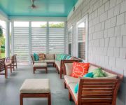
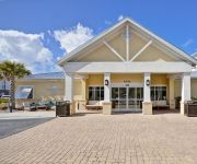
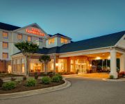
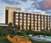
Need some hints on where to stay? We compiled a list of available hotels close to the map centre further down the page.
Being here already, you might want to pay a visit to some of the following locations: Wilmington, Burgaw, Bolivia, Jacksonville and Kenansville. To further explore this place, just scroll down and browse the available info.
Local weather forecast
Todays Local Weather Conditions & Forecast: 9°C / 48 °F
| Morning Temperature | 5°C / 42 °F |
| Evening Temperature | 10°C / 49 °F |
| Night Temperature | 7°C / 45 °F |
| Chance of rainfall | 0% |
| Air Humidity | 38% |
| Air Pressure | 1008 hPa |
| Wind Speed | Moderate breeze with 13 km/h (8 mph) from East |
| Cloud Conditions | Clear sky, covering 7% of sky |
| General Conditions | Sky is clear |
Saturday, 23rd of November 2024
13°C (55 °F)
9°C (49 °F)
Broken clouds, moderate breeze.
Sunday, 24th of November 2024
14°C (58 °F)
12°C (53 °F)
Sky is clear, light breeze, clear sky.
Monday, 25th of November 2024
16°C (60 °F)
14°C (57 °F)
Sky is clear, gentle breeze, clear sky.
Hotels and Places to Stay
Holiday Inn Resort WILMINGTON E-WRIGHTSVILLE BCH
SpringHill Suites Wilmington Mayfaire
Residence Inn Wilmington Landfall
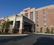
Hampton Inn - Suites Wilmington-Wrightsville Beach
Homewood Suites Wilmington-Mayfaire NC
Hilton Garden Inn Wilmington Mayfaire Town Center
BLOCKADE RUNNER BEACH RESORT
TownePlace Suites Wilmington/Wrightsville Beach
Fairfield Inn & Suites Wilmington/Wrightsville Beach
Hampton Inn Wilmington - University Area-Smith Creek Station
Videos from this area
These are videos related to the place based on their proximity to this place.
Kyles Wave of the Day Hurricane Hanna 2008 Surf City NC
www.surftopsail.com There are 3 waves with the last wave being the best, in my opinion. I'm still learning how to edit so give me a break here. I duplicated all 3 waves with special effects...
601 Bedminister Lane, Courtyards at Regency in Landfall
The Berkshire plan in Landfall's newest neighborhood, The Courtyards at Regency, is just one of five floorplans designed and built by Hagood Homes. Low maintenance at it's finest, the Courtyards...
Wilmington KOA Campground
The Wilmington KOA is located on the shores of the Atlantic Ocean in North Carolina. Minutes from Wrightsville Beach, this campground offers a swimming pool, live stage, special events, a playgroun...
832 Bedminister Lane, Wilmington, NC - UNDER CONTRACT!!!
Check out this awesome new construction home in Landfall here in Wilmington, NC. It's in a great location and I'd love to show it to you! Come live in Landfall and enjoy the lifestyle you've...
Cordgrass Bay 2319D - Vacation Rental Home In Wrightsville Beach, NC
http://www.intracoastalrentals.com/vacation-rentals/cordgrass-bay-2319-d During the summer season, daily rentals are only available for booking within 7 days...
Parade of Sailboats heading south on the intracoastal waterway at Wrightsville Beach, NC
Nov. 6, 2010 - Having just crossed the Heide Trask Draw Bridge headed onto Wrightsville, I noticed a long line of sailboats to the north. I decided to park at the boat ramp and capture their...
Oceanfront Home: 162 Beach South Rd Figure Eight Island Wilmington, NC
For More Info on this Oceanfront Home at 162 Beach South Rd, Figure Eight Island, Wilmington, NC, 28411, contact Jennifer Farmer: 910-297-9811 or visit: ...
2025 Northstar Place in Landfall / Wilmington NC 28405
Hagood Homes' has listed their personal home in Landfall. This home will delight and amaze you. It seems no detail has been overlooked from the architectural detail in the millwork, to the...
Videos provided by Youtube are under the copyright of their owners.
Attractions and noteworthy things
Distances are based on the centre of the city/town and sightseeing location. This list contains brief abstracts about monuments, holiday activities, national parcs, museums, organisations and more from the area as well as interesting facts about the region itself. Where available, you'll find the corresponding homepage. Otherwise the related wikipedia article.
New Hanover County, North Carolina
New Hanover County is one of 100 counties located in the U.S. state of North Carolina. Though second smallest in area, it is one of the most populous as its county seat, Wilmington, is one of the state's largest cities. At the 2010 census, the population was 202,667, an increase of 26.4 percent from 160,367 at the 2000 census. The county is included in the Wilmington Metropolitan Statistical Area, which also includes neighboring Brunswick and Pender counties.
Bayshore, North Carolina
Bayshore is a census-designated place (CDP) in New Hanover County, North Carolina, United States. The population was 2,974 at the 2007 census. It is part of the Wilmington Metropolitan Statistical Area.
Kings Grant, North Carolina
Kings Grant is a census-designated place (CDP) in New Hanover County, North Carolina, United States. The population was 9,162 at the 2007 census. It is part of the Wilmington Metropolitan Statistical Area.
Kirkland, North Carolina
Kirkland, more commonly known as Porter's Neck, is a census-designated place (CDP) in New Hanover County, North Carolina, United States. The population was 685 at the 2007 census. It is part of the Wilmington Metropolitan Statistical Area.
Masonboro, North Carolina
Masonboro is a census-designated place (CDP) in New Hanover County, North Carolina, United States. The population was 11,812 at the 2000 census. Masonboro is located southeast of Wilmington near the Atlantic coast. It is part of the Wilmington Metropolitan Statistical Area.
Murraysville, North Carolina
Murraysville is a census-designated place (CDP) in New Hanover County, North Carolina, United States. The population was 7,279 at the 2000 census. It is part of the Wilmington Metropolitan Statistical Area.
Ogden, North Carolina
Ogden is a census-designated place (CDP) in New Hanover County, North Carolina, United States. It is both a suburb of the city of Wilmington and part of the Wilmington Metropolitan Statistical Area. The population was 5,481 at the 2000 census.
Seagate, North Carolina
Seagate is a census-designated place (CDP) in New Hanover County, North Carolina, United States. The population was 4,590 at the 2000 census. It is part of the Wilmington Metropolitan Statistical Area.
Wrightsville Beach, North Carolina
Wrightsville Beach is a town in New Hanover County, North Carolina, United States. Wrightsville Beach is just east of Wilmington and is part of the Wilmington Metropolitan Statistical Area. The population was 2,593 at the 2000 census. The town consists of a four-mile-long beach island, an interior island called Harbor Island, and pockets of commercial property on the mainland.
Wilmington, North Carolina
Wilmington, North Carolina — City — Downtown Wilmington from across the Cape Fear River Official seal of Wilmington, North Carolina Location of Wilmington Coordinates: {{#invoke:Coordinates|coord}}{{#coordinates:34|13|24|N|77|54|44|W|type:city_region:US-NC |primary |name= }} Country United States State North Carolina County New Hanover Incorporated February 20, 1739/40 Government • Mayor Bill Saffo Area • City 41.5 sq mi (107.4 km) • Land 41.0 sq mi (106.2 km) • Water 0.5 sq mi (1.2 km) Elevation 30 ft (9 m) Population • City 106,476 • Density 1,849.8/sq mi (714.2/km) • Metro 362,315 Time zone Eastern (EST) • Summer EDT ZIP codes 28401-28412 Area code(s) 910 FIPS code 37-74440 GNIS feature ID 1023269 Sister cities Dandong, Liaoning, ChinaDoncaster, South Yorkshire, United KingdomBridgetown, Barbados Wilmington is a port city in and is the county seat of New Hanover County in coastal southeastern North Carolina, United States.
University of North Carolina Wilmington
The University of North Carolina at Wilmington (UNCW), sometimes referred to as UNC Wilmington, is a public, co-educational university located in Wilmington, North Carolina, United States. UNCW enrolls approximately 14,000 undergraduate, graduate and doctoral students each year as part of the 17-campus University of North Carolina System.
Wilmington International Airport
Wilmington International Airport is a public airport located just north of Wilmington, North Carolina, in unincorporated Wrightsboro, Cape Fear Township, New Hanover County. The airport began in 1927 as Bluethenthal Field, named for aviator Arthur Bluethenthal, the first Wilmingtonian to be killed in World War I. In the 1950s the airport became known as the New Hanover County Airport. In 1988 the airport added "International" to become known as New Hanover County International Airport.
Emsley A. Laney High School
Emsley A. Laney High School is a high school in Wilmington, North Carolina, is named in honor of Emsley Armfield Laney, who distinguished himself as a business and community leader for several decades in Wilmington. In 1941, Mr. Laney was elected to the New Hanover County Board of Education, serving as a member for 32 years, as well as chairperson for a portion of his service. A portrait of Mr.
Trask Coliseum
Trask Coliseum is a 5,500-seat multi-purpose arena in Wilmington, North Carolina. It is home to the University of North Carolina at Wilmington Seahawks basketball team, as well as some graduations for New Hanover County high schools.
Cape Fear Academy
Cape Fear Academy is a PK3-12 school located in Wilmington, North Carolina. It is a coeducational day school with 600 students and is a non-profit organization unaffiliated with any other institution, group, or church. Cape Fear Academy strives to be "a learning community sharing a commitment to respect, integrity, academic excellence, and service to others. " The school was incorporated in 1966 and opened its doors in September 1967.
Figure Eight Island
Figure Eight Island is an island in North Carolina, just north of Wrightsville Beach, with approximately 441 homes. It is surrounded by the Intracoastal Waterway and the Atlantic Ocean. It is a private island and that can only be reached via a guarded causeway bridge. It has been a popular destination for celebrities and politicians including former Vice President Al Gore, who has rented a house there, and John Edwards, who owns a house on the island.
New Hanover County Extension Service Arboretum
New Hanover County Extension Service Arboretum (7 acres) is a new arboretum being established on the grounds of the New Hanover County Cooperative Extension Service, 6206 Oleander Drive, Wilmington, North Carolina. It is open daily without charge. The arboretum was formally opened in 1989, and is still under development. It currently contains 33 gardens including an aquatic garden, bog garden, children's garden, herb garden, Japanese garden, and rose garden.
Airlie Gardens
Airlie Gardens (67 acres) is a public garden in Wilmington, North Carolina. It was created in 1901 as a private garden, for the Pembroke Jones family by Mrs. Jones, as a lush, flowing, naturalistic Southern garden, with thousands of azaleas, camellias, magnolias, and wisteria. German landscape architect Rudolf Topel, transformed the garden to a picturesque garden.
Brooks Field (Wilmington)
Bill Brooks Field is a stadium in Wilmington, North Carolina on the campus of UNC-Wilmington. Brooks Field is the home of the UNC Wilmington Seahawks baseball team and has hosted the Colonial Athletic Association Baseball Tournament a number of times (1989–90, 1993, 2004–11). The ballpark has a capacity of 3,000 people and first opened in 1989.
Hampstead, North Carolina
Hampstead is an unincorporated community in Pender County, North Carolina, United States. It is located between Wilmington and Jacksonville on U.S. Route 17. It is known as the "seafood capital of the Carolinas". Hampstead is part of the Wilmington Metropolitan Statistical Area.
Isaac Bear Early College High School
Isaac Bear Early College High School, also called Isaac Bear, is a selective-enrollment School at 630 MacMillan Avenue, Wilmington, North Carolina. The premises are situated on UNCW campus. New Hanover County Schools operates this school with the support of the local college, the University of North Carolina at Wilmington, and the Gates Foundation. Students must apply to attend this school; no more than 100 submissions are accepted per year.
John T. Hoggard High School
John T. Hoggard High School is a public high school in the New Hanover County School System in Wilmington, North Carolina.
Masonboro Inlet
Masonboro Inlet is an inlet in New Hanover County, North Carolina, separating the town of Wrightsville Beach from Masonboro Island. The inlet was used as a hideout by Confederate blockade runners during the Civil War. The blockade runners would hide in the inlet until nightfall, then sail to the nearby port of Wilmington in the cover of darkness.
Friends School of Wilmington
Friends School of Wilmington is an 18 months - 8th grade private/independent Quaker school located in New Hanover County in Wilmington, NC. The school was founded in 1995 by the Wilmington (NC) Friends Meeting and has grown from a middle school for 30 students to a school for 190 students. Friends School is located on two campuses located 2.9 miles apart with five buildings and eight acres of playgrounds, fields, gardens, woods, and a pond.
Harbor Island, South Carolina
Harbor Island is a small resort island located 14 miles (22 km) east of Beaufort, South Carolina. It is one of the Carolina Sea Islands. The majority of the island is tidal marsh, though approximately 800 acres of upland acreage exist on the northeastern portions of the island. The island was uninhabited and used primarily as hunting grounds until the 1930s, when U.S. Highway 21 was constructed to connect St. Helena Island with Hunting Island State Park.


